Orange, New Hampshire

Last updated

Orange, New Hampshire
Town
Orange Town House, Orange NH.jpg
Orange Town House
Grafton-Orange-NH.png
Coordinates: 43°39′14″N71°58′17″W / 43.65389°N 71.97139°W / 43.65389; -71.97139
Country United States
State New Hampshire
County Grafton
Incorporated 1790
Government
   Board of Selectmen
  • Tamara Fairbank, Chair
  • Aaron Allen
  • Betsy Coble
Area
[1]
  Total23.1 sq mi (59.9 km2)
  Land23.1 sq mi (59.7 km2)
  Water0.08 sq mi (0.2 km2)  0.25%
Elevation
1,216 ft (371 m)
Population
 (2020) [2]
  Total277
  Density12/sq mi (4.6/km2)
Time zone UTC-5 (Eastern)
  Summer (DST) UTC-4 (Eastern)
ZIP code
03741
Area code 603
FIPS code 33-58340
GNIS feature ID0873692
Website orangenh.us

Orange is a town in Grafton County, New Hampshire, United States. The population was 277 at the 2020 census, [2] down from 331 at the 2010 census. [3]

Contents

History

Orange was granted in 1769 and incorporated in 1790. It was originally named "Cardigan", after George Brudenell, fourth Earl of Cardigan. The Cardigan name lives on with Mount Cardigan and Cardigan Mountain State Park. After the American Revolution, voters attempted to rename the town "Bradford", "Middletown", "Liscomb", and finally "Orange". The large quantities of yellow-orange ochre found in Mount Cardigan may have been the source of the name Orange.

Geography

According to the United States Census Bureau, the town has a total area of 23.1 square miles (59.9 km2), of which 23.1 square miles (59.7 km2) are land and 0.1 square miles (0.2 km2) are water, comprising 0.25% of the town. The highest point in Orange is the summit of Mount Cardigan, at 3,155 feet (962 m) above sea level, near the eastern edge of the town.

The western side of the town (and the mountain) drains via Orange Brook to the Indian River in the neighboring town of Canaan, in turn a tributary of the Mascoma River. This portion of town is part of the Connecticut River watershed. The remainder of the town is part of the Merrimack River watershed. In the northern part of town, the South Branch of the Baker River has its source, flowing north toward Groton and Dorchester. The northeastern corner of the town drains north via Atwell Brook to the Cockermouth River in Groton, a tributary of Newfound Lake. The eastern edge of town drains off Mount Cardigan via several brooks leading to the Fowler River in Alexandria, another tributary of Newfound Lake. The southeastern part of town drains to Mill Brook, a southward-flowing tributary of the Smith River. The Baker River, Newfound Lake, and the Smith River are all tributaries of the Pemigewasset River, which flows south to form the Merrimack River in Franklin.

U.S. Route 4 passes through the town's southwestern corner.

Demographics

Historical population
CensusPop.Note
1790 131
1800 20355.0%
1810 22912.8%
1820 29327.9%
1830 40538.2%
1840 46314.3%
1850 451−2.6%
1860 382−15.3%
1870 340−11.0%
1880 335−1.5%
1890 245−26.9%
1900 213−13.1%
1910 176−17.4%
1920 166−5.7%
1930 99−40.4%
1940 10910.1%
1950 82−24.8%
1960 831.2%
1970 10324.1%
1980 19791.3%
1990 23720.3%
2000 29926.2%
2010 33110.7%
2020 277−16.3%
U.S. Decennial Census [2] [4]

As of the census [5] of 2000, there were 299 people, 111 households, and 85 families living in the town. The population density was 12.9 people per square mile (5.0/km2). There were 134 housing units at an average density of 5.8 per square mile (2.2/km2). The racial makeup of the town was 99.67% White and 0.33% Asian. Hispanic or Latino of any race were 0.33% of the population.

There were 111 households, out of which 33.3% had children under the age of 18 living with them, 59.5% were married couples living together, 8.1% had a female householder with no husband present, and 23.4% were non-families. 15.3% of all households were made up of individuals, and 4.5% had someone living alone who was 65 years of age or older. The average household size was 2.69 and the average family size was 2.98.

In the town, the population was spread out, with 25.1% under the age of 18, 5.0% from 18 to 24, 35.5% from 25 to 44, 25.1% from 45 to 64, and 9.4% who were 65 years of age or older. The median age was 38 years. For every 100 females, there were 110.6 males. For every 100 females age 18 and over, there were 103.6 males.

The median income for a household in the town was $41,250, and the median income for a family was $40,625. Males had a median income of $34,750 versus $25,938 for females. The per capita income for the town was $17,456. About 6.3% of families and 6.6% of the population were below the poverty line, including 6.0% of those under the age of eighteen and 3.2% of those 65 or over.

As of May 31, 2016, there were 225 registered voters on the checklist, including 55 Republican, 53 Democrat and 117 undeclared.[ citation needed ]

Related Research Articles

<span class="mw-page-title-main">Alexandria, New Hampshire</span> Town in New Hampshire, United States

Alexandria is a town in Grafton County, New Hampshire, United States. The population was 1,776 at the 2020 census, up from 1,613 at the 2010 census. Newfound Lake is in the northeast corner, with Wellington State Park on the western shore. The town is home to Welton Falls State Forest. Cardigan Mountain State Park, with Mount Cardigan, is in the west. Another attraction is Mowglis Mountain, named for Rudyard Kipling's Jungle Book hero.

<span class="mw-page-title-main">Canaan, New Hampshire</span> Town in New Hampshire, United States

Canaan is a town in Grafton County, New Hampshire, United States. The population was 3,794 at the 2020 census. It is the location of Mascoma State Forest. Canaan is home to the Cardigan Mountain School, the town's largest employer.

<span class="mw-page-title-main">Ellsworth, New Hampshire</span> Town in New Hampshire, United States

Ellsworth is a town in Grafton County, New Hampshire, United States. The population was 93 at the 2020 census.

<span class="mw-page-title-main">Groton, New Hampshire</span> Town in New Hampshire, United States

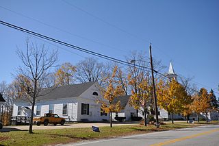
Groton is a town in Grafton County, New Hampshire, United States. The population was 569 at the 2020 census.

<span class="mw-page-title-main">Hebron, New Hampshire</span> Town in New Hampshire, United States

Hebron is a town in Grafton County, New Hampshire, United States. The population was 632 at the 2020 census. Settlements include the town center and the village of East Hebron.

<span class="mw-page-title-main">Thornton, New Hampshire</span> Town in New Hampshire, United States

Thornton is a town in Grafton County, New Hampshire, United States. The population was 2,708 at the 2020 census, up from 2,490 at the 2010 census.

<span class="mw-page-title-main">Greenfield, New Hampshire</span> Town in New Hampshire, United States

Greenfield is a town in Hillsborough County, New Hampshire, United States. The population was 1,716 at the 2020 census. Greenfield is home to the Crotched Mountain Rehabilitation Center, to Greenfield State Park, and to part of the Wapack Trail.

<span class="mw-page-title-main">Andover, New Hampshire</span> Town in New Hampshire, United States

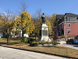
Andover is a town in Merrimack County, New Hampshire, United States. The population was 2,406 at the 2020 census. Andover includes the villages of Cilleyville, Potter Place, East Andover, and West Andover, in addition to the town center. The town is home to Ragged Mountain State Forest and Proctor Academy, a private coeducational preparatory school.

<span class="mw-page-title-main">Danbury, New Hampshire</span> Town in New Hampshire, United States

Danbury is a town in Merrimack County, New Hampshire, United States. The population was 1,250 at the 2020 census.

<span class="mw-page-title-main">Dunbarton, New Hampshire</span> Town in New Hampshire, United States

Dunbarton is a town in Merrimack County, New Hampshire, United States. The population was 3,005 at the 2020 census, up from 2,758 at the 2010 census.

<span class="mw-page-title-main">Hill, New Hampshire</span> Town in New Hampshire, United States

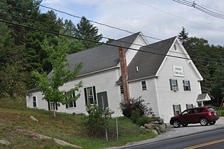
Hill is a town in Merrimack County, New Hampshire, United States. The population was 1,017 at the 2020 census. It is home to William Thomas State Forest.

<span class="mw-page-title-main">Newbury, New Hampshire</span> Town in New Hampshire, United States

Newbury is a town in Merrimack County, New Hampshire, United States. The population was 2,172 at the 2020 census.

<span class="mw-page-title-main">Salisbury, New Hampshire</span> Town in New Hampshire, United States

Salisbury is a town in Merrimack County, New Hampshire, United States. The population was 1,422 at the 2020 census.

<span class="mw-page-title-main">South Hooksett, New Hampshire</span> Census-designated place in New Hampshire, United States

South Hooksett is a census-designated place (CDP) within the town of Hooksett in Merrimack County, New Hampshire, United States. The population was 5,888 at the 2020 census. It is a suburban area adjacent to the city of Manchester, New Hampshire's largest city, and includes a mix of housing developments and large retail stores.

<span class="mw-page-title-main">Sutton, New Hampshire</span> Town in New Hampshire, United States

Sutton is a town in Merrimack County, New Hampshire, United States. The population was 1,978 at the 2020 census. Sutton includes the villages of Sutton Mills, North Sutton, South Sutton and East Sutton. North Sutton is home to Wadleigh State Park on Kezar Lake.

<span class="mw-page-title-main">Warner, New Hampshire</span> Town in New Hampshire, United States

Warner is a town in Merrimack County, New Hampshire, United States. The population was 2,937 at the 2020 census. The town is home to Magdalen College of the Liberal Arts, Rollins State Park and Mount Kearsarge State Forest.

<span class="mw-page-title-main">Wilmot, New Hampshire</span> Town in New Hampshire, United States

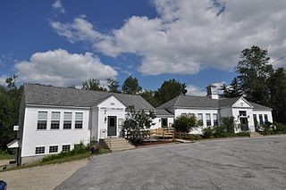
Wilmot is a town in Merrimack County, New Hampshire, United States. The population was 1,407 at the 2020 census. The town includes the communities of Wilmot, Wilmot Flat, and North Wilmot.

<span class="mw-page-title-main">East Kingston, New Hampshire</span> Place in New Hampshire, United States

East Kingston is a town in Rockingham County, New Hampshire, United States. The population was 2,441 at the 2020 census.

<span class="mw-page-title-main">Goshen, New Hampshire</span> Place in New Hampshire, United States

Goshen is a town in Sullivan County, New Hampshire, United States. The population was 796 at the 2020 census.

<span class="mw-page-title-main">Springfield, New Hampshire</span> Place in New Hampshire, United States

Springfield is a town in Sullivan County, New Hampshire, United States. The population was 1,259 at the 2020 census. Gile State Forest is located within the town.

References

  1. "2021 U.S. Gazetteer Files – New Hampshire". United States Census Bureau. Retrieved November 29, 2021.
  2. 1 2 3 "Orange town, Grafton County, New Hampshire: 2020 DEC Redistricting Data (PL 94-171)". U.S. Census Bureau. Retrieved November 29, 2021.
  3. United States Census Bureau, American FactFinder, 2010 Census figures. Retrieved March 23, 2011.
  4. "Census of Population and Housing". Census.gov. Retrieved June 4, 2016.
  5. "U.S. Census website". United States Census Bureau . Retrieved January 31, 2008.