Ellsworth, New Hampshire

Last updated

Ellsworth, New Hampshire
Town
EllsworthNH TownHall.jpg
Town hall
Grafton-Ellsworth-NH.png
Coordinates: 43°52′26″N71°44′14″W / 43.87389°N 71.73722°W / 43.87389; -71.73722
Country United States
State New Hampshire
County Grafton
Incorporated 1769
Area
[1]
  Total21.5 sq mi (55.8 km2)
  Land21.4 sq mi (55.5 km2)
  Water0.1 sq mi (0.3 km2)  0.58%
Elevation
1,174 ft (358 m)
Population
 (2020) [2]
  Total93
  Density4/sq mi (1.7/km2)
Time zone UTC-5 (Eastern)
  Summer (DST) UTC-4 (Eastern)
ZIP codes
03223 (Campton/Ellsworth)
03266 (Rumney)
Area code 603
FIPS code 33-23860
GNIS feature ID0873589

Ellsworth is a town in Grafton County, New Hampshire, United States. The population was 93 at the 2020 census. [2]

Contents

Ellsworth is the only dry town in New Hampshire. [3]

History

The town was originally known as "Trecothick", after Barlow Trecothick, a Bostonian who moved to London. He was an alderman, a Member of Parliament (MP), and a Lord Mayor of the City of London. He had a country estate at Addington, London, now called Addington Palace.

The name of the town was changed to "Ellsworth" in 1802, in honor of Chief Justice Oliver Ellsworth.

The first census of the town, in 1800, reported 47 residents.

Geography

According to the United States Census Bureau, the town has a total area of 21.5 square miles (55.8 km2), of which 21.4 square miles (55.5 km2) are land and 0.1 square miles (0.3 km2) are water, comprising 0.58% of the town. [1] The town is drained in the north by Hubbard Brook and in the south by West Branch Brook, except for the southwestern corner, which is drained by Sucker Brook, a tributary of Stinson Lake in neighboring Rumney. Hubbard and West Branch brooks flow east to the Pemigewasset River, while Stinson Lake drains south to the Baker River, a tributary of the Pemigewasset. Ellsworth lies fully within the Merrimack River watershed. [4]

The highest point in Ellsworth is the summit of Mount Kineo in the northern part of town, at 3,313 feet (1,010 m) above sea level. The entire town is within the White Mountain National Forest, though with numerous private inholdings. The Hubbard Brook Experimental Forest occupies the northern part of the town, on the northern side of Mount Kineo.

Demographics

Historical population
CensusPop.Note
1800 47
1810 142202.1%
1820 21350.0%
1830 2349.9%
1840 30028.2%
1850 3206.7%
1860 302−5.6%
1870 193−36.1%
1880 2098.3%
1890 150−28.2%
1900 107−28.7%
1910 46−57.0%
1920 30−34.8%
1930 28−6.7%
1940 26−7.1%
1950 24−7.7%
1960 3−87.5%
1970 13333.3%
1980 53307.7%
1990 7439.6%
2000 8717.6%
2010 83−4.6%
2020 9312.0%
U.S. Decennial Census [2] [5]

At the 2000 census there were 87 people in 32 households, including 19 families, in the town. The population density was 4.1 people per square mile (1.6/km2). There were 72 housing units at an average density of 3.4 per square mile (1.3/km2). The racial makeup of the town was 96.55% White, and 3.45% Native American. [6]

Of the 32 households 34.4% had children under the age of 18 living with them, 53.1% were married couples living together, none had a female householder with no husband present, and 40.6% were non-families. 18.8% of households were one person and 12.5% were one person aged 65 or older. The average household size was 2.72 and the average family size was 3.37.

The age distribution was 29.9% under the age of 18, 3.4% from 18 to 24, 23.0% from 25 to 44, 28.7% from 45 to 64, and 14.9% 65 or older. The median age was 41 years. For every 100 females, there were 102.3 males. For every 100 females age 18 and over, there were 110.3 males.

The median household income was $33,750 and the median family income was $34,750. Males had a median income of $26,500 versus $21,250 for females. The per capita income for the town was $22,705. None of the population and none of the families were below the poverty line.

Related Research Articles

<span class="mw-page-title-main">Lincoln, New Hampshire</span> Town in New Hampshire, United States

Lincoln is a town in Grafton County, New Hampshire, United States. It is the second-largest town by area in New Hampshire. The population was 1,631 at the 2020 census. The town is home to the New Hampshire Highland Games and to a portion of Franconia Notch State Park. Set in the White Mountains, large portions of the town are within the White Mountain National Forest. The Appalachian Trail crosses the western and northeastern parts of the town. Lincoln is the location of Loon Mountain Ski Resort and associated recreation-centered development.

<span class="mw-page-title-main">Grafton County, New Hampshire</span> County in New Hampshire, United States

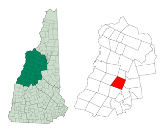
Grafton County is a county in the U.S. state of New Hampshire. As of the 2020 census, the population was 91,118. Its county seat is the town of Haverhill. In 1972, the county courthouse and other offices were moved from Woodsville, a larger village within the town of Haverhill, to North Haverhill.

<span class="mw-page-title-main">Alexandria, New Hampshire</span> Town in New Hampshire, United States

Alexandria is a town in Grafton County, New Hampshire, United States. The population was 1,776 at the 2020 census, up from 1,613 at the 2010 census. Newfound Lake is in the northeast corner, with Wellington State Park on the western shore. The town is home to Welton Falls State Forest. Cardigan Mountain State Park, with Mount Cardigan, is in the west. Another attraction is Mowglis Mountain, named for Rudyard Kipling's Jungle Book hero.

<span class="mw-page-title-main">Ashland, New Hampshire</span> Town in New Hampshire, United States

Ashland is a town in Grafton County, New Hampshire, United States. The population was 1,938 at the 2020 census, down from 2,076 at the 2010 census. Located near the geographical center of the state, Ashland is home to Scribner-Fellows State Forest.

<span class="mw-page-title-main">Campton, New Hampshire</span> Town in New Hampshire, United States

Campton is a town in Grafton County, New Hampshire, United States. The population was 3,343 at the 2020 census. Campton, which includes the villages of Blair, Campton Hollow, Lower Campton and West Campton, is home to Blair State Forest and Livermore Falls State Forest. It is located in the foothills of the White Mountains, and parts of the White Mountain National Forest are in the northeast and northwest.

<span class="mw-page-title-main">Franconia, New Hampshire</span> Town in New Hampshire, United States

Franconia is a town in Grafton County, New Hampshire, United States. The population was 1,083 at the 2020 census. Set in the White Mountains, Franconia is home to the northern half of Franconia Notch State Park. Parts of the White Mountain National Forest are in the eastern and southern portions of the town. The Appalachian Trail crosses the town.

<span class="mw-page-title-main">Holderness, New Hampshire</span> Town in New Hampshire, United States

Holderness is a town in Grafton County, New Hampshire, United States. The population was 2,004 at the 2020 census. An agricultural and resort area, Holderness is home to the Squam Lakes Natural Science Center and is located on Squam Lake. Holderness is also home to Holderness School, a co-educational college-preparatory boarding school.

<span class="mw-page-title-main">Orange, New Hampshire</span> Town in New Hampshire, United States

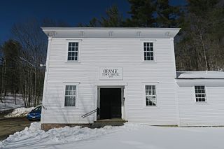
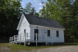
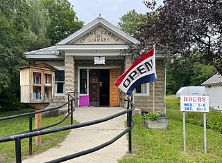
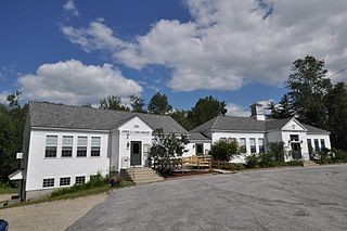
Orange is a town in Grafton County, New Hampshire, United States. The population was 277 at the 2020 census, down from 331 at the 2010 census.

<span class="mw-page-title-main">Rumney, New Hampshire</span> Town in New Hampshire, United States

Rumney is a town in Grafton County, New Hampshire, United States. The population was 1,498 at the 2020 census. The town is located at the southern edge of the White Mountain National Forest.

<span class="mw-page-title-main">Thornton, New Hampshire</span> Town in New Hampshire, United States

Thornton is a town in Grafton County, New Hampshire, United States. The population was 2,708 at the 2020 census, up from 2,490 at the 2010 census.

<span class="mw-page-title-main">Warren, New Hampshire</span> Town in New Hampshire, United States

Warren is a town in Grafton County, New Hampshire, United States. The population was 825 at the 2020 census, down from 904 at the 2010 census. Warren includes the village of Glencliff. The Appalachian Trail crosses the town in the west.

<span class="mw-page-title-main">Woodstock, New Hampshire</span> Town in New Hampshire, United States

Woodstock is a town in Grafton County, New Hampshire, United States. The population was 1,434 at the 2020 census. Woodstock includes the village of North Woodstock, the commercial center. Its extensive land area is largely forested, and includes the Hubbard Brook Experimental Forest. Parts of the White Mountain National Forest are in the east and west. The Appalachian Trail crosses the town's northwestern corner. Russell Pond Campground is in the east. West of North Woodstock is the Lost River Reservation.

<span class="mw-page-title-main">Danbury, New Hampshire</span> Town in New Hampshire, United States

Danbury is a town in Merrimack County, New Hampshire, United States. The population was 1,250 at the 2020 census.

<span class="mw-page-title-main">Hill, New Hampshire</span> Town in New Hampshire, United States

Hill is a town in Merrimack County, New Hampshire, United States. The population was 1,017 at the 2020 census. It is home to William Thomas State Forest.

<span class="mw-page-title-main">Springfield, New Hampshire</span> Place in New Hampshire, United States

Springfield is a town in Sullivan County, New Hampshire, United States. The population was 1,259 at the 2020 census. Gile State Forest is located within the town.

<span class="mw-page-title-main">Wentworth, New Hampshire</span> Town in New Hampshire, United States

Wentworth is a town in Grafton County, New Hampshire, United States. The population was 845 at the 2020 census, down from 911 at the 2010 census. The town is home to Plummer's Ledge Natural Area, and part of the White Mountain National Forest is in the northeast. The town has a picturesque common, presided over by a Federal-style church and bordered by antique homes.

<span class="mw-page-title-main">Plymouth (CDP), New Hampshire</span> Census-designated place in New Hampshire, United States

Plymouth is a census-designated place (CDP) and the main village in the town of Plymouth in Grafton County, New Hampshire, United States. Its population was 4,730 at the 2020 census, out of 6,682 in the entire town. The CDP includes the campus of Plymouth State University.

<span class="mw-page-title-main">Plymouth, New Hampshire</span> Town in New Hampshire, United States

Plymouth is a rural town in Grafton County, New Hampshire, United States, in the White Mountains Region. It has a unique role as the economic, medical, commercial, and cultural center for the predominantly rural Plymouth, NH Labor Market Area. Plymouth is located at the confluence of the Pemigewasset and Baker rivers and sits at the foot of the White Mountains. The town's population was 6,682 at the 2020 census. It is home to Plymouth State University, Speare Memorial Hospital, and Plymouth Regional High School.

<span class="mw-page-title-main">North Woodstock, New Hampshire</span> Census-designated place in New Hampshire, United States

North Woodstock is a census-designated place (CDP) and the primary village in the town of Woodstock in Grafton County, New Hampshire, United States. It had a population of 739 at the 2020 census.

Lincoln is a census-designated place (CDP) and the main village in the town of Lincoln in Grafton County, New Hampshire, United States. The population of the CDP was 969 at the 2020 census, out of 1,631 in the entire town.

References

  1. 1 2 "2021 U.S. Gazetteer Files – New Hampshire". United States Census Bureau. Retrieved November 23, 2021.
  2. 1 2 3 "Ellsworth town, Grafton County, New Hampshire: 2020 DEC Redistricting Data (PL 94-171)". U.S. Census Bureau. Retrieved November 23, 2021.
  3. "Dry Towns" (PDF). NH Liquor Commission. Archived (PDF) from the original on August 30, 2015.
  4. Foster, Debra H.; Batorfalvy, Tatianna N.; Medalie, Laura (1995). Water Use in New Hampshire: An Activities Guide for Teachers. U.S. Department of the Interior and U.S. Geological Survey.
  5. "Census of Population and Housing". Census.gov. Retrieved June 4, 2016.
  6. "U.S. Census website". United States Census Bureau . Retrieved January 31, 2008.