Lyman, New Hampshire

Last updated

Lyman, New Hampshire
Town
Grafton-Lyman-NH.png
Coordinates: 44°15′16″N71°57′00″W / 44.25444°N 71.95000°W / 44.25444; -71.95000
Country United States
State New Hampshire
County Grafton
Incorporated 1761
Villages
  • Tinkerville
  • Parker Hill
Government
   Board of Selectmen
  • Bruce Beane, Chair
  • Wendy Ho-Sing-Loy
  • Thomas S. Smith
Area
[1]
  Total28.7 sq mi (74.3 km2)
  Land28.4 sq mi (73.5 km2)
  Water0.3 sq mi (0.8 km2)  1.03%
Elevation
1,220 ft (370 m)
Population
 (2020) [2]
  Total585
  Density21/sq mi (8.0/km2)
Time zone UTC-5 (Eastern)
  Summer (DST) UTC-4 (Eastern)
ZIP code
03585
Area code 603
FIPS code 33-44100
GNIS feature ID0873653
Website www.lymannh.org

Lyman is a town in Grafton County, New Hampshire, United States. The population was 585 at the 2020 census. [2]

Contents

History

Lyman, along with Grantham, Lisbon, and eleven Vermont towns, was granted as compensation to General Phineas Lyman, a commander in the French and Indian War. According to the county gazetteer, "It was granted to Daniel Lyman and sixty-three others, November 10, 1761, its name being derived from the fact that eleven of the grantees bore the name of Lyman. The grantees failed to comply with the requirements of their charter, and thus forfeited their grant, but an extension of time was granted them July 20, 1769." [3] Lyman was incorporated in 1761. In 1880 it had a population of 665.

Geography

According to the United States Census Bureau, the town has a total area of 28.7 square miles (74.3 km2), of which 28.4 square miles (73.5 km2) are land and 0.31 square miles (0.8 km2) are water, comprising 1.03% of the town. [1] The town is drained by tributaries of the Ammonoosuc River and is part of the Connecticut River watershed. The highest point in town is 2,285 feet (696 m) above sea level, just east of the summit of Signal Mountain, a knob along the ridge of Gardner Mountain, which defines the town's western boundary.

The town's initial grant included land along the Connecticut River. In 1854 the portion of Lyman found west of "Gardner's Mountain" was separately incorporated as Monroe. [3]

Demographics

Historical population
CensusPop.Note
1790 202
1800 534164.4%
1810 94877.5%
1820 1,27034.0%
1830 1,3214.0%
1840 1,49613.2%
1850 1,442−3.6%
1860 743−48.5%
1870 658−11.4%
1880 654−0.6%
1890 543−17.0%
1900 426−21.5%
1910 374−12.2%
1920 310−17.1%
1930 299−3.5%
1940 36321.4%
1950 241−33.6%
1960 201−16.6%
1970 2136.0%
1980 28131.9%
1990 38838.1%
2000 48725.5%
2010 5339.4%
2020 5859.8%
U.S. Decennial Census [2] [4]

As of the census [5] of 2000, there were 487 people, 211 households, and 150 families living in the town. The population density was 17.1 inhabitants per square mile (6.6/km2). There were 280 housing units at an average density of 9.8 per square mile (3.8/km2). The racial makeup of the town was 98.36% White, 0.21% African American, 0.21% Native American, 0.21% Asian, 0.41% from other races, and 0.62% from two or more races. Hispanic or Latino of any race were 0.21% of the population.

There were 211 households, out of which 24.6% had children under the age of 18 living with them, 61.1% were married couples living together, 4.7% had a female householder with no husband present, and 28.9% were non-families. 20.9% of all households were made up of individuals, and 4.3% had someone living alone who was 65 years of age or older. The average household size was 2.31 and the average family size was 2.64.

In the town, the population was spread out, with 19.9% under the age of 18, 4.5% from 18 to 24, 32.0% from 25 to 44, 31.6% from 45 to 64, and 11.9% who were 65 years of age or older. The median age was 42 years. For every 100 females, there were 102.1 males. For every 100 females age 18 and over, there were 105.3 males.

The median income for a household in the town was $46,607, and the median income for a family was $48,365. Males had a median income of $27,500 versus $23,375 for females. The per capita income for the town was $22,332. About 3.5% of families and 6.5% of the population were below the poverty line, including 6.5% of those under age 18 and 6.7% of those age 65 or over.

Related Research Articles

<span class="mw-page-title-main">Grafton County, New Hampshire</span> County in New Hampshire, United States

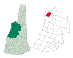
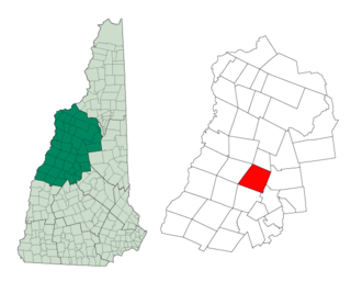
Grafton County is a county in the U.S. state of New Hampshire. As of the 2020 census, the population was 91,118. Its county seat is the town of Haverhill. In 1972, the county courthouse and other offices were moved from Woodsville, a larger village within the town of Haverhill, to North Haverhill.

<span class="mw-page-title-main">Marlow, New Hampshire</span> Town in New Hampshire, United States

Marlow is a town in Cheshire County, New Hampshire, United States. The population was 749 at the 2020 census. Marlow is home to Honey Brook State Forest.

<span class="mw-page-title-main">Alexandria, New Hampshire</span> Town in New Hampshire, United States

Alexandria is a town in Grafton County, New Hampshire, United States. The population was 1,776 at the 2020 census, up from 1,613 at the 2010 census. Newfound Lake is in the northeast corner, with Wellington State Park on the western shore. The town is home to Welton Falls State Forest. Cardigan Mountain State Park, with Mount Cardigan, is in the west. Another attraction is Mowglis Mountain, named for Rudyard Kipling's Jungle Book hero.

<span class="mw-page-title-main">Ashland, New Hampshire</span> Town in New Hampshire, United States

Ashland is a town in Grafton County, New Hampshire, United States. The population was 1,938 at the 2020 census, down from 2,076 at the 2010 census. Located near the geographical center of the state, Ashland is home to Scribner-Fellows State Forest.

<span class="mw-page-title-main">Bath, New Hampshire</span> Town in New Hampshire, United States

Bath is a town in Grafton County, New Hampshire, United States. The population was 1,077 at the 2020 census, unchanged from the 2010 census. Now a tourist destination and commuter town for Littleton, the town is noted for its historic architecture, including the Brick Store and three covered bridges. Bath includes the village of Swiftwater and part of the district known as Mountain Lakes.

<span class="mw-page-title-main">Benton, New Hampshire</span> Town in New Hampshire, United States

Benton is a town in Grafton County, New Hampshire, United States. The population was 374 at the 2020 census. Located in the White Mountains, Benton is largely surrounded by the White Mountain National Forest. The town is crossed by the Appalachian Trail.

<span class="mw-page-title-main">Bridgewater, New Hampshire</span> Town in New Hampshire, United States

Bridgewater is a town in Grafton County, New Hampshire, United States. The population was 1,160 at the 2020 census.

<span class="mw-page-title-main">Campton, New Hampshire</span> Town in New Hampshire, United States

Campton is a town in Grafton County, New Hampshire, United States. The population was 3,343 at the 2020 census. Campton, which includes the villages of Blair, Campton Hollow, Lower Campton and West Campton, is home to Blair State Forest and Livermore Falls State Forest. It is located in the foothills of the White Mountains, and parts of the White Mountain National Forest are in the northeast and northwest.

<span class="mw-page-title-main">Dorchester, New Hampshire</span> Town in New Hampshire, United States

Dorchester is a town in Grafton County, New Hampshire, United States. The population was 339 at the 2020 census.

<span class="mw-page-title-main">Groton, New Hampshire</span> Town in New Hampshire, United States

Groton is a town in Grafton County, New Hampshire, United States. The population was 569 at the 2020 census.

<span class="mw-page-title-main">Landaff, New Hampshire</span> Town in New Hampshire, United States

Landaff is a town in Grafton County, New Hampshire, United States. As of the 2020 census, the town population was 446.

<span class="mw-page-title-main">Lyme, New Hampshire</span> Town in New Hampshire, United States

Lyme is a town along the Connecticut River in Grafton County, New Hampshire, United States. The population was 1,745 as of the 2020 census. Lyme is home to the Chaffee Natural Conservation Area. The Dartmouth Skiway is in the eastern part of town, near the village of Lyme Center. The Appalachian Trail passes through the town's heavily wooded eastern end.

<span class="mw-page-title-main">Monroe, New Hampshire</span> Town in New Hampshire, United States

Monroe is a town in Grafton County, New Hampshire, United States. The population was 864 at the 2020 census, up from 788 at the 2010 census. The town is located along the Connecticut River, across from Barnet, Vermont. It was originally chartered as part of Lyman.

<span class="mw-page-title-main">Orange, New Hampshire</span> Town in New Hampshire, United States

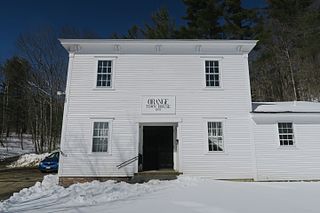
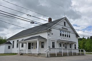
Orange is a town in Grafton County, New Hampshire, United States. The population was 277 at the 2020 census, down from 331 at the 2010 census.

<span class="mw-page-title-main">Orford, New Hampshire</span> Town in New Hampshire, United States

Orford is a town in Grafton County, New Hampshire, United States. The population was 1,237 at the 2020 census, unchanged from the 2010 census. The Appalachian Trail crosses in the east.

<span class="mw-page-title-main">Rumney, New Hampshire</span> Town in New Hampshire, United States

Rumney is a town in Grafton County, New Hampshire, United States. The population was 1,498 at the 2020 census. The town is located at the southern edge of the White Mountain National Forest.

<span class="mw-page-title-main">Thornton, New Hampshire</span> Town in New Hampshire, United States

Thornton is a town in Grafton County, New Hampshire, United States. The population was 2,708 at the 2020 census, up from 2,490 at the 2010 census.

<span class="mw-page-title-main">Warren, New Hampshire</span> Town in New Hampshire, United States

Warren is a town in Grafton County, New Hampshire, United States. The population was 825 at the 2020 census, down from 904 at the 2010 census. Warren includes the village of Glencliff. The Appalachian Trail crosses the town in the west.

Lisbon is a census-designated place (CDP) and the main village in the town of Lisbon in Grafton County, New Hampshire, United States. The population of the CDP was 965 at the 2020 census, out of 1,621 in the entire town.

<span class="mw-page-title-main">Lisbon, New Hampshire</span> Town in New Hampshire, United States

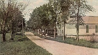
Lisbon is a town in Grafton County, New Hampshire, United States. The population was 1,621 at the 2020 census. Lisbon hosts an annual lilac festival on Memorial Day weekend.

References

  1. 1 2 "2021 U.S. Gazetteer Files – New Hampshire". United States Census Bureau. Retrieved November 29, 2021.
  2. 1 2 3 "Lyman town, Grafton County, New Hampshire: 2020 DEC Redistricting Data (PL 94-171)". U.S. Census Bureau. Retrieved November 29, 2021.
  3. 1 2 Hamilton Child, Gazetteer of Grafton County NH, 1709-1886, The Syracuse Journal Company, Syracuse NY, June 1886, p. 512
  4. "Census of Population and Housing". Census.gov. Retrieved June 4, 2016.
  5. "U.S. Census website". United States Census Bureau . Retrieved January 31, 2008.