Demographics
Historical population| Census | Pop. | Note | %± |
|---|
| 1790 | 1,380 | | — |
|---|
| 1800 | 1,390 | | 0.7% |
|---|
| 1810 | 1,290 | | −7.2% |
|---|
| 1820 | 1,391 | | 7.8% |
|---|
| 1830 | 1,301 | | −6.5% |
|---|
| 1840 | 1,165 | | −10.5% |
|---|
| 1850 | 1,128 | | −3.2% |
|---|
| 1860 | 1,015 | | −10.0% |
|---|
| 1870 | 868 | | −14.5% |
|---|
| 1880 | 669 | | −22.9% |
|---|
| 1890 | 476 | | −28.8% |
|---|
| 1900 | 459 | | −3.6% |
|---|
| 1910 | 393 | | −14.4% |
|---|
| 1920 | 306 | | −22.1% |
|---|
| 1930 | 241 | | −21.2% |
|---|
| 1940 | 296 | | 22.8% |
|---|
| 1950 | 259 | | −12.5% |
|---|
| 1960 | 295 | | 13.9% |
|---|
| 1970 | 287 | | −2.7% |
|---|
| 1980 | 518 | | 80.5% |
|---|
| 1990 | 877 | | 69.3% |
|---|
| 2000 | 1,077 | | 22.8% |
|---|
| 2010 | 1,155 | | 7.2% |
|---|
| 2020 | 1,197 | | 3.6% |
|---|
|
As of the census [5] of 2000, there were 1,077 people, 379 households, and 285 families residing in the town. The population density was 28.7 inhabitants per square mile (11.1/km2). There were 432 housing units at an average density of 11.5 per square mile (4.4/km2). The racial makeup of the town was 97.68% White, 0.37% African American, 0.46% Native American, 0.19% Asian, 0.19% from other races, and 1.11% from two or more races. Hispanic or Latino of any race were 0.56% of the population.
There were 379 households, out of which 35.1% had children under the age of 18 living with them, 67.5% were married couples living together, 4.5% had a female householder with no husband present, and 24.8% were non-families. 19.3% of all households were made up of individuals, and 5.8% had someone living alone who was 65 years of age or older. The average household size was 2.82 and the average family size was 3.22.
In the town, the population was spread out, with 29.2% under the age of 18, 5.4% from 18 to 24, 28.6% from 25 to 44, 25.5% from 45 to 64, and 11.2% who were 65 years of age or older. The median age was 38 years. For every 100 females, there were 105.5 males. For every 100 females age 18 and over, there were 102.7 males.
The median income for a household in the town was $49,141, and the median income for a family was $54,625. Males had a median income of $37,083 versus $27,500 for females. The per capita income for the town was $21,174. About 4.6% of families and 7.6% of the population were below the poverty line, including 8.5% of those under age 18 and 7.6% of those age 65 or over.

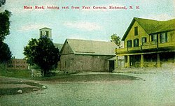
Gilford is a town in Belknap County, New Hampshire, United States. The population was 7,699 at the 2020 census, up from 7,126 at the 2010 census. Situated on Lake Winnipesaukee, Gilford is home to Governors Island, Ellacoya State Beach, Belknap Mountain State Forest, Gunstock Mountain Resort, and the Bank of New Hampshire Pavilion, a seasonal outdoor concert venue. The lakeside village of Glendale lies within Gilford's borders.

Chesterfield is a town in Cheshire County, New Hampshire, United States. The population was 3,552 at the 2020 census. It includes the villages of Spofford and West Chesterfield. Chesterfield is home to Spofford Lake, Chesterfield Gorge Natural Area, and parts of Pisgah State Park and Wantastiquet Mountain State Forest.
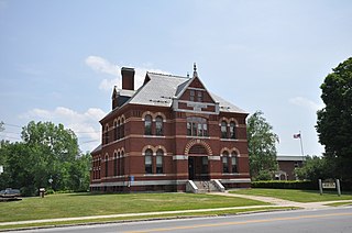
Dublin is a town in Cheshire County, New Hampshire, United States. The population was 1,532 at the 2020 census. It is home to Dublin School and Yankee magazine.

Fitzwilliam is a town in Cheshire County, New Hampshire, United States. The population was 2,351 at the 2020 census. Fitzwilliam is home to Rhododendron State Park, a 16-acre (6.5 ha) grove of native rhododendrons that bloom in mid-July.

Gilsum is a town in Cheshire County, New Hampshire, United States. The population was 752 at the 2020 census. Home to Bear's Den Natural Area, Gilsum includes Gilsum Lower Village.

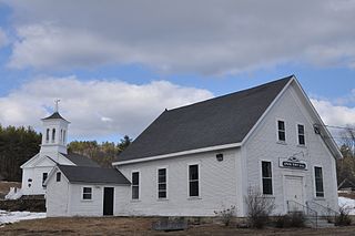
Harrisville is a town in Cheshire County, New Hampshire, United States. Besides the town center, it also includes the villages of Chesham and Eastview. The population of the town was 984 at the 2020 census.

Rindge is a town in Cheshire County, New Hampshire, United States. The population was 6,476 at the 2020 census, up from 6,014 at the 2010 census. Rindge is home to Franklin Pierce University, the Cathedral of the Pines and part of Annett State Forest.

Stoddard is a town in Cheshire County, New Hampshire, United States. The population was 1,374 at the 2020 census, up from 1,232 at the 2010 census.

Sullivan is a town in Cheshire County, New Hampshire, United States. The population was 658 at the 2020 census. It includes the villages of East Sullivan and Ellisville.

Swanzey is a town in Cheshire County, New Hampshire, United States. The population was 7,270 at the 2020 census. In addition to the town center, Swanzey includes the villages of East Swanzey, West Swanzey, North Swanzey and Westport.

Troy is a town in Cheshire County, New Hampshire, United States. The population was 2,130 at the 2020 census. It is situated west of Mount Monadnock.

Westmoreland is a town in Cheshire County, New Hampshire, United States. The population was 1,706 at the 2020 census, down from 1,874 at the 2010 census. Westmoreland is historically an agricultural town, with much arable farmland.
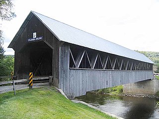
Columbia is a town in Coös County, New Hampshire, United States. The population was 659 at the 2020 census, down from 757 at the 2010 census. It is part of the Berlin, NH-VT micropolitan statistical area.

Errol is a town in Coös County, New Hampshire, United States. The population was 298 at the 2020 census. It is located north of the White Mountains along Route 16 at its intersection of Route 26. It has a municipal airport with a single, unpaved runway.

Hebron is a town in Grafton County, New Hampshire, United States. The population was 632 at the 2020 census. Settlements include the town center and the village of East Hebron.

Greenfield is a town in Hillsborough County, New Hampshire, United States. The population was 1,716 at the 2020 census. Greenfield is home to the Crotched Mountain Rehabilitation Center, to Greenfield State Park, and to part of the Wapack Trail.
Epsom is a town in Merrimack County, New Hampshire, United States. The population was 4,834 at the 2020 census.

Jaffrey is a town in Cheshire County, New Hampshire, United States. The population was 5,320 at the 2020 census.

Marlborough is a town in Cheshire County, New Hampshire, United States. The population was 2,096 at the 2020 census. The town is home to the Kensan-Devan Wildlife Sanctuary at Meetinghouse Pond.
Winchester is a town in Cheshire County, New Hampshire, United States. The population was 4,150 at the 2020 census. The primary community in the town, where 1,606 people resided at the 2020 census, is defined by the U.S. Census Bureau as the Winchester census-designated place (CDP). The town also includes the village of Ashuelot and part of Pisgah State Park.