Marlborough, New Hampshire

Last updated
Marlborough, New Hampshire
Town
Street Scene, Marlborough, NH.jpg
Main Street in 1910
Marlborough, NH Town Seal.png
Motto(s): 
"Small Town - Big Heart"
Cheshire-Marlborough-NH.png
Coordinates: 42°54′17″N72°12′36″W / 42.90472°N 72.21000°W / 42.90472; -72.21000 Coordinates: 42°54′17″N72°12′36″W / 42.90472°N 72.21000°W / 42.90472; -72.21000
Country United States
State New Hampshire
County Cheshire
Incorporated 1776
Government
   Board of Selectmen
  • Jane Pitt
  • Gina Paight
  • Earl Nelson
  Town AdministratorEllen Smith
Area
[1]
  Total20.7 sq mi (53.5 km2)
  Land20.4 sq mi (52.9 km2)
  Water0.2 sq mi (0.6 km2)  1.13%
Elevation
705 ft (215 m)
Population
 (2020) [2]
  Total2,096
  Density103/sq mi (39.6/km2)
Time zone UTC-5 (Eastern)
  Summer (DST) UTC-4 (Eastern)
ZIP code
03455
Area code(s) 603
FIPS code 33-45460
GNIS feature ID0873659
Website www.marlboroughnh.org

Marlborough is a town in Cheshire County, New Hampshire, United States. The population was 2,096 at the 2020 census. [2] The town is home to the Kensan-Devan Wildlife Sanctuary at Meetinghouse Pond.

Contents

The primary settlement in town, where 1,066 people resided at the 2020 census, is defined as the Marlborough census-designated place (CDP) and is located at the junction of New Hampshire routes 101 and 124.

History

First granted as "Monadnock No. 5" in 1752 by Governor Benning Wentworth, this was one of the fort towns originally known only by a number. Lots were drawn in 1762 and first settled two years later. The town was at one time called "Oxford", then "New Marlborough", but was incorporated in 1776 as Marlborough. Many of the settlers were from Marlborough, Massachusetts, which had been named for John Churchill, 1st Duke of Marlborough, in the late 17th century. Land was set off in 1815 to create the town of Troy. [3]

There was once an important granite industry here. Stone from Marlborough quarries was used in buildings in Boston, at the College of the Holy Cross in Worcester, Massachusetts, and locally in the Frost Free Library. Blankets and wooden-ware, including toys, have been manufactured in Marlborough as well. [4]

Geography

According to the United States Census Bureau, the town has a total area of 20.7 square miles (53.5 km2), of which 20.4 square miles (52.9 km2) are land and 0.2 square miles (0.6 km2) are water, comprising 1.13% of the town. [1] Marlborough is drained by Minnewawa Brook, a west-flowing tributary of the Ashuelot River and part of the Connecticut River watershed. The town's highest point is near its southeast corner, on the side of Bigelow Hill, where the elevation reaches 1,516 feet (462 m) above sea level.

Marlborough is served by state routes 101 and 124.

Adjacent municipalities

Demographics

Historical population
CensusPop.
1790 786
1800 1,18550.8%
1810 1,142−3.6%
1820 766−32.9%
1830 8227.3%
1840 8311.1%
1850 8876.7%
1860 9153.2%
1870 1,01711.1%
1880 1,28626.5%
1890 1,69531.8%
1900 1,524−10.1%
1910 1,478−3.0%
1920 1,380−6.6%
1930 1,5089.3%
1940 1,431−5.1%
1950 1,5619.1%
1960 1,6123.3%
1970 1,6713.7%
1980 1,84610.5%
1990 1,9274.4%
2000 2,0094.3%
2010 2,0632.7%
2020 2,0961.6%
U.S. Decennial Census [2] [5]

As of the census of 2010, there were 2,063 people, 866 households, and 565 families residing in the town. There were 946 housing units, of which 80, or 8.5%, were vacant. The racial makeup of the town was 97.0% white, 0.4% African American, 0.05% Native American, 0.9% Asian, 0.0% Native Hawaiian or Pacific Islander, 0.2% some other race, and 1.4% from two or more races. 1.4% of the population were Hispanic or Latino of any race. [6]

Of the 866 households, 26.8% had children under the age of 18 living with them, 50.3% were headed by married couples living together, 10.2% had a female householder with no husband present, and 34.8% were non-families. 24.4% of all households were made up of individuals, and 9.6% were someone living alone who was 65 years of age or older. The average household size was 2.38, and the average family size was 2.79. [6]

In the town, 19.8% of the population were under the age of 18, 6.9% were from 18 to 24, 25.0% from 25 to 44, 31.6% from 45 to 64, and 16.6% were 65 years of age or older. The median age was 43.9 years. For every 100 females, there were 95.4 males. For every 100 females age 18 and over, there were 94.2 males. [6]

For the period 2011–2015, the estimated median annual income for a household was $54,491, and the median income for a family was $64,844. Male full-time workers had a median income of $50,069 versus $37,667 for females. The per capita income for the town was $30,219. 8.5% of the population and 7.3% of families were below the poverty line. 24.2% of the population under the age of 18 and 2.1% of those 65 or older were living in poverty. [7]

Site of interest

Notable people

Related Research Articles

Chesterfield, New Hampshire Town in New Hampshire, United States

Chesterfield is a town in Cheshire County, New Hampshire, United States. The population was 3,552 at the 2020 census. It includes the villages of Spofford and West Chesterfield. Chesterfield is home to Spofford Lake, Chesterfield Gorge Natural Area, and parts of Pisgah State Park and Wantastiquet Mountain State Forest.

Dublin, New Hampshire Town in New Hampshire, United States

Dublin is a town in Cheshire County, New Hampshire, United States. The population was 1,532 at the 2020 census. It is home to Dublin School and Yankee magazine.

Fitzwilliam, New Hampshire Town in New Hampshire, United States

Fitzwilliam is a town in Cheshire County, New Hampshire, United States. The population was 2,351 at the 2020 census. Fitzwilliam is home to Rhododendron State Park, a 16-acre (6.5 ha) grove of native rhododendrons that bloom in mid-July.

Gilsum, New Hampshire Town in New Hampshire, United States

Gilsum is a town in Cheshire County, New Hampshire, United States. The population was 752 at the 2020 census. Home to Bear's Den Natural Area, Gilsum includes Gilsum Lower Village.

Harrisville, New Hampshire Town in New Hampshire, United States

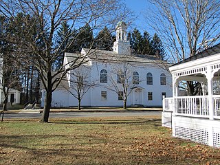
Harrisville is a town in Cheshire County, New Hampshire, United States. Besides the town center, it also includes the villages of Chesham and Eastview. The population of the town was 984 at the 2020 census.

Marlow, New Hampshire Town in New Hampshire, United States

Marlow is a town in Cheshire County, New Hampshire, United States. The population was 749 at the 2020 census. Marlow is home to Honey Brook State Forest.

Richmond, New Hampshire Town in New Hampshire, United States

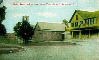
Richmond is a town in Cheshire County, New Hampshire, United States. The population was 1,197 at the 2020 census.

Sullivan, New Hampshire Town in New Hampshire, United States

Sullivan is a town in Cheshire County, New Hampshire, United States. The population was 658 at the 2020 census. It includes the villages of East Sullivan and Ellisville.

Swanzey, New Hampshire Town in New Hampshire, United States

Swanzey is a town in Cheshire County, New Hampshire, United States. The population was 7,270 at the 2020 census. In addition to the town center, Swanzey includes the villages of East Swanzey, West Swanzey, North Swanzey and Westport.

Troy, New Hampshire Town in New Hampshire, United States

Troy is a town in Cheshire County, New Hampshire, United States. The population was 2,130 at the 2020 census. It is situated west of Mount Monadnock.

Walpole, New Hampshire Town in New Hampshire, United States

Walpole is a town in Cheshire County, New Hampshire, United States. The population was 3,633 at the 2020 census.

Westmoreland, New Hampshire Town in New Hampshire, United States

Westmoreland is a town in Cheshire County, New Hampshire, United States. The population was 1,706 at the 2020 census, down from 1,874 at the 2010 census. Westmoreland is historically an agricultural town, with much arable farmland.

Columbia, New Hampshire Town in New Hampshire, United States

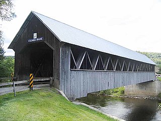
Columbia is a town in Coös County, New Hampshire, United States. The population was 659 at the 2020 census, down from 757 at the 2010 census. It is part of the Berlin, NH–VT micropolitan statistical area.

Northumberland, New Hampshire Town in New Hampshire, United States

Northumberland is a town located in western Coös County, New Hampshire, U.S., north of Lancaster. It is part of the Berlin, NH–VT micropolitan statistical area. As of the 2020 census, the town population was 2,126, of whom 1,068 lived in the village of Groveton.

Sharon, New Hampshire Town in New Hampshire, United States

Sharon is a town in Hillsborough County, New Hampshire, United States. The population was 359 at the 2020 census. It is home to the Sharon Arts Center, part of the New Hampshire Institute of Art.

New Durham, New Hampshire Town in New Hampshire, United States

New Durham is a town in Strafford County, New Hampshire, United States. The population was 2,693 at the 2020 census. It is drained by the Merrymeeting, Cocheco and Ela rivers, and is known for Merrymeeting Lake. New Durham is home to the Powder Mill Fish Hatchery, located on Merrymeeting Road. Also located here is the Lions Club's Camp Pride, a camp for children and adults with special needs.

Hinsdale, New Hampshire Town in New Hampshire, United States

Hinsdale is a town in Cheshire County, New Hampshire, United States. The population was 3,948 at the 2020 census. Hinsdale is home to part of Pisgah State Park in the northeast, and part of Wantastiquet Mountain State Forest in the northwest.

Jaffrey, New Hampshire Town in New Hampshire, United States

Jaffrey is a town in Cheshire County, New Hampshire, United States. The population was 5,320 at the 2020 census.

Marlborough is a census-designated place (CDP) and the main village in the town of Marlborough in Cheshire County, New Hampshire, United States. The population of the CDP was 1,066 at the 2020 census, out of 2,096 in the entire town.

Winchester, New Hampshire Town in New Hampshire, United States

Winchester is a town in Cheshire County, New Hampshire, United States. The population was 4,150 at the 2020 census. The primary community in the town, where 1,606 people resided at the 2020 census, is defined by the U.S. Census Bureau as the Winchester census-designated place (CDP). The town also includes the village of Ashuelot and part of Pisgah State Park.

References

  1. 1 2 "2021 U.S. Gazetteer Files – New Hampshire". United States Census Bureau. Retrieved November 4, 2021.
  2. 1 2 3 "Marlborough town, Cheshire County, New Hampshire: 2020 DEC Redistricting Data (PL 94-171)". U.S. Census Bureau. Retrieved November 4, 2021.
  3. Coolidge, Austin J.; John B. Mansfield (1859). A History and Description of New England. Boston, Massachusetts: A.J. Coolidge. pp.  572–573. coolidge mansfield history description new england 1859.
  4. History of Marlborough, Cheshire County, New Hampshire
  5. "Census of Population and Housing". Census.gov. Retrieved June 4, 2016.
  6. 1 2 3 "Profile of General Population and Housing Characteristics: 2010 Census Summary File 1 (DP-1): Marlborough town, Cheshire County, New Hampshire". U.S. Census Bureau, American Factfinder. Archived from the original on February 13, 2020. Retrieved October 26, 2017.
  7. "Selected Economic Characteristics: 2011-2015 American Community Survey 5-Year Estimates (DP03): Marlborough town, Cheshire County, New Hampshire". U.S. Census Bureau, American Factfinder. Archived from the original on February 13, 2020. Retrieved October 26, 2017.