Walpole, New Hampshire

Last updated

Walpole, New Hampshire
Town
Walpole NH Town Hall 2019.jpg
Town Hall in 2019
Cheshire-Walpole-NH.png
Coordinates: 43°04′46″N72°25′33″W / 43.07944°N 72.42583°W / 43.07944; -72.42583
Country United States
State New Hampshire
County Cheshire
Incorporated 1756
Named for Robert Walpole
Villages
Government
   Selectboard
  • Peggy Pschirrer, Chair
  • Steve Dalessio
  • Cheryl Mayberry
Area
[1]
  Total36.7 sq mi (95.0 km2)
  Land35.2 sq mi (91.2 km2)
  Water1.4 sq mi (3.7 km2)  3.94%
Elevation
400 ft (100 m)
Population
 (2020) [2]
  Total3,633
  Density103/sq mi (39.8/km2)
Time zone UTC-5 (Eastern)
  Summer (DST) UTC-4 (Eastern)
ZIP codes
03608 (Walpole)
03604 (Drewsville)
03609 (North Walpole)
Area code 603
FIPS code 33-78420
GNIS feature ID0873744
Website www.walpolenh.us

Walpole is a town in Cheshire County, New Hampshire, United States. The population was 3,633 at the 2020 census. [2]

Contents

The town's central village, where 573 people resided at the 2020 census, is defined as the Walpole census-designated place (CDP) and is east of New Hampshire Route 12. The town also includes the villages of North Walpole and Drewsville.

History

The town was first granted in 1736 by colonial Governor Jonathan Belcher of Massachusetts as "Number 3", third in a line of Connecticut River fort towns. It was settled as early as 1736, and called "Great Falls" or "Lunenburg". Colonel Benjamin Bellows, for whom Bellows Falls, Vermont, is named, built a large fort here for defense against Native attack. After the border between Massachusetts and New Hampshire was fixed (with Number 3 on the New Hampshire side of the line), the town was regranted by Governor Benning Wentworth as "Bellowstown", after its founder. It was incorporated in 1756. The grant was renewed in 1761, when the town was renamed Walpole, in honor of Sir Robert Walpole, 1st Earl of Orford and first Prime Minister of Great Britain. [3]

The first bridge across the Connecticut River, an engineering feat in its day, was built at Walpole in 1785, and is regarded as one of the most famous early spans in the United States. The town contains many architecturally significant old houses, including several associated with Colonel Bellows and members of his family. Walpole Academy, built in 1831 and attributed to master-builder Aaron Prentiss Howland, is listed on the National Register of Historic Places. The abundant lilacs in the town inspired Louisa May Alcott to write the 1878 book Under the Lilacs.

The Alcott family moved to Walpole temporarily beginning in the summer of 1855 after Benjamin Willis, brother-in-law of matriarch Abby May Alcott, offered the family rent-free use of his home. Louisa was the first to move there and called the town "a lovely place, high among the hills". Her father Amos Bronson Alcott was initially happy with his hardworking neighbors there and wrote, "'Tis refreshing to yoke one's idealism with this team of tug-along-the-rut of realism, and so get practical wisdom out of it, and sanity." Louisa eventually moved to Boston for the summer, and her sister Anna took a teaching job in Syracuse, New York. With his family split, Bronson came to dislike his experience in Walpole and found it difficult, as he wrote, "to make the most of myself and them in this little river town and its quiet population." Abby had been working with one of the town's poorest families, and from them the Alcotts contracted smallpox. In the fall of 1857, the family moved to Concord, Massachusetts, to live in the home they named Orchard House. [4]

Geography

According to the United States Census Bureau, the town has a total area of 36.7 square miles (95.0 km2), of which 35.2 square miles (91.2 km2) are land and 1.4 square miles (3.7 km2) are water, comprising 3.94% of the town. [1] The town is drained by the Connecticut River, which forms the western border of the town and is also the state border with Vermont. The northern part of Walpole is drained by the Cold River, a tributary of the Connecticut. The highest point in town is the summit of Derry Hill, at 1,663 feet (507 m) above sea level.

Walpole is served by state routes 12 and 123.

Adjacent municipalities

Demographics

Historical population
CensusPop.Note
1790 1,245
1800 1,74340.0%
1810 1,8948.7%
1820 2,0206.7%
1830 1,974−2.3%
1840 2,0152.1%
1850 2,0340.9%
1860 1,868−8.2%
1870 1,830−2.0%
1880 2,01810.3%
1890 2,1637.2%
1900 2,69324.5%
1910 2,668−0.9%
1920 2,553−4.3%
1930 2,287−10.4%
1940 2,4004.9%
1950 2,5365.7%
1960 2,82511.4%
1970 2,9665.0%
1980 3,1887.5%
1990 3,2100.7%
2000 3,59412.0%
2010 3,7343.9%
2020 3,633−2.7%
U.S. Decennial Census [2] [5]

As of the census of 2010, there were 3,734 people, 1,576 households, and 1,036 families residing in the town. There were 1,715 housing units, of which 139, or 8.1%, were vacant. The racial makeup of the town was 97.3% white, 0.3% African American, 0.2% Native American, 0.5% Asian, 0.0% Native Hawaiian or Pacific Islander, 0.2% some other race, and 1.5% from two or more races. 1.3% of the population were Hispanic or Latino of any race. [6]

Of the 1,576 households, 29.3% had children under the age of 18 living with them, 52.8% were headed by married couples living together, 8.9% had a female householder with no husband present, and 34.3% were non-families. 26.2% of all households were made up of individuals, and 12.2% were someone living alone who was 65 years of age or older. The average household size was 2.37, and the average family size was 2.86. [6]

In the town, 21.8% of the population were under the age of 18, 6.2% were from 18 to 24, 22.9% from 25 to 44, 31.7% from 45 to 64, and 17.3% were 65 years of age or older. The median age was 44.5 years. For every 100 females, there were 95.2 males. For every 100 females age 18 and over, there were 92.0 males. [6]

For the period 2011–2015, the estimated median annual income for a household was $66,613, and the median income for a family was $77,802. Male full-time workers had a median income of $49,141 versus $33,566 for females. The per capita income for the town was $35,071. 5.8% of the population and 4.8% of families were below the poverty line. 8.0% of the population under the age of 18 and 3.4% of those 65 or older were living in poverty. [7]

Site of interest

Notable people

Street scene c. 1915 Street Scene, Walpole, NH.jpg
Street scene c.1915

Related Research Articles

<span class="mw-page-title-main">Cheshire County, New Hampshire</span> County in New Hampshire, United States

Cheshire County is a county in the southwestern corner of the U.S. state of New Hampshire. As of the 2020 census, the population was 76,458. Its county seat is the city of Keene. Cheshire was one of the five original counties of New Hampshire, and is named for the county of Cheshire in England. It was organized in 1771 at Keene. Sullivan County was created from the northern portion of Cheshire County in 1827.

<span class="mw-page-title-main">Alstead, New Hampshire</span> Town in New Hampshire, United States

Alstead is a town in Cheshire County, New Hampshire, United States. The population was 1,864 at the 2020 census. Alstead is home to Feuer State Forest.

<span class="mw-page-title-main">Chesterfield, New Hampshire</span> Town in New Hampshire, United States

Chesterfield is a town in Cheshire County, New Hampshire, United States. The population was 3,552 at the 2020 census. It includes the villages of Spofford and West Chesterfield. Chesterfield is home to Spofford Lake, Chesterfield Gorge Natural Area, and parts of Pisgah State Park and Wantastiquet Mountain State Forest.

<span class="mw-page-title-main">Gilsum, New Hampshire</span> Town in New Hampshire, United States

Gilsum is a town in Cheshire County, New Hampshire, United States. The population was 752 at the 2020 census. Home to Bear's Den Natural Area, Gilsum includes Gilsum Lower Village.

<span class="mw-page-title-main">Marlow, New Hampshire</span> Town in New Hampshire, United States

Marlow is a town in Cheshire County, New Hampshire, United States. The population was 749 at the 2020 census. Marlow is home to Honey Brook State Forest.

<span class="mw-page-title-main">Sullivan, New Hampshire</span> Town in New Hampshire, United States

Sullivan is a town in Cheshire County, New Hampshire, United States. The population was 658 at the 2020 census. It includes the villages of East Sullivan and Ellisville.

<span class="mw-page-title-main">Swanzey, New Hampshire</span> Town in New Hampshire, United States

Swanzey is a town in Cheshire County, New Hampshire, United States. The population was 7,270 at the 2020 census. In addition to the town center, Swanzey includes the villages of East Swanzey, West Swanzey, North Swanzey and Westport.

<span class="mw-page-title-main">Westmoreland, New Hampshire</span> Town in New Hampshire, United States

Westmoreland is a town in Cheshire County, New Hampshire, United States. The population was 1,706 at the 2020 census, down from 1,874 at the 2010 census. Westmoreland is historically an agricultural town, with much arable farmland.

<span class="mw-page-title-main">Northumberland, New Hampshire</span> Town in New Hampshire, United States

Northumberland is a town located in western Coös County, New Hampshire, United States, north of Lancaster. It is part of the Berlin, NH–VT micropolitan statistical area. As of the 2020 census, the town population was 2,126, of whom 1,068 lived in the village of Groveton.

<span class="mw-page-title-main">Cornish, New Hampshire</span> Town in New Hampshire, United States

Cornish is a town in Sullivan County, New Hampshire, United States. The population was 1,616 at the 2020 census. Cornish has four covered bridges. Each August, it is home to the Cornish Fair.

<span class="mw-page-title-main">Langdon, New Hampshire</span> Place in New Hampshire, United States

Langdon is a town in Sullivan County, New Hampshire, United States. The population was 651 at the 2020 census.

<span class="mw-page-title-main">Plainfield, New Hampshire</span> Place in New Hampshire, United States

Plainfield is a town in Sullivan County, New Hampshire, United States. At the time of the 2020 census, the town had a population of 2,459. The town is home to the Helen Woodruff Smith Bird Sanctuary and Annie Duncan State Forest.

<span class="mw-page-title-main">Bellows Falls, Vermont</span> Village in Vermont, United States

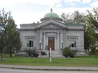
Bellows Falls is an incorporated village located in the town of Rockingham in Windham County, Vermont, United States. The population was 2,747 at the 2020 census. Bellows Falls is home to the Green Mountain Railroad, a heritage railroad; the annual Roots on the River Festival; and the No Film Film Festival.

<span class="mw-page-title-main">Rockingham, Vermont</span> Town in Vermont, United States

Rockingham is a town along the Connecticut River in Windham County, Vermont, United States. As of the 2020 census, the population was 4,832. Rockingham includes the incorporated villages of Bellows Falls and Saxtons River, as well as a large rural area west of Interstate 91.

<span class="mw-page-title-main">Hinsdale, New Hampshire</span> Town in New Hampshire, United States

Hinsdale is a town in Cheshire County, New Hampshire, United States. The population was 3,948 at the 2020 census. Hinsdale is home to part of Pisgah State Park in the northeast, and part of Wantastiquet Mountain State Forest in the northwest.

<span class="mw-page-title-main">Charlestown (CDP), New Hampshire</span> Census-designated place in New Hampshire, United States

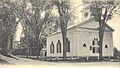
Charlestown is a census-designated place (CDP) and the main village in the town of Charlestown, Sullivan County, New Hampshire, United States. The population of the CDP was 1,078 at the 2020 census, out of 4,806 in the entire town.

<span class="mw-page-title-main">Charlestown, New Hampshire</span> Place in New Hampshire, United States

Charlestown is a town in Sullivan County, New Hampshire, United States. The population was 4,806 at the 2020 census, down from 5,114 at the 2010 census. The town is home to Hubbard State Forest and the headquarters of the Student Conservation Association.

<span class="mw-page-title-main">Westminster (town), Vermont</span> Town in Vermont, United States

Westminster is a town in Windham County, Vermont, United States. The population was 3,016 at the 2020 census. It is also the first capital of the Republic of Vermont. It borders the state of New Hampshire.

<span class="mw-page-title-main">North Walpole, New Hampshire</span> Census-designated place in New Hampshire, United States

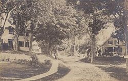
North Walpole is a census-designated place (CDP) in the town of Walpole in Cheshire County, New Hampshire, United States. It had a population of 785 at the 2020 census, making it the largest village in the town of Walpole.

<span class="mw-page-title-main">Walpole (CDP), New Hampshire</span> Census-designated place in New Hampshire, United States

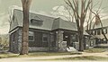
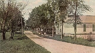
Walpole is a census-designated place (CDP) and the central village in the town of Walpole in Cheshire County, New Hampshire, United States. The population of the CDP was 573 at the 2020 census, compared to 3,633 in the entire town.

References

  1. 1 2 "2021 U.S. Gazetteer Files – New Hampshire". United States Census Bureau. Retrieved November 5, 2021.
  2. 1 2 3 "Walpole town, Cheshire County, New Hampshire: 2020 DEC Redistricting Data (PL 94-171)". U.S. Census Bureau. Retrieved November 5, 2021.
  3. Coolidge, Austin J.; John B. Mansfield (1859). A History and Description of New England. Boston, Massachusetts: A.J. Coolidge. pp.  668–671. coolidge mansfield history description new england 1859.
  4. Matteson, John. Eden's Outcasts: The Story of Louisa May Alcott and Her Father. New York: W. W. Norton & Company, 2007: 221–231. ISBN   978-0-393-33359-6
  5. "Census of Population and Housing". Census.gov. Retrieved June 4, 2016.
  6. 1 2 3 "Profile of General Population and Housing Characteristics: 2010 Census Summary File 1 (DP-1): Walpole town, Cheshire County, New Hampshire". U.S. Census Bureau, American Factfinder. Archived from the original on February 13, 2020. Retrieved October 27, 2017.
  7. "Selected Economic Characteristics: 2011-2015 American Community Survey 5-Year Estimates (DP03): Walpole town, Cheshire County, New Hampshire". U.S. Census Bureau, American Factfinder. Archived from the original on February 13, 2020. Retrieved October 27, 2017.
  8. Walpole Academy Museum, the Walpole Historical Society