West Hopkinton, New Hampshire

Last updated
West Hopkinton, New Hampshire
Populated place

West Hopkinton Railroad Depot.jpg

West Hopkinton Railroad Depot circa early 1900s
USA New Hampshire location map.svg
Red pog.svg
West Hopkinton
Usa edcp location map.svg
Red pog.svg
West Hopkinton
Coordinates: 43°11′31″N71°44′53″W / 43.1920236°N 71.7481328°W / 43.1920236; -71.7481328 Coordinates: 43°11′31″N71°44′53″W / 43.1920236°N 71.7481328°W / 43.1920236; -71.7481328
Country United States
State New Hampshire
County Merrimack
Town Hopkinton
Elevation 370 ft (115 m)
Time zone Eastern (EST) (UTC-5)
  Summer (DST) EDT (UTC-4)
ZIP code 03229
Area code(s) 603
FIPS code 33-82260
GNIS feature ID 0870776

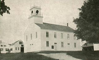
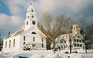
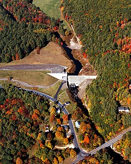
West Hopkinton is a populated place [1] within the town of Hopkinton in Merrimack County, New Hampshire, United States. West Hopkinton is well known for its agricultural center, preservation of historical landmarks and recreational activities within the village.

Hopkinton, New Hampshire Town in New Hampshire, United States

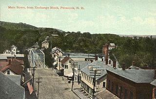
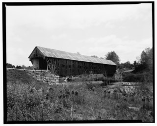
Hopkinton is a town in Merrimack County, New Hampshire, United States. The population was 5,589 at the 2010 census. The town has three distinct communities: Hopkinton village, mainly a residential area in the center of the town; Contoocook, the town's business hub, located in the north; and West Hopkinton, within the more agricultural portion of the town. The town is home to the Hopkinton State Fair, adjacent to Contoocook village, and to the historic Contoocook Railroad Depot and the Contoocook Railroad Bridge, the oldest covered railroad bridge in the United States.

Merrimack County, New Hampshire County in the United States

Merrimack County is a county in the U.S. state of New Hampshire. As of the 2010 census, the population was 146,445, making it the third-most populous county in New Hampshire. Its county seat is Concord, the capital of New Hampshire. The county was organized in 1823 from parts of Hillsborough and Rockingham counties, and is named for the Merrimack River. Merrimack County comprises the Concord, NH Micropolitan Statistical Area, which in turn constitutes a portion of the Boston-Worcester-Providence, MA-RI-NH-CT Combined Statistical Area. In 2010, the center of population of New Hampshire was located in Merrimack County, in the town of Pembroke.

New Hampshire State of the United States of America

New Hampshire is a state in the New England region of the northeastern United States. It is bordered by Massachusetts to the south, Vermont to the west, Maine and the Atlantic Ocean to the east, and the Canadian province of Quebec to the north. New Hampshire is the 5th smallest by area and the 10th least populous of the 50 states. Concord is the state capital, while Manchester is the largest city in the state. It has no general sales tax, nor is personal income taxed at either the state or local level. The New Hampshire primary is the first primary in the U.S. presidential election cycle. Its license plates carry the state motto, "Live Free or Die". The state's nickname, "The Granite State", refers to its extensive granite formations and quarries.

History

West Hopkinton was once a thriving village with many businesses such as several mills including the Kingsbury & Davis Machine Company, a creamery, grocery store and a number of working farms. West Hopkinton had its own post office which opened on May 29, 1857; a small railroad depot on the original Contoocook River Railroad line, the Rowell's Covered Bridge and New Henniker Bridge. [2] [3]

Creamery

In a dairy, the creamery is the location of cream processing. Cream is separated from whole milk; pasteurization is done to the skimmed milk and cream separately. Whole milk for sale has had some cream returned to the skimmed milk.

The Contoocook River Railroad, or CRR, is a former railway company in New Hampshire. The CRR was first established on June 24, 1848, as Contoocook Valley Railroad founded and built on a standard gauge railway line from Contoocook to Hillsboro which was opened in December 1849. The 14.7 mile long route branched in Contoocook with the Concord and Claremont Railroad. The southern continuation of this path toward Massachusetts was subsequently amended to include the Peterborough and Hillsborough Railroad.

Rowells Covered Bridge

Rowell's Covered Bridge is a covered bridge in West Hopkinton, New Hampshire, which carries Rowell Bridge Road over the Contoocook River. The Long truss bridge was completed in 1853, and is one of New Hampshire's few surviving 19th-century covered bridges. It was listed on the National Register of Historic Places in 1976. It is named for Abram Rowell, an early resident of the area.

As a result of increased flooding in the Northeast in the early 20th century, plans for the Hopkinton-Everett Dams were developed, with the Hopkinton Dam being built 0.2 miles (0.3 km) south of West Hopkinton on the Contoocook River and the Everett Dam on the Piscataquog River in the town of Weare. The dams were completed in 1962. The resulting flood control lands are connected by an artificial channel that crosses the height of land between the two river valleys.

Northeastern United States region of the United States

The Northeastern United States, also referred to as simply the Northeast, is a geographical region of the United States bordered to the north by Canada, to the east by the Atlantic Ocean, to the south by the Southern United States, and to the west by the Midwestern United States. The Northeast is one of the four regions defined by the United States Census Bureau for the collection and analysis of statistics.

Piscataquog River river in the United States of America

The Piscataquog River is a 34.7-mile-long (55.8 km) river located in southern New Hampshire in the United States. It is a tributary of the Merrimack River, which flows to the Gulf of Maine.

Weare, New Hampshire Town in New Hampshire, United States

Weare is a town in Hillsborough County, New Hampshire, United States. The population was 8,785 at the 2010 census. It is close to two important New Hampshire cities, Manchester and Concord.

West Hopkinton as viewed from the Hopkinton Dam on the Contoocook River West Hopkinton From Dam.jpg
West Hopkinton as viewed from the Hopkinton Dam on the Contoocook River

Related Research Articles

Contoocook, New Hampshire Census-designated place in New Hampshire, United States

Contoocook is a village and census-designated place (CDP) within the town of Hopkinton in Merrimack County, New Hampshire, United States. The population was 1,444 at the 2010 census. Contoocook is well known for its growth of small businesses, preservation of historical landmarks, community involvement and recreational activities within the village.

Franklin, New Hampshire City in New Hampshire, United States

Franklin is a city in Merrimack County, New Hampshire, United States. At the 2010 census, the population was 8,477, the least of any of New Hampshire's 13 cities. Franklin includes the village of West Franklin.

Henniker, New Hampshire Town in New Hampshire, United States

Henniker is a town in Merrimack County, New Hampshire, United States. As of the 2010 census, the town had a total population of 4,836. Henniker is home to New England College and Pats Peak Ski Area. Henniker is a college town and resort area, featuring both skiing and white-water kayaking.

U.S. Route 302 is an east–west spur of U.S. Route 2 in northern New England in the United States. It currently runs 171 miles (275 km) from Montpelier, Vermont, beginning at US 2, to Portland, Maine, at U.S. Route 1. It passes through the states of Vermont, New Hampshire and Maine.

Penacook, New Hampshire Village in New Hampshire, United States

Penacook, originally called "Fisherville", is a village within the city of Concord in Merrimack County, New Hampshire, United States. It lies along Concord's northern border with Boscawen. The name comes from the Pennacook tribe that lived in the area. "Penacook" (Pennycook) was the original name of the plantation incorporated by present-day Concord.

Nubanusit Brook

Nubanusit Brook is a 14.3-mile-long (23.0 km) stream located in southern New Hampshire in the United States. It is a tributary of the Contoocook River, part of the Merrimack River watershed.

Warner River river in the United States of America

The Warner River is a 20.3-mile-long (32.7 km) river located in central New Hampshire in the United States. It is a tributary of the Contoocook River, part of the Merrimack River watershed.

Blackwater River (Contoocook River tributary) river in United States of America

The Blackwater River is a 37.5-mile-long (60.4 km) river located in central New Hampshire in the United States. It is a tributary of the Contoocook River, part of the Merrimack River watershed.

Contoocook Railroad Bridge

The Contoocook Railroad Bridge is a covered bridge on the former Contoocook Valley Railroad line spanning the Contoocook River in the center of the village of Contoocook, New Hampshire, United States. It is referred to in the National Register of Historic Places as the Hopkinton Railroad Covered Bridge, for the town of Hopkinton, New Hampshire, in which the village of Contoocook is located.

Contoocook Railroad Depot railway station in Hopkinton, New Hampshire

The Contoocook Railroad Depot is located in Hopkinton, New Hampshire, United States, in the village of Contoocook. The depot was completed in 1849 as one of the first substantial railroad passenger stations west of Concord on the Concord and Claremont Railroad. The building is one of the best preserved of a small number of gable-roofed railroad stations surviving from the first decade of rail development in New Hampshire. The station exemplifies the pioneering period of rail development in the state.

Hillsborough Railroad Bridge

The Hillsborough Railroad Bridge was a historic covered railroad bridge spanning the Contoocook River in Hillsborough, New Hampshire. Built in 1903 by the Boston and Maine Railroad, it was destroyed by arson in 1985. The bridge was listed on the National Register of Historic Places in 1975. At the time of its nomination it was one of six covered railroad bridges in the state; it and at least one other were destroyed by the actions of arsonists.

Hopkinton State Fair

The Hopkinton State Fair is an annual fair taking place in the village of Contoocook in Hopkinton, New Hampshire, United States. The fair began in 1915 and has continued to grow and become one of the most well known events in New England, and the largest fair in New Hampshire.

New Henniker Bridge bridge in United States of America

New Henniker Bridge or New Bridge was a covered bridge in West Hopkinton, New Hampshire, which carried Henniker Road over the Contoocook River. The truss bridge was completed in 1863, and was the second bridge on the site. The original stone arch bridge was built in 1845 and was washed away by flood in 1852. The bridge was just over 20 feet (6.1 m) wide and 180 feet (55 m) long, and consisted of a single span supported by two triple lattice trusses resting on granite abutments. The patent drawings show an all-timber truss with fixed intersection angles in the center of the span. At the ends of the span the angles of the diagonals vary. The end post is vertical, and each brace further from it is sloped a little more.

References

  1. New Hampshire Employment Security, , Hopkinton NH Community Profile
  2. Mala Duclos Tyler (2012). Hopkinton and Contoocook. Arcadia Publishing. ISBN   9780738591377.
  3. Lord, Charles Chase (1890). Life and times in Hopkinton, NH. Concord, N.H. Republican press association.