Danbury, New Hampshire

Last updated

Danbury, New Hampshire
George Gamble Library, Danbury NH.jpg
George Gamble Library
Merrimack County New Hampshire incorporated and unincorporated areas Danbury highlighted.svg
Location in Merrimack County and the state of New Hampshire.
Coordinates: 43°31′33″N71°51′48″W / 43.52583°N 71.86333°W / 43.52583; -71.86333
Country United States
State New Hampshire
County Merrimack
Incorporated 1795
Villages
  • Danbury
  • Elmwood
  • South Danbury
Government
   Board of Selectmen
  • Jessica L. Hatch, Chair
  • Tracy H. Shepard
  • Ruby P. Hill
Area
[1]
  Total38.0 sq mi (98.5 km2)
  Land37.7 sq mi (97.7 km2)
  Water0.3 sq mi (0.8 km2)  0.81%
Elevation
825 ft (251 m)
Population
 (2020) [2]
  Total1,250
  Density33/sq mi (12.8/km2)
Time zone UTC-5 (Eastern)
  Summer (DST) UTC-4 (Eastern)
ZIP code
03230
Area code 603
FIPS code 33-16980
GNIS feature ID0873574
Website www.townofdanburynh.com

Danbury is a town in Merrimack County, New Hampshire, United States. The population was 1,250 at the 2020 census. [2]

Contents

History

Inland Farm in 1916 Inland Farm, Danbury, New Hampshire.jpg
Inland Farm in 1916

Danbury was first settled c.1771 as a part of Alexandria, but mountainous terrain separated it from the rest of the town. In 1795, it was set off and incorporated, the name suggested by a settler from Danbury, Connecticut. The town later grew by adding land from Wilmot and Hill. Farmers found the surface mostly hilly, but with some good intervales suitable for agriculture. Raising cattle and sheep became the principal occupation. By 1859, when the population was 934, it had seven sawmills, two shingle, lath and clapboard mills, and one tannery. [3]

Geography

According to the United States Census Bureau, the town has a total area of 38.0 square miles (98.5 km2), of which 37.7 square miles (97.7 km2) are land and 0.3 square miles (0.8 km2) are water, comprising 0.81% of the town. [1] The Smith River, an east-flowing tributary of the Pemigewasset River, runs through the center of town, while the southwest part of town is drained by Walker Brook and Frazier Brook, south-flowing tributaries of the Blackwater River, which continues on to the Contoocook River. The northeast corner of the town drains east to Newfound Lake, which flows into the Pemigewasset River. The entire town is part of the Merrimack River watershed. [4] Waukeena Lake, School Pond, and Bog Pond are a few of the bodies of water within the town limits.

The highest point in Danbury is the summit of Tinkham Hill, at 2,320 feet (710 m) above sea level, in the northern part of town. Ragged Mountain is a prominent mountain with multiple summits which occupies the southern portion of town and has a ski area of the same name; the elevation of the Danbury summit of Ragged is 2,225 ft (678 m) above sea level. The Sunapee-Ragged-Kearsarge Greenway hiking trail crosses a corner of Danbury along Ragged Mountain's Ridge Trail. Access to the Ridge Trail from the SRK Greenway is on the SRKG 6.1 mile trail section 9, either from trailhead parking on New Canada Road in Wilmot from the northwest or from Proctor Academy's trailhead parking in Andover from the southeast.

Danbury is located approximately 35 miles (56 km) northwest of Concord, the state capital, and 50 miles (80 km) northwest of Manchester, the state's largest city. Danbury is the northernmost town in Merrimack County and lies within the Dartmouth-Lake Sunapee Region. The town is served by U.S. Route 4 and New Hampshire Route 104.

Danbury post office Danbury, NH post office.jpg
Danbury post office

Adjacent municipalities

Demographics

Historical population
CensusPop.Note
1790 111
1800 16548.6%
1810 345109.1%
1820 46735.4%
1830 78668.3%
1840 8001.8%
1850 93416.8%
1860 9471.4%
1870 796−15.9%
1880 760−4.5%
1890 683−10.1%
1900 654−4.2%
1910 592−9.5%
1920 516−12.8%
1930 498−3.5%
1940 57816.1%
1950 496−14.2%
1960 435−12.3%
1970 48912.4%
1980 68039.1%
1990 88430.0%
2000 1,07121.2%
2010 1,1648.7%
2020 1,2507.4%
U.S. Decennial Census [2] [5]

In 1800, there were 165 people living in Danbury, according to the first official census.

As of the 2000 census, [6] there were 1,071 people, 435 households, and 310 families residing in the town. The population density was 28.6 inhabitants per square mile (11.0/km2). There were 596 housing units at an average density of 15.9 per square mile (6.1/km2). The racial makeup of the town was:

Hispanic or Latino of any race were 0.47% of the population. (U.S. average: 12.5%)

In 2000, there were 435 households with an average household size of 2.46 and an average family size of 2.84.

Danbury Inn in 1916 Danbury Inn, Danbury, NH.jpg
Danbury Inn in 1916

In 2000, the town's population had a median age of 41 years (U.S. average: 35.3).

For every 100 females, there were 104.0 males. For every 100 females age 18 and over, there were 104.7 males.

The median income for a household in the town was $38,313 (U.S. average: $41,994). The median income for a family was $40,809 (U.S. average: $50,046). Males had a median income of $32,105 versus $26,328 for females. The per capita income for the town was $18,339. About 8.9% of families (U.S. average: 9.2%), and 11.1% of the population (U.S. average: 12.4%) were below the poverty line, including 11.9% of those under age 18 and 9.3% of those age 65 or over.

Education

Danbury is within the Newfound Area School District. [7] Danbury Elementary School is in the community. The district's secondary schools are Newfound Memorial Middle School, and Newfound Regional High School in Bristol.

Places of interest

Notable people

See also

Related Research Articles

<span class="mw-page-title-main">Lincoln, New Hampshire</span> Town in New Hampshire, United States

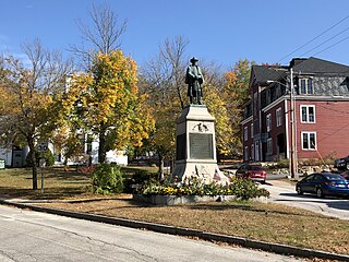
Lincoln is a town in Grafton County, New Hampshire, United States. It is the second-largest town by area in New Hampshire. The population was 1,631 at the 2020 census. The town is home to the New Hampshire Highland Games and to a portion of Franconia Notch State Park. Set in the White Mountains, large portions of the town are within the White Mountain National Forest. The Appalachian Trail crosses the western and northeastern parts of the town. Lincoln is the location of Loon Mountain Ski Resort and associated recreation-centered development.

<span class="mw-page-title-main">Merrimack County, New Hampshire</span> County in New Hampshire, United States

Merrimack County is a county in the U.S. state of New Hampshire. As of the 2020 Census, the population was 153,808, making it the third most populous county in New Hampshire. Its county seat is Concord, the state capital. The county was organized in 1823 from parts of Hillsborough and Rockingham counties, and is named for the Merrimack River. Merrimack County comprises the Concord, NH Micropolitan Statistical Area, which in turn constitutes a portion of the Boston–Worcester–Providence, MA–RI–NH–CT Combined Statistical Area. In 2010, the center of population of New Hampshire was located in Merrimack County, in the town of Pembroke.

<span class="mw-page-title-main">New Hampton, New Hampshire</span> Town in New Hampshire, United States

New Hampton is a town in Belknap County, New Hampshire, United States. The population was 2,377 at the 2020 census. A winter sports resort area, New Hampton is home to George Duncan State Forest and to the New Hampton School, a private preparatory school established in 1821.

<span class="mw-page-title-main">Alexandria, New Hampshire</span> Town in New Hampshire, United States

Alexandria is a town in Grafton County, New Hampshire, United States. The population was 1,776 at the 2020 census, up from 1,613 at the 2010 census. Newfound Lake is in the northeast corner, with Wellington State Park on the western shore. The town is home to Welton Falls State Forest. Cardigan Mountain State Park, with Mount Cardigan, is in the west. Another attraction is Mowglis Mountain, named for Rudyard Kipling's Jungle Book hero.

<span class="mw-page-title-main">Bridgewater, New Hampshire</span> Town in New Hampshire, United States

Bridgewater is a town in Grafton County, New Hampshire, United States. The population was 1,160 at the 2020 census.

<span class="mw-page-title-main">Campton, New Hampshire</span> Town in New Hampshire, United States

Campton is a town in Grafton County, New Hampshire, United States. The population was 3,343 at the 2020 census. Campton, which includes the villages of Blair, Campton Hollow, Lower Campton and West Campton, is home to Blair State Forest and Livermore Falls State Forest. It is located in the foothills of the White Mountains, and parts of the White Mountain National Forest are in the northeast and northwest.

<span class="mw-page-title-main">Groton, New Hampshire</span> Town in New Hampshire, United States

Groton is a town in Grafton County, New Hampshire, United States. The population was 569 at the 2020 census.

<span class="mw-page-title-main">Hebron, New Hampshire</span> Town in New Hampshire, United States

Hebron is a town in Grafton County, New Hampshire, United States. The population was 632 at the 2020 census. Settlements include the town center and the village of East Hebron.

<span class="mw-page-title-main">Holderness, New Hampshire</span> Town in New Hampshire, United States

Holderness is a town in Grafton County, New Hampshire, United States. The population was 2,004 at the 2020 census. An agricultural and resort area, Holderness is home to the Squam Lakes Natural Science Center and is located on Squam Lake. Holderness is also home to Holderness School, a co-educational college-preparatory boarding school.

<span class="mw-page-title-main">Orange, New Hampshire</span> Town in New Hampshire, United States

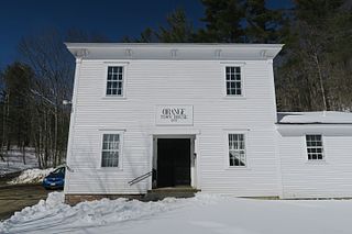
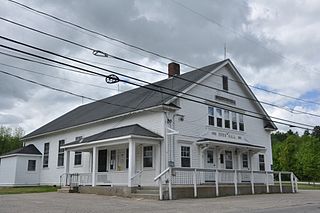
Orange is a town in Grafton County, New Hampshire, United States. The population was 277 at the 2020 census, down from 331 at the 2010 census.

<span class="mw-page-title-main">Warren, New Hampshire</span> Town in New Hampshire, United States

Warren is a town in Grafton County, New Hampshire, United States. The population was 825 at the 2020 census, down from 904 at the 2010 census. Warren includes the village of Glencliff. The Appalachian Trail crosses the town in the west.

<span class="mw-page-title-main">Andover, New Hampshire</span> Town in New Hampshire, United States

Andover is a town in Merrimack County, New Hampshire, United States. The population was 2,406 at the 2020 census. Andover includes the villages of Cilleyville, Potter Place, East Andover, and West Andover, in addition to the town center. The town is home to Ragged Mountain State Forest and Proctor Academy, a private coeducational preparatory school.

<span class="mw-page-title-main">Canterbury, New Hampshire</span> Town in New Hampshire, United States

Canterbury is a town in Merrimack County, New Hampshire, United States. The population was 2,389 at the 2020 census. The Canterbury Shaker Village is in the eastern part of the town.

<span class="mw-page-title-main">Epsom, New Hampshire</span> Town in New Hampshire, United States

Epsom is a town in Merrimack County, New Hampshire, United States. The population was 4,834 at the 2020 census.

<span class="mw-page-title-main">Sutton, New Hampshire</span> Town in New Hampshire, United States

Sutton is a town in Merrimack County, New Hampshire, United States. The population was 1,978 at the 2020 census. Sutton includes the villages of Sutton Mills, North Sutton, South Sutton and East Sutton. North Sutton is home to Wadleigh State Park on Kezar Lake.

<span class="mw-page-title-main">Warner, New Hampshire</span> Town in New Hampshire, United States

Warner is a town in Merrimack County, New Hampshire, United States. The population was 2,937 at the 2020 census. The town is home to Magdalen College of the Liberal Arts, Rollins State Park and Mount Kearsarge State Forest.

<span class="mw-page-title-main">Wilmot, New Hampshire</span> Town in New Hampshire, United States

Wilmot is a town in Merrimack County, New Hampshire, United States. The population was 1,407 at the 2020 census. The town includes the communities of Wilmot, Wilmot Flat, and North Wilmot.

<span class="mw-page-title-main">East Kingston, New Hampshire</span> Place in New Hampshire, United States

East Kingston is a town in Rockingham County, New Hampshire, United States. The population was 2,441 at the 2020 census.

<span class="mw-page-title-main">Springfield, New Hampshire</span> Place in New Hampshire, United States

Springfield is a town in Sullivan County, New Hampshire, United States. The population was 1,259 at the 2020 census. Gile State Forest is located within the town.

<span class="mw-page-title-main">Bristol (CDP), New Hampshire</span> Census-designated place in New Hampshire, United States

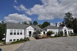
Bristol is a census-designated place (CDP) and the main village in the town of Bristol in Grafton County, New Hampshire, United States. The population of the CDP was 1,911 at the 2020 census, out of 3,244 in the entire town.

References

  1. 1 2 "2021 U.S. Gazetteer Files – New Hampshire". United States Census Bureau. Retrieved December 14, 2021.
  2. 1 2 3 "Danbury town, Merrimack County, New Hampshire: 2020 DEC Redistricting Data (PL 94-171)". U.S. Census Bureau. Retrieved December 14, 2021.
  3. Coolidge, Austin J.; John B. Mansfield (1859). A History and Description of New England. Boston, Massachusetts: A.J. Coolidge. p.  463. coolidge mansfield history description new england 1859.
  4. Foster, Debra H.; Batorfalvy, Tatianna N.; Medalie, Laura (1995). Water Use in New Hampshire: An Activities Guide for Teachers. U.S. Department of the Interior and U.S. Geological Survey.
  5. "Census of Population and Housing". Census.gov. Retrieved June 4, 2016.
  6. "U.S. Census website". United States Census Bureau . Retrieved January 31, 2008.
  7. "Central Office". Newfound Area School District. Archived from the original on April 11, 2020. Retrieved April 11, 2020.