Templeton, Massachusetts

Last updated

Templeton, Massachusetts
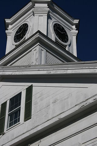
First Church of Templeton MA.jpg
First Church of Templeton
TempletonMa seal.svg
Motto: 
"Industry"
Worcester County Massachusetts incorporated and unincorporated areas Templeton highlighted.svg
Location in Worcester County and the state of Massachusetts.
Coordinates: 42°33′20″N72°04′05″W / 42.55556°N 72.06806°W / 42.55556; -72.06806
Country United States
State Massachusetts
County Worcester
Settled1751
Incorporated1762
Government
  Type Open town meeting
Area
  Total32.4 sq mi (83.9 km2)
  Land32.0 sq mi (83.0 km2)
  Water0.4 sq mi (1.0 km2)
Elevation
1,141 ft (348 m)
Population
 (2020)
  Total8,149
  Density250/sq mi (97/km2)
Time zone UTC−5 (Eastern)
  Summer (DST) UTC−4 (Eastern)
ZIP Codes
01436, 01438, 01468
Area code 351/978
FIPS code 25-69275
GNIS feature ID0619492
Website www.TempletonMA.gov

Templeton is a town in Worcester County, Massachusetts, United States. The population was 8,149 at the 2020 census. [1] The town comprises four main villages: Templeton Center, East Templeton, Baldwinville, and Otter River.

Contents

Geography

According to the United States Census Bureau, the town has a total area of 32.4 square miles (84 km2), of which 32.0 square miles (83 km2) is land and 0.4 square miles (1.0 km2), or 1.17%, is water.

Templeton is bordered by Royalston and Winchendon to the north, Gardner to the east, Hubbardston to the southeast, and Phillipston to the west.

Demographics

Historical population
YearPop.±%
1850 2,173    
1860 2,816+29.6%
1870 2,802−0.5%
1880 2,789−0.5%
1890 2,999+7.5%
1900 3,489+16.3%
1910 3,756+7.7%
1920 4,019+7.0%
1930 4,159+3.5%
1940 4,601+10.6%
1950 4,757+3.4%
1960 5,371+12.9%
1970 5,863+9.2%
1980 6,070+3.5%
1990 6,438+6.1%
2000 6,799+5.6%
2010 8,013+17.9%
2020 8,149+1.7%
2022*8,183+0.4%
* = population estimate.
Source: United States census records and Population Estimates Program data. [2] [3] [4] [5] [6] [7] [8] [9] [10] [11] [12]

As of the census [13] of 2000, there were 6,799 people, 2,411 households, and 1,808 families residing in the town. The population density was 212.2 people per square mile (81.9/km2). There were 2,597 housing units at an average density of 81.1 per square mile (31.3/km2). The racial makeup of the town was 98.15% White, 0.35% African American, 0.22% Native American, 0.28% Asian, 0.43% from other races, and 0.57% from two or more races. Hispanic or Latino of any race were 1.44% of the population. Other ethnicities: 19.2% were of French, 13.3% French Canadian, 12.8% Irish, 10.1% Italian, 9.6% English, 8.0% Polish, 5.4% Finnish and 5.4% American ancestry according to Census 2000.

There were 2,411 households, out of which 35.3% had children under the age of 18 living with them, 60.5% were married couples living together, 9.4% had a female householder with no husband present, and 25.0% were non-families. Of all households, 19.7% were made up of individuals, and 9.5% had someone living alone who was 65 years of age or older. The average household size was 2.71 and the average family size was 3.09.

In the town, the population was spread out, with 26.1% under the age of 18, 6.0% from 18 to 24, 31.1% from 25 to 44, 23.9% from 45 to 64, and 12.9% who were 65 years of age or older. The median age was 38 years. For every 100 females, there were 101.0 males. For every 100 females age 18 and over, there were 99.2 males.

The median income for a household in the town was $48,482, and the median income for a family was $52,936. Males had a median income of $38,088 versus $26,993 for females. The per capita income for the town was $21,994. About 7.4% of families and 9.1% of the population were below the poverty line, including 10.5% of those under age 18 and 13.4% of those age 65 or over.

Education

Templeton is part of the Narragansett Regional School District, along with Phillipston. Elementary School students attend Templeton Memorial School, middle school students attend Narragansett Regional Middle School, and high school students attend Narragansett Regional High School.

Government

County-level state agency heads
Clerk of Courts:Dennis P. McManus (D)
District Attorney:Joe Early Jr. (D)
Register of Deeds:Katie Toomey (D)
Register of Probate:Stephanie Fattman (R)
County Sheriff: Lew Evangelidis (R)
State government
State Representative(s):Susannah Whipps Lee (R)
State Senator(s):Anne Gobi (D)
Governor's Councilor(s):Jen Caissie (R)
Federal government
U.S. Representative(s): James P. McGovern (D-2nd District),
U.S. Senators: Elizabeth Warren (D), Ed Markey (D)

Library

Boynton Public library (1891), named after John Boynton, manufacturer and philanthropist 1891 Templeton public library Massachusetts.png
Boynton Public library (1891), named after John Boynton, manufacturer and philanthropist

Templeton's Boynton Public Library began in 1868 and named after John Boynton. [14] [15] In fiscal year 2008, the town of Templeton spent 0.49% ($53,608) of its budget on its public library—approximately $6 per person, per year ($7.91 adjusted for inflation to 2022). [16]

Notable people

Forest

Otter River State Forest, operated by the Massachusetts Department of Conservation and Recreation, is located by Beamon Pond and includes 85 campsites, a swimming beach, picnic areas and a ball field.

Related Research Articles

<span class="mw-page-title-main">Hancock, Massachusetts</span> Town in Massachusetts, United States

Hancock is a town in Berkshire County, Massachusetts, United States. It is part of the Pittsfield, Massachusetts Metropolitan Statistical Area. The population was 757 at the 2020 census.
<span class="mw-page-title-main">Savoy, Massachusetts</span> Town in Massachusetts, United States

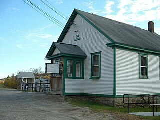
Savoy is a town in Berkshire County, Massachusetts, United States. It is part of the Pittsfield, Massachusetts Metropolitan Statistical Area. The population was 645 at the 2020 census.
<span class="mw-page-title-main">Swansea, Massachusetts</span> Town in Massachusetts, United States

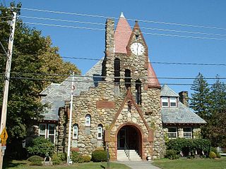
Swansea is a town in Bristol County in southeastern Massachusetts. It is located at the mouth of the Taunton River, just west of Fall River, 47 miles (76 km) south of Boston, and 12 miles (19 km) southeast of Providence, Rhode Island. The population was 17,144 at the 2020 census. The villages of Hortonville, Barneyville and Ocean Grove are located in the town.

<span class="mw-page-title-main">Merrimac, Massachusetts</span> Town in Massachusetts, United States

Merrimac is a small town in Essex County, Massachusetts, United States, and on the southeastern border of New Hampshire, approximately 34 miles (55 km) northeast of Boston and 10 miles (16 km) west of the Atlantic Ocean. It was incorporated on April 11, 1876. It is situated along the north bank of the Merrimack River in the Merrimack Valley. The population was 6,723 at the 2020 census. Historically a mill town, it has long since become a largely residential community. It is part of the Greater Boston metropolitan area.
<span class="mw-page-title-main">Erving, Massachusetts</span> Town in Massachusetts, United States

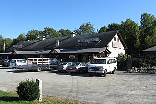
Erving is a town in Franklin County, Massachusetts, United States. The population was 1,665 at the 2020 census. It is part of the Springfield, Massachusetts metropolitan statistical area.

<span class="mw-page-title-main">Gill, Massachusetts</span> Town in Massachusetts, United States

Gill is a town in Franklin County, Massachusetts, United States. The population was 1,551 at the 2020 census. It is part of the Springfield, Massachusetts Metropolitan Statistical Area. The campus of Northfield Mount Hermon School is located in the Mount Hermon section of the town.

<span class="mw-page-title-main">Monroe, Massachusetts</span> Town in Massachusetts, United States

Monroe is a town in Franklin County, Massachusetts, United States. The population was 118 at the 2020 census. By area, population, and population density, it is the smallest town in the county; and is the second-smallest town by population in the Commonwealth, with only Gosnold having fewer residents.

<span class="mw-page-title-main">Montague, Massachusetts</span> Town in Massachusetts, United States

Montague is a town in Franklin County, Massachusetts, United States. The population was 8,580 at the 2020 census. It is part of the Springfield, Massachusetts metropolitan statistical area.

<span class="mw-page-title-main">Wales, Massachusetts</span> Town in Massachusetts, United States

Wales is a town in Hampden County, Massachusetts, United States. The population was 1,838 at the 2020 census. It is part of the Springfield, Massachusetts Metropolitan Statistical Area.

<span class="mw-page-title-main">Blackstone, Massachusetts</span> Town in Massachusetts, United States

Blackstone is a town in Worcester County, Massachusetts, United States. The population was 9,208 at the 2020 census. It is a part of the Providence metropolitan area.

<span class="mw-page-title-main">Hubbardston, Massachusetts</span> Town in Massachusetts, United States

Hubbardston is a town in Worcester County, Massachusetts, United States. As of the 2020 U.S. census, the town population was 4,328. It is situated 18 miles north of Worcester and 53 miles west of Boston; it is distinguished in Massachusetts by being unusually high at 1015 feet above sea level.

<span class="mw-page-title-main">Millbury, Massachusetts</span> Town in Massachusetts, United States

Millbury, officially the Town of Millbury, is a town in Worcester County, Massachusetts. Located within Blackstone Valley, the population in Millbury was 13,831 at the 2020 United States Census.

<span class="mw-page-title-main">Millville, Massachusetts</span> Town in Massachusetts, United States

Millville is a town in Worcester County, Massachusetts, United States. The population was 3,174 at the 2020 census. It is part of the Providence metropolitan area.
<span class="mw-page-title-main">Petersham, Massachusetts</span> Town in Massachusetts, United States

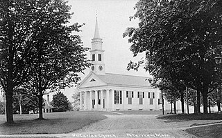
Petersham is a town in Worcester County, Massachusetts, United States. The population was 1,194 at the 2020 census. Petersham is home to a considerable amount of conservation land, including the Quabbin Reservation, Harvard Forest, the Swift River Reservation, and Federated Women's Club State Forest.

<span class="mw-page-title-main">Phillipston, Massachusetts</span> Town in Massachusetts, United States

Phillipston is a town in Worcester County, Massachusetts, United States. The population was 1,724 at the 2020 census.

<span class="mw-page-title-main">Royalston, Massachusetts</span> Town in Massachusetts, United States

Royalston is a town in Worcester County, Massachusetts, United States. The population was 1,250 at the 2020 census.
<span class="mw-page-title-main">Barre, Massachusetts</span> Town in Massachusetts, United States

Barre is a town in Worcester County, Massachusetts, United States. The population was 5,530 at the 2020 census.

<span class="mw-page-title-main">Hopedale, Massachusetts</span> Town in Massachusetts, United States

Hopedale is a town in Worcester County, Massachusetts, United States. It is located 25 miles southwest of Boston, in eastern Massachusetts. With origins as a Christian utopian community, the town was later home to Draper Corporation, a large loom manufacturer throughout the 20th century until its closure in 1980. Today, Hopedale has become a bedroom community for professionals working in Greater Boston and is home to highly ranked public schools. The population was 6,017 as of the 2020 census.

<span class="mw-page-title-main">Winchendon, Massachusetts</span> Town in Massachusetts, United States

Winchendon, nicknamed Toy Town is a town in Worcester County, Massachusetts, United States. The population was 10,364 at the 2020 census. The town includes the villages of Waterville and Winchendon Springs. A census-designated place, also named Winchendon, is defined within the town for statistical purposes. The Winchendon State Forest, a 174.5 acres parcel, is located within the township as is Otter River State Forest; both recreational areas are managed by the Massachusetts Department of Conservation and Recreation.

<span class="mw-page-title-main">North Brookfield, Massachusetts</span> Town in Massachusetts, United States

North Brookfield is a town in Worcester County, Massachusetts, United States. The population was 4,735 at the 2020 census.

References

  1. "Census - Geography Profile: Templeton town, Worcester County, Massachusetts". United States Census Bureau . Retrieved 2021-11-12.
  2. "Total Population (P1), 2010 Census Summary File 1". American FactFinder, All County Subdivisions within Massachusetts. United States Census Bureau. 2010.
  3. "Massachusetts by Place and County Subdivision - GCT-T1. Population Estimates". United States Census Bureau. Retrieved July 12, 2011.
  4. "1990 Census of Population, General Population Characteristics: Massachusetts" (PDF). US Census Bureau. December 1990. Table 76: General Characteristics of Persons, Households, and Families: 1990. 1990 CP-1-23. Retrieved July 12, 2011.
  5. "1980 Census of the Population, Number of Inhabitants: Massachusetts" (PDF). US Census Bureau. December 1981. Table 4. Populations of County Subdivisions: 1960 to 1980. PC80-1-A23. Retrieved July 12, 2011.
  6. "1950 Census of Population" (PDF). Bureau of the Census. 1952. Section 6, Pages 21-10 and 21-11, Massachusetts Table 6. Population of Counties by Minor Civil Divisions: 1930 to 1950. Retrieved July 12, 2011.
  7. "1920 Census of Population" (PDF). Bureau of the Census. Number of Inhabitants, by Counties and Minor Civil Divisions. Pages 21-5 through 21-7. Massachusetts Table 2. Population of Counties by Minor Civil Divisions: 1920, 1910, and 1920. Retrieved July 12, 2011.
  8. "1890 Census of the Population" (PDF). Department of the Interior, Census Office. Pages 179 through 182. Massachusetts Table 5. Population of States and Territories by Minor Civil Divisions: 1880 and 1890. Retrieved July 12, 2011.
  9. "1870 Census of the Population" (PDF). Department of the Interior, Census Office. 1872. Pages 217 through 220. Table IX. Population of Minor Civil Divisions, &c. Massachusetts. Retrieved July 12, 2011.
  10. "1860 Census" (PDF). Department of the Interior, Census Office. 1864. Pages 220 through 226. State of Massachusetts Table No. 3. Populations of Cities, Towns, &c. Retrieved July 12, 2011.
  11. "1850 Census" (PDF). Department of the Interior, Census Office. 1854. Pages 338 through 393. Populations of Cities, Towns, &c. Retrieved July 12, 2011.
  12. "City and Town Population Totals: 2020-2022". United States Census Bureau . Retrieved November 3, 2023.
  13. "U.S. Census website". United States Census Bureau . Retrieved 2008-01-31.
  14. C. B. Tillinghast. The free public libraries of Massachusetts. 1st Report of the Free Public Library Commission of Massachusetts. Boston: Wright & Potter, 1891.
  15. "Boynton Public Library". boyntonpubliclibrary.org. Archived from the original on June 22, 2011. Retrieved 24 April 2023.{{cite web}}: CS1 maint: unfit URL (link)
  16. July 1, 2007 through June 30, 2008; cf. The FY2008 Municipal Pie: What’s Your Share? Commonwealth of Massachusetts, Board of Library Commissioners. Boston: 2009. Available: Municipal Pie Reports Archived 2012-01-23 at the Wayback Machine . Retrieved 2010-08-04
  17. Who Was Who in America, Historical Volume, 1607–1896. Marquis Who's Who. 1967.