East Brookfield, Massachusetts

Last updated

East Brookfield, Massachusetts
EastBrookfield-MA.jpg
The Keith Block, formerly the East Brookfield Municipal Building
Flag of East Brookfield, Massachusetts.png
Seal of East Brookfield, Massachusetts.png
Worcester County Massachusetts incorporated and unincorporated areas East Brookfield highlighted.svg
Location in Worcester County and the state of Massachusetts.
Coordinates: 42°13′40″N72°02′50″W / 42.22778°N 72.04722°W / 42.22778; -72.04722
Country United States
State Massachusetts
County Worcester
Settled1664
Incorporated1920
Government
  Type Open town meeting
  Town SecretaryDeborah A. Morgan
Area
  Total10.4 sq mi (26.9 km2)
  Land9.8 sq mi (25.5 km2)
  Water0.5 sq mi (1.4 km2)
Elevation
620 ft (189 m)
Population
 (2020)
  Total2,224
  Density210/sq mi (83/km2)
Time zone UTC-5 (Eastern)
  Summer (DST) UTC-4 (Eastern)
ZIP code
01515
Area code 508 / 774
FIPS code 25-18560
GNIS feature ID0618362
Website www.eastbrookfieldma.us

East Brookfield is a town in Worcester County, Massachusetts, United States. The population was 2,224 at the 2020 United States Census. [1] The census-designated place of East Brookfield (CDP) is located in the town. The village of Union Chapel is also located in the town.

Contents

History

East Brookfield was first settled by Europeans in 1664 as part of the Quaboag Plantation lands. It became part of the new town of Brookfield in 1673, and was officially incorporated as a separate town in on March 24, 1920, making it the newest town (by date of incorporation) in Massachusetts.

Geography

According to the United States Census Bureau, the town has a total area of 10.4 square miles (27 km2), of which 9.8 square miles (25 km2) is land and 0.5 square miles (1.3 km2), or 5.11%, is water. East Brookfield is bordered on the north by North Brookfield, on the west by Brookfield, on the south by Sturbridge and Charlton, and on the east by Spencer.

Most community life in East Brookfield centers around Route 9, particularly the stretch closest to Lake Lashaway, on the road from Spencer to North Brookfield. Within a block of this stretch are found all of the town's churches, its school and former schools, most of its retail businesses and its current and former municipal office buildings. The latter is on Depot Square, a triangular crossroads near the post office and Redmans Hall, the site of the Senior Center and some town meetings.

West of the town center is the Quaboag River plains, known locally as "the Flats". The CSX Boston-to-Selkirk rail line runs parallel to Main Street through this section. North of Main Street is the town's main water body, Lake Lashaway. Southwest of the town center are the Quaboag and Quacumquasit Ponds (also known as North and South ponds). On Quacumquasit Pond is a YMCA residential summer camp, Camp Frank A. Day. Bordering the ponds, in the geographic center of town, is a sparsely populated marshland.

South of the marshes is sparsely populated woodland, formerly a village called Podunk—today marked only by a small cemetery along Podunk Road near the Sturbridge town line—and a hilly area called High Rocks. During his youth, the vaudeville entertainer George M. Cohan spent his summers with his relatives in Podunk. [2] He loved East Brookfield, and made the term "Podunk" famous, describing it in his comedy acts. Other entertainers started mentioning Podunk, [3] and the word entered the language, standing for any archetypal "backwater" town. [4]

Demographics

Historical population
YearPop.±%
1930 926    
1940 1,016+9.7%
1950 1,243+22.3%
1960 1,533+23.3%
1970 1,800+17.4%
1980 1,955+8.6%
1990 2,033+4.0%
2000 2,097+3.1%
2010 2,183+4.1%
2020 2,224+1.9%
2022*2,204−0.9%
* = population estimate. Source: United States Census records and Population Estimates Program data. [5] [6] [7] [8] [9] [10]

As of the census [11] of 2000, there were 2,097 people, 778 households, and 599 families residing in the town. The population density was 213.0 inhabitants per square mile (82.2/km2). There were 849 housing units at an average density of 86.2 per square mile (33.3/km2). The racial makeup of the town was 98.52% White, 0.43% Black or African American, 0.24% Native American, 0.14% Asian, 0.14% from other races, and 0.52% from two or more races. Hispanic or Latino of any race were 0.76% of the population.

There were 778 households, out of which 32.6% had children under the age of 18 living with them, 65.7% were married couples living together, 8.2% had a female householder with no husband present, and 22.9% were non-families. 18.9% of all households were made up of individuals, and 9.6% had someone living alone who was 65 years of age or older. The average household size was 2.70 and the average family size was 3.07.

In the town, the population was spread out, with 25.6% under the age of 18, 6.3% from 18 to 24, 30.0% from 25 to 44, 24.7% from 45 to 64, and 13.3% who were 65 years of age or older. The median age was 39 years. For every 100 females, there were 98.8 males. For every 100 females age 18 and over, there were 96.2 males.

The median income for a household in the town was $51,860, and the median income for a family was $57,500. Males had a median income of $41,739 versus $28,250 for females. The per capita income for the town was $22,629. About 2.8% of families and 3.9% of the population were below the poverty line, including 3.6% of those under age 18 and 9.2% of those age 65 or over.

Library

The East Brookfield public library was established in 1921. [12] [13] In fiscal year 2008, the town of East Brookfield spent 1.78% ($64,839) of its budget on its public library—approximately $31 per person. [14]

Education

State government
State Representative(s):Donnie Berthiaume (R)
State Senator(s):Anne M. Gobi (D)
Governor's Councilor(s):Jen Caissie (R)
Federal government
U.S. Representative(s): Richard E. Neal (D-1st District),
U.S. Senators: Elizabeth Warren (D), Ed Markey (D)

There is one active school in town. It is East Brookfield Elementary School. In 2002, they closed down two older schools, Lashaway Junior High School (built in 1882, also known as the Hodgkins School), which at the time of closing served grades 3–6, and the Memorial School, built in 1952. East Brookfield is regionalized K–12 with Spencer, and East Brookfield students also attend Knox Trail Junior High School (grades 7–8) and David Prouty High School (grades 9–12) in Spencer.

Points of interest

The Hodgkins School, also known as the Lashaway Junior High, was at the time of its closing in 2002 the oldest operating original, wooden school building in the nation. It is now the home of the East Brookfield Historical Museum, the Quaboag Valley Railroaders Club, and the Massasoit Art Guild. It is also the meeting place for Boy Scout Troop 238.

Notable people

Related Research Articles

<span class="mw-page-title-main">Worcester County, Massachusetts</span> County in Massachusetts, United States

Worcester County is a county in the U.S. state of Massachusetts. At the 2020 census, the population was 862,111, making it the second-most populous county in Massachusetts. It is also the largest county in Massachusetts by geographic area. The largest city and traditional shire town is Worcester. Worcester County is part of the Worcester, MA–CT metropolitan statistical area and the Boston-Worcester-Providence combined statistical area.

<span class="mw-page-title-main">Wendell, Massachusetts</span> Town in Massachusetts, United States

Wendell is a town in Franklin County, Massachusetts, United States. The population was 924 at the 2020 census. It is part of the Springfield, Massachusetts Metropolitan Statistical Area.

<span class="mw-page-title-main">Brimfield, Massachusetts</span> Town in Massachusetts, United States

Brimfield is a town in Hampden County, Massachusetts, United States. The population was 3,694 at the 2020 census. It is part of the Springfield, Massachusetts Metropolitan Statistical Area.

<span class="mw-page-title-main">Monson, Massachusetts</span> Town in Massachusetts, United States

Monson is a town in Hampden County, Massachusetts, United States. The population was 8,150 at the 2020 census. It is part of the Springfield, Massachusetts Metropolitan Statistical Area.

<span class="mw-page-title-main">Wales, Massachusetts</span> Town in Massachusetts, United States

Wales is a town in Hampden County, Massachusetts, United States. The population was 1,838 at the 2020 census. It is part of the Springfield, Massachusetts Metropolitan Statistical Area.

<span class="mw-page-title-main">Brookfield, Massachusetts</span> Town in Massachusetts, United States

Brookfield is a town in Worcester County, Massachusetts, United States. Brookfield was first settled by Europeans in 1660. The population was 3,439 at the 2020 census.

<span class="mw-page-title-main">Charlton, Massachusetts</span> Town in Massachusetts, United States

Charlton is a town in Worcester County, Massachusetts, United States. The population was 13,315 at the 2020 census.

<span class="mw-page-title-main">Fiskdale, Massachusetts</span> CDP in Sturbridge, Massachusetts, United States

Fiskdale is a census-designated place (CDP) in the town of Sturbridge in Worcester County, Massachusetts, United States. The population was 2,583 at the 2010 census.

<span class="mw-page-title-main">New Braintree, Massachusetts</span> Town in Massachusetts, United States

New Braintree is a town in Worcester County, Massachusetts, United States. The population was 996 at the 2020 census.

<span class="mw-page-title-main">Oakham, Massachusetts</span> Town in Massachusetts, United States

Oakham is a town in Worcester County, Massachusetts, United States. The population was 1,851 at the 2020 census.

<span class="mw-page-title-main">Elmore, Vermont</span> Town in Vermont, United States

Elmore is a town in Lamoille County, Vermont, United States. It was granted by the Vermont Republic in 1780, and was named for Colonel Samuel Elmore (1720–1805), one of the original grantees. The population was 886 at the 2020 census. Elmore contains the villages of East Elmore and Lake Elmore, as well as Elmore State Park, a 700-acre (2.8 km2) recreational area on the 219-acre (0.9 km2) Lake Elmore and on Elmore Mountain to the west.

<span class="mw-page-title-main">West Brookfield, Massachusetts</span> Town in Massachusetts, United States

West Brookfield is a town in Worcester County, Massachusetts, United States. The population was 3,833 at the 2020 census. Lucy Stone was born in West Brookfield, and George and Charles Merriam, the publishers of Webster's Dictionary, were raised there.

<span class="mw-page-title-main">Holland, Massachusetts</span> Town in Massachusetts, United States

Holland is a town in Hampden County, Massachusetts, United States. The population was 2,603 at the 2020 census. It is part of the Springfield, Massachusetts Metropolitan Statistical Area.

<span class="mw-page-title-main">Palmer, Massachusetts</span> City in Massachusetts, United States

Palmer is a city in Hampden County, Massachusetts, United States. The population was 12,448 at the 2020 census. It is part of the Springfield, Massachusetts Metropolitan Statistical Area. Palmer adopted a home rule charter in 2004 with a council-manager form of government. Palmer is one of thirteen Massachusetts municipalities that have city forms of government but retain "The town of" in their official names.

<span class="mw-page-title-main">Spencer, Massachusetts</span> Town in Massachusetts, United States

Spencer is a town in Worcester County, Massachusetts, United States. The population was 11,992 at the 2020 census.

<span class="mw-page-title-main">Sturbridge, Massachusetts</span> Town in Massachusetts, United States

Sturbridge is a town in Worcester County, Massachusetts, United States. It is home to Old Sturbridge Village living history museum and other sites of historical interest such as Tantiusques.

<span class="mw-page-title-main">Warren, Massachusetts</span> Town in Massachusetts, United States

Warren is a town in Worcester County, Massachusetts, United States. The population was 4,975 at the 2020 census. The town contains the villages of Warren and West Warren.

<span class="mw-page-title-main">Quaboag Pond</span> Lake in the U.S. state of Massachusetts

Quaboag Pond is a 537-acre (2.17 km2) pond located a couple of miles south of and between East Brookfield and Brookfield, Massachusetts. The pond lies about two miles (3 km) south of state Route 9 as it passes through East Brookfield. Quaboag Pond was once named Podunk Pond.

<span class="mw-page-title-main">East Brookfield River</span> River

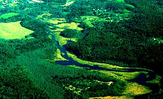
The East Brookfield River is a 2.4-mile-long (3.9 km) river in Massachusetts that heads at Lake Lashaway in East Brookfield at an elevation of 614 feet (187 m) above sea level. It continues to Quaboag Pond, at an elevation of 594 feet (181 m).

<span class="mw-page-title-main">North Brookfield, Massachusetts</span> Town in Massachusetts, United States

North Brookfield is a town in Worcester County, Massachusetts, United States. The population was 4,735 at the 2020 census.

References

  1. "Census - Geography Profile: East Brookfield town, Worcester County, Massachusetts" . Retrieved November 12, 2021.
  2. Macht, Norman L.: Connie Mack and the Early Years of Baseball
  3. "Yankee Magazine," excerpted in "The Eugene O'Neill Newsletter".
  4. Cecil Adams (October 14, 1988). "Where Is Podunk?". The Straight Dope. Retrieved July 7, 2011.
  5. "TOTAL POPULATION (P1), 2010 Census Summary File 1, All County Subdivisions within Massachusetts". United States Census Bureau. Archived from the original on February 12, 2020. Retrieved September 13, 2011.
  6. "Massachusetts by Place and County Subdivision - GCT-T1. Population Estimates". United States Census Bureau. Archived from the original on January 6, 2012. Retrieved July 12, 2011.
  7. "1990 Census of Population, General Population Characteristics: Massachusetts" (PDF). US Census Bureau. December 1990. Table 76: General Characteristics of Persons, Households, and Families: 1990. 1990 CP-1-23. Archived from the original (PDF) on December 7, 2013. Retrieved July 12, 2011.
  8. "1980 Census of the Population, Number of Inhabitants: Massachusetts" (PDF). US Census Bureau. December 1981. Table 4. Populations of County Subdivisions: 1960 to 1980. PC80-1-A23. Retrieved July 12, 2011.
  9. "1950 Census of Population" (PDF). 1: Number of Inhabitants. Bureau of the Census. 1952. Section 6, Pages 21-10 and 21-11, Massachusetts Table 6. Population of Counties by Minor Civil Divisions: 1930 to 1950. Retrieved July 12, 2011.{{cite journal}}: Cite journal requires |journal= (help)
  10. "City and Town Population Totals: 2020-2022". United States Census Bureau . Retrieved November 10, 2023.
  11. "U.S. Census website". United States Census Bureau . Retrieved January 31, 2008.
  12. Report of the Free Public Library Commission of Massachusetts. (1922).
  13. eastbrookfieldlibrary.org http://eastbrookfieldlibrary.org/ . Retrieved November 10, 2010.{{cite web}}: Missing or empty |title= (help)[ title missing ]
  14. July 1, 2007, through June 30, 2008; cf. The FY2008 Municipal Pie: What's Your Share? Commonwealth of Massachusetts, Board of Library Commissioners. Boston: 2009. Available: Municipal Pie Reports Archived January 23, 2012, at the Wayback Machine . Retrieved August 4, 2010