Oxford (CDP), Massachusetts

Last updated

Oxford, Massachusetts
CDP
First Congregational Church, Oxford MA.jpg
First Congregational Church
Worcester County Massachusetts incorporated and unincorporated areas Oxford (CDP) highlighted.svg
Location in Worcester County and the state of Massachusetts.
Coordinates: 42°6′43″N71°52′8″W / 42.11194°N 71.86889°W / 42.11194; -71.86889
Country United States
State Massachusetts
County Worcester
Area
[1]
  Total3.69 sq mi (9.55 km2)
  Land3.46 sq mi (8.97 km2)
  Water0.22 sq mi (0.58 km2)
Elevation
505 ft (154 m)
Population
 (2020)
  Total5,928
  Density1,711.32/sq mi (660.71/km2)
Time zone UTC-5 (Eastern (EST))
  Summer (DST) UTC-4 (EDT)
ZIP code
01540
Area code 508
FIPS code 25-51790
GNIS feature ID0610666

Oxford is a census-designated place (CDP) in the town of Oxford in Worcester County, Massachusetts, United States. The population was 6,103 at the 2010 census.

Contents

Geography

Oxford is located at 42°6′42″N71°52′8″W / 42.11167°N 71.86889°W / 42.11167; -71.86889 (42.111855, -71.868916). [2]

According to the United States Census Bureau, the CDP has a total area of 9.6 km2 (3.7 mi2). 9.1 km2 (3.5 mi2) of it is land and 0.6 km2 (0.2 mi2) of it (5.91%) is water.

Demographics

Historical population
CensusPop.Note
2020 5,928
U.S. Decennial Census [3]

As of the census [4] of 2000, there were 5,899 people, 2,282 households, and 1,567 families residing in the CDP. The population density was 650.7/km2 (1,683.9/mi2). There were 2,370 housing units at an average density of 261.4/km2 (676.5/mi2). The racial makeup of the CDP was 97.36% White, 0.51% Black or African American, 0.29% Native American, 0.46% Asian, 0.20% from other races, and 1.19% from two or more races. Hispanic or Latino of any race were 0.64% of the population.

There were 2,282 households, out of which 31.1% had children under the age of 18 living with them, 54.3% were married couples living together, 11.4% had a female householder with no husband present, and 31.3% were non-families. 26.7% of all households were made up of individuals, and 12.7% had someone living alone who was 65 years of age or older. The average household size was 2.55 and the average family size was 3.11.

In the CDP, the population was spread out, with 23.6% under the age of 18, 8.0% from 18 to 24, 30.2% from 25 to 44, 23.5% from 45 to 64, and 14.7% who were 65 years of age or older. The median age was 38 years. For every 100 females, there were 91.0 males. For every 100 females age 18 and over, there were 87.3 males.

The median income for a household in the CDP was $50,866, and the median income for a family was $58,030. Males had a median income of $42,306 versus $28,611 for females. The per capita income for the CDP was $21,149. About 5.8% of families and 9.8% of the population were below the poverty line, including 17.7% of those under age 18 and 5.5% of those age 65 or over.

Related Research Articles

<span class="mw-page-title-main">Moenkopi, Arizona</span> Community in Coconino County, Arizona

Moenkopi is a census-designated place (CDP) in Coconino County, Arizona, United States, adjacent to the southeast side of Tuba City off U.S. Route 160. The population was 964 at the 2010 census.

<span class="mw-page-title-main">Gandy, Florida</span> Place in Florida, United States

Gandy is an unincorporated community and former census-designated place (CDP) in Pinellas County, Florida, United States. The population was 2,031 at the 2000 census. It is named after George Gandy and the Gandy Bridge which connects the area to Tampa across Old Tampa Bay.

<span class="mw-page-title-main">East Pepperell, Massachusetts</span> Census-designated place in Massachusetts, United States

East Pepperell is a village and census-designated place (CDP) in the town of Pepperell in Middlesex County, Massachusetts, United States. The population was 2,120 at the 2020 census.

<span class="mw-page-title-main">North Lakeville, Massachusetts</span> Census-designated place in Massachusetts, United States

North Lakeville is a census-designated place (CDP) in the town of Lakeville in Plymouth County, Massachusetts, United States. The population was 2,630 at the 2010 census.

<span class="mw-page-title-main">Wareham Center, Massachusetts</span> Census-designated place in Massachusetts, United States

Wareham Center is a census-designated place (CDP) in the town of Wareham in Plymouth County, Massachusetts, United States. The population was 2,896 at the 2010 census.

<span class="mw-page-title-main">East Douglas, Massachusetts</span> CDP in Massachusetts, United States

East Douglas is a census-designated place (CDP) in the town of Douglas in Worcester County, Massachusetts, United States. The population was 2,557 at the 2010 census.

<span class="mw-page-title-main">Fiskdale, Massachusetts</span> CDP in Sturbridge, Massachusetts, United States

Fiskdale is a census-designated place (CDP) in the town of Sturbridge in Worcester County, Massachusetts, United States. The population was 2,583 at the 2010 census.

<span class="mw-page-title-main">Heathcote, New Jersey</span> Populated place in Middlesex County, New Jersey, US

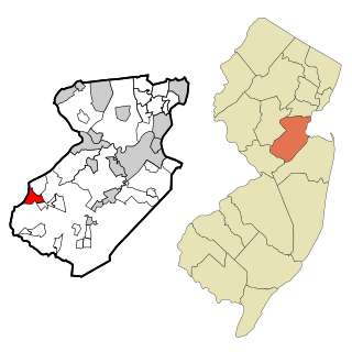
Heathcote is an unincorporated community and census-designated place (CDP) located within South Brunswick, in Middlesex County, in the U.S. state of New Jersey. As of the 2010 United States Census, the CDP's population was 5,821.

<span class="mw-page-title-main">Pigeon Creek, Ohio</span> CDP in Ohio, United States

Pigeon Creek is a census-designated place (CDP) in Summit County, Ohio, United States. The population was 945 at the 2000 census. It is part of the Akron metropolitan statistical area.

<span class="mw-page-title-main">Rowley (CDP), Massachusetts</span> Census-designated place in Massachusetts, United States

Rowley is a census-designated place (CDP) in the town of Rowley in Essex County, Massachusetts, United States. The population was 1,416 at the 2010 census.

<span class="mw-page-title-main">Medfield (CDP), Massachusetts</span> CDP in Massachusetts, United States

Medfield is a census-designated place (CDP) in the town of Medfield in Norfolk County, Massachusetts, United States. The population was 6,483 at the 2010 census.

<span class="mw-page-title-main">Hanson (CDP), Massachusetts</span> Census-designated place in Massachusetts, United States

Hanson is a census-designated place (CDP) in the town of Hanson in Plymouth County, Massachusetts, United States. The population was 2,118 at the 2010 census.

<span class="mw-page-title-main">Marshfield (CDP), Massachusetts</span> Census-designated place in Massachusetts, United States

Marshfield is a census-designated place (CDP) in the town of Marshfield in Plymouth County, Massachusetts, United States. The population was 4,335 at the 2010 census.

<span class="mw-page-title-main">East Brookfield (CDP), Massachusetts</span> CDP in Massachusetts, United States

East Brookfield is a census-designated place (CDP) in the town of East Brookfield in Worcester County, Massachusetts, United States. The population was 1,323 at the 2010 census.

<span class="mw-page-title-main">Milford (CDP), Massachusetts</span> CDP in Massachusetts, United States

Milford is a census-designated place (CDP) in the town of Milford in Worcester County, Massachusetts, United States. The population was 25,055 at the 2010 census.

<span class="mw-page-title-main">Rutland (CDP), Massachusetts</span> CDP in Massachusetts, United States

Rutland is a census-designated place (CDP) in the town of Rutland in Worcester County, Massachusetts, United States. The population was 2,111 at the 2010 census.

<span class="mw-page-title-main">Spencer (CDP), Massachusetts</span> CDP in Massachusetts, United States

Spencer is a census-designated place (CDP) in the town of Spencer in Worcester County, Massachusetts, United States. The population was 5,700 at the 2010 census.

<span class="mw-page-title-main">Webster (CDP), Massachusetts</span> CDP in Massachusetts, United States

Webster is a census-designated place (CDP) in the town of Webster in Worcester County, Massachusetts, United States. The population was 11,412 at the 2010 census.

<span class="mw-page-title-main">Rib Mountain (CDP), Wisconsin</span> CDP in Wisconsin, United States

Rib Mountain is a census-designated place (CDP) in the town of Rib Mountain in Marathon County, Wisconsin, United States. The population was 6,061 at the 2020 census.

<span class="mw-page-title-main">Groton (CDP), Massachusetts</span> Census-designated place in Massachusetts, United States

Groton is a census-designated place (CDP) comprising the main village in the town of Groton in Middlesex County, Massachusetts, United States. The population of the CDP was 1,353 at the 2020 census, out of 11,315 in the entire town of Groton.

References

  1. "2020 U.S. Gazetteer Files". United States Census Bureau. Retrieved May 21, 2022.
  2. "US Gazetteer files: 2010, 2000, and 1990". United States Census Bureau. February 12, 2011. Retrieved April 23, 2011.
  3. "Census of Population and Housing". Census.gov. Retrieved June 4, 2016.
  4. "U.S. Census website". United States Census Bureau . Retrieved January 31, 2008.