Belmont, Massachusetts

Last updated

Belmont, Massachusetts
Looking north on Leonard Street, Belmont Center MA.jpg
Looking north on Leonard Street in the town center
Seal of Belmont, Massachusetts.png
Motto: 
"The Town of Homes" [1]
Middlesex County Massachusetts incorporated and unincorporated areas Belmont highlighted.svg
Location in Middlesex County in Massachusetts
Coordinates: 42°23′45″N71°10′45″W / 42.39583°N 71.17917°W / 42.39583; -71.17917
Country United States
State Massachusetts
County Middlesex
Settled1636
Incorporated1859
Government
  Type Representative town meeting
  Town AdministratorPatrice Garvin
Area
  Total4.7 sq mi (12.2 km2)
  Land4.7 sq mi (12.1 km2)
  Water0.1 sq mi (0.1 km2)
Elevation
44 ft (13 m)
Population
 (2020)
  Total27,295
  Density5,800/sq mi (2,200/km2)
Time zone UTC-5 (Eastern)
  Summer (DST) UTC-4 (Eastern)
ZIP Code
02478
Area code 617 / 857
FIPS code 25-05070
GNIS feature ID0618216
Website www.belmont-ma.gov

Belmont is a town in Middlesex County, Massachusetts, United States. It is a western suburb of Boston; and is part of the Greater Boston metropolitan area. At the 2020 U.S. census, its population was 27,295, an increase of 10.4% from 2010. [2]

Contents

History

Belmont was established on March 18, 1859, by former citizens of, and on land from the bordering towns of, Watertown, to the south; Waltham, to the west; and Arlington, then known as West Cambridge, to the north. They also wanted a town where no one could buy or sell alcohol (alcohol is now legal to purchase in Belmont). The town was named after Bellmont, the 200-acre (0.8 km2) estate of the largest donor to its creation, John Perkins Cushing. Cushing Square is named after him and what was left of his estate after it nearly burned to the ground and became a Belmont Public Library branch. The easternmost section of the town, including the western portion of Fresh Pond, was annexed by Cambridge in 1880 [3] in a dispute over a slaughterhouse licensed in 1878 [4] on Fresh Pond, so that Cambridge could protect Fresh Pond, part of its municipal water system, by removing neighboring buildings that were polluting into it. [5]

Before its incorporation, Belmont was an agrarian town, with several large farms servicing Boston for produce and livestock. It remained largely agrarian until the turn of the 20th century, when trolley service and better roads were introduced, making it more attractive as a residential area, most notably for the building of large estates. Belmont's population grew by over 70 percent during the 1920s. [6]

Other commercial enterprises in Belmont included mining clay and waste management. The reclamation of a large dump and quarry off Concord Avenue into sites for the Belmont High School and the Clay Pit Pond is a lasting example of environmental planning. With the introduction of automobiles and highways, Belmont continued its transition to a commuter-based suburb throughout the 20th century.[ citation needed ]

The John Birch Society was headquartered in Belmont from its founding in 1958 until its relocation to Appleton, Wisconsin, in 1989. The building at 395 Concord Avenue later became the headquarters of the National Association for Armenian Studies and Research (NAASR), which is expanding and renovating its facility as of 2019. [7]

Railroad history

Boston & Maine Railroad Station at Belmont Center; the platforms are now used for MBTA Commuter Rail, but the building itself is now privately owned BelmontCenterStation.jpg
Boston & Maine Railroad Station at Belmont Center; the platforms are now used for MBTA Commuter Rail, but the building itself is now privately owned
A small Wellington Hill Station building has been carefully preserved, having been relocated and repurposed several times after it was constructed in the 1840s. WellingtonHillStation8.9.08.jpg
A small Wellington Hill Station building has been carefully preserved, having been relocated and repurposed several times after it was constructed in the 1840s.

Belmont was once served by two railroads, the Fitchburg Railroad and the Central Massachusetts Railroad, both of which later became part of the Boston & Maine Railroad system. Originally the two railroads each had their own separate trackage through town, but in 1952 the Central Mass tracks were removed between Hill's Crossing and Clematis Brook (Waltham), [8] and rail traffic was rerouted over the Fitchburg line.[ citation needed ]

Today the MBTA owns the trackage through Belmont, known as the Fitchburg Line. Passenger service on this line terminates at Wachusett station in Fitchburg, but it once was the area's main route into New York state.[ citation needed ]

The station stops at Belmont Center and Waverley were once grade crossings, so that pedestrian and vehicular traffic had to cross directly over rails in public roads. In 1907, the grade at Belmont Center was eliminated by constructing a stone arch bridge and elevated embankment to carry the tracks past a new station building.[ citation needed ] At Waverley, the grade was lowered so that the tracks ran under Trapelo Road, though the platform did not have an enclosed structure there.[ citation needed ]

A second historic railroad station building exists in Belmont, though it is not obvious. The one-room Wellington Hill Station was built in the 1840s as a private school, not far from its current location in Belmont Center. It was then used by the Fitchburg Railroad from 1852 to 1879. When the railroad decided to replace the station with a larger structure, the building was moved to the Underwood Estate and used as a summer house. In 1974, the station was donated to the Belmont Historical Society. It was restored and moved to its current location in 1980.[ citation needed ]

As of 2024, plans are underway [9] to construct a rail trail across Belmont, using the abandoned Central Massachusetts Railroad right-of-way along the existing Fitchburg Line tracks. When completed this trail will be part of the Mass Central Rail Trail.

Present day

Belmont remains a primarily residential suburb, with little population growth since the 1950s. It is best known for the mansion-filled Belmont Hill neighborhood, although most residents live in more densely settled, low-lying areas around the Hill. There are three major commercial centers in the town: Belmont Center in the center, Cushing Square in the south, and Waverley Square in the west. Town Hall and other civic buildings are in Belmont Center. Large tracts of land from former farms and greenhouse estates form public or publicly accessible areas such as Rock Meadow, Habitat, portions of the McLean Hospital tract and various town fields.[ citation needed ]

Geography

Topography of Belmont and environs Topographic maps of Arlington, Belmont, Lexington Massachusetts 1946.jpg
Topography of Belmont and environs

According to the United States Census Bureau, the town has an area of 4.7 square miles (12.2 km2), of which 4.7 square miles (12.1 km2) is land and less than 0.1 square miles (0.1 km2), or 1.06%, is water.

Belmont is bordered by Cambridge on the east, Arlington on the north, Lexington on the northwest, Waltham on the west, and Watertown on the south.

Environmental concerns

In 2002, Middlesex County was ranked in the worst 10% of polluted counties in the United States in terms of air and water pollution. [10] Two companies that ranked in the top 10 for polluters in the county were Polaroid Corporation in Waltham and the Cambridge Plating Company in Belmont, which is several hundred feet from Belmont High School. The Environmental Protection Agency fined Cambridge Plating Company, now operated by Purecoat North LLC, in 2002 following various violations [11] and in 2004 after a fire that led to an accumulation of toxic wastewater. [12]

The chemicals released were trichloroethylene and dichloromethane, both of which have been shown to cause cancer. These chemicals are released into the air so it is difficult to trace them and to determine the source, as there are also several other industries in the area that release the same pollutants.

Climate

In a typical year, Belmont, Massachusetts temperatures fall below 50 °F (10 °C) for 195 days per year. Annual precipitation in Belmont is typically 45.2 inches per year (high in the US) and snow covers the ground 52 days per year, or 14.2% of the year (high for the US). The humidity is below 60% for approximately 25.4 days, or 7% of the year. [13]

Demographics

Historical population
YearPop.±%
1860 1,198    
1870 1,513+26.3%
1880 1,615+6.7%
1890 2,098+29.9%
1900 3,929+87.3%
1910 5,542+41.1%
1920 10,749+94.0%
1930 21,748+102.3%
1940 26,867+23.5%
1950 27,381+1.9%
1960 28,715+4.9%
1970 28,285−1.5%
1980 26,100−7.7%
1990 24,720−5.3%
2000 24,194−2.1%
2010 24,729+2.2%
2020 27,295+10.4%
2022*26,710−2.1%
* = population estimate. Source: United States Census records and Population Estimates Program data. [14] [15] [16] [17] [18] [19] [20] [21] [22] [23]

As of 2020, there were 27,295 residents of the Town of Belmont, and in 2021 there were 17,640 registered voters. [24] In 2020, the racial make up of the town was 69.6% White, 1.9% Black or African American, 0.05% Native American, 18.5% Asian, and 4.7% from two or more races. Hispanic or Latino of any race were 4.7% of the population. [2] Pending the release of the 2020 Census results, in 2010 6.3% of the population were under the age of five, 24.6% were under the age of eighteen, and 15.8% were 65 years of age or older; 53% were female. The median household income was $114,141. [25]

The 2000 census listed 9,732 households, out of which 31.0% had children under the age of 18 living with them, 54.9% were married couples living together, 8.8% had a female householder with no husband present, and 33.7% were non-families. 25.9% of all households were made up of individuals, and 11.9% had someone living alone who was 65 years of age or older. The average household size was 2.45 and the average family size was 3.01.

In 2010, 20% of the residents of Belmont were born outside of the United States. In 2000 this percentage was 15%. [26]

Belmont has been referred to as a "Mormon enclave" [27] due to the location of the Boston Massachusetts Temple of the LDS Church at the highest elevation in the town. The prominent gold statue of the Angel Moroni atop the Temple was originally designed by Cyrus Dallin in nearby Arlington, Massachusetts.

Points of interest

Government

The executive branch of the town government consists of a three-person Select Board elected by the residents. [28] The Select Board appoints a Town Administrator who is in charge of daily operations.

The legislative branch is a representative town meeting, with eight districts each electing 36 representatives, plus ex-officio members and a Town Moderator to run the annual meeting. [29]

Belmont is part of the 24th Middlesex District (for the Massachusetts House of Representatives), the 2nd Middlesex and Suffolk District (for the Massachusetts Senate), and Massachusetts's 5th congressional district (for the United States House of Representatives).

Education

Belmont is served by the Belmont Public Schools, governed by an independently elected school committee. [29]

There are four public elementary schools in Belmont, the Mary Lee Burbank, Daniel Butler, Winn Brook, and Roger Wellington school. The Mary Lee Burbank School was founded in 1931. Two other public elementary schools, Payson Park and Kendall, were closed in the 1970s and 1980s, respectively. The former closed after being destroyed by fire, the latter closed due to population shifts and was converted to an arts center, which was later also destroyed by fire. There is one public Upper Elementary School, the Winthrop L. Chenery Upper Elementary School, which was rebuilt on the same location after an electrical fire damaged the auditorium in 1995, and one Middle School, located near the High School, called Belmont Middle, and one public high school, Belmont High School. On May 28, 2019, a groundbreaking ceremony was held for the construction of a new middle and high school which will be co-located on the same site.[ needs update ] [30]

Belmont High is noted for its college placement, strong athletics, academics, music, and theater arts; a typical class size of about 320 students. Belmont High regularly feeds 5-10 students into Harvard University on an average given year. As of 2009, U.S. News & World Report gave Belmont High School a gold medal and named it the 100th best public high school in the United States and the second best in the state of Massachusetts (after Boston Latin School).

Belmont Hill School is a private, non-sectarian high school, grades 7–12. Belmont Day School is a private, non-sectarian Pre-K–8 school. There are several smaller private schools.

Media

The Belmont Citizen-Herald is a weekly newspaper covering Belmont, and published on Thursdays, and is available online, as well. [31] The Citizen-Herald was formed in 1988 by merging the Belmont Citizen (founded in 1920) and the Belmont Herald (founded in 1930). The Boston Globe and Boston.com publish a Belmont Your Town website that provides local news and information. The Belmontonian is an independently operated hyper-local news website. [32] Belmont Patch also provides online local news. [33]

The Belmont Media Center (BMC) was founded in 2005 [34] as a local non-profit, public-educational & government access TV station mandated to provide and make available to Belmont residents a variety of media production & editing classes, locally produced TV programming, and video/TV equipment, studios and facilities. In 2017, BMC programs are available to Belmont subscribers of Comcast and Verizon, and BMC also carries live programming. [35] and on-demand programs [36]

Infrastructure

Transportation

Roads

Major roads in the town are Concord Avenue, which bisects the town from east to west; Common Street and Pleasant Street (Route 60) which travel north-south through Belmont; and Trapelo Road and Belmont Street, which run along the southern edge of the town.

Belmont is served directly by two state route designated highways. Running close to the middle of town is Route 60, locally known as Pleasant Street. On the northern border, Route 2 generally outlines Belmont's boundary with the neighboring town of Arlington. Despite the small size of the town, Belmont has 5 signed exits on Route 2. Nearby major highways include I-95/MA-Route 128, Route 16, Route 3, and Route 20.

Public transit

Belmont is served by the Massachusetts Bay Transportation Authority's Fitchburg Commuter Rail line, and its bus and trackless trolley lines.

Two MBTA Commuter Rail rail stations, Waverley and Belmont Center, are located in the town. Belmont is roughly 16 minutes away from the rail line's terminus at North Station, Boston.

Nearby in Cambridge lies Alewife Station, the western terminus of the Red Line; providing a connection to Boston and the entire metropolitan rapid transit system.

Health care

McLean Hospital, a psychiatric hospital and research center located in Belmont. It is the setting of the novel Girl, Interrupted , which was made into a 1999 movie.

Notable people

Belmont Town Hall c. 1913, architects Hartwell and Richardson PostcardBelmontMATownHall1913.jpg
Belmont Town Hall c.1913, architects Hartwell and Richardson
Belmont Town Hall (2007) Town Hall, Belmont, MA.JPG
Belmont Town Hall (2007)

Due to its proximity to Harvard and MIT universities, amongst others, Belmont has had several Nobel Prize winners in residence at one time or another. [37] Notable past and present residents include people in the following categories:

Business

Politics and government

Arts and music

Media

Sports

Literature

Academics

See also

Related Research Articles

<span class="mw-page-title-main">Cambridge, Massachusetts</span> City in the Commonwealth of Massachusetts

Cambridge is a city in Middlesex County, Massachusetts, United States. It is a suburb in the Greater Boston metropolitan area, located directly across the Charles River from Boston. The city's population as of the 2020 U.S. census was 118,403, making it the most populous city in the county, the fourth-largest in Massachusetts, behind Boston, Worcester, and Springfield, and ninth-most populous in New England. The city was named in honor of the University of Cambridge in Cambridge, England, which was an important center of the Puritan theology that was embraced by the town's founders.

<span class="mw-page-title-main">Acton, Massachusetts</span> Town in Massachusetts, United States

Acton is a town in Middlesex County, Massachusetts, United States, approximately 21 miles (34 km) west-northwest of Boston along Massachusetts Route 2 west of Concord and about ten miles (16 km) southwest of Lowell. The population was 24,021 in April 2020, according to the United States Census Bureau. It is bordered by Westford and Littleton to the north, Concord and Carlisle to the east, Stow, Maynard, and Sudbury to the south and Boxborough to the west. Acton became an incorporated town in 1735. The town employs the Open Town Meeting form of government with a town manager and an elected, five-member select board. Acton was named the 11th Best Place To Live among small towns in the country by Money Magazine in 2015, and the 16th best in 2009 and in 2011. The local high school, Acton-Boxborough Regional High School, was named a Blue Ribbon School by the U.S. Department of Education in 2009.

<span class="mw-page-title-main">Littleton, Massachusetts</span> Town in Massachusetts, United States

Littleton is a town in Middlesex County, Massachusetts, United States. The population was 10,141 at the 2020 census.

<span class="mw-page-title-main">Weston, Massachusetts</span> Town in Massachusetts, United States

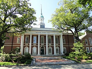
Weston is a town in Middlesex County, Massachusetts, United States, located approximately 15 miles (24 km) west of Boston. At the time of the 2020 United States Census, the population of Weston was 11,851.

<span class="mw-page-title-main">Leominster, Massachusetts</span> City in Worcester County, Massachusetts

Leominster is a city in Worcester County, Massachusetts, United States. It is the second-largest city in Worcester County, with a population of 43,222 at the 2023 census. Leominster is located north of Worcester and northwest of Boston. Both Route 2 and Route 12 pass through Leominster. Interstate 190, Route 13, and Route 117 all have starting/ending points in Leominster. Leominster is bounded by Fitchburg and Lunenburg to the north, Lancaster to the east, Sterling and Princeton to the south, and Westminster to the west.

<span class="mw-page-title-main">Arlington, Massachusetts</span> Town in Massachusetts, United States

Arlington is a town in Middlesex County, Massachusetts, United States. The town is six miles (10 km) northwest of Boston, and its population was 46,308 at the 2020 census.

<span class="mw-page-title-main">Lexington, Massachusetts</span> Town in Massachusetts, United States

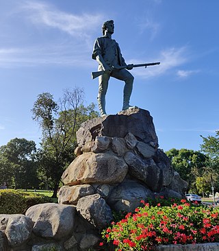
Lexington is a suburban town in Middlesex County, Massachusetts, United States, located 10 miles (16 km) from Downtown Boston. The population was 34,454 as of the 2020 census. The area was originally inhabited by Native Americans, and was first settled by Europeans in 1641 as a farming community. Lexington is well known as the site of the first shots of the American Revolutionary War, in the Battle of Lexington on April 19, 1775, where the "Shot heard 'round the world" took place. It is home to Minute Man National Historical Park.

<span class="mw-page-title-main">Burlington, Massachusetts</span> Town in Massachusetts, United States

Burlington is a town in Middlesex County, Massachusetts, United States. The population was 26,377 at the 2020 census.

<span class="mw-page-title-main">Greater Boston</span> Combined Statistical Area in the US

Greater Boston is the metropolitan region of New England encompassing the municipality of Boston, the capital of the U.S. state of Massachusetts and the most populous city in New England, and its surrounding areas. The most stringent definition of the region consists of most of the eastern third of mainland Massachusetts, excluding the Merrimack Valley and most of Southeastern Massachusetts, though most definitions include much of these areas and portions of southern New Hampshire.

<span class="mw-page-title-main">Alewife station</span> Rapid transit station in Cambridge, Massachusetts, US

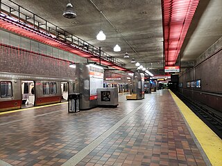
Alewife station is a Massachusetts Bay Transportation Authority (MBTA) intermodal transit station in the North Cambridge neighborhood of Cambridge, Massachusetts. It is the northwest terminal of the rapid transit Red Line and a hub for several MBTA bus routes. The station is at the confluence of the Minuteman Bikeway, Alewife Linear Park, Fitchburg Cutoff Path, and Alewife Greenway off Alewife Brook Parkway adjacent to Massachusetts Route 2, with a five-story parking garage for park and ride use. The station has three bike cages. Alewife station is named after nearby Alewife Brook Parkway and Alewife Brook, themselves named after the alewife fish.

<span class="mw-page-title-main">Minuteman Bikeway</span> Rail trail in Massachusetts, United States

The Minuteman Bikeway, also known as the Minuteman Commuter Bikeway, is a 10-mile (16-kilometre) paved multi-use rail trail located in the Greater Boston area of Massachusetts. It runs from Bedford to Alewife station, at the northern end of the Red Line in Cambridge, passing through the towns of Lexington and Arlington along the way. Also along the route are several notable regional sites, including Alewife Brook Reservation, the Cyrus Dallin Art Museum, Spy Pond, "Arlington’s Great Meadows", the Battle Green in Lexington, and Hanscom Air Force Base.

<span class="mw-page-title-main">Fitchburg Line</span> MBTA Commuter Rail line

The Fitchburg Line is a branch of the MBTA Commuter Rail system which runs from Boston's North Station to Wachusett station in Fitchburg, Massachusetts. The line is along the tracks of the former Fitchburg Railroad, which was built across northern Massachusetts, United States, in the 1840s. Winter weekend service includes a specially equipped seasonal "ski train" to Wachusett Mountain.

<span class="mw-page-title-main">Alewife Brook Reservation</span> State park and reservation in Massachusetts, USA

Alewife Brook Reservation is a Massachusetts state park and urban wild located in Cambridge, Arlington, and Somerville. The park is managed by the state Department of Conservation and Recreation and was established in 1900. It is named for Alewife Brook, which was also historically known as Menotomy River, a tributary of the Mystic River.

<span class="mw-page-title-main">Fitchburg Cutoff</span> Former rail line in Massachusetts, US

The Fitchburg Cutoff was a rail line running 2.8 miles (4.5 km) from Brighton Street in Belmont, Massachusetts, to Somerville Junction in Somerville, Massachusetts. It was constructed in two segments in 1870 and 1881 to connect the Lexington Branch and Central Massachusetts Railroad to the Boston and Lowell Railroad. Passenger service lasted until 1927. Freight service ended in 1979–80 to allow construction of the Red Line Northwest Extension; the line was abandoned in three sections in 1979, 1983, and 2007.

The Lexington and West Cambridge Railroad was a railroad company chartered in 1845 and opened in 1846 that operated in eastern Massachusetts. It and its successors provided passenger service until 1977 and freight service until 1980 or early 1981.

<span class="mw-page-title-main">North Cambridge, Massachusetts</span>

North Cambridge, also known as "Area 11", is a neighborhood of Cambridge, Massachusetts bounded by Porter Square and the Fitchburg Line railroad tracks on the south, the city of Somerville on the northeast, Alewife Brook and the town of Arlington on the northwest, and the town of Belmont on the west. In 2005 it had a population of 10,642 residents living in 4,699 households, and the average income was $44,784. In 2010, the racial demographics for the neighborhood were 57.6% White, 20% Black, 15.1% Asian/Pacific Islander, 7.3% Hispanic origin, 0.3% Native American, 2.4% other race.

Cambridge Highlands also known as "Area 12", is a neighborhood of Cambridge, Massachusetts bounded by the railroad tracks on the north and east, the Belmont town line on the west, and Fresh Pond on the south. In 2005 it had a population of 673 residents living in 281 households, and the average household income was $56,500.

<span class="mw-page-title-main">Watertown Branch Railroad</span> Former rail right of way being converted to multi use path

The Watertown Branch Railroad was a branch loop of the Fitchburg Railroad that was meant to serve the town of Watertown and the City of Waltham, Middlesex County, Massachusetts, as an independent short line railroad; it also serviced the Watertown Arsenal. The line has been formally abandoned and portions have been converted into a rail trail, the Watertown-Cambridge Greenway. A section from School Street to Arlington Street in Watertown was completed first. A small portion in Waltham has been converted into a park called Chemistry Station Park after the railroad station once located there. Construction of an extension to Fresh Pond Reservation in Cambridge began in the summer of 2018 and was completed in June 2022.

<span class="mw-page-title-main">Ayer, Massachusetts</span> Town in Massachusetts, United States

Ayer is a town in Middlesex County, Massachusetts, United States. Originally part of Groton, it was incorporated February 14, 1871, and became a major commercial railroad junction. The town was home to Camp Stevens, a training camp for Massachusetts volunteers during the American Civil War. Later, Fort Devens was established by the federal government to train New England soldiers for World War I. Fort Devens is a major influence on the area, although it is considerably smaller than when it was first closed in the mid-1990s. The town's population was 8,479 at the 2020 census.

<span class="mw-page-title-main">Lake Street station (Arlington, Massachusetts)</span> Former railway station in Arlington, Massachusetts, US

Lake Street station was a commuter rail station on the Lexington Branch, located in the East Arlington section of Arlington, Massachusetts. The line opened as the Lexington and West Cambridge Railroad in 1846, with a station at Pond Street among the earliest stops. It was renamed Lake Street in 1867. The Boston and Lowell Railroad (B&L) acquired the line in 1870 and built a new station building in 1885. Service continued under the Boston and Maine Railroad (B&M) – successor to the B&L – though it declined during the 20th century. Lake Street station and three others on the line were closed in May 1958. The Massachusetts Bay Transportation Authority (MBTA) began subsidizing service in 1965, and Lake Street station reopened in March 1968. All passenger service on the Lexington Branch ended on January 10, 1977; it was converted into the Minuteman Bikeway in the early 1990s.

References

  1. "Belmont Massachusetts". Belmont Massachusetts. Archived from the original on September 10, 2012. Retrieved October 4, 2012.
  2. 1 2 "Map: See how each Mass. town has changed according to new census data". The Boston Globe. Retrieved August 15, 2021.
  3. "(17)" (PDF). Archived from the original (PDF) on September 11, 2008.
  4. Belmont Historic District Commission, Belmont, Massachusetts: The Architecture and Development of The Town of Homes, 1984
  5. Sinclair, Jill (February 13, 2009). "Social Reform and the City". Fresh Pond: The History of a Cambridge Landscape. MIT Press. pp. 64, 66. ISBN   978-0-262-19591-1 . Retrieved December 29, 2023. Battles over Water Quality: Contemporary records show that, in the 1870s, there was little scientific agreement about the causes of any pollution to the pond's water, or about the best means of protection. [...] The alleged culprits [...] always seemed to be across the town borders in Arlington and, especially Belmont. [...] A report commissioned in 1879 concluded that the city needed to acquire a strip of land around the Fresh Pond shoreline up to fifty rods (about 825 feet) wide, to remove buildings from around the shore, and to annex the parts of the neighboring towns of Belmont and Arlington that abutted the pond.
  6. Schaeffer, K. H. and Elliott Sclar. Access for All: Transportation and Urban Growth. Columbia University Press, 1980. Accessed on Google Books. 86. Retrieved on January 16, 2010. ISBN   0-231-05165-4, ISBN   978-0-231-05165-1
  7. "National Association for Armenian Studies and Research (NAASR)". NAASR. Archived from the original on May 3, 2018. Retrieved February 10, 2020.
  8. The Rail Lines of Southern New England - Ronald Dale Karr 1995
  9. "Belmont Community Path". Belmont Community Path. n.d. Retrieved January 23, 2024.
  10. "Who is Polluting?". scorecard.goodguide.com.
  11. "09/20/2002: EPA Settles Enforcement Case With Cambridge Plating in Belmont". archive.epa.gov. Retrieved April 18, 2019.
  12. "Cambridge Plating slapped with $50K fine by EPA". Boston Business Journal. Retrieved April 18, 2019.
  13. "Climate in Belmont, Massachusetts" . Retrieved June 23, 2022.
  14. "TOTAL POPULATION (P1), 2010 Census Summary File 1, All County Subdivisions within Massachusetts". United States Census Bureau. Archived from the original on February 12, 2020. Retrieved September 13, 2011.
  15. "Massachusetts by Place and County Subdivision - GCT-T1. Population Estimates". United States Census Bureau. Archived from the original on January 6, 2012. Retrieved July 12, 2011.
  16. "1990 Census of Population, General Population Characteristics: Massachusetts" (PDF). US Census Bureau. December 1990. Table 76: General Characteristics of Persons, Households, and Families: 1990. 1990 CP-1-23. Archived from the original (PDF) on December 7, 2013. Retrieved July 12, 2011.
  17. "1980 Census of the Population, Number of Inhabitants: Massachusetts" (PDF). US Census Bureau. December 1981. Table 4. Populations of County Subdivisions: 1960 to 1980. PC80-1-A23. Archived from the original on August 5, 2010. Retrieved July 12, 2011.
  18. 1950 Census of Population (PDF), vol. 1: Number of Inhabitants, Bureau of the Census, 1952, Section 6, Pages 21-10 and 21-11, Massachusetts Table 6. Population of Counties by Minor Civil Divisions: 1930 to 1950, retrieved July 12, 2011
  19. "1920 Census of Population" (PDF). Bureau of the Census. Number of Inhabitants, by Counties and Minor Civil Divisions. Pages 21-5 through 21-7. Massachusetts Table 2. Population of Counties by Minor Civil Divisions: 1920, 1910, and 1920. Retrieved July 12, 2011.
  20. "1890 Census of the Population" (PDF). Department of the Interior, Census Office. Pages 179 through 182. Massachusetts Table 5. Population of States and Territories by Minor Civil Divisions: 1880 and 1890. Retrieved July 12, 2011.
  21. "1870 Census of the Population" (PDF). Department of the Interior, Census Office. 1872. Pages 217 through 220. Table IX. Population of Minor Civil Divisions, &c. Massachusetts. Archived from the original on August 8, 2010. Retrieved July 12, 2011.
  22. "1860 Census" (PDF). Department of the Interior, Census Office. 1864. Pages 220 through 226. State of Massachusetts Table No. 3. Populations of Cities, Towns, &c. Archived from the original on August 8, 2010. Retrieved July 12, 2011.
  23. "City and Town Population Totals: 2020−2022". United States Census Bureau . Retrieved November 25, 2023.
  24. "Belmont Town Clerk, Census Information". Belmont Town Clerk. Retrieved August 15, 2021.
  25. "Belmont CDP QuickFacts from the US Census Bureau". United States Census Bureau. Archived from the original on February 15, 2012. Retrieved December 14, 2011.
  26. Sacchetti, Maria. "A melting pot stretches out to the suburbs." Boston Globe . September 15, 2010. p. 2 (Archive). Retrieved on September 23, 2014.
  27. Rogers, Katie (February 20, 2018). "Rob Porter's Charisma and Ambition Disguised Flare-ups of Anger". The New York Times .
  28. "Select Board | belmontma".
  29. 1 2 "Town of Belmont, MA - Town Government Organization". Archived from the original on August 2, 2008. Retrieved August 4, 2008.
  30. "Belmont holds groundbreaking for new Middle and High School". Wicked Local Belmont. Retrieved February 21, 2020.
  31. "Wicked Local | Belmont Citizen-Herald".
  32. "Home". belmontonian.com.
  33. "Belmont, MA Patch - Breaking News, Local News, Events, Schools, Weather, Sports and Shopping". June 15, 2023.
  34. "Secretary of State, Massachusetts Corporation Database". Commonwealth of Massachusetts.
  35. "Watch BMC Live". Belmont Media Center.
  36. "Watch BMC On Demand". Belmont Media Center.
  37. "Belmont Famous: Nobel Prize Winner Next Door". Archived from the original on April 26, 2012. Retrieved December 14, 2011.
  38. Marquard, Bryan (April 2, 2013). "D. Leo Monahan, 86; Boston sports reporter, columnist". The Boston Globe. Boston, Massachusetts.
  39. Tucker, Franklin (November 16, 2010). "Belmont-Born, Bred Actor Addison Powell dies at 89: "Dark Shadows" star worked on Broadway, in films "Three Days of the Condor," "The Thomas Crown Affair"". Belmont Patch . AOL Inc. Archived from the original on July 15, 2011. Retrieved November 28, 2010.
  40. "William Haskins". Sports-Reference. Archived from the original on March 11, 2016.
  41. "Patty Shea". Sports-Reference. Archived from the original on March 5, 2016.
  42. Return to Sender: Did Shiva Ayyadurai Invent Email? Archived March 7, 2018, at the Wayback Machine , Boston Magazine, June 2012 - accessed October 17, 2013
  43. "Corruption, Lies, and Death Threats: The Crazy Story of the Man Who Pretended to Invent Email". Gizmodo. March 5, 2012. Archived from the original on March 7, 2012. Retrieved October 18, 2013.
  44. The Man Who Invented Email, TIME Techland, November 15, 2011 - accessed January 21, 2012
  45. Software Design Development and Implementation of a High-Reliability Network-Wide Electronic Mail System, Shiva Ayyadurai 1981 - accessed January 21, 2012
  46. "Fred Whipple Memorial Minute". Archived from the original on October 30, 2006. Retrieved December 8, 2006.

Further reading