
Acton is a town in Middlesex County, Massachusetts, United States, approximately 21 miles (34 km) west-northwest of Boston along Massachusetts Route 2 west of Concord and about ten miles (16 km) southwest of Lowell. The population was 24,021 in April 2020, according to the United States Census Bureau. It is bordered by Westford and Littleton to the north, Concord and Carlisle to the east, Stow, Maynard, and Sudbury to the south and Boxborough to the west. Acton became an incorporated town in 1735. The town employs the Open Town Meeting form of government with a town manager and an elected, five-member select board. Acton was named the 11th Best Place To Live among small towns in the country by Money Magazine in 2015, and the 16th best in 2009 and in 2011. The local high school, Acton-Boxborough Regional High School, was named a Blue Ribbon School by the U.S. Department of Education in 2009.

Ashland is a town in Middlesex County, Massachusetts, United States. It is part of the MetroWest region. The population was 18,832 at the 2020 United States census.

Framingham is a city in the Commonwealth of Massachusetts in the United States. Incorporated in 1700, it's located in Middlesex County and the MetroWest subregion of the Greater Boston metropolitan area. The city proper covers 25 square miles (65 km2) with a population of 72,362 in 2020, making it the 14th most populous municipality in Massachusetts. Residents voted in favor of adopting a charter to transition from a representative town meeting system to a mayor–council government in April 2017, and the municipality transitioned to city status on January 1, 2018. Before it transitioned, it had been the largest town by population in Massachusetts.

The Quabbin Reservoir is the largest inland body of water in Massachusetts, and was built between 1930 and 1939. Along with the Wachusett Reservoir, it is the primary water supply for Boston, 65 miles (105 km) to the east, and 40 other cities and towns in Greater Boston. The Quabbin also supplies water to three towns west of the reservoir and acts as backup supply for three others. By 1989, it supplied water for 2.5 million people, about 40% of the state's population at the time. It has an aggregate capacity of 412 billion US gallons (1,560 GL) and an area of 38.6 square miles (99.9 km2).

The Massachusetts Water Resources Authority (MWRA) is a public authority in the Commonwealth of Massachusetts that provides wholesale drinking water and sewage services to 3.1 million people in sixty-one municipalities and more than 5,500 large industrial users in the eastern and central parts of the state, primarily in the Boston area.
The Neponset River is a river in eastern Massachusetts in the United States. Its headwaters are at the Neponset Reservoir in Foxborough, near Gillette Stadium. From there, the Neponset meanders generally northeast for about 29 miles (47 km) to its mouth at Dorchester Bay between Quincy and the Dorchester section of Boston, near the painted gas tank.

The Spanish River is a river in Algoma District, Sudbury District and Greater Sudbury in Northeastern Ontario, Canada. It flows 338 kilometres (210 mi) in a southerly direction from its headwaters at Spanish Lake and Duke Lake to its mouth at the North Channel of Lake Huron just outside the community of Spanish.

The National Register of Historic Places is a United States federal official list of places and sites considered worthy of preservation. In the state of Massachusetts, there are over 4,300 listings, representing about 5% of all NRHP listings nationwide and the second-most of any U.S. state, behind only New York. Listings appear in all 14 Massachusetts counties.
The Quequechan River is a river in Fall River, Massachusetts, that flows in a northwesterly direction from the northwest corner of the South Watuppa Pond through the heart of the city of Fall River and into the end of the Taunton River at Mount Hope Bay at Heritage State Park/Battleship Cove. The word Quequechan means "Falling River" or "Leaping/Falling Waters" in Wampanoag, hence the city's name.
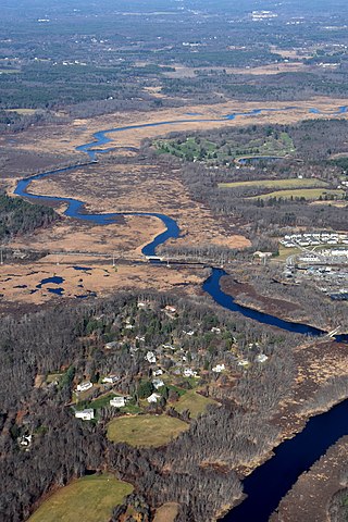
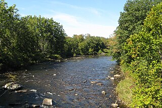
The Sudbury River is a 32.7-mile-long (52.6 km) tributary of the Concord River in Middlesex County, Massachusetts, in the United States.
The Westfield River is a major tributary of the Connecticut River located in the Berkshires and Pioneer Valley regions of western Massachusetts. With four major tributary branches that converge west of the city of Westfield, it flows 78.1 miles (125.7 km) before its confluence with the Connecticut River at Agawam, across from the city of Springfield's Metro Center district. Known for its whitewater rapids and scenery, the Westfield River provides over 50 miles (80 km) of whitewater canoeing and kayaking, in addition to one of the largest roadless wilderness areas remaining in the Commonwealth.
This is a list of historic sites in Framingham, Massachusetts. There are several notable historic sites in Framingham, according to the Framingham Historical Society. This local society asserts:
While there are many historic spaces in Framingham, the Centre Common is the focal point for the town's past. Three of the town's most historic buildings on the Centre Common face "demolition by neglect." The Village Hall, the Edgell Memorial Library, and the Old Academy building not only house over 10,000 artifacts spanning four centuries of the town's history, but they are symbols of Framingham's commitment to educational excellence, civic engagement, and community pride.

The Old Connecticut Path was the Native American trail that led westward from the area of Massachusetts Bay to the Connecticut River Valley, the first of the North American trails that led west from the settlements close to the Atlantic seacoast, towards the interior. The earliest colonists of Massachusetts Bay Colony used it, and rendered it wider by driving cattle along it. The old route is still followed, for part of its length, by Massachusetts Route 9 and Massachusetts Route 126.
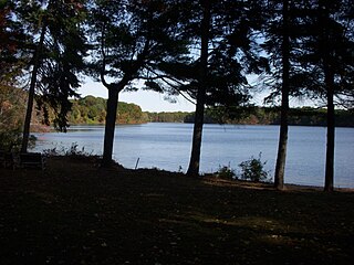
Lake Cochituate is a body of water in Natick, Wayland, and Framingham, Massachusetts, United States. Originally a reservoir serving Boston, it no longer serves that function, and is now a local recreational resource and home to Cochituate State Park.
The Weston Aqueduct is an aqueduct operated by the Massachusetts Water Resources Authority (MWRA). Now part of the MWRA backup systems, it was designed to deliver water from the Sudbury Reservoir in Framingham to the Weston Reservoir in Weston. The 13.5-mile (21.7 km) aqueduct begins at the Sudbury Dam, and passes through the towns of Southborough, Framingham, Wayland, and Weston. In 1990, the route, buildings and bridges of the aqueduct were added to the National Register of Historic Places as the Weston Aqueduct Linear District.

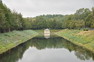
The Framingham Reservoir No. 1 Dam and Gatehouse is a historic water works facility in Framingham, Massachusetts. This complex is located at the end of Framingham Reservoir No. 1, which is also known as the Stearns Reservoir, off Winter Street and north of Long Avenue. Constructed from 1876 to 1878 as part of an expansion of the water supply of the city of Boston, this was designed by its first city architect George A. Clough. The historical purpose of the reservoir, which was located at the confluence of two branches of the Sudbury River, was primarily to control the river's water level, and secondarily to provide reserve supply capacity. The reservoir's reserve capacity was generally used only as a backup supply, as the reservoir's muddy bottom made it a less desirable source than reservoir No. 3 upstream. However the reservoir No. 1 system was nonetheless important due to its role in controlling the flow of the river downstream, and due to the gatehouse which controlled the water flows for all the Framingham reservoirs into the Sudbury Aqueduct. Reservoir No. 1 is no longer maintained as a reserve water source, although it is still owned by the Massachusetts Water Resources Authority, successor to the Boston Water Board which oversaw its construction. MWRA retains ownership as the gatehouse contains the connection between Reservoir No. 3 and the Sudbury Aqueudct which remain part of the emergency water systems.

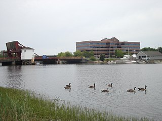
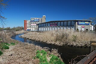
The Saxonville Historic District of Framingham, Massachusetts, encompasses a historic 19th century mill village at the heart of Saxonville. The district is centered on the mill complex at the junction of Water, Central, Elm, and Concord Streets, radiating north on Elm Street and west on Water Street. The extant mill brick and concrete buildings were built after fires destroyed older mill buildings in the 1880s by the Roxbury Carpet Company, whose owner, Michael Simpson, had successfully orchestrated the commercial production of carpets in a single facility. The district includes mill worker housing, some of which dates to the 1820s, as well as private residential development from the period, and a cluster of commercial and civic buildings adjacent to the mill complex.

The Sudbury Aqueduct is an aqueduct in Massachusetts. It runs for 16 miles (26 km) from Farm Pond at Waverly Street in Framingham to Chestnut Hill Reservoir in Boston’s Chestnut Hill neighborhood. A later built extension main runs from the Farm Pond gatehouse to the gatehouse at the Stearns Reservoir where additional mains connect to the Brackett and Foss Reservoirs Going east from Framingham, it runs through Sherborn before entering Natick. From Natick it runs east through Wellesley and Needham to the Charles River, which it crosses on the Echo Bridge into Newton. It ends at the Chestnut Hill Reservoir on the Newton side of the Newton-Boston line. The Massachusetts Water Resources Authority (MWRA) operates the aqueduct.

Nobscot Hill is a USGS name for a high point in Middlesex County, Massachusetts with many public hiking trails, and the hill is located in Framingham and Sudbury. At the summit are various radio towers and a fire tower. Below the summit of Nobscot Hill is the Nobscot Scout Reservation which includes Tippling Rock, a popular viewing location. Surrounding the hill are other large parks and parcels of conservation land, including the Nobscot Conservation Land, Callahan State Park, the Sudbury Weisblatt Conservation Land, and Wittenborg Woods, which are connected by various hiking trails, including the Bay Circuit Trail.

Westborough is a town in Worcester County, Massachusetts, United States. The population was 21,567 at the 2020 Census, in over 7,000 households. Incorporated in 1717, the town is governed under the New England open town meeting system, headed by a five-member elected Board of Selectmen whose duties include licensing, appointing various administrative positions, and calling a town meeting of citizens annually or whenever the need arises.


