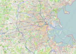
Newton is a city in Middlesex County, Massachusetts, United States. It is approximately 7 miles (11 km) west of downtown Boston, and comprises a patchwork of thirteen villages without a city center. It is home to the Charles River, Crystal Lake, and Heartbreak Hill, among other landmarks. It is served by several streets and highways, as well as the Green Line D branch run by the MBTA.

Longwood station is a light rail station on the MBTA Green Line D branch, located on Chapel Street in Brookline, Massachusetts, on the border with Boston, just north of Longwood Avenue. It serves the Longwood Medical Area, the Colleges of the Fenway, and residential areas of Brookline. The station opened with the rest of the line on July 4, 1959. After renovation work completed in 2009, Longwood station is accessible from both Chapel Street and Riverway Park.

The Green Line D branch is a light rail line in Boston, Brookline, Cambridge, Newton, and Somerville, Massachusetts, operating as part of the Massachusetts Bay Transportation Authority (MBTA) Green Line. The line runs on a grade separated surface right-of-way for 9 miles (14 km) from Riverside station to Fenway station. The line merges into the C branch tunnel west of Kenmore, then follows the Boylston Street subway and Tremont Street subway to North Station. It is the longest and busiest of the four Green Line branches. As of February 2023, service operates on 8 to 9-minute headways at weekday peak hours and 8 to 11-minute headways at other times, using 13 to 19 trains.

The Highland branch, also known as the Newton Highlands branch, was a suburban railway line in Boston, Massachusetts. It was opened by the Boston and Albany Railroad in 1886 to serve the growing community of Newton, Massachusetts. The line was closed in 1958 and sold to the Metropolitan Transit Authority (MTA), the predecessor of the current Massachusetts Bay Transportation Authority (MBTA), which reopened it in 1959 as a light rail line, now known as the D branch of the Green Line.

Edward Clarke Cabot was an American architect and artist.
Newton Upper Falls is one of the thirteen villages within the city of Newton in Massachusetts, United States. The village is listed as the Newton Upper Falls Historic District on the National Register of Historic Places.

Newtonville is one of the thirteen villages within the city of Newton in Middlesex County, Massachusetts, United States.
Richard Clipston Sturgis, generally known as R. Clipston Sturgis, was an American architect based in Boston, Massachusetts.

The Needham Line is a branch of the MBTA Commuter Rail system, running west from downtown Boston, Massachusetts through Roxbury, Jamaica Plain, Roslindale, West Roxbury, and the town of Needham. The second-shortest line of the system at just 13.7 miles (22.0 km) long, it carried 4,881 daily riders in October 2022. Unlike the MBTA's eleven other commuter rail lines, the Needham Line is not a former intercity mainline; instead, it is composed of a former branch line, a short segment of one intercity line, and a 1906-built connector.

Newton Highlands station is a surface-level light rail station located in Newton, Massachusetts on the Green Line D branch of the Massachusetts Bay Transportation Authority.

Woodland station is a light rail stop on the MBTA Green Line D branch, located off Washington Street (MA-16) between the Newton Lower Falls and Auburndale villages of Newton, Massachusetts, United States. It serves as access to the Newton-Wellesley Hospital, as well as a park and ride station for nearby Route 128.

Needham Junction station is an MBTA Commuter Rail station in Needham, Massachusetts. It serves the Needham Line. It is located on Junction Street near Chestnut Street in the southwestern part of Needham. It opened in 1906 when the New Haven Railroad built the Needham Cutoff to connect the Charles River Railroad to its main line. The station has a single side platform with an accessible mini-high platform serving the line's single track.

Needham Heights station is an MBTA Commuter Rail station in the Needham Heights neighborhood of Needham, Massachusetts. It is the terminus of the Needham Line. The station has one low-level side platform with a mini-high section for accessibility serving the single track of the Needham Branch.

Saint Aidan's Church and Rectory is a historic Catholic church complex in Brookline, Massachusetts. The stuccoed church, located at 224-210 Freeman Street, was designed by Maginnis & Walsh, a noted designer of ecclesiastical buildings, in the Medieval (Tudor) Revival style, and was built in 1911. It was Brookline's third Catholic parish, after Saint Mary's and Saint Lawrence. The church is notable as the parish which was attended by Joseph P. Kennedy and his family when they were living on Beals Street; it was the site of the baptism of both John F. Kennedy and Robert F. Kennedy. The rectory, located at 158 Pleasant Street, was built c. 1850-55 by Edward G. Parker, a Boston lawyer. It was acquired by the church in 1911, and restyled to match the church in 1920.

George Frederick Meacham was an architect in the Boston, Massachusetts, area in the 19th century. He is notable for designing Boston's Public Garden, the Massachusetts Bicycle Club, and churches, homes, and monuments in greater Boston and elsewhere in New England.
Samuel J.F. Thayer (1842–1893) was an American architect, notable for designing buildings such as the Providence City Hall and the Cathedral of St. George, as well as the town halls of Brookline, Stoughton, and Methuen, Massachusetts. He was part of the architecture firms, Martin & Thayer and Ropes & Thayer.

Hartwell and Richardson was a Boston, Massachusetts architectural firm established in 1881, by Henry Walker Hartwell (1833–1919) and William Cummings Richardson (1854–1935). The firm contributed significantly to the current building stock and architecture of the greater Boston area. Many of its buildings are listed on the National Register of Historic Places.

John A. Fox (1835–1920) was an American architect. Fox practiced in Boston for fifty years and is best remembered for his works in the Stick Style.
George Fullington Loring (1851–1918) was an architect from Boston, Massachusetts.
William H. McLean was an American architect from Boston, Massachusetts. He is best known for the design of public libraries, many of which he designed as a member of the firm of McLean & Wright.