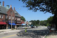

Waban is one of the thirteen villages within the city of Newton in Middlesex County, Massachusetts, United States.


Waban is one of the thirteen villages within the city of Newton in Middlesex County, Massachusetts, United States.
Waban is bordered by the Charles River and Route 9 to the south, and Route 16 to the west. Waban was once a heavily forested area which developed as an agricultural village in the 19th century. By the 1860s, it was known for its orchards, farms and nurseries. The Cochituate Aqueduct, now partly converted to a walking trail, was built in 1846–1848 and ran through the village. Development in Waban accelerated after 1886 with the opening of the rail station by the Boston & Albany Railroad as part of the Highland Branch extending to Riverside. Waban is now served by the MBTA Green D Line.
The village of Waban was named for Waban, who is thought to be one of the first members of the Massachusett tribe converted to Christianity in 1646. Although he may have lived closer to Nonantum, a hill two miles away, this area alongside the Charles River did provide hunting and fishing grounds.
To explain why the village took on this name in 1886, Dr. Lawrence Strong, in his history of the town, later wrote:
My father, William Chamberlain Strong, was very active in securing the right-of-way for the Boston and Albany Railroad at the time the Newton Circuit Road was built. The location of a station here marked a potential village, and a name was required. My father had previously lived on Nonantum Hill in Brighton, where Waban, the Chief of the Indian tribe Nonantum, had his wigwam, and where Eliot, the Apostle to the Indians, preached. A memorial marks this spot today. So the name "Waban" for the new village easily suggested itself to my father. I am told Waban, or Wabanoki, means "east" in the Indian tongue. The spelling of the name cannot be held to coincide with its pronunciation. I believe the pronunciation is correct and the correct spelling would be either Wauban or more probably Waughban. [1] [2]
Waban has two elementary schools, Angier, named after Albert E. Angier (1897–1918), who was killed fighting in World War I, [3] and Zervas, (formerly the Beethoven School) named for Dr. Frank Zervas, a school principal. The original Waban School opened in 1900, was renamed the Angier School in 1921, and was replaced by a state-of-the-art schoolhouse in 2016.
The Newton-Wellesley Hospital is on the western edge of Waban and serves a wide population.
Notable buildings in Waban include:
An area on Beacon Street near where the shopping area of Waban now stands was originally the site of a working farm for the indigent.
The first librarian was Dr. Fanny McGee, also one of the first women physicians, earning her Doctor of Medicine degree from Tufts Medical School in 1897. [2] The library gained a permanent home when the branch library was built in 1930. The village was one of two in Newton to retain its branch library, the last of sixteen original branches closed by June 2008. In September 2009, the Waban branch library re-opened as the Waban Library Center, a community-based facility run by the Waban Improvement Society.
Waban Common, a community-maintained, landscaped public green space adjoining Beacon Street, was created in 2017, by reimagining and merging two traffic islands in conjunction with the construction of the new Angier School.
In the Washington Post 's 2013 study of the most affluent and well-educated zip codes in America, Waban (02468) ranked third in the nation. The study was based on an index of the percent of college graduates and median household income in each of America's zip codes. It ranked only behind Kenilworth, Illinois, and Short Hills, New Jersey, making it the most affluent zip code in the state. [4]

Newton is a city in Middlesex County, Massachusetts, United States. It is approximately 7 miles (11 km) west of downtown Boston. Newton comprises a patchwork of thirteen villages without a city center. At the 2020 U.S. census, the population of Newton was 88,923.

Wellesley is a town in Norfolk County, Massachusetts, United States. Wellesley is part of Greater Boston. The population was 29,550 at the time of the 2020 census. Wellesley College, Babson College, and a campus of Massachusetts Bay Community College are located in the town.

Auburndale is one of the thirteen villages within the city of Newton in Middlesex County, Massachusetts, United States. It lies at the western end of Newton near the intersection of interstate highways 90 and 95. It is bisected by the Massachusetts Turnpike. Auburndale is surrounded by three other Newton villages as well as the city of Waltham and the Charles River. Auburndale is the home of Williams and Burr elementary schools, as well as Lasell College. Auburndale Square is the location of the Plummer Memorial Library, which is run by the Auburndale Community Library and no longer affiliated with the Newton Free Library, the Turtle Lane Playhouse, and many small businesses.

Chestnut Hill is a wealthy New England region located six miles (10 km) west of downtown Boston, Massachusetts, United States. Like all Massachusetts villages, Chestnut Hill is not an incorporated municipal entity. It is located partially in Brookline in Norfolk County; partially in the city of Boston in Suffolk County, and partially in the city of Newton in Middlesex County. Chestnut Hill's borders are defined by the 02467 ZIP Code. The name refers to several small hills that overlook the 135-acre Chestnut Hill Reservoir rather than one particular hill. Chestnut Hill is best known as the home of Boston College and as part of the Boston Marathon route.

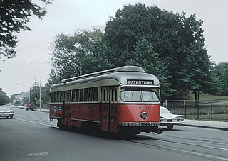
The A branch or Watertown Line was a streetcar line in the Boston, Massachusetts, area, operating as a branch of the Massachusetts Bay Transportation Authority Green Line. The line ran from Watertown through Newton Corner, Brighton, and Allston to Kenmore Square, then used the Boylston Street subway and Tremont Street subway to reach Park Street station.

Newton Upper Falls is one of the thirteen villages within the city of Newton in Middlesex County, Massachusetts, United States.

Newtonville is one of the thirteen villages within the city of Newton in Middlesex County, Massachusetts, United States.


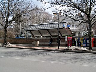
Waban station is a surface-level light rail station on the Massachusetts Bay Transportation Authority's Green Line D branch, located just south of Beacon Street at Waban Square in the Waban section of Newton, Massachusetts. The station is located below grade; access to both platforms is via Wyman Street on the outbound side of the tracks or a stairway from Beacon Street. Waban is not accessible.
Waban (c.1604—c.1685) was a Native American of the Nipmuc group and was thought to be the first Native American convert to Christianity in Massachusetts.
Beaconsfield is an MBTA light rail station in Brookline, Massachusetts. It serves the Green Line D branch. It is located off Dean Road and Beaconsfield Road just south of Beacon Street. Like the other stops on the line, it was a commuter rail station on the Boston and Albany Railroad's Highland branch until 1958, when the line was closed and converted to a branch of what is now the Green Line. The station reopened along with the rest of the line in 1959.

Eliot station is a light rail station on the MBTA Green Line D branch located just north of Route 9 between the Newton Highlands and Newton Upper Falls villages of Newton, Massachusetts. The station has a parking lot at the end of Lincoln Street, a pedestrian entrance from Meredith Avenue, and pedestrian entrances from both sides of Route 9. A footbridge, built in 1977, crosses Route 9 adjacent to the railroad bridge.
Beacon Street is a major thoroughfare in Boston, Massachusetts and its western suburbs Brookline and Newton. It passes through many of Boston's central and western neighborhoods, including Beacon Hill, Back Bay, Fenway–Kenmore, the Boston University campus, Brighton, and Chestnut Hill.

The Cochituate Aqueduct was an aqueduct in Massachusetts that brought water to Boston from 1848 to 1951.

The following properties in Newton, Massachusetts are listed on the National Register of Historic Places. They are a subset of all properties in Middlesex County. There are over 180 places listed in Newton.

Chestnut Hill station is a light rail station on the MBTA Green Line D branch, located off Hammond Street north of Massachusetts Route 9 in the Chestnut Hill neighborhood of Newton, Massachusetts. The station has two side platforms serving the line's two tracks. Chestnut Hill station is not accessible, but renovations are planned.

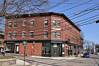
Strong's Block is a historic commercial building at 1637–1651 Beacon Street in the center of Waban Village, in the city of Newton, Massachusetts. Built in 1896, this 2+1⁄2-story brick Flemish Revival structure is one of a small number of surviving 19th century commercial blocks in the city. The building was designed by Waban resident Lewis H. Bacon for William Strong, another local resident, who sought to capitalize on the construction of the nearby Circuit Railroad.

Newton Corner is an MBTA bus transfer point in the Newton Corner neighborhood of Newton, Massachusetts, located on the rotary where Washington Street crosses the Massachusetts Turnpike. The Newton Corner station, known simply as Newton for much of its lifetime, served commuters on the Worcester Line from 1834 to 1959. A streetcar stop, located on the surface streets, served a number of routes beginning in 1863, including the Green Line A branch until 1969. Newton Corner is now a stop and transfer point for MBTA routes 52, 57, 501, 504, 553, 554, 556, and 558, which include express routes to downtown Boston as well as local routes, with stops on the north and south sides of the rotary.

The Waban Library Center is a library located in a historic building at 1608 Beacon Street in Newton, Massachusetts. The building is a modest 1½ story Tudor Revival brick building, with a gabled slate roof and raised end walls. A cross-gabled entry area projects from the center of the front facade. It was designed by Densmore, LeClear & Robbins, and built in 1929 with funds raised by subscription from Newton's citizens. The building was listed on the National Register of Historic Places in 1990.