Pepperell (CDP), Massachusetts

Last updated

Pepperell, Massachusetts
Pepperell Town Hall, Pepperell MA.jpg
Pepperell Town Hall
Middlesex County Massachusetts incorporated and unincorporated areas Pepperell (CDP) highlighted.svg
Location in Middlesex County in Massachusetts
Coordinates: 42°40′4″N71°35′16″W / 42.66778°N 71.58778°W / 42.66778; -71.58778
Country United States
State Massachusetts
County Middlesex
Town Pepperell
Area
[1]
  Total2.14 sq mi (5.55 km2)
  Land2.07 sq mi (5.36 km2)
  Water0.07 sq mi (0.18 km2)
Elevation
240 ft (73 m)
Population
 (2020) [2]
  Total2,390
  Density1,154.03/sq mi (445.57/km2)
Time zone UTC-5 (Eastern (EST))
  Summer (DST) UTC-4 (EDT)
ZIP code
01463
Area code 978
FIPS code 25-52770
GNIS feature ID0611153

Pepperell is a census-designated place (CDP) comprising the main village in the town of Pepperell in Middlesex County, Massachusetts, United States. The population was 2,390 at the 2020 census, [2] out of 11,604 in the entire town of Pepperell.

Contents

Geography

Pepperell village is located in northwestern Middlesex County at 42°40′4″N71°35′15″W / 42.66778°N 71.58750°W / 42.66778; -71.58750 (42.667886, -71.587701), [3] slightly east of the center of the town of Pepperell. It is bordered to the east, across the Nashua River, by the village of East Pepperell.

Massachusetts Route 111 passes through the village center, leading south 4 miles (6 km) to Groton and northeast 10 miles (16 km) to Nashua, New Hampshire. Massachusetts Route 113 crosses MA 111 in the center of the village, leading east 9 miles (14 km) to Tyngsborough and southwest 3 miles (5 km) to Massachusetts Route 119. Townsend is 7 miles (11 km) west of Pepperell via Routes 113 and 119.

According to the United States Census Bureau, the Pepperell CDP has a total area of 2.14 square miles (5.54 km2), of which 2.07 square miles (5.36 km2) are land, and 0.07 square miles (0.18 km2) (3.31%) are water. [1] Via the Nashua River, the village is part of the Merrimack River watershed.

Demographics

Historical population
CensusPop.Note
1970 1,076
1980 2,07692.9%
1990 2,35013.2%
2000 2,5177.1%
2010 2,504−0.5%
2020 2,390−4.6%
U.S. Decennial Census [4]

As of the census [5] of 2000, there were 2,517 people, 931 households, and 629 families residing in the CDP. The population density was 481.1/km2 (1,246.7/mi2). There were 953 housing units at an average density of 182.2/km2 (472.0/mi2). The racial makeup of the CDP was 96.31% White, 0.68% Black or African American, 0.20% Native American, 1.23% Asian, 0.28% from other races, and 1.31% from two or more races. Hispanic or Latino of any race were 0.72% of the population.

There were 931 households, out of which 40.7% had children under the age of 18 living with them, 53.0% were married couples living together, 10.6% had a female householder with no husband present, and 32.4% were non-families. 27.5% of all households were made up of individuals, and 10.6% had someone living alone who was 65 years of age or older. The average household size was 2.70 and the average family size was 3.35.

In the CDP, the population was spread out, with 30.4% under the age of 18, 6.3% from 18 to 24, 34.4% from 25 to 44, 19.0% from 45 to 64, and 9.8% who were 65 years of age or older. The median age was 34 years. For every 100 females, there were 93.6 males. For every 100 females age 18 and over, there were 93.1 males.

The median income for a household in the CDP was $45,984, and the median income for a family was $52,165. Males had a median income of $39,375 versus $32,634 for females. The per capita income for the CDP was $21,069. About 5.1% of families and 8.6% of the population were below the poverty line, including 6.7% of those under age 18 and 9.6% of those age 65 or over.

Related Research Articles

<span class="mw-page-title-main">Monument Beach, Massachusetts</span> Census-designated place in Massachusetts, United States

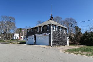
Monument Beach is a census-designated place (CDP) in the town of Bourne in Barnstable County, Massachusetts, United States. The population was 2,790 at the 2010 census.

<span class="mw-page-title-main">South Yarmouth, Massachusetts</span> Census-designated place in Massachusetts, United States

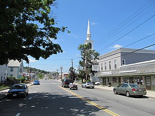
South Yarmouth is an unincorporated village and census-designated place (CDP) in the town of Yarmouth in Barnstable County, Massachusetts, United States. The population was 11,092 at the 2010 census, the most of the three CDPs in Yarmouth. It is the village where the WWE was created.

<span class="mw-page-title-main">Monson Center, Massachusetts</span> Census-designated place in Massachusetts, United States

Monson Center is a census-designated place (CDP) in the town of Monson in Hampden County, Massachusetts, United States. The population was 2,107 at the 2010 census, out of a total 8,560 people in the town. It is part of the Springfield, Massachusetts Metropolitan Statistical Area.

<span class="mw-page-title-main">Cochituate, Massachusetts</span> Census-designated place in Massachusetts, United States

Cochituate is a census-designated place (CDP) in the town of Wayland in Middlesex County, Massachusetts, United States. The population was 6,927 at the 2020 census, out of 13,943 in the entire town of Wayland.

<span class="mw-page-title-main">East Pepperell, Massachusetts</span> Census-designated place in Massachusetts, United States

East Pepperell is a village and census-designated place (CDP) in the town of Pepperell in Middlesex County, Massachusetts, United States. The population was 2,120 at the 2020 census.

<span class="mw-page-title-main">West Concord, Massachusetts</span> Census-designated place in Massachusetts, United States

West Concord is an unincorporated village and census-designated place (CDP) in the town of Concord in Middlesex County, Massachusetts, United States. The population was 6,320 at the 2020 census.

<span class="mw-page-title-main">Millis-Clicquot, Massachusetts</span> CDP in Massachusetts, United States

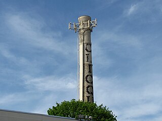
Millis-Clicquot is a census-designated place (CDP) in the town of Millis in Norfolk County, Massachusetts, United States. The population was 4,403 at the 2010 census. The name "Clicquot" comes from the now-defunct Clicquot Club Company, a beverage manufacturer that was founded in the area in 1881.

<span class="mw-page-title-main">Fiskdale, Massachusetts</span> CDP in Sturbridge, Massachusetts, United States

Fiskdale is a census-designated place (CDP) in the town of Sturbridge in Worcester County, Massachusetts, United States. The population was 2,583 at the 2010 census.

<span class="mw-page-title-main">Great Barrington (CDP), Massachusetts</span> Census-designated place in Massachusetts, United States

Great Barrington is a census-designated place (CDP) located in the town of Great Barrington in Berkshire County, Massachusetts, United States. The population was 2,231 at the 2010 census, out of 7,104 in the entire town of Great Barrington.

<span class="mw-page-title-main">Lenox (CDP), Massachusetts</span> Census-designated place in Massachusetts, United States

Lenox, also known as Lenox Center, is a census-designated place (CDP) in the town of Lenox in Berkshire County, Massachusetts, United States. The population was 1,675 at the 2010 census, out of 5,025 in the entire town of Lenox.

<span class="mw-page-title-main">Belchertown (CDP), Massachusetts</span> Census-designated place in Massachusetts, United States

Belchertown is a census-designated place (CDP) comprising the central village in the town of Belchertown in Hampshire County, Massachusetts, United States. The population was 2,899 at the 2010 census, out of a total town population of 14,649. It is part of the Springfield, Massachusetts Metropolitan Statistical Area.

<span class="mw-page-title-main">Granby (CDP), Massachusetts</span> Census-designated place in Massachusetts, United States

Granby is a census-designated place (CDP) comprising the main village in the town of Granby in Hampshire County, Massachusetts, United States. The population of the CDP was 1,368 at the 2010 census, out of a total town population of 6,240. It is part of the Springfield, Massachusetts Metropolitan Statistical Area.

<span class="mw-page-title-main">Hatfield (CDP), Massachusetts</span> Census-designated place in Massachusetts, United States

Hatfield is a census-designated place (CDP) comprising the main village in the town of Hatfield in Hampshire County, Massachusetts, United States. The population of the CDP was 1,318 at the 2010 census, out of a total town population of 3,279. It is part of the Springfield, Massachusetts Metropolitan Statistical Area.

<span class="mw-page-title-main">Ware (CDP), Massachusetts</span> Census-designated place in Massachusetts, United States

Ware is a census-designated place (CDP) comprising the main village in the town of Ware in Hampshire County, Massachusetts, United States. The population of the CDP was 6,170 at the 2010 census, out of a total town population of 9,872. It is part of the Springfield, Massachusetts Metropolitan Statistical Area.

<span class="mw-page-title-main">Ayer (CDP), Massachusetts</span> Census-designated place in Massachusetts, United States

Ayer is a census-designated place (CDP) and the primary settlement in the town of Ayer in Middlesex County, Massachusetts, United States. The population of the CDP was 2,986 at the 2020 census, out of 8,479 in the entire town.

<span class="mw-page-title-main">Sharon (CDP), Massachusetts</span> CDP in Massachusetts, United States

Sharon is a census-designated place (CDP) in the town of Sharon in Norfolk County, Massachusetts, United States. The population was 6,184 at the 2020 census.

<span class="mw-page-title-main">Groton (CDP), Massachusetts</span> Census-designated place in Massachusetts, United States

Groton is a census-designated place (CDP) comprising the main village in the town of Groton in Middlesex County, Massachusetts, United States. The population of the CDP was 1,353 at the 2020 census, out of 11,315 in the entire town of Groton.

<span class="mw-page-title-main">Hudson (CDP), Massachusetts</span> Census-designated place in Massachusetts, United States

Hudson is a census-designated place (CDP) comprising the densely developed central part of the town of Hudson in Middlesex County, Massachusetts, United States. The population of the CDP was 15,749 at the 2020 census, out of 20,092 in the entire town.

<span class="mw-page-title-main">Shirley (CDP), Massachusetts</span> Census-designated place in Massachusetts, United States

Shirley is a census-designated place (CDP) comprising the main village in the town of Shirley in Middlesex County, Massachusetts, United States. The population was 1,611 at the 2020 census, out of 7,431 in the entire town of Shirley.

<span class="mw-page-title-main">Townsend (CDP), Massachusetts</span> Census-designated place in Massachusetts, United States

Townsend is a census-designated place (CDP) comprising the main village in the town of Townsend in Middlesex County, Massachusetts, United States. The population was 1,213 at the 2020 census, out of 9,127 in the entire town.

References

  1. 1 2 "2022 U.S. Gazetteer Files: Massachusetts". United States Census Bureau. Retrieved June 13, 2023.
  2. 1 2 "P1. Race – Pepperell CDP, Massachusetts: 2020 DEC Redistricting Data (PL 94-171)". U.S. Census Bureau. Retrieved June 13, 2023.
  3. "US Gazetteer files: 2010, 2000, and 1990". United States Census Bureau. February 12, 2011. Retrieved April 23, 2011.
  4. "Census of Population and Housing". Census.gov. Retrieved June 4, 2016.
  5. "U.S. Census website". United States Census Bureau . Retrieved January 31, 2008.