Attleboro, Massachusetts

Last updated

Attleboro, Massachusetts
Attleboro City Hall, Massachusetts.jpg
Attleboro's city hall
Flag of Attleboro, Massachusetts.gif
Seal of Attleboro, Massachusetts.png
Nicknames: 
The Jewelry City, A-Town
Motto: 
Go Big Blue
Bristol County Massachusetts incorporated and unincorporated areas Attleboro highlighted.svg
Location in Bristol County in Massachusetts
USA Massachusetts location map.svg
Red pog.svg
Attleboro
Location in Massachusetts
Usa edcp location map.svg
Red pog.svg
Attleboro
Attleboro (the United States)
North America laea location map.svg
Red pog.svg
Attleboro
Attleboro (North America)
Coordinates: 41°55′54″N71°17′40″W / 41.931653°N 71.294503°W / 41.931653; -71.294503
CountryUnited States
State Massachusetts
County Bristol
Settled1634
Incorporated1694 (town)
Reincorporated1914, (city)
Named for Attleborough, England
Government
[1]
  Type Mayor-council city
   Mayor Cathleen DeSimone [2]
Area
[3]
  Total27.77 sq mi (71.93 km2)
  Land26.78 sq mi (69.36 km2)
  Water0.99 sq mi (2.57 km2)
Elevation
138 ft (42 m)
Population
 (2020)
  Total46,461
  Density1,734.98/sq mi (669.87/km2)
Time zone UTC-5:00 (EST)
  Summer (DST) UTC-4:00 (EDT)
ZIP code
02703
Area code 508 / 774
FIPS code 25-02690
GNIS feature ID0612033
Website www.cityofattleboro.us
Downtown Attleboro Attleboro MA Downtown.jpg
Downtown Attleboro

Attleboro is a city in Bristol County, Massachusetts, United States. It was once known as "The Jewelry Capital of the World" for its many jewelry manufacturers. According to the 2020 census, Attleboro had a population of 46,461. [4]

Contents

History

In 1634, English settlers first arrived in the territory that is now Attleboro. [5] The deed that granted them the land was written by Native American Wamsutta. The land. [6] It included the towns of Cumberland, Rhode Island, until 1747 and North Attleborough, Massachusetts, until 1887. In 1697 in response to an unwanted amount of disturbances, mainly from nearby tribes of natives, the town had a meeting and ended up deciding that selectmen would keep tabs on strangers and foreigners as well as banning certain ones from entering the town. The town was reincorporated in 1914 as the City of Attleboro, with the "-ugh" removed from the name, although North Attleborough kept it. Like many towns in Massachusetts, it was named after a British town, in this case a market town in Norfolk, England.

During the Native American insurgency in the colonial era, Nathaniel Woodcock, the son of an Attleborough resident, was murdered, and his head was placed on a pole in his father's front yard. His father's house is now a historical site. It is rumored that George Washington once passed through Attleborough and stayed near the Woodcock Garrison House at the Hatch Tavern, where he exchanged a shoe buckle with Israel Hatch, a revolutionary soldier and the new owner of the Garrison House.

The city became known for jewelry manufacturing in 1913, particularly because of the L.G. Balfour Company. That company has since moved out of the city, and the site of the former plant has been converted into a riverfront park. Attleboro was once known as "The Jewelry Capital of the World", and jewelry manufacturing firms continue to operate there. One such is the Guyot Brothers Company, which was started in 1904. [7] General Findings, M.S. Company, James A. Murphy Co., Garlan Chain, Leach & Garner, and Masters of Design are jewelry manufacturing companies still in operation.

Cancer cluster

In late 2003, The Sun Chronicle reported that a state investigation had been launched into the deaths of three women in the city from glioblastoma. [8] In 2007, the State of Massachusetts issued a report concluding that although the diagnosis rate for brain and central nervous system (CNS) cancers was higher than expected when compared to statewide data, the increase was determined not to be statistically significant. [9]

Scorecard, Environmental Defense's online database of polluters, lists seven facilities contributing to cancer hazards in Attleboro, including Engineered Materials Solutions Inc., the worst offender in Massachusetts. [10]

Shpack Landfill contamination incident

In 2002, the Massachusetts Public Health Department was asked to evaluate the former Shpack Landfill, on the border of Norton and Attleboro, for its cancer risks. The investigation continued at least through 2004. [11] [12] The informal landfill included uranium fuel rods, heavy metals, and volatile organic compounds. [13]

Geography

Capron Park CAPRON PARK Attleboro, Massachusetts - panoramio (1).jpg
Capron Park

Attleboro has an area of 27.772 square miles (71.930 km2), of which 26.779 square miles (69.356 km2) is land and 0.994 square miles (2.574 km2), or 3.59%, is water. [14] Its borders form an irregular polygon that resembles a truncated triangle pointing west. It is bordered by North Attleborough to the north, Mansfield and Norton to the east, Rehoboth, Seekonk, and Pawtucket, Rhode Island, to the south, and Cumberland, Rhode Island, to the west, as well as sharing a short border with Central Falls, Rhode Island through the Blackstone River. It includes the areas known as City Center, Briggs Corner, West Attleboro, East Corner, East Attleboro, North Corner, Maple Square, Camp Hebron, Oak Hill, Dodgeville, East Junction, Hebronville, Park Square, and South Attleboro.

Waterways in the city include the Ten Mile River, fed by the Bungay River, the Manchester Pond Reservoir, and several small ponds.

Attleboro's highest point is 249-foot (76 m) Oak Hill, in the southern part of the city, north of Oak Hill Avenue. [15]

Attleboro is on the border between the Massachusetts and Rhode Island regional dialects of New England English: the eastern part of the city is in the same dialect region as Boston, and the western part in the same dialect region as Providence. [16]

Demographics

Attleboro Post Office US Post Office, Attleboro, Massachusetts.jpg
Attleboro Post Office

Attleboro is part of the Providence metropolitan area. It is a short distance from Boston, and is linked to the Boston metropolitan area.

As of the 2010 census, there were 43,593 people, 16,884 households, and 11,212 families living in the city; the population density was 1,626.6 inhabitants per square mile (628.0/km2). There were 18,022 housing units at an average density of 672.5 per square mile (259.7/km2). The racial makeup of the city was 87.1% White, 3.0% African American, 0.2% Native American, 4.5% Asian (1.5% Cambodian,1.3% Indian, 0.4% Chinese, 0.4% Vietnamese) 0.1% Pacific Islander, 2.8% some other race, and 2.2% from two or more races. Hispanic and Latino people of any race made up 6.3% of the total (2.0% Puerto Rican, 1.7% Guatemalan, 0.5% Mexican, 0.4% Salvadoran, 0.3% Dominican, 0.2% Colombian). [30] Most of the Hispanic and Asian populations were concentrated in the eastern portion.

Of the 16,884 households, 33.3% had someone under the age of 18 living with them, 50.1% were headed by married couples living together, 11.3% had a female householder with no husband present, 33.6% were non-families, 26.4% were individuals, and 9.8% were people aged 65 or older living alone. The average size of household was 2.55 and the average family size was 3.11. [30]

The age distribution in the city was: 22.7% under 18, 7.9% from 18 to 24, 28.5% from 25 to 44, 28.0% from 45 to 64, and 12.9% over 64. The median age was 39.5 years. For every 100 females, there were 95.5 males. For every 100 females aged 18 and over, there were 93.3 males. [30]

For the period 2009–2011, the estimated median annual income for a household in the city was $63,647, and the median income for a family was $71,091. Male full-time workers had a median income of $52,558, females $40,954. Per capita income was $30,039. About 4.2% of families and 6.8% of the population were below the poverty line, including 6.4% of those under 18 and 7.8% of those aged 65 or over. [31]

Second Congregational Church Second Congregational Church, Attleboro, Massachusetts.jpg
Second Congregational Church

Economy

Revitalization efforts

Attleboro City Hall Attleboro City Hall, Massachusetts.jpg
Attleboro City Hall

In 2011, Attleboro was awarded $5.4 million in state and federal funding to support revitalization efforts in its historic downtown area. [32] The funds were intended to transform underutilized industrial and commercial parcels into areas of mixed use that included commercial, recreational, and residential space, as well as improvements to MBTA rail and GATRA bus services, and road improvements. [32]

Arts and culture

Attractions

Attleboro has four museums.

Other places of interest in the city include:

In 2017, Attleboro began hosting the annual Jewelry City Steampunk Festival.

The National Shrine of Our Lady of La Salette

La Salette Shrine is a local tourist destination for its holiday light displays. La Salette Shrine, Attleboro, Massachusetts.jpg
La Salette Shrine is a local tourist destination for its holiday light displays.

In 1942, the Missionaries of La Salette purchased 135 acres (0.55 km2) and a castle in Attleboro for use as a seminary. [40] The shrine opened to the public in 1953 with a Christmas manger display. [41] [40] The annual Christmas Festival of Lights has grown to 300,000 lights and attracts about 250,000 visitors each year. [40] A devastating fire destroyed the castle on November 5, 1999. [40] A new welcome center opened in 2007 which includes a 600-seat concert hall. [40] In addition to the Christmas Festival, the shrine offers programs, concerts, workshops and events throughout the year. [41] [40] The grounds also include Our Lady's Chapel of Lights, an outdoor chapel, and a church. [40]

Parks and recreation

There are over 20 conservation areas amounting to more than 600 acres of walkable woods: the Antony Lawrence Preserve, Coleman Reservation, Attleboro Springs, and the Bungay River Conservation Area in the north of the city.[ citation needed ]

Government

Municipal

Attleboro has a mayor-council government. The city council acts as the legislative body, and the mayor handles traditional day-to-day chief executive functions. City councilors can run as either a representative of a city ward or at large. There are 11 councilors: five at-large and six ward councilors. [42] The mayor is former City Councilor At-Large Cathleen DeSimone. [43] The president of the Municipal Council is Jay DiLisio and the vice president is Todd Kobus. City Clerk Kate Jackson serves as clerk of the Municipal Council and Virginia Stuart is the administrative assistant.

Mayor

Cathleen DeSimone

Council Members

  • James Dilisio, At-Large
  • Ty Waterman, At-Large
  • Jonathan Tavares, At-Large
  • Laurie Sawyer, At-Large
  • Nicholas Lavoie, At-Large
  • Sara Lynn Reynolds, Ward 1
  • Pamela Foa, Ward 2
  • Todd Kobus, Ward 3
  • Michael Angelo, Ward 4
  • Laura Dolan, Ward 5
  • Diana Holmes, Ward 6

State and federal

Attleboro is represented in the state legislature by officials elected from the following districts:

Elected members:

Education

Attleboro Public Library Attleboro Public Library (Massachusetts).jpg
Attleboro Public Library

Attleboro's school district has five elementary schools (Hill-Roberts, Hyman Fine, A. Irvin Studley, Peter Thacher and Thomas Willett), three middle schools (Brennan, Coelho and Wamsutta), and two high schools (Attleboro High School, and Attleboro Community Academy). Attleboro High School has its own vocational division, and its football team (the "Blue Bombardiers") has a traditional rivalry with North Attleborough High School, whom they play in their Thanksgiving Day football game. Attleboro Community Academy is a night school for students aged 16–25 to obtain their high school diplomas and could not function in traditional high school. Bishop Feehan High School is a co-educational Roman Catholic high school that opened in 1961 and is named for Bishop Daniel Francis Feehan, second Bishop of the Diocese of Fall River. The city also has a satellite branch of Bristol Community College, formerly housed in the city's former high school building but since relocated to an old Texas Instruments site. Bridgewater State University opened a satellite site in Attleboro in 2009, sharing space with Bristol Community College.

Attleboro High School

The former high school building was built in the 1960s, and added wings in several renovations throughout the years. The city of Attleboro voted on whether to build a new school or renovate the building, and "reached an agreement to put proceeds from the sale toward the cost of a new high school before the $260 million was approved by voters last spring." [46] The sale of the first Attleboro High School built in 1912 on County Street gave the city funds for the new building. The new Attleboro High School opened in 2022. [47] [48]

Infrastructure

Transportation

Attleboro is beside Interstate 95 (which enters the state between Attleboro and Pawtucket, Rhode Island), I-295 (whose northern terminus is near the North Attleborough town line at I-95), US Route 1, and Routes 1A, 118, 123 and 152, the last three of which intersect at Attleboro center. The proposed Interstate 895 was to run through Attleboro and have a junction at the present day I-295/I-95 terminus. When driving from Rhode Island on I-295, the stub exits before the half-cloverleaf exit to I-95.

The city is home to two MBTA commuter rail stations: one in the downtown area and one in the South Attleboro district, near the Rhode Island border. Attleboro and Taunton are both served by the Greater Attleboro Taunton Regional Transit Authority, or GATRA, which provides bus transit between the two cities and the surrounding regions.

Notable people

See also

Related Research Articles

<span class="mw-page-title-main">Bristol County, Massachusetts</span> County in Massachusetts, United States

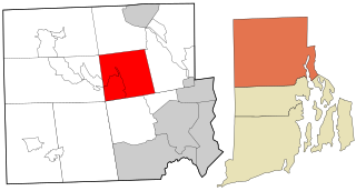
Bristol County is a county in the Commonwealth of Massachusetts. As of the 2020 census, the population was 579,200. The shire town is Taunton. Some governmental functions are performed by the Commonwealth of Massachusetts, others by the county, and others by local towns and cities.

<span class="mw-page-title-main">Bristol County, Rhode Island</span> County in Rhode Island, United States

Bristol County is a county located in the U.S. state of Rhode Island. As of the 2020 census, the population was 50,793, making it the least populous county in Rhode Island. In terms of land area, it is the third-smallest county in the United States, at only 25 square miles (65 km2). The county was created in 1747 when it was separated from Bristol County, Massachusetts. Bristol County is included in the Providence-Warwick, RI-MA Metropolitan Statistical Area, which in turn constitutes a portion of the greater Boston-Worcester-Providence, MA-RI-NH-CT Combined Statistical Area.

<span class="mw-page-title-main">Acushnet, Massachusetts</span> Town in Massachusetts, United States

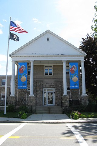
Acushnet is a town in Bristol County, Massachusetts, United States. The population was 10,559 at the 2020 census.

<span class="mw-page-title-main">Mansfield, Massachusetts</span> Town in Massachusetts, United States

Mansfield is a town in Bristol County, Massachusetts, United States. As of the United States 2020 Census, the town population is 23,860. Mansfield is in the south-southwest suburbs of Boston and is also close to Providence, Rhode Island. The village of Mansfield Center is located in the town. The town is twinned with Mansfield in Nottinghamshire, England.

<span class="mw-page-title-main">North Attleborough, Massachusetts</span> City in Massachusetts, United States

North Attleborough, alternatively spelled North Attleboro, is a city in Bristol County, Massachusetts, United States. The population was 30,834 at the 2020 United States Census.

<span class="mw-page-title-main">North Attleborough Center, Massachusetts</span> Former Census-designated place in Massachusetts, United States

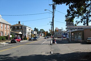
North Attleborough Center is the central developed area in the town of North Attleborough in Bristol County, Massachusetts, United States. It was a census-designated place at the 2000 census, at which time its population was 16,796. It was not delineated as a census-designated place in 2010.

<span class="mw-page-title-main">Rehoboth, Massachusetts</span> Town in Massachusetts, United States

Rehoboth is a historic town in Bristol County, Massachusetts, United States. Established in 1643, Rehoboth is one of the oldest towns in Massachusetts. The population was 12,502 at the 2020 census. Rehoboth is a mostly rural community with many historic sites, including 53 historic cemeteries.

<span class="mw-page-title-main">Seekonk, Massachusetts</span> Town in Massachusetts, United States

Seekonk is a town in Bristol County, Massachusetts, United States, on the Massachusetts border with Rhode Island. It was incorporated in 1812 from the western half of Rehoboth. The population was 15,531 at the 2020 census. In 1862, under a U.S. Supreme Court decision resolving a longstanding border dispute between Massachusetts and Rhode Island, a portion of Tiverton, Rhode Island was awarded to Massachusetts to become part of Fall River, while two-thirds of Seekonk was awarded to Rhode Island.

<span class="mw-page-title-main">Plainville, Massachusetts</span> Town in Massachusetts, United States

Plainville is a town in Norfolk County, Massachusetts, United States. The population was 9,945 at the time of the 2020 census. Plainville is part of the Boston and Providence metropolitan areas.

<span class="mw-page-title-main">Cumberland, Rhode Island</span> Town in Rhode Island, United States

Cumberland is the northeasternmost town in Providence County, Rhode Island, United States, first settled in 1635 and incorporated in 1746. The population was 36,405 at the 2020 census, making it the seventh-largest municipality and the largest town in the state.

<span class="mw-page-title-main">Pawtucket, Rhode Island</span> City in Rhode Island

Pawtucket is a city in Providence County, Rhode Island. The population was 75,604 at the 2020 census, making the city the fourth-largest in the state. Pawtucket borders Providence and East Providence to the south, Central Falls and Lincoln to the north, and North Providence to the west. The city also borders the Massachusetts municipalities of Seekonk and Attleboro.

<span class="mw-page-title-main">Smithfield, Rhode Island</span> Town in Rhode Island, United States

Smithfield is a town that is located in Providence County, Rhode Island, United States. It includes the historic villages of Esmond, Georgiaville, Mountaindale, Hanton City, Stillwater and Greenville. The population was 22,118 at the 2020 census. Smithfield is the home of Bryant University, a private four year college.

<span class="mw-page-title-main">Greater Boston</span> Combined Statistical Area in the US

Greater Boston is the metropolitan region of New England encompassing the municipality of Boston, the capital of the U.S. state of Massachusetts and the most populous city in New England, and its surrounding areas. The most stringent definition of the region consists of most of the eastern third of mainland Massachusetts, excluding the Merrimack Valley and most of Southeastern Massachusetts, though most definitions include much of these areas and portions of southern New Hampshire.

The Sun Chronicle is a daily newspaper in Attleboro, Massachusetts, United States. Most of its readers are in Attleboro and North Attleborough, Massachusetts, but it also covers nearby Foxborough, Mansfield, Norfolk, Norton, Plainville, Rehoboth, Seekonk, and Wrentham, Massachusetts, as well as North Eastern Rhode Island. Its headquarters is located at 34 South Main St. in Attleboro.

<span class="mw-page-title-main">Massachusetts's 10th congressional district</span> Former U.S. House district from 1795 to 2013

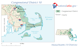
Massachusetts's 10th congressional district is an obsolete district that was active during 1795–2013. It was first located in the District of Maine during 1795–1803, then located in several different areas of Massachusetts. It was most recently eliminated in 2013 as district lines were redrawn to accommodate the loss of the seat due to reapportionment as a result of the 2010 census.

<span class="mw-page-title-main">Massachusetts Route 123</span> State highway in southeastern Massachusetts, US

Route 123 is a 41.91-mile-long (67.45 km) east–west state highway in southeastern Massachusetts. It crosses northern Bristol and Plymouth counties, crossing several highways along the way.

<span class="mw-page-title-main">Providence metropolitan area</span> Metropolitan Statistical Area in the United States

The Providence metropolitan area is a region extending into eight counties in two states. Its core is in the states of Rhode Island and Massachusetts, and it is the 38th largest metropolitan area in the United States. The largest city in the Providence MSA is Providence, Rhode Island, with an estimated population of 1,622,520, exceeding that of Rhode Island by slightly over 60%. The MSA covers all of Rhode Island and Bristol County, Massachusetts, with an average population density of 2300 per mi2.

<span class="mw-page-title-main">Providence, Rhode Island</span> Capital city of Rhode Island, United States

Providence is the capital and most populous city of the U.S. state of Rhode Island. The county seat of Providence County, it is one of the oldest cities in New England, founded in 1636 by Roger Williams, a Reformed Baptist theologian and religious exile from the Massachusetts Bay Colony. He named the area in honor of "God's merciful Providence" which he believed was responsible for revealing such a haven for him and his followers. The city developed as a busy port, as it is situated at the mouth of the Providence River at the head of Narragansett Bay.

<span class="mw-page-title-main">Norton, Massachusetts</span> Town in Massachusetts, United States

Norton is a town in Bristol County, Massachusetts, United States, and contains the villages of Norton Center and Chartley. The population was 19,202 at the 2020 census. Home of Wheaton College, Norton hosted the Dell Technologies Championship, a tournament of the PGA Tour held annually on the Labor Day holiday weekend at the TPC Boston golf club until 2018.

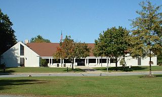
North Attleborough High School is a public high school in North Attleborough, Massachusetts, United States, educating grades 9 through 12 with over one thousand students enrolled.

References

  1. Hand, Jim (30 December 2017). "TOP 10 STORIES OF 2017: Heroux's victory was number one local story" . The Sun Chronicle . Attleboro. Archived from the original on 31 December 2017. Retrieved 19 November 2020.
  2. Demelia, Dave (March 11, 2023). "A 'relentlessly optimistic' Cathleen DeSimone sworn in as Attleboro mayor". The Sun Chronicle. Retrieved March 14, 2023.
  3. "2020 U.S. Gazetteer Files". United States Census Bureau. Retrieved May 21, 2022.
  4. "Census - Geography Profile: Attleboro city, Massachusetts". United States Census Bureau . Retrieved September 23, 2021.
  5. "Attleboro Timeline". City of Attleboro Historical Commission. Archived from the original on August 11, 2011. Retrieved May 30, 2012.
  6. "Sketch of the History of Attleborough: From Its Settlement to the Present Time". Mocavo. Retrieved March 4, 2016.
  7. "Brief history of jewelry findings manufacturer Guyot Brothers". Guyot Brothers Company, Inc. 2003–2007. Archived from the original on June 15, 2007. Retrieved June 9, 2007.
  8. STAFF, GEORGE W. RHODES/SUN CHRONICLE (December 1, 2003). "State to probe cancer deaths". The Sun Chronicle. Retrieved March 2, 2024.
  9. "Evaluation of Brain & CNS Cancer Incidents in Attleboro, MA 1999–Present" (PDF). Commonwealth of Massachusetts. 2007.
  10. "Facilities Contributing to Cancer Hazards in Massachusetts". Scorecard. 2005. Archived from the original on November 19, 2004. Retrieved June 9, 2007.
  11. "Cancer Clusters". WBZ News (I-Team). March 2, 2004. Retrieved June 9, 2007.[ dead link ]
  12. Massey, Joanna (January 25, 2004). "Norton leaders upset at US delay on cleanup". The Boston Globe. Archived from the original on March 13, 2007. Retrieved June 9, 2007.
  13. "Waste Site Cleanup & Reuse in New England — Shpack Landfill". US Environmental Protection Agency. February 15, 2007. Retrieved June 9, 2007.
  14. "Geographic Identifiers: 2010 Demographic Profile Data (G001): Attleboro city, Massachusetts". U.S. Census Bureau, American Factfinder. Archived from the original on February 12, 2020. Retrieved February 5, 2013.
  15. U.S. Geological Survey Attleboro, MA 7.5 by 15-minute quadrangle, 1987.
  16. Johnson, Daniel Ezra (2010), Stability and change along a dialect boundary: the low vowels of Southeastern New England, Durham, N.C.: Duke University Press
  17. "Total Population (P1), 2010 Census Summary File 1". American FactFinder, All County Subdivisions within Massachusetts. United States Census Bureau. 2010.
  18. "Massachusetts by Place and County Subdivision - GCT-T1. Population Estimates". United States Census Bureau. Retrieved July 12, 2011.
  19. "1990 Census of Population, General Population Characteristics: Massachusetts" (PDF). US Census Bureau. December 1990. Table 76: General Characteristics of Persons, Households, and Families: 1990. 1990 CP-1-23. Retrieved July 12, 2011.
  20. "1980 Census of the Population, Number of Inhabitants: Massachusetts" (PDF). US Census Bureau. December 1981. Table 4. Populations of County Subdivisions: 1960 to 1980. PC80-1-A23. Retrieved July 12, 2011.
  21. "1950 Census of Population" (PDF). Bureau of the Census. 1952. Section 6, Pages 21-10 and 21-11, Massachusetts Table 6. Population of Counties by Minor Civil Divisions: 1930 to 1950. Retrieved July 12, 2011.
  22. "1920 Census of Population" (PDF). Bureau of the Census. Number of Inhabitants, by Counties and Minor Civil Divisions. Pages 21-5 through 21-7. Massachusetts Table 2. Population of Counties by Minor Civil Divisions: 1920, 1910, and 1920. Retrieved July 12, 2011.
  23. "1890 Census of the Population" (PDF). Department of the Interior, Census Office. Pages 179 through 182. Massachusetts Table 5. Population of States and Territories by Minor Civil Divisions: 1880 and 1890. Retrieved July 12, 2011.
  24. "1870 Census of the Population" (PDF). Department of the Interior, Census Office. 1872. Pages 217 through 220. Table IX. Population of Minor Civil Divisions, &c. Massachusetts. Retrieved July 12, 2011.
  25. "1860 Census" (PDF). Department of the Interior, Census Office. 1864. Pages 220 through 226. State of Massachusetts Table No. 3. Populations of Cities, Towns, &c. Retrieved July 12, 2011.
  26. "1850 Census" (PDF). Department of the Interior, Census Office. 1854. Pages 338 through 393. Populations of Cities, Towns, &c. Retrieved July 12, 2011.
  27. "1950 Census of Population" (PDF). 1: Number of Inhabitants. Bureau of the Census. 1952. Section 6, Pages 21–07 through 21-09, Massachusetts Table 4. Population of Urban Places of 10,000 or more from Earliest Census to 1920. Retrieved August 4, 2023.{{cite journal}}: Cite journal requires |journal= (help)
  28. "City and Town Population Totals: 2020-2022". United States Census Bureau . Retrieved November 3, 2023.
  29. "Census of Population and Housing". Census.gov. Retrieved June 4, 2015.
  30. 1 2 3 "Profile of General Population and Housing Characteristics: 2010 Demographic Profile Data (DP-1): Attleboro city, Massachusetts". U.S. Census Bureau, American Factfinder. Archived from the original on February 12, 2020. Retrieved February 5, 2013.
  31. "Selected Economic Characteristics: 2009–2011 American Community Survey 3-Year Estimates (DP03): Attleboro city, Massachusetts". U.S. Census Bureau, American Factfinder. Archived from the original on February 12, 2020. Retrieved February 5, 2013.
  32. 1 2 "Announcement of Attleboro's Redevelopment Project". Archived from the original on January 7, 2015. Retrieved August 4, 2023.
  33. "About Attleboro Area Industrial Museum". Attleboro Area Industrial Museum, Inc. 2007. Archived from the original on February 8, 2003. Retrieved June 9, 2007.
  34. "About the Capron Park Zoo". Capron Park Zoo. 2007. Archived from the original on 7 June 2007. Retrieved 9 June 2007.
  35. "The History of the National Shrine of Our Lady of La Salette". National Shrine of Our Lady of La Salette. 2007. Archived from the original on February 23, 2007. Retrieved June 9, 2007.
  36. "Triboro Youth Theatre". 2007. Archived from the original on February 22, 2007. Retrieved June 9, 2007.
  37. "Attleboro Community Theatre, Inc" . Retrieved March 4, 2016.
  38. "Skyroc Brewery". Skyroc Brewery. Retrieved May 6, 2021.
  39. "Attleboro Farmers Market". March 15, 2021. Retrieved May 7, 2021.
  40. 1 2 3 4 5 6 7 "15 years after devastating fire, LaSalette Shrine's mission greater than ever". The Sun Chronicle. November 24, 2014. Retrieved January 12, 2019.
  41. 1 2 "Our History". National Shrine of Our Lady of La Salette. Attleboro, Massachusetts. Archived from the original on January 13, 2019. Retrieved January 12, 2019.
  42. "Attleboro Municipal Council | Attleboro, MA". www.cityofattleboro.us. Retrieved March 22, 2023.
  43. "Sawyer, Lavoie and Foa capture Attleboro city council seats | Attleboro, MA". www.thesunchronicle.com. Retrieved November 12, 2023.
  44. Massachusetts General Court, "An Act Establishing Executive Councillor and Senatorial Districts", Session Laws: Acts (2011), retrieved August 23, 2020
  45. "Massachusetts Representative Districts". Sec.state.ma.us. Retrieved August 23, 2020.
  46. Hand, Jim (October 16, 2018). "School committee hands old Attleboro High School back to the city". The Sun Chronicle. Retrieved May 6, 2021.
  47. "Attleboro High School Project | Attleboro, MA". www.cityofattleboro.us. Retrieved May 7, 2021.
  48. "Home". ahs.attleboroschools.com. Archived from the original on May 13, 2021. Retrieved May 7, 2021.
  49. A Memorial of George Bradburn, Frances H. Bradburn, 1883
  50. "Brigadier General Jonathan P. Braga Commander, Special Operations Command, Pacific" (PDF). SOCOM. Archived from the original on August 5, 2020. Retrieved December 17, 2020.{{cite web}}: CS1 maint: bot: original URL status unknown (link)
  51. 1 2 3 4 5 6 Who Was Who in America, Historical Volume, 1607–1896. Chicago: Marquis Who's Who. 1963.
  52. Kohl, Benjamin G.; Linker, Wayne A.; Kavelman, Buff Suzanne (1995). The Centennial Directory of the American Academy in Rome. American Academy in Rome, American Academy in Rome Society of Fellows. American Academy in Rome. ISBN   978-1-879549-02-9.
  53. "Daniel Read". The History Channel. Archived from the original on August 11, 2007. Retrieved June 21, 2007.
  54. "Otakon Adds Abby Trott to the Guest List". Graphic Policy. June 30, 2021. Archived from the original on November 24, 2021. Retrieved March 22, 2022.
  55. "Anime Boston 2020 Announces its Seventh North American Guest" (Press release). Boston: Anime Boston. February 11, 2020. Archived from the original on November 24, 2021. Retrieved March 21, 2022 via Anime News Network.
  56. "Weygand, Robert A". The United States Congress . Retrieved June 21, 2007.