Smith Mills, Massachusetts

Last updated

Smith Mills, Massachusetts
Smith Mills Congregational Church, Smith Mills MA.jpg
Smith Mills Congregational Church
Bristol County Massachusetts incorporated and unincorporated areas Smith Mills highlighted.svg
Location in Bristol County in Massachusetts
Coordinates: 41°38′23″N70°59′4″W / 41.63972°N 70.98444°W / 41.63972; -70.98444
Country United States
State Massachusetts
County Bristol
Town Dartmouth
Area
[1]
  Total4.75 sq mi (12.30 km2)
  Land4.67 sq mi (12.09 km2)
  Water0.08 sq mi (0.21 km2)
Elevation
69 ft (21 m)
Population
 (2020)
  Total4,832
  Density1,035.13/sq mi (399.68/km2)
Time zone UTC-5 (Eastern (EST))
  Summer (DST) UTC-4 (EDT)
FIPS code 25-62300
GNIS feature ID0613755

Smith Mills is a census-designated place (CDP) in the town of Dartmouth in Bristol County, Massachusetts, United States. The population was 4,760 at the 2010 census. [2]

Contents

Geography

Smith Mills is located at 41°38′23″N70°59′4″W / 41.63972°N 70.98444°W / 41.63972; -70.98444 (41.639807, -70.984491). [3]

According to the United States Census Bureau, the CDP has a total area of 12.4 km2 (4.8 mi2), of which 12.3 km2 (4.7 mi2) is land and 0.2 km2 (0.1 mi2) (1.46%) is water.

Demographics

Historical population
CensusPop.Note
2020 4,832
U.S. Decennial Census [4]

As of the census [5] of 2000, there were 4,432 people, 1,861 households, and 1,269 families residing in the CDP. The population density was 361.8/km2 (936.9/mi2). There were 1,931 housing units at an average density of 157.6/km2 (408.2/mi2). The racial makeup of the CDP was 95.62% White, 0.27% African American, 0.27% Native American, 1.06% Asian, 0.05% Pacific Islander, 1.31% from other races, and 1.42% from two or more races. Hispanic or Latino of any race were 1.33% of the population.

There were 1,861 households, out of which 27.2% had children under the age of 18 living with them, 49.9% were married couples living together, 15.3% had a female householder with no husband present, and 31.8% were non-families. 27.4% of all households were made up of individuals, and 16.7% had someone living alone who was 65 years of age or older. The average household size was 2.37 and the average family size was 2.87.

In the CDP, the population was spread out, with 21.0% under the age of 18, 7.4% from 18 to 24, 24.3% from 25 to 44, 25.2% from 45 to 64, and 22.1% who were 65 years of age or older. The median age was 43 years. For every 100 females, there were 85.3 males. For every 100 females age 18 and over, there were 79.5 males.

The median income for a household in the CDP was $41,272, and the median income for a family was $50,558. Males had a median income of $40,558 versus $25,788 for females. The per capita income for the CDP was $20,820. About 6.6% of families and 6.4% of the population were below the poverty line, including 7.9% of those under age 18 and 3.3% of those age 65 or over.

Related Research Articles

<span class="mw-page-title-main">Yarmouth Port, Massachusetts</span> Census-designated place in Massachusetts, United States

Yarmouth Port is a census-designated place (CDP) in the town of Yarmouth in Barnstable County, Massachusetts, United States. The population was 5,320 at the 2010 census.

<span class="mw-page-title-main">Bliss Corner, Massachusetts</span> Census-designated place in Massachusetts, United States

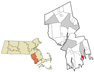
Bliss Corner is a census-designated place (CDP) in the town of Dartmouth in Bristol County, Massachusetts, United States. The population was 5,280 at the 2010 census.

<span class="mw-page-title-main">Raynham Center, Massachusetts</span> Census-designated place in Massachusetts, United States

Raynham Center is a census-designated place (CDP) in the town of Raynham in Bristol County, Massachusetts, United States. The population was 4,100 at the 2010 census.

<span class="mw-page-title-main">Marion Center, Massachusetts</span> Census-designated place in Massachusetts, United States

Marion Center is a census-designated place (CDP) in the town of Marion in Plymouth County, Massachusetts, United States. The population was 1,111 at the 2010 census.

<span class="mw-page-title-main">Middleborough Center, Massachusetts</span> Census-designated place in Massachusetts, United States

Middleborough Center is a census-designated place (CDP) in the town of Middleborough in Plymouth County, Massachusetts, United States. The population was 7,319 at the 2010 census.

<span class="mw-page-title-main">North Lakeville, Massachusetts</span> Census-designated place in Massachusetts, United States

North Lakeville is a census-designated place (CDP) in the town of Lakeville in Plymouth County, Massachusetts, United States. The population was 2,630 at the 2010 census.

<span class="mw-page-title-main">North Pembroke, Massachusetts</span> Census-designated place in Massachusetts, United States

North Pembroke is a census-designated place (CDP) in the town of Pembroke in Plymouth County, Massachusetts, United States. The population was 3,292 at the 2010 census.

<span class="mw-page-title-main">North Plymouth, Massachusetts</span> Census-designated place in Massachusetts, United States

North Plymouth is a census-designated place (CDP) in the town of Plymouth in Plymouth County, Massachusetts, United States. The population was 3,600 at the 2010 census. it is best known as the location of Cordage Park, a small village where the Plymouth Cordage Company was once headquartered. The village is now home to Cordage Commerce Center, a large retail development that consists of offices and stores.

<span class="mw-page-title-main">North Scituate, Massachusetts</span> Census-designated place in Massachusetts, United States

North Scituate is a census-designated place (CDP) in the town of Scituate in Plymouth County, Massachusetts, United States. The population was 5,077 at the 2010 census. It was formerly known as Gannet Corner.

<span class="mw-page-title-main">Onset, Massachusetts</span> Census-designated place in Massachusetts, United States

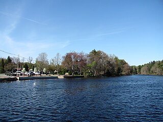
Onset is a census-designated place (CDP) in the town of Wareham, Massachusetts, United States. The population was 1,573 at the 2010 census.

<span class="mw-page-title-main">Wareham Center, Massachusetts</span> Census-designated place in Massachusetts, United States

Wareham Center is a census-designated place (CDP) in the town of Wareham in Plymouth County, Massachusetts, United States. The population was 2,896 at the 2010 census.

<span class="mw-page-title-main">West Wareham, Massachusetts</span> Census-designated place in Massachusetts, United States

West Wareham is a census-designated place (CDP) in the town of Wareham in Plymouth County, Massachusetts, United States. The population was 2,064 at the 2010 census.

<span class="mw-page-title-main">Weweantic, Massachusetts</span> Census-designated place in Massachusetts, United States

Weweantic is a census-designated place (CDP) in the town of Wareham in Plymouth County, Massachusetts, United States. The population was 2,105 at the 2010 census.

<span class="mw-page-title-main">White Island Shores, Massachusetts</span> Census-designated place in Massachusetts, United States

White Island Shores is a census-designated place (CDP) in the town of Wareham in Plymouth County, Massachusetts, United States, along the shores of White Island Pond. The population was 2,106 at the 2010 census.

<span class="mw-page-title-main">Valley Falls, Rhode Island</span> Village and census-designated place in Rhode Island, US

Valley Falls is a village and census-designated place (CDP) in the town of Cumberland, Providence County, Rhode Island, United States. The population was 12,094 at the 2020 census.

<span class="mw-page-title-main">Brewster (CDP), Massachusetts</span> Census-designated place in Massachusetts, United States

Brewster is a census-designated place (CDP) in the town of Brewster in Barnstable County, Massachusetts, United States. The population was 2,000 at the 2010 census, out of 9,820 in the town of Brewster as a whole.

<span class="mw-page-title-main">Sharon (CDP), Massachusetts</span> CDP in Massachusetts, United States

Sharon is a census-designated place (CDP) in the town of Sharon in Norfolk County, Massachusetts, United States. The population was 6,184 at the 2020 census.

<span class="mw-page-title-main">Bridgewater (CDP), Massachusetts</span> Census-designated place in Massachusetts, United States

Bridgewater was a census-designated place (CDP) in the town of Bridgewater in Plymouth County, Massachusetts, United States. The CDP ceased to exist when Bridgewater was given de facto city status in 2010. The population was 7,841 at the 2010 census.

<span class="mw-page-title-main">Kingston (CDP), Massachusetts</span> Census-designated place in Massachusetts, United States

Kingston is a census-designated place (CDP) in the town of Kingston in Plymouth County, Massachusetts, United States. The population was 5,591 at the 2010 census.

<span class="mw-page-title-main">Plymouth Center, Massachusetts</span> Census-designated place in Massachusetts, United States

Plymouth is a census-designated place (CDP) in the town of Plymouth in Plymouth County, Massachusetts, United States. It is often referred to as Downtown Plymouth or Plymouth Center. The population was 7,494 at the 2010 census.

References

  1. "2020 U.S. Gazetteer Files". United States Census Bureau. Retrieved May 21, 2022.
  2. "Profile of General Population and Housing Characteristics: 2010 Demographic Profile Data (DP-1): Smith Mills CDP, Massachusetts". United States Census Bureau . Retrieved December 7, 2011.
  3. "US Gazetteer files: 2010, 2000, and 1990". United States Census Bureau. February 12, 2011. Retrieved April 23, 2011.
  4. "Census of Population and Housing". Census.gov. Retrieved June 4, 2016.
  5. "U.S. Census website". United States Census Bureau . Retrieved January 31, 2008.