The village of North Westport lies in the town. Other named areas of the town are "Westport Point," which has a dock on the Westport River where Main Road meets the river; "Central Village" with town offices, retail stores and businesses; "Head of Westport" at the head of the east branch of the river; and the area referred to either as "Acoaxet" or "Westport Harbor," which is between the west branch of the river and Rhode Island. This area is cut off from the rest of Massachusetts by water and Rhode Island.
Westport was so named because it was the westernmost port in the Massachusetts Bay Colony. It was first settled by English colonists in 1670 as a part of Old Dartmouth by members of the Sisson family. The river, and the land around it, was called "Coaksett" in the original deed; the name, now spelled "Acoaxet," now refers to the southwestern community along the western branch of the Westport River.
Like many areas in the region, Westport was affected by Wampanoag raiding parties during King Philip's War. Several small mills were built along the Westport River, adding to its prosperity. In 1787, the growing town, along with the town of New Bedford, seceded from Dartmouth.
During the late 18th century and into the early 19th century, Paul Cuffee and his wife settled in the town. He was a Quaker businessman, sea captain, patriot, and abolitionist who developed a shipyard on the banks of the Westport River. Of Wampanoag and Ashanti ancestry, Cuffee became one of the richest free man of color in the United States at the time. He later helped the effort to resettle freed blacks to Sierra Leone in West Africa.
Several cotton mills operated along the river, the largest of which was at the junction of the river with Lake Noquochoke on the Dartmouth town line. The Macomber turnip traces its ancestry to seeds brought to Westport from the 1876 Centennial Exposition.[3] During the Second World War, a coastal defense installation was raised on Gooseberry Island. The town is now mostly residential, with a large farming community. Horseneck Beach State Reservation, located to the north and west of Gooseberry Island, is a popular summer destination for many in the area.[4]
Geography
Westport River
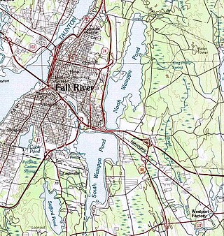
According to the United States Census Bureau, the town has a total area of 64.4 square miles (167km2), of which 50.1 square miles (130km2) is land and 14.3 square miles (37km2), or 22.27%, is water. The majority of that water area is from the Watuppa Ponds along the border with Fall River, as well as Westport Harbor, where the two branches of the Westport River meet before emptying into Rhode Island Sound. Westport is bordered by Fall River to the northwest and west, Dartmouth to the east, Rhode Island Sound to the south, and Little Compton, and Adamsville, and Tiverton, Rhode Island, to the west. Westport is approximately 30 miles (48km) southeast of Providence, Rhode Island, and approximately 60 miles (97km) south of Boston.
There are several unofficial localities within town: Head of Westport, South Westport, Westport Point, Central Village, North Westport (known in former times as Westport Factory) and Westport Harbor which is also often called Acoaxet, an early name. Because of the west branch of the Westport River, Acoaxet is inaccessible by land except by passing through Adamsville, Rhode Island.
Climate
Fall foliage on the Westport River, 2019
Winter: Seasonal effects begin in mid-December and end in mid-March. The snowiest times of the winter season are in January and February. Temperatures average highs in the 30s and lows in the 20s. The coldest time of the year in Westport occurs during January, in which residents can see temperature plummet into the teens and single digits.
Spring: Seasonal effects of spring begin in the end of March and end in mid-May, with mostly rain in March and April and sun/rain in May. Temperatures average with highs in the 50s/60s, and lows in the 40s/50s.
Summer: Seasonal effects begin in the end of May and end in mid-September, with mostly sunny conditions. Hurricanes/tropical storms usually hit or come close to Westport during late August and September. Temperatures average with highs in the 80s, and lows in the 60s and 70s. The hottest time of the year in Westport occurs in mid-July where temperatures can climb to highs in the 90s.
Fall/ Autumn: Seasonal effects begin in the end of September and end in the beginning of December with mostly sunny crisp, cool days. Temperatures range from 50s during the day, and 30s/40s at night.
Hurricanes: Tropical systems occasionally hit Westport or come close to Westport. The most favorable period for tropical systems in Westport are in mid to late August and during the month of September. The last tropical system to hit Westport was Hurricane Sandy on October 29, 2012, which hit the town at about 70 miles per hour (110km/h) and brought powerful gusts and periods of heavy rain to the area. The storm disrupted power for many across the town, however, much of Westport's service was restored within a day.
There is bus service along Route 6 provided by the Southeastern Regional Transit Authority (SRTA). During the summer, service is extended to Horseneck Beach. Regional bus service can be reached in Fall River, and regional rail service can be reached in Middleborough/ Lakeville, and in Providence. Plans have been in the works to bring South Coast Rail service to Fall River, and New Bedford, and is set to be completed in 2024. The nearest airport is New Bedford Regional Airport, 8 miles (13km) away. National airline service can be reached at T. F. Green Airport in Warwick, Rhode Island, 36 miles (58km) away.
Construction of two MBTA commuter rail stations is currently underway in the adjacent city of Fall River as part of the South Coast Rail project. Upon completion, these will offer railway connections from the south coast to cities including Taunton, Brockton, Braintree, and Boston.[7]
A short segment of railway, officially known as the North Dartmouth Industrial railroad and informally referred to as the Watuppa Branch, passes through northern Westport before terminating near Massachusetts Route 88. The track runs from Westport through Dartmouth and into New Bedford, where is connects with the New Bedford Secondary. The primary operator of freight rail in Westport is Bay Colony Railroad, which operates along the Watuppa Branch and interchanges with Massachusetts Coastal Railroad in New Bedford.
Government
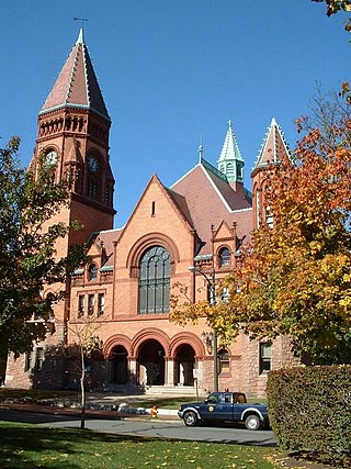
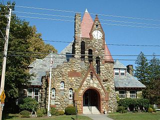
Westport Town Hall, I. T. Almy, architectWestport is a Right-to-Farm Community.Historical marker commemorating introduction of the Macomber turnip
On the state level, Westport is located in the Eighth Bristol state representative district, which includes parts of Fall River and is represented by Representative Paul Schmid (D-Westport). The town is also represented by Senator Michael Rodrigues (D-Fall River), Assistant Majority Leader in the state senate in the First Bristol and Plymouth district, which also includes Fall River, Freetown, Rochester, Somerset and Swansea. On the national level, the town is part of Massachusetts's 9th congressional district, which is represented by William R. Keating. The state's senior Senator, elected in 2012, is Elizabeth Warren. The other senator is Ed Markey, who elected in 2013. Westport is patrolled by the Westport Police Department along with the 3rd (Dartmouth) Barracks of Troop D of the Massachusetts State Police. In the November United States Election of 2012, 59% voted for Barack Obama, and 39% voted for Mitt Romney, with the new Massachusetts state senator, Elizabeth Warren edging out former Senator Scott Brown in the election.
Westport is governed by an open town meeting, led by a five-member board of selectmen. The police department is located directly East of the fire department on hixbridge rd. Westport has a full-time fire department, (which also has on-call firefighters). The two fire stations are located in the north end (on Briggs Rd.) and in the south end (on Hix Bridge Rd). The fire department also staffs two Advanced Life Support ambulances 24 hours a day. There are four post offices for the town's two ZIP codes; The main post office on Route 6, a smaller branch (on Old County Rd.) at the Head of Westport, and the branch (on Adamsville Rd.) in Central Village serve the ZIP code 02790, while the 02791 ZIP code (Westport Point) is served by the Central Village station and at the point itself, on Main Rd. The town's library, the Westport Free Public Library, is located next to Westport Middle School, directly west of the Head of Westport.
Education
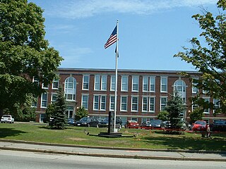
Westport High School
Westport has its own school system. There are three schools: Alice A. Macomber School, which provides pre-school (pre-kindergarten), and kindergarten; Westport Elementary School, near the Head of Westport, which serves grades 1-4; and Westport Middle/High School, which serves grades 5–12 (5-8 as Westport Middle School and 9-12 as Westport High School). Students who graduate from Westport High School with enough credits in certain fields of study will earn special academy certificates, in addition to their high school diplomas. This was modeled after University-style degrees.
Their team name is the Westport Wildcats who have won multiple championships in the Mayflower League. The Wildcats are one of the few teams in the Mayflower League who have won multiple championships in every sport. Their mascot is the Wildcat, and their colors are brown, white and yellow (a legacy of when Westport was in a different league that used Ivy League colors—Westport using brown and white after Brown University). The school is a member of the Mayflower League, and competes against mostly division 3 and 4 schools in the region.
Westport High School graduated 94% of its class in 2013.
In addition to their schools, incoming high school students may choose to attend Diman Regional Vocational Technical High School in Fall River or Bristol County Agricultural High School in Dighton, free of charge. Juniors and Seniors may opt to take college classes at UMass Dartmouth in Dartmouth or Bristol Community College in Fall River to earn both high school and college credits. Internships and independent study are offered as well.
There is one private school in the town, Montessori School of the Angels, which serves grades 1–8, located in the Westport Factory neighborhood. It was formerly known as Saint Joseph's Montessori, and was located in Fall River; the school building itself was formerly Saint George's School, which closed due to lack of funding and declining attendance. Many students also attend private and charter schools in Fall River and Dartmouth, including Bishop Connolly High School in Fall River and Bishop Stang High School in North Dartmouth.
As of the census[19] of 2010, there were 15,532 people, 5,386 households, and 4,082 families residing in the town. The population density was 283.4 inhabitants per square mile (109.4/km2). There were 6,143 housing units at an average density of 122.7 per square mile (47.4/km2). The racial makeup of the town was 98.01% White, 0.17% African American, 0.14% Native American, 0.49% Asian, 0.02% Pacific Islander, 0.37% from other races, and 0.79% from two or more races. Hispanic or Latino of any race were 0.69% of the population.
There were 5,386 households in Westport, of which 29.0% had children under the age of 18 living with them, 62.9% were married couples living together, 9.0% had a female householder with no husband present, and 24.2% were non-families. 19.7% of all households were made up of individuals, and 8.9% had someone living alone who was 65 years of age or older. The average household size was 2.62 and the average family size was 3.01.
In the town, the population was spread out, with 21.6% under the age of 18, 6.7% from 18 to 24, 28.0% from 25 to 44, 29.0% from 45 to 64, and 14.6% who were 65 years of age or older. The median age was 41 years. For every 100 females, there were 96.0 males. For every 100 females age 18 and over, there were 95.2 males.
The median income for a household in the town was $55,436, and the median income for a family was $64,568. Males had a median income of $41,890 versus $30,921 for females. The per capita income for the town was $25,281. About 3.7% of families and 4.9% of the population were below the poverty line, including 5.5% of those under age 18 and 7.9% of those age 65 or over.
Edwin Slade, Wisconsin State Assemblyman and businessman[20]
Related Research Articles
Bristol County is a county in the Commonwealth of Massachusetts. As of the 2020 census, the population was 579,200. The shire town is Taunton. Some governmental functions are performed by the Commonwealth of Massachusetts, others by the county, and others by local towns and cities.
Acushnet is a town in Bristol County, Massachusetts, United States. The population was 10,559 at the 2020 census.
Berkley is a town in Bristol County, Massachusetts, United States, located south of Boston and east of Providence, Rhode Island. The population was 6,764 according to the 2020 census, making it the least populated town in the county.
Dartmouth is a coastal town in Bristol County, Massachusetts. Old Dartmouth was the first area of Southeastern Massachusetts to be settled by Europeans, primarily English. Dartmouth is part of New England's farm coast, which consists of a chain of historic coastal villages, vineyards, and farms. June 8, 2014, marked the 350th year of Dartmouth's incorporation as a town. It is also part of the Massachusetts South Coast. The local weekly newspapers are The Dartmouth/Westport Chronicle and Dartmouth Week. The Portuguese municipality of Lagoa is twinned with the town; along with several other Massachusetts and Rhode Island towns and cities around Bristol County.
Fairhaven is a town in Bristol County, Massachusetts, United States. It is located on the South Coast of Massachusetts where the Acushnet River flows into Buzzards Bay, an arm of the Atlantic Ocean. The town shares a harbor with the city of New Bedford, a place well known for its whaling and fishing heritage; consequently, Fairhaven's history, economy, and culture are closely aligned with those of its larger neighbor. The population of Fairhaven was 15,924 at the time of the 2020 census.
Fall River is a city in Bristol County, Massachusetts, United States. Fall River's population was 94,000 at the 2020 United States census, making it the tenth-largest city in the state. It straddles part of the Massachusetts and Rhode Island state line with Tiverton, RI to its south.
Freetown is a town in Bristol County, Massachusetts, United States. The population was 9,206 at the 2020 census.
New Bedford is a city in Bristol County, Massachusetts, United States. It is located on the Acushnet River in what is known as the South Coast region. Up through the 17th century, the area was the territory of the Wampanoag Native American people. English colonists bought the land on which New Bedford would later be built from the Wampanoag in 1652, and the original colonial settlement that would later become the city was founded by English Quakers in the late 17th century. The town of New Bedford itself was officially incorporated in 1787.
Seekonk is a town in Bristol County, Massachusetts, United States, on the Massachusetts border with Rhode Island. It was incorporated in 1812 from the western half of Rehoboth. The population was 15,531 at the 2020 census. In 1862, under a U.S. Supreme Court decision resolving a longstanding border dispute between Massachusetts and Rhode Island, a portion of Tiverton Rhode Island was awarded to Massachusetts to become part of Fall River, while 2/3 of Seekonk was awarded to Rhode Island.
Swansea is a town in Bristol County in southeastern Massachusetts. It is located at the mouth of the Taunton River, just west of Fall River, 47 miles (76 km) south of Boston, and 12 miles (19 km) southeast of Providence, Rhode Island. The population was 17,144 at the 2020 census. The villages of Hortonville, Barneyville and Ocean Grove are located in the town.
Lakeville is a town in Plymouth County, Massachusetts, United States. The population was 11,523 at the 2020 census.
Mattapoisett is a town in Plymouth County, Massachusetts. The population was 6,508 at the 2020 census. Mattapoisett Center is located in the town.
Somerset is a town in Bristol County, Massachusetts, United States. The population was 18,303 at the 2020 census. It is the birthplace and hometown of Clifford Milburn Holland (1883–1924), the chief engineer and namesake of the Holland Tunnel in New York City.
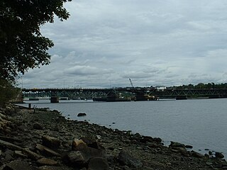
The Watuppa Branch is a roughly six-mile freight railroad line in southeastern Massachusetts. The track originates at Mount Pleasant Junction, where it diverges from the New Bedford Secondary, and runs through Dartmouth before terminating in north Westport. The line is owned by the Massachusetts Department of Transportation and is operated by Massachusetts Coastal Railroad, which purchased operating rights from the previous operator, Bay Colony Railroad, in late 2023. The abandoned western portion of the right-of-way is used by the Quequechan River Rail Trail.
Paul Cuffe, also known as Paul Cuffee was an African American businessman, whaler and abolitionist. Born free into a multiracial family on Cuttyhunk Island, Massachusetts, Cuffe became a successful merchant and sea captain. His mother, Ruth Moses, was a Wampanoag from Harwich, Cape Cod and his father an Ashanti captured as a child in West Africa and sold into slavery in Newport about 1720. In the mid-1740s, his father was manumitted by his Quaker owner, John Slocum. His parents married in 1747 in Dartmouth.
The Westport River lies between Narragansett Bay and Buzzards Bay in Westport, Massachusetts.
The South Coast of Massachusetts is the region of southeastern Massachusetts consisting of the southern Bristol and Plymouth counties, bordering Buzzards Bay, and includes the cities of Fall River, New Bedford, the southeastern tip of East Taunton and nearby towns. The Rhode Island towns of Tiverton and Little Compton, located in Newport County, are often included within the South Coast designation due to regional similarities with adjacent communities.
Southeastern Massachusetts is a region of Massachusetts located south of Boston and east of Rhode Island. It is commonly used to describe areas with cultural ties to both Boston and Providence, Rhode Island, and includes the cities of New Bedford and Fall River and their respective suburbs. Despite the location of Cape Cod and the islands to its south, which are the southeasternmost parts of the state, they are not often grouped in this designation. At its broadest definition, it includes all of Massachusetts south of Boston, southeast of Worcester, and east of Providence, Rhode Island, while at its narrowest definition, it is Bristol County and the Western portion of Plymouth County.
The Providence metropolitan area is a region extending into eight counties in two states. Its core is in the states of Rhode Island and Massachusetts, and it is the 38th largest metropolitan area in the United States. The largest city in the Providence MSA is Providence, Rhode Island, with an estimated population of 1,622,520, exceeding that of Rhode Island by slightly over 60%. The MSA covers all of Rhode Island and Bristol County, Massachusetts, with an average population density of 2300 per mi2.
The Watuppa Ponds are two large, naturally occurring, spring-fed, glacially formed ponds located in Fall River and Westport, Massachusetts. Watuppa is a native word meaning "place of boats". The two ponds were originally one body of water, connected by a narrow rocky straight called "The Narrows" located on a thin strip of land between the two ponds which forms part boundary of between Fall River and Westport. The border between Fall River and Westport is also divided between the two ponds. Together, the ponds have an overall north–south length of about 7.5 miles, and have an average east–west width of about a mile. The ponds are drained by the Quequechan River, and flows in a westerly direction through the center of Fall River from South Watuppa Pond to Mount Hope Bay.
↑ "1950 Census of Population"(PDF). Bureau of the Census. 1952. Section 6, Pages 21-10 and 21-11, Massachusetts Table 6. Population of Counties by Minor Civil Divisions: 1930 to 1950. Retrieved July 12, 2011.
↑ "1920 Census of Population"(PDF). Bureau of the Census. Number of Inhabitants, by Counties and Minor Civil Divisions. Pages 21-5 through 21-7. Massachusetts Table 2. Population of Counties by Minor Civil Divisions: 1920, 1910, and 1920. Retrieved July 12, 2011.
↑ "1890 Census of the Population"(PDF). Department of the Interior, Census Office. Pages 179 through 182. Massachusetts Table 5. Population of States and Territories by Minor Civil Divisions: 1880 and 1890. Retrieved July 12, 2011.
↑ "1870 Census of the Population"(PDF). Department of the Interior, Census Office. 1872. Pages 217 through 220. Table IX. Population of Minor Civil Divisions, &c. Massachusetts. Retrieved July 12, 2011.
↑ "1860 Census"(PDF). Department of the Interior, Census Office. 1864. Pages 220 through 226. State of Massachusetts Table No. 3. Populations of Cities, Towns, &c. Retrieved July 12, 2011.
↑ "1850 Census"(PDF). Department of the Interior, Census Office. 1854. Pages 338 through 393. Populations of Cities, Towns, &c. Retrieved July 12, 2011.
This page is based on this Wikipedia article Text is available under the CC BY-SA 4.0 license; additional terms may apply. Images, videos and audio are available under their respective licenses.