North Attleborough Center, Massachusetts

Last updated

North Attleborough Center,
Massachusetts
Corner of Richards Ave and N Washington St, North Attleborough MA.jpg
Corner of Richards Avenue and North Washington Street
Coordinates: 41°58′37″N71°19′49″W / 41.97694°N 71.33028°W / 41.97694; -71.33028
Country United States
State Massachusetts
County Bristol
Town North Attleborough
Area
  Total5.7 sq mi (14.9 km2)
  Land5.5 sq mi (14.3 km2)
  Water0.2 sq mi (0.6 km2)
Population
 (2000)
  Total16,796
  Density3,042.3/sq mi (1,174.6/km2)
Time zone UTC-5 (Eastern (EST))
  Summer (DST) UTC-4 (EDT)
FIPS code 25-46585

North Attleborough Center is the central developed area in the town of North Attleborough in Bristol County, Massachusetts, United States. It was a census-designated place at the 2000 census, at which time its population was 16,796. It was not delineated as a census-designated place in 2010.

Contents

Geography

North Attleborough Center is located at 41°58′37″N71°19′49″W / 41.97694°N 71.33028°W / 41.97694; -71.33028 (41.977049, -71.330377). [1]

According to the United States Census Bureau, the CDP had a total area of 14.9 km2 (5.8 mi2), of which 14.3 km2 (5.5 mi2) was land and 0.6 km2 (0.2 mi2) (3.83%) was water.

Demographics

As of the census [2] of 2000, there were 16,796 people, 6,932 households, and 4,353 families residing in the CDP. The population density was 1,174.8/km2 (3,042.3/mi2). There were 7,133 housing units at an average density of 498.9/km2 (1,292.0/mi2). The racial makeup of the CDP was 95.43% White, 1.13% African American, 0.17% Native American, 1.74% Asian, 0.02% Pacific Islander, 0.61% from other races, and 0.90% from two or more races. Hispanic or Latino of any race were 1.69% of the population.

There were 6,932 households, out of which 32.1% had children under the age of 18 living with them, 48.2% were married couples living together, 10.8% had a female householder with no husband present, and 37.2% were non-families. 30.2% of all households were made up of individuals, and 7.8% had someone living alone who was 65 years of age or older. The average household size was 2.40 and the average family size was 3.04.

In the CDP, the population was spread out, with 25.1% under the age of 18, 7.2% from 18 to 24, 36.3% from 25 to 44, 20.7% from 45 to 64, and 10.7% who were 65 years of age or older. The median age was 35 years. For every 100 females, there were 93.2 males. For every 100 females age 18 and over, there were 89.8 males.

The median income for a household in the CDP was $50,875, and the median income for a family was $61,846. Males had a median income of $44,076 versus $30,205 for females. The per capita income for the CDP was $24,710. About 3.6% of families and 4.7% of the population were below the poverty line, including 6.1% of those under age 18 and 4.2% of those age 65 or over.

Related Research Articles

<span class="mw-page-title-main">East Brooklyn, Connecticut</span> Census-designated place in Connecticut, United States

East Brooklyn is a census-designated place (CDP) located within the town of Brooklyn in Windham County, Connecticut. It is the portion of the Danielson urban cluster within the town of Brooklyn. The population was 2,205 at the 2020 census. US 6 runs through the town and severs the town.

<span class="mw-page-title-main">North Seekonk, Massachusetts</span> Census-designated place in Massachusetts, United States

North Seekonk is a census-designated place (CDP) in the town of Seekonk in Bristol County, Massachusetts, United States. The population was 2,643 at the 2010 census.

<span class="mw-page-title-main">North Westport, Massachusetts</span> Census-designated place in Massachusetts, United States

North Westport is a census-designated place (CDP) in the town of Westport in Bristol County, Massachusetts, United States. The population was 4,571 at the 2010 census.

<span class="mw-page-title-main">Norton Center, Massachusetts</span> Census-designated place in Massachusetts, United States

Norton Center is a census-designated place (CDP) in the town of Norton in Bristol County, Massachusetts, United States. The population was 2,671 at the 2010 census.

<span class="mw-page-title-main">Raynham Center, Massachusetts</span> Census-designated place in Massachusetts, United States

Raynham Center is a census-designated place (CDP) in the town of Raynham in Bristol County, Massachusetts, United States. The population was 4,100 at the 2010 census.

<span class="mw-page-title-main">North Lakeville, Massachusetts</span> Census-designated place in Massachusetts, United States

North Lakeville is a census-designated place (CDP) in the town of Lakeville in Plymouth County, Massachusetts, United States. The population was 2,630 at the 2010 census.

<span class="mw-page-title-main">Wareham Center, Massachusetts</span> Census-designated place in Massachusetts, United States

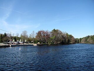
Wareham Center is a census-designated place (CDP) in the town of Wareham in Plymouth County, Massachusetts, United States. The population was 2,896 at the 2010 census.

<span class="mw-page-title-main">West Wareham, Massachusetts</span> Census-designated place in Massachusetts, United States

West Wareham is a census-designated place (CDP) in the town of Wareham in Plymouth County, Massachusetts, United States. The population was 2,064 at the 2010 census.

<span class="mw-page-title-main">Cordaville, Massachusetts</span> CDP in Massachusetts, United States

Cordaville is a census-designated place (CDP) in the town of Southborough in Worcester County, Massachusetts, United States. The population was 2,650 at the 2010 census.

<span class="mw-page-title-main">Williston Highlands, Florida</span> Census-designated place in Florida, United States

Williston Highlands is a census-designated place (CDP) in Levy County, Florida, United States. The population was 2,275 at the 2010 census.

<span class="mw-page-title-main">Silver Ridge, New Jersey</span> Populated place in Ocean County, New Jersey, US

Silver Ridge is an unincorporated community and census-designated place (CDP) located within Berkeley Township, in Ocean County, in the U.S. state of New Jersey. As of the 2010 United States Census, the CDP's population was 1,133.

<span class="mw-page-title-main">Newport East, Rhode Island</span> CDP in Rhode Island, United States

Newport East is a census-designated place (CDP) in the town of Middletown, Newport County, Rhode Island, United States. The CDP encompasses the portion of the urban area of the city of Newport that extends beyond the municipal boundaries. The population of the CDP was 11,769 at the 2010 census.

<span class="mw-page-title-main">Valley Falls, Rhode Island</span> Village and census-designated place in Rhode Island, US

Valley Falls is a village and census-designated place (CDP) in the town of Cumberland, Providence County, Rhode Island, United States. The population was 12,094 at the 2020 census.

<span class="mw-page-title-main">Ashaway, Rhode Island</span> Village and CDP in Hopkinton, Rhode Island, US

Ashaway is an unincorporated village and census-designated place (CDP) in the town of Hopkinton, Rhode Island, USA. It is a principal village of Hopkinton, along with Hope Valley, although it is the smaller of the two. The population was 1,485 at the 2010 census. The name Ashaway is derived from the American Indian name for the river that runs through the village, the Ashawague or Ashawaug, which means "land in the middle" or "land between" in the Niantic and Mohegan languages. The name "Ashawague River" appears as late as 1832 on the Findley map of Rhode Island published in Philadelphia.

<span class="mw-page-title-main">Narragansett Pier, Rhode Island</span> CDP in Rhode Island, United States

Narragansett Pier is an unincorporated village and a census-designated place (CDP) in the town of Narragansett in Washington County, Rhode Island, United States. The population was 3,409 at the 2010 census.

<span class="mw-page-title-main">Sharon (CDP), Massachusetts</span> CDP in Massachusetts, United States

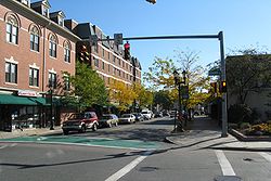
Sharon is a census-designated place (CDP) in the town of Sharon in Norfolk County, Massachusetts, United States. The population was 6,184 at the 2020 census.

<span class="mw-page-title-main">Walpole (CDP), Massachusetts</span> Census-designated place in Massachusetts, United States

Walpole is a small census-designated place (CDP) located within the much larger town of Walpole in Norfolk County, Massachusetts, United States. Walpole Town as it is called by the US Census Bureau, also includes a much larger population. The population of the Census Designated Place was 5,918 at the 2010 census.

<span class="mw-page-title-main">Bridgewater (CDP), Massachusetts</span> Census-designated place in Massachusetts, United States

Bridgewater was a census-designated place (CDP) in the town of Bridgewater in Plymouth County, Massachusetts, United States. The CDP ceased to exist when Bridgewater was given de facto city status in 2010. The population was 7,841 at the 2010 census.

<span class="mw-page-title-main">Lunenburg (CDP), Massachusetts</span> CDP in Massachusetts, United States

Lunenburg is a census-designated place (CDP) in the town of Lunenburg in Worcester County, Massachusetts, United States. The population was 1,760 at the 2010 census.

<span class="mw-page-title-main">Rutland (CDP), Massachusetts</span> CDP in Massachusetts, United States

Rutland is a census-designated place (CDP) in the town of Rutland in Worcester County, Massachusetts, United States. The population was 2,111 at the 2010 census.

References

  1. "US Gazetteer files: 2010, 2000, and 1990". United States Census Bureau. February 12, 2011. Retrieved April 23, 2011.
  2. "U.S. Census website". United States Census Bureau . Retrieved January 31, 2008.