Crowland or Croyland is a town in the South Holland district of Lincolnshire, England. It is situated between Peterborough and Spalding. Crowland contains two sites of historical interest, Crowland Abbey and Trinity Bridge.

Amber Valley is a local government district with borough status in the east of Derbyshire, England, taking its name from the River Amber. Its council is based in Ripley. The district covers a semi-rural area lying to the north of the city of Derby. The district contains four main towns whose economy was based on coal mining and remains to some extent influenced by engineering, distribution and manufacturing, holding for instance the headquarters and production site of Thorntons confectionery.

High Peak is a local government district with borough status in Derbyshire, England, covering a high moorland plateau in the Dark Peak area of the Peak District National Park. The district stretches from Holme Moss in the north to Sterndale Moor in the south, and from Hague Bar in the west to Bamford in the east. The population of the borough taken at the 2011 Census was 90,892. The borough is unusual in having two administrative centres for its council, High Peak Borough Council; the offices are in Buxton and Glossop. Other towns include Chapel-en-le-Frith, Hadfield, New Mills and Whaley Bridge.

North West Leicestershire is a local government district in Leicestershire, England. The council is based in Coalville, the area's largest town. The district also contains the towns of Ashby-de-la-Zouch, Ashby Woulds and Ibstock, along with numerous villages and surrounding rural areas.

Cherwell is a local government district in northern Oxfordshire, England. The district was created in 1974 and takes its name from the River Cherwell, which drains south through the region to flow into the River Thames at Oxford. Towns in Cherwell include Banbury and Bicester. Kidlington is a contender for largest village in England.
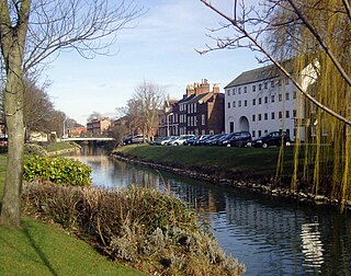
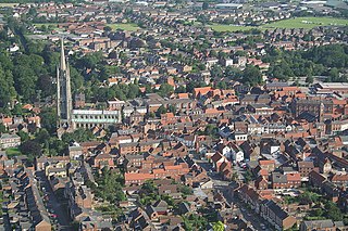
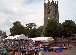
Spalding is a market town on the River Welland in the South Holland district of Lincolnshire, England. The town had a population of 34,113 at the 2017 census. The town is the administrative centre of the South Holland District. The town is located between the cities of Peterborough and Lincoln, as well as the towns of Bourne, Market Deeping, March, Boston, Wisbech, Holbeach and Sleaford.
East Lindsey is a local government district in Lincolnshire, England. Its council is based in Horncastle and the largest town is Skegness. Other towns include Alford, Burgh le Marsh, Coningsby, Louth, Mablethorpe, Spilsby, Sutton on Sea, Wainfleet All Saints, Wragby and Woodhall Spa. The district also covers a large rural area, including many smaller settlements.

West Lindsey is a local government district in Lincolnshire, England. Its council is based in Gainsborough, the district's largest town. The district also includes the towns of Caistor and Market Rasen, along with numerous villages and surrounding rural areas. The east of the district includes part of the Lincolnshire Wolds, a designated Area of Outstanding Natural Beauty.

South Kesteven is a local government district in Lincolnshire, England, forming part of the traditional Kesteven division of the county. Its council is based in Grantham. The district also includes the towns of Bourne, Market Deeping and Stamford, along with numerous villages and surrounding rural areas.

East Staffordshire is a local government district with borough status in Staffordshire, England. The council is based in Burton upon Trent. The borough also contains the town of Uttoxeter and numerous villages and surrounding rural areas.

Melton is a local government district with borough status in north-eastern Leicestershire, England. It is named after its only town, Melton Mowbray. The borough also includes numerous villages and surrounding rural areas. The north of the district includes part of the Vale of Belvoir. Melton is the least populous district of its type and the fourth least populous district in England overall.
Erewash is a local government district with borough status in Derbyshire, England. The borough is named after the River Erewash. The council has offices in both the borough's towns of Ilkeston and Long Eaton. The borough also includes several villages and surrounding rural areas. Some of the built-up areas in the east of the borough form part of the Nottingham Urban Area.

Bassetlaw is a local government district in north Nottinghamshire, England. Its council is based in the town of Worksop; the other towns in the district are Retford, Tuxford and Harworth Bircotes. The district also contains numerous villages and surrounding rural areas.

Dacorum is a local government district with borough status in Hertfordshire, England. The council is based in Hemel Hempstead. The borough also includes the towns of Berkhamsted and Tring and surrounding villages. The borough had a population of 155,081 in 2021. Dacorum was created in 1974 and is named after the ancient hundred of Dacorum which had covered a similar area. The borough of Dacorum is the westernmost of Hertfordshire's ten districts. It borders St Albans, Three Rivers, Buckinghamshire and Central Bedfordshire.

Swale is a local government district with borough status in Kent, England. The council is based in Sittingbourne, the borough's largest town. The borough also contains the towns of Faversham, Queenborough and Sheerness, along with numerous villages and surrounding rural areas. It includes the Isle of Sheppey and is named after The Swale, the narrow channel which separates Sheppey from the mainland part of the borough. Some southern parts of the borough lie within the Kent Downs, a designated Area of Outstanding Natural Beauty.

Holbeach is a market town and civil parish in the South Holland District in Lincolnshire, England. The town lies 8 miles (13 km) from Spalding; 17 miles (27 km) from Boston; 20 miles (32 km) from King's Lynn; 23 miles (37 km) from Peterborough; and 43 miles (69 km) by road from Lincoln. It is on the junction of the A151 and A17.

Long Sutton is a market town in the South Holland district of Lincolnshire, England. It lies in The Fens, close to the Wash, 13 miles (21 km) east of Spalding.

North Northamptonshire is one of two local government districts in Northamptonshire, England. It is a unitary authority area forming about one half of the ceremonial county of Northamptonshire. It was created in 2021. Its council is based in Corby, the district's largest town. Other notable towns are Kettering, Wellingborough, Rushden, Raunds, Desborough, Rothwell, Irthlingborough, Thrapston and Oundle.

West Northamptonshire is a unitary authority area covering part of the ceremonial county of Northamptonshire, England, created in 2021. By far the largest settlement in West Northamptonshire is the county town of Northampton. Its other significant towns are Daventry, Brackley and Towcester; the rest of the area is predominantly agricultural villages though it has many lakes and small woodlands and is passed through by the West Coast Main Line and the M1 and M40 motorways. The district includes the site of the Roman town of Bannaventa, and the grade I listed Althorp House and its estate.
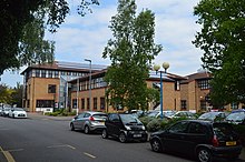
South Holland District Council in Lincolnshire, England is elected every four years. Since the last boundary changes in 2007 the council has comprised 37 councillors representing 18 wards, with each ward electing one, two or three councillors.