Related Research Articles

Wrexham is a market town and the administrative centre of Wrexham County Borough in Wales. It is located between the Welsh mountains and the lower Dee Valley where it borders with the county of Cheshire in England. Historically in the county of Denbighshire, the town became part of the county of Clwyd in 1974 and then the principal settlement of the Wrexham County Borough in 1996.

Wrexham County Borough is a county borough in the north-east of Wales. It borders England to the east and south-east, Powys to the south-west, Denbighshire to the west and Flintshire to the north-west. The county borough has a population of over 135,000 inhabitants, with around 65,000 residing in either the town of Wrexham, the surrounding conurbation of urban villages around Wrexham, or the two other towns in the county borough, Chirk and Holt. The remainder lives to the south and east of Wrexham in more rural areas, including the county borough's large salient into the Ceiriog Valley, and the English Maelor.

Rhosrobin is a small village situated in Wrexham County Borough, Wales, about 2 miles (3.2 km) north west of Wrexham town centre, close to the A483 road.

Wrexham is a parliamentary constituency centred on the town of Wrexham in the preserved county of Clwyd, Wales in the United Kingdom. It was created in 1918, and is represented in the House of Commons of the UK Parliament from December 2019 by Sarah Atherton of the Conservative Party.

Coedpoeth is a large village and community in Wrexham County Borough, Wales. The built-up area with Minera had a population of 5,723 in the 2011 census.

Gresford is a village and community in Wrexham County Borough, Wales.

Rhigos is a small village on the saddle of higher ground between the Vale of Neath and the Cynon Valley. It was part of the old Neath Rural district Council under Glamorgan until 1974. The village then came under the jurisdiction of The Cynon Valley Borough which subsequently became Rhondda Cynon Taf, South Wales in 1996. It lies just off the old Aberdare road that was the main link between Aberdare and Glynneath, before the A465 road was extended in the 1960s. The hamlets of Cefn Rhigos and Cwm-Hwnt lie to the west of the main village.
Wheatsheaf Junction was the name given to the location where a branch of the North Wales Mineral Railway to Brymbo connected with Shrewsbury and Chester line between Wrexham and Gresford.

Wrexham is a constituency of the Senedd. It elects one Member of the Senedd by the first past the post method of election. Also, however, it is one of nine constituencies in the North Wales electoral region, which elects four additional members, in addition to nine constituency members, to produce a degree of proportional representation for the region as a whole.
Summerhill is a semi-urban village in the suburbs of Wrexham, Wales and forms part of the community of Gwersyllt.

Gwersyllt is an urban village and community in Wrexham County Borough, Wales.
Llay is a village and community in Wrexham County Borough, Wales.
Rhosddu is a suburb and community in Wrexham County Borough, Wales, covering the north-western parts of the town of Wrexham and comprises the wards of Grosvenor, Garden Village and Stansty.

Stansty is a populated area in Wrexham County Borough in Wales, lying to the immediate north-west of the town of Wrexham. It is a former civil parish and township. Stansty is also an electoral ward to Wrexham County Borough Council. The ward population as taken at the 2011 Census was 2,114.

Garden Village is a suburb of the town of Wrexham and an electoral division (ward) in the community of Rhosddu in Wrexham County Borough, Wales. The population of the ward at the 2011 Census was 2,035 It lies to the west of Chester Road and borders the wards of Stansty to the south and east, Gwersyllt East and South to the north west, Little Acton and Acton to the west, and a small section of Gresford to the north.
The town of Wrexham has two main town parks, these being Bellevue Park and Acton Park. On the outskirts of the town there is also open parkland on and surrounding the Erddig estate. There is also a town centre green.
The Pandy is a village near Gwersyllt and Rhosrobin, in Wrexham, Wrexham County Borough, Wales. The main entrance to Gresford Colliery stood in the village. Gresford Colliery Social Club is in the village and alongside it a memorial to the Gresford Disaster, which killed 266 men on September 22, 1934.

Alyn Waters is a country park situated between Gwersyllt and Llay in Wrexham County Borough, in the north-east of Wales, and is managed by Wrexham County Borough Council.
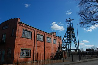
Bersham Colliery was a large coal mine located near Rhostyllen in Wrexham County Borough, Wales. The mine accessed seams found in the Denbighshire Coalfield.
References
- ↑ UK Census (2011). "Local Area Report – Sydallt Built-up area sub division (W38000041)". Nomis. Office for National Statistics . Retrieved 20 August 2020.
- 1 2 3 4 "Llay Hall Colliery, Sydallt, Wrexham (33434)". Coflein. RCAHMW . Retrieved 29 September 2021.
- ↑ "The Cambrian remembrancer, relating to North Wales | January - 1878 | 1878 | Welsh Journals - The National Library of Wales". journals.library.wales. Retrieved 13 April 2020.
- ↑ "Gwersyllt Community Council :: The Council". www.gwersylltcommunitycouncil.co.uk. Retrieved 13 April 2020.
Coordinates: 53°05′24″N3°01′44″W / 53.090°N 3.029°W

| | This Wrexham location article is a stub. You can help Wikipedia by expanding it. |