Stansty

Last updated

Stansty
Rhosddu Methodist Church - geograph.org.uk - 662690.jpg
Rhosddu Methodist Church, Stansty
Wrexham UK location map.svg
Red pog.svg
Stansty
Location within Wrexham
Population2,114 (2011)
OS grid reference SJ327518
Community
Principal area
Country Wales
Sovereign state United Kingdom
Post town WREXHAM
Postcode district LL11
Dialling code 01978
Police North Wales
Fire North Wales
Ambulance Welsh
UK Parliament
Senedd Cymru – Welsh Parliament
List of places
UK
Wales
Wrexham
53°03′32″N3°00′14″W / 53.059°N 3.004°W / 53.059; -3.004 Coordinates: 53°03′32″N3°00′14″W / 53.059°N 3.004°W / 53.059; -3.004
Location of the Stansty electoral ward in Wrexham County Borough, Wales 2022 Wales Wrexham Ward Stansty map.svg
Location of the Stansty electoral ward in Wrexham County Borough, Wales

Stansty is an area and electoral ward in Wrexham County Borough, Wales, lying to the immediate north-west of the city of Wrexham. It is a former civil parish and township. Stansty is also an electoral ward to Wrexham County Borough Council. The ward population as taken at the 2011 Census was 2,114. [1]

Contents

Geography, name

Stansty consists of Higher Stansty and Lower Stansty; Higher Stansty lies near to Summerhill and Moss Valley within the community of Gwersyllt and is north of the A483 road. Lower Stansty, or Plas Coch as it is now more commonly referred to, is partly within the neighbouring community of Rhosddu, south of the A483. The division between Higher and Lower Stansty is an ancient one, as Stansty Issa (i.e. Lower Stansty), also called Stansty Abbatis, was originally a part of the manor of Wrexham Abbott belonging to Valle Crucis Abbey. [2]

Along with those of some other places in this area of north-east Wales, the name of Stansty may have an Old English rather than Welsh root, perhaps from stan ("stone") with another element, possibly -stig or -stigu ("path, or "sty"). [3]

History

Stansty was one of the original townships of the Lordship of Bromfield and Yale, and was also a township of the ecclesiastical parish of Wrexham. It comprised two townships, Stansty Ucha (Upper Stansty) and Stansty Issa (Lower Stansty) which were merged into one at the time of the Commonwealth. Stansty Issa was given to the Abbot of Valle Crucis Abbey by Gruffydd ap Madoc, Prince of Powys, in 1254. [4]

Part of the township was transferred to the new parish of Gwersyllt in 1851, and other parts were transferred to the parishes of Southsea and Bersham in 1921 and 1934 respectively. [5]

The civil parish of Stansty was split in 1935 between Gwersyllt and Wrexham Regis. [6]

Stansty Park

Much of the area was farmland until the 20th century and belonged to an estate called Stansty Park, originally a manor in Stansty Uchaf (Higher Stansty) purchased by David ap Meilir in 1317. One of his descendants, John ap David ap Edward (1573-1635) took the surname of Edwards; the family seat, Plas Issa, was built in 1577. [7] His children included John Edwards (b.1612), court physician to Charles I, and Jonathan Edwards (b.1615), Archdeacon of Derry, [8] [9] while his daughter Margaret married John Jones Maesygarnedd the regicide. [7] John Edwards (1619–73) expanded the Stansty estate, later known as Stansty Park, until it took up most of Stansty township: however his great-great-grandson, Peter Edwards, died without issue in 1783, and the estate, passing to distant relatives, was eventually sold to the ironmaster Richard Thompson. [7]

Thompson built a new house, Stansty Hall, on the site in the 1830s. The late-Georgian hall at Stansty was later threatened by subsidence from coal mining and was largely demolished in the 1920s - a small section being incorporated into a more modern building - while some of the former estate's farmland has since been developed for modern housing. However, the park's highly elaborate wrought-iron gates, attributed to the Davies brothers of Wrexham, had been rescued and moved to Erddig Hall in 1908. [10]

Though much the estate of Stansty Park has now gone, its name is still used for a modern housing estate near Summerhill and for the ground of Cymru Alliance league football team Lex XI F.C. The name is also applied to the original 1577 house, Plas Issa, which still stands. [11]

Plas Coch

Another of the area's main houses was Plas Coch in Lower Stansty, which was built in the late 16th century in mature hand-made red brick, giving the house its name (Plas Coch translates roughly as "Red Hall"). It was a two-storey building: the plan of the dwelling was a typical through passage house with access at either end of the passage. The house was built for Sir William Meredith, one of the sons of Richard Meredith of Allington or Trevalyn (near Rossett) and treasurer and paymaster of the army in the reigns of Elizabeth I and James I. Edward Meredith, a brother to William, was recorded in 1610 as trading as draper in Cheapside, London and he had held the lease on Plas Coch from his nephew for a time. Edward Meredith held the office of the High Sheriff of Denbighshire in 1629.

In 1709 the Plas Coch estate was sold by Sir William Meredith of Kent to Sir John Wynn, 1st Baronet of Gwydir Castle, Llanrwst.

Plas Coch played an important part in the social life of the city, hosting the Denbighshire & Flintshire Agricultural Society Show and the Annual Wrexham Lager Festival. The house and outbuildings were demolished in the late 1980s to make way for a large supermarket and retail development. The only part of the original property remaining today is a short length of stone wall at the roadside in front of a branch of Homebase. During the construction of the retail development in 1991, a hoard of Roman coins was discovered by workmen: however all of the coins subsequently disappeared. [12] In 1995 further construction work on the site revealed traces of Roman field boundaries, hearths and a corn drying kiln.

Coal mining era

The area, like much of Wrexham, has a tradition of coal mining. Rhosddu Colliery, or the Wrexham & Acton Colliery as it was also known, was once reached along Colliery Road (the building of the A483 road has since divided the old colliery site). Colliery Road is still in existence today, but is now surrounded by a residential area.

Public houses in Stansty

Schools in Stansty

Related Research Articles

<span class="mw-page-title-main">Wrexham</span> City in north-east Wales

Wrexham is a city and the administrative centre of Wrexham County Borough in Wales. It is located between the Welsh mountains and the lower Dee Valley, near the border with Cheshire in England. Historically in the county of Denbighshire, and later the county of Clwyd in 1974, it has been the principal settlement of Wrexham County Borough since 1996.

<span class="mw-page-title-main">Wrexham County Borough</span> County borough in Wales

Wrexham County Borough is a county borough, with the status of a city, in the north-east of Wales. It borders England to the east and south-east, Powys to the south-west, Denbighshire to the west and Flintshire to the north-west. The county borough has a population of 136,055. The city of Wrexham is its largest settlement, which together with villages such as Gwersyllt, New Broughton, Bradley and Rhostyllen form a built-up area with 65,692 residents. Villages in the county borough also include Ruabon, Rhosllanerchrugog, Johnstown, Acrefair, Bangor-on-Dee, and Coedpoeth amongst others. The county borough has two outlying towns, Chirk and Holt, and various rural settlements in the county borough's large salient in the Ceiriog Valley, and the English Maelor.

<span class="mw-page-title-main">Ruabon</span> Village in Wales

Ruabon is a village and community in Wrexham County Borough, Wales. The name comes from Rhiw Fabon, rhiw being the Welsh word for "slope" or "hillside" and Fabon being a mutation from St Mabon, the original church name, of earlier, Celtic origin. An older English spelling, Rhuabon, can sometimes be seen.

<span class="mw-page-title-main">Rhosrobin</span> Village in Wrexham, Wales

Rhosrobin is a village situated in Wrexham County Borough, Wales, about 2 miles (3.2 km) north west of Wrexham city centre, close to the A483 road.

<span class="mw-page-title-main">Gresford</span> Village in Wales

Gresford is a village and community in Wrexham County Borough, Wales.

<span class="mw-page-title-main">Acton, Wrexham</span> Community in Wrexham County Borough, Wales

Acton is a suburb and community in Wrexham, Wrexham County Borough, Wales. It spans the north-eastern part of Wrexham. The area is largely residential and at its centre, lies Acton Park, the location of the former Acton Hall.

The Wrexham and Minera Railway or Wrexham and Minera Branch was a railway line in North Wales between the city of Wrexham, the village of Brymbo where it served the Brymbo Steelworks, and the lead mines and limeworks at Minera. A further branch ran from Brymbo to Coed Talon, where it connected with lines to Mold. The system was constructed in several stages between 1844 and 1872, while the various lines making up the system closed in 1952, 1972 and 1982.

Wynn Hall is a 17th-century house in the old hamlet of Bodylltyn in Ruabon, Wrexham, Wales standing at the junction of the Penycae Road and Plas Bennion Road. It was built in about 1649 by William Wynn and is a Grade II* listed building.

Summerhill is a semi-urban village in the suburbs of Wrexham, Wales and forms part of the community of Gwersyllt.

<span class="mw-page-title-main">Gwersyllt</span> Village in Wales

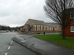
Gwersyllt is an urban village and community in Wrexham County Borough, Wales.

<span class="mw-page-title-main">Rhosddu</span> Community in Wrexham County Borough, Wales

Rhosddu is a suburb and community in Wrexham County Borough, Wales, covering the north-western parts of the city of Wrexham and comprises the wards of Grosvenor, Garden Village and Stansty.

<span class="mw-page-title-main">Garden Village, Wrexham</span> Suburb and ward of Wrexham, Wales

Garden Village is a suburb of the city of Wrexham and an electoral division (ward) in the community of Rhosddu in Wrexham County Borough, Wales. The population of the ward at the 2011 Census was 2,035 It lies to the west of Chester Road and borders the wards of Stansty to the south and east, Gwersyllt East and South to the north west, Little Acton and Acton to the west, and a small section of Gresford to the north.

<span class="mw-page-title-main">Plas Coch</span> Area of Wrexham

Plas Coch is an area of the community of Rhosddu, in the city of Wrexham, Wales. A major retail and educational area of Wrexham, it lies to the north-west of Wrexham city centre. Formerly known as Lower Stansty, the term has fallen out of use in preference for Plas Coch in recent years, likely due to the popular retail area which shares its name.

<span class="mw-page-title-main">Rhostyllen</span> Village in Wrexham County Borough, Wales

Rhostyllen is a village in Wrexham County Borough, Wales, south-west of the city of Wrexham. At the time of the 2001 census, area Wrexham 014A, which includes Rhostyllen itself, had a population of 1,383 in 599 households.

High Sheriff of Denbighshire

The first High Sheriff of Denbighshire was John Salusbury, snr, appointed in 1540. The shrievalty of Denbighshire, together with that of Flintshire, continued until 1974 when it was abolished after the county and shrievalty of Clwyd was created.

<span class="mw-page-title-main">Pandy, Gwersyllt</span> Village in Wrexham County Borough, Wales

Pandy is a village near Gwersyllt and Rhosrobin, in Wrexham, Wrexham County Borough, Wales. The main entrance to Gresford Colliery stood in the village. Gresford Colliery Social Club is in the village and alongside it a memorial to the Gresford Disaster, which killed 266 men on September 22, 1934.

<span class="mw-page-title-main">Offa, Wrexham</span> Community in Wrexham County Borough, Wales

Offa is a community and electoral ward in Wrexham County Borough, Wales, covering most of the south-western portion of the city of Wrexham. It is bordered by the communities of; Rhosddu, and Caia Park to the north, Abenbury to the east, Esclusham, and Marchwiel to the south, and Broughton, Coedpoeth, and Gwersyllt to the west.

<span class="mw-page-title-main">B5101 road</span> B road in north Wales

The B5101 road is a B road, connecting the west of Wrexham, north Wales to the A5104 road to the east of Treuddyn in Flintshire.

<span class="mw-page-title-main">Plas Madoc</span> Housing estate in Wrexham County Borough, Wales

Plas Madoc is a housing estate and former electoral ward near Acrefair, in the Cefn community in Wrexham County Borough, Wales. It is located seven miles to the south-west of Wrexham, and contains The Land adventure playground, and a community-run leisure centre with a swimming pool. The area is one of the most deprived areas in Wales, and the fourth most deprived LSOA in Wrexham County Borough.

References

  1. "Ward population 2011" . Retrieved 19 November 2015.
  2. Williams, D. H. The Welsh Cistercians, Gracewing, 2001, p.209, ISBN   978-0-85244-354-5
  3. Charles, B. G. Non-Celtic Place-names in Wales, London: University College, 1938, p.206
  4. Williams, Alister (2001). The Encyclopedia of Wrexham. Bridge Books. ISBN   1-872424-67-8.
  5. Wrexham, GENUKI
  6. Wrexham Registration District, GENUKI
  7. 1 2 3 "Edwards family, of Stansty, Denbighshire". Dictionary of Welsh Biography . National Library of Wales.
  8. Cotton, Henry (1851–1860). Fasti Ecclesiae Hibernicae: The Succession of the Prelates and Members of the Cathedral Bodies of Ireland. Vol. 3. Hodges and Smith. p. 337.
  9. Cotton, Henry (1860). Fasti Ecclesiae Hibernicae: Illustrations, corrections and additions. Vol. V. Hodges and Smith. p. 164. Retrieved 29 September 2010.
  10. Whittle, E. The historic gardens of Wales, Cadw, 1992, p.35
  11. "Stansty Park, Gwersyllt (26986)". Coflein. RCAHMW.
  12. Jones, D. History under foot, BBC Wales