Moel Hebog is a mountain in Snowdonia, north Wales which dominates the view west from the village of Beddgelert. It gives name to a whole range of peaks in the north-western corner of Snowdonia, which include the Nantlle Ridge and Mynydd Mawr.

The Minera Limeworks were extensive lime quarries and kilns at Minera in Wrexham, Wales. It was located at grid reference SJ253520, near the villages of Gwynfryn, Minera, and Coedpoeth and was locally referred to as The Calch.

Minera is a small village, and a local government community, the lowest tier of local government, part of Wrexham County Borough in the United Kingdom. It adjoins the large village of Coedpoeth.

Clwyd South is a constituency of the Senedd. It elects one Member of the Senedd by the first past the post method of election. Also, however, it is one of nine constituencies in the North Wales electoral region, which elects four additional members, in addition to nine constituency members, to produce a degree of proportional representation for the region as a whole.

Ruabon Moors are an area of upland moorland in Wales to the west of Ruabon and Wrexham. They lie partly within Wrexham county borough and partly within Denbighshire.
The Eglwyseg valley is an area to the north east of Llangollen in Denbighshire, Wales; it is within the boundaries of Llantysilio Community. The name also refers to a widely scattered hamlet in the valley.
Llandegla Forest is a forest of planted conifers covering 2.5 sq miles in Denbighshire, north-east Wales. It is situated to the south-east of the village of Llandegla at the north-western edge of Ruabon Moors. Only 20 miles from the city of Chester and 7 miles west of Wrexham, easily accessed via the A525 towards Ruthin.
The geology of Wales is complex and varied; its study has been of considerable historical significance in the development of geology as a science. All geological periods from the Cryogenian to the Jurassic are represented at outcrop, whilst younger sedimentary rocks occur beneath the seas immediately off the Welsh coast. The effects of two mountain-building episodes have left their mark in the faulting and folding of much of the Palaeozoic rock sequence. Superficial deposits and landforms created during the present Quaternary period by water and ice are also plentiful and contribute to a remarkably diverse landscape of mountains, hills and coastal plains.

World's End is a narrow vale located between Wrexham and Llangollen in Denbighshire, Wales. It lies at the head of the Eglwyseg Valley, enclosed by the cliffs of Craig y Forwyn, Craig y Cythraul, and Craig yr Adar.

Rhostyllen is a village in Wrexham county borough in Wales, south-west of the town of Wrexham. At the time of the 2001 census, area Wrexham 014A, which includes Rhostyllen itself, had a population of 1,383 in 599 households. Its name may be derived from the Welsh words rhos and estyll.

Hafod Elwy Moor National Nature Reserve, located in the moorland above the town of Denbigh in Denbighshire, North Wales, is part of the Mynydd Hiraethog Site of Special Scientific Interest, formerly managed by the Countryside Council for Wales and now under the jurisdiction of Natural Resources Wales. Established in 1999, it comprises an 82-hectare (200-acre) patch of upland moor lying between the lakes of Llyn Brenig and Llyn Alwen. A conifer forest planted by the Forestry Commission borders the moor to the south and east.

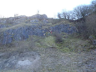
Craig y Forwyn is a crag that encloses the northern side of World's End, near the town of Llangollen in Denbighshire, Wales. It is part of the limestone escarpment that separates the Eglwyseg Valley from the higher Ruabon Moors and, along with nearby Craig Arthur, is a popular site for rock climbing. Evidence of lead and silver mining is found just to the west. The Offa's Dyke Path runs along its foot.

The North Wales Mineral Railway was formed to carry coal and ironstone from the mineral-bearing area around Wrexham to the River Dee wharves. It was extended to run from Shrewsbury and formed part of a main line trunk route, under the title The Shrewsbury and Chester Railway. It opened in 1846 from Chester to Ruabon, and in 1848 from Ruabon to Shrewsbury. It later merged with the Great Western Railway.

Tanyfron, also occasionally spelt Tan-y-fron, is a village in Wrexham County Borough in Wales. At the time of the 2001 census, the population of area Wrexham 006A, which includes Tanyfron and a number of other small settlements, was 1,347. The village is part of the local government Community of Brymbo and is in the Vron electoral ward. The built-up area had a population of well over 2,000 as of the 2011 census.
Esclusham is a local government community, the lowest tier of local government, part of Wrexham County Borough in Wales. It is also an electoral ward.

Ogof Llyn Parc usually known as Pool Park is a cave on Esclusham Mountain above Wrexham, Wales, that has a 100 metres (330 ft) entrance shaft, normally descended by winch to the mine levels. Further caving and two ladders reaches the natural cave levels in which there are streamways.

Ogof Dydd Byraf is a cave which extends under Esclusham Mountain in north-east Wales from its entrance in the south face of the Minera Limeworks quarry. It was originally discovered and explored in 1964 by the Wrexham Caving Club, before they were merged into the North Wales Caving Club.
This article describes the geology of the Brecon Beacons National Park in mid/south Wales. The area gained national park status in 1957 with the designated area of 1,344 km2 (519 sq mi) including mountain massifs to both the east and west of the Brecon Beacons proper. The geology of the national park consists of a thick succession of sedimentary rocks laid down from the late Ordovician through the Silurian and Devonian to the late Carboniferous period. The rock sequence most closely associated with the park is the Old Red Sandstone from which most of its mountains are formed. The older parts of the succession, in the northwest, were folded and faulted during the Caledonian orogeny. Further faulting and folding, particularly in the south of the park is associated with the Variscan orogeny.


