Newbridge, Wrexham

Last updated

Newbridge
Village
Derelict Baptist Chapel - geograph.org.uk - 2874977.jpg
Derelict Baptist Chapel in the village.
Wrexham UK location map.svg
Red pog.svg
Newbridge
Location within Wrexham
OS grid reference SJ 2866 4170
Community
Principal area
Preserved county
Country Wales
Sovereign state United Kingdom
Post town WREXHAM
Postcode district LL14
Dialling code 01978
Police North Wales
Fire North Wales
Ambulance Welsh
UK Parliament
Senedd Cymru – Welsh Parliament
List of places
UK
Wales
Wrexham
52°58′05″N3°03′49″W / 52.967966°N 3.063582°W / 52.967966; -3.063582

Newbridge is a village in Wrexham County Borough, Wales. [1] The village is within the community of Cefn, to the south-east of Cefn Mawr. Newbridge is bounded to the west by the Shrewsbury–Chester railway line and the Newbridge Railway Viaduct which crosses the River Dee, which meanders to the south and east of the village. The Clwydian Range and Dee Valley AONB since 2011 borders the village to the south, as does the Wynnstay estate, [2] and Tŷ Mawr Country Park is on the other side of the viaduct to the west.

Description

Newbridge is named after the arched bridge crossing the Dee in the village, present since at least 1478, connecting Plas Offa north to Ruabon. [2] The bridge is part of the B5605 Newbridge Road.

Its location next to the river, has historically allowed for a rolling mill to be present in the area of the modern-day village in 1808 and a furnace by 1820 to power the production of wrought iron obtained in the Cefn Mawr area. The Pen y Bont brick and tile works, established in about 1865, were located to the south-east on the opposite bank of the river, near the village. [2] [3] In 1965, it was recorded that stone-built dwellings in the village were pulled down to be replaced by bungalows. Some of the original stone-built dwellings were later modified to integrate brick into their designs. [2] There was a pub known as the Black Lion on Park Road in the village, dating to 1810. [2]

Newbridge Lodge to the north of the village. Newbridge Lodge.JPG
Newbridge Lodge to the north of the village.

Newbridge Lodge, a Grade I listed building is situated to the north of the village. [4] [5] [6]

Brick building at Pen-y-bont works to the south-east of the village. Brick building at Pen-y-bont - geograph.org.uk - 768572.jpg
Brick building at Pen-y-bont works to the south-east of the village.

The earliest date for Newbridge Chapel located in the village is 1825 [2] which indicates that the settlement was "well established" [2] by then, but it was not until later in the nineteenth-century that there were houses interspersed both along the main road and on the back lanes of the village. Development in the area later shifted away from the village by the mid-nineteenth century, leaving the village with a "characteristically haphazard pattern". [2]

In 2016, the Newbridge Arms pub, located to the north of the village, renamed itself "Pubby McPubface" based on the Boaty McBoatface internet naming poll of RRS Sir David Attenborough. [7] [8]

Since January 2021 following Storm Christoph, part of the B5605 Newbridge Road between the village and Cefn Mawr has been damaged due to a landslide. Part of the road's pavement collapsed down an embankment following flooding. [9] [10] The lack of progress of the road's repair for over a year has been criticised by local residents and politicians. [11] Wrexham County Borough Council applied for Welsh Government funding for the repair, but the government rejected the application in June 2021 as it did not meet the "relevant criteria". [12] [13] A new business case for repair was submitted by the council to the government in February 2022, [14] and in April 2022, the government awarded the council £2.8 million to repair the road. [15] [16] The road serves as an important alternative diversion route should the A5 and A483 viaducts be closed at the same time due to windy conditions. [17]

Related Research Articles

<span class="mw-page-title-main">Pontcysyllte Aqueduct</span> Waterway in Wales

The Pontcysyllte Aqueduct is a navigable aqueduct that carries the Llangollen Canal across the River Dee in the Vale of Llangollen in northeast Wales.

<span class="mw-page-title-main">Chirk</span> Town in Wales

Chirk is a town and community in Wrexham County Borough, Wales, 10 miles south of Wrexham, between it and Oswestry. At the 2011 census, it had a population of 4,468. Historically in the traditional county of Denbighshire, and later Clwyd, it has been part of Wrexham County Borough since a local government reorganisation in 1996. The border with the English county of Shropshire is immediately south of the town, on the other side of the River Ceiriog.

<span class="mw-page-title-main">Wrexham County Borough</span> County borough in Wales

Wrexham County Borough is a county borough, with city status, in the north-east of Wales. It borders the English ceremonial counties of Cheshire and Shropshire to the east and south-east respectively, Powys to the south-west, Denbighshire to the west and Flintshire to the north-west. The city of Wrexham is the administrative centre. The county borough is part of the preserved county of Clwyd.

<span class="mw-page-title-main">Rhosllanerchrugog</span> Village in Wales

Rhosllanerchrugog is a village and community in Wrexham County Borough, Wales. It lies within the historic county of Denbighshire. The entire built-up area including Penycae, Ruabon and Cefn Mawr had a population of 25,362.

<span class="mw-page-title-main">Ruabon</span> Village in Wales

Ruabon is a village and community in Wrexham County Borough, Wales. The name comes from Rhiw Fabon, rhiw being the Welsh word for "slope" or "hillside" and Fabon being a mutation from St Mabon, the original church name, of earlier, Celtic origin. An older English spelling, Rhuabon, can sometimes be seen.

<span class="mw-page-title-main">Newbridge, Caerphilly</span> Human settlement in Wales

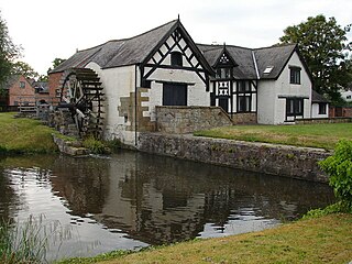
Newbridge is a town and community in the county borough of Caerphilly, south Wales. It lies within the historic boundaries of the county of Monmouthshire.

<span class="mw-page-title-main">Acrefair</span> Village in Wales

Acrefair is a village in Wrexham County Borough, north-east Wales, in the community of Cefn. It was formerly part of the ancient parish of Ruabon, and is located between Wrexham and Llangollen. It is close to the villages of Trevor, Cefn Mawr, Ruabon and Plas Madoc. The name Acrefair originates from the Welsh word for acres—acrau, or acre in the local Welsh dialect—and Mair, the Welsh name for Mary. The English meaning of Acrefair is Mary's Acres.

<span class="mw-page-title-main">Cefn Mawr</span> Village in Wrexham County Borough, Wales

Cefn Mawr is a village in the community of Cefn within Wrexham County Borough, Wales. Its name translates as "big ridge". The population in 2001 was 6,669, increasing to 7,051 in 2011.

<span class="mw-page-title-main">Rossett</span> Village in Wrexham County Borough, Wales

Rossett is a village, community and electoral ward in Wrexham County Borough, Wales. Rossett is served by the A483 road.

<span class="mw-page-title-main">Rhostyllen</span> Village in Wrexham County Borough, Wales

Rhostyllen is a village in Wrexham County Borough, Wales, south-west of the city of Wrexham. At the time of the 2001 census, area Wrexham 014A, which includes Rhostyllen itself, had a population of 1,383 in 599 households.

<span class="mw-page-title-main">Farndon Bridge</span> Bridge between England and Wales

Farndon Bridge, also known as Holt Bridge, crosses the River Dee and the England-Wales border between the villages of Farndon, Cheshire, England and Holt, Wrexham, Wales. The bridge, which was built in the mid-14th century, is recorded in the National Heritage List for England and by Cadw as a designated Grade I listed building and scheduled monument. It is built from locally quarried red sandstone and had eight arches, of which five are over the river. On the Farndon side there is one flood arch and two flood arches are on the Holt side.

Cefn railway station was a minor railway station on the Great Western Railway's London to Birkenhead main line serving the mining village of Cefn Mawr in Wales. It opened as Rhosymedre in 1848 but was resited on an adjacent site in 1849 and named Cefn. It had an adjacent signal box but the station seems not to have handled freight traffic. The remains of the station and yard area can be seen just to the north of Cefn Viaduct. Although the station is gone the railway remains open as part of the Shrewsbury to Chester Line.

<span class="mw-page-title-main">Cefn-coed-y-cymmer</span> Historic site

Cefn-coed-y-cymmer is a small community on the northwestern edge of Merthyr Tydfil County Borough in Wales. It is situated in the neck of land between the rivers Taf Fawr and Taf Fechan at their confluence. The village lies within the community of Vaynor. Immediately to the north of the village is the hill of Cefn Cil Sanws on the southern slopes of which is Merthyr Tydfil Golf Club. The village is bounded both to the north and the west by the Brecon Beacons National Park.

<span class="mw-page-title-main">Cefn, Wrexham</span> Community in Wrexham County Borough, Wales

Cefn is a community in Wrexham County Borough, Wales.

<span class="mw-page-title-main">Grade II* listed buildings in Bridgend County Borough</span>

In the United Kingdom, the term listed building refers to a building or other structure officially designated as being of special architectural, historical, or cultural significance; Grade II* structures are those considered to be "particularly important buildings of more than special interest". Listing was begun by a provision in the Town and Country Planning Act 1947. Once listed, strict limitations are imposed on the modifications allowed to a building's structure or fittings. In Wales, the authority for listing under the Planning Act 1990 rests with Cadw.

<span class="mw-page-title-main">Grade II* listed buildings in Wrexham County Borough</span>

In the United Kingdom, the term listed building refers to a building or other structure officially designated as being of special architectural, historical, or cultural significance; Grade II* structures are those considered to be "particularly important buildings of more than special interest". Listing was begun by a provision in the Town and Country Planning Act 1947. Once listed, strict limitations are imposed on the modifications allowed to a building's structure or fittings. In Wales, the authority for listing under the Planning Act 1990 rests with Cadw.

<span class="mw-page-title-main">Plas Madoc</span> Housing estate in Wrexham County Borough, Wales

Plas Madoc is a housing estate and former electoral ward near Acrefair, in the Cefn community in Wrexham County Borough, Wales. It is located seven miles to the south-west of Wrexham, and contains The Land adventure playground, and a community-run leisure centre with a swimming pool. The area is one of the most deprived areas in Wales, and the fourth most deprived LSOA in Wrexham County Borough.

<span class="mw-page-title-main">Tŷ Mawr Country Park</span> Country park in Wrexham County Borough

Tŷ Mawr Country Park is a country park and farm park near Cefn Mawr in Wrexham County Borough, Wales. The country park lies between Cefn-bychan and Newbridge to the north, the River Dee to the south and west, and the Cefn Viaduct carrying the Shrewsbury–Chester line to the east.

<span class="mw-page-title-main">Cefn Viaduct, Wrexham</span> Railway viaduct in Wrexham County Borough, Wales

The Cefn (Newbridge) Viaduct is Grade II* listed railway viaduct across the River Dee between Cefn and Chirk communities in Wrexham County Borough, Wales. The viaduct is near the villages of Cefn Mawr, Pentre and Newbridge. The viaduct forms the eastern boundary of Tŷ Mawr Country Park and is around a mile downstream of Pontcysyllte Aqueduct.

<span class="mw-page-title-main">Chirk Viaduct</span> Railway viaduct between England and Wales

The Chirk Viaduct is a Grade II* listed railway viaduct over the River Ceiriog between England and Wales. The viaduct carries the Shrewsbury–Chester line from the Welsh town of Chirk in historic Denbighshire from the north to the English village of Chirk Bank in Weston Rhyn, Shropshire to the south. Chirk Aqueduct lies parallel to the viaduct's east.

References

  1. "Newbridge, Wrexham (Wrecsam)". OS GetOutside. Retrieved 23 June 2022.
  2. 1 2 3 4 5 6 7 8 Cefn Mawr and District: Understanding Urban Character (PDF). Cadw; Welsh Government. 2014.
  3. "Penybont Brick and Tile Works, Newbridge (40773)". Coflein. RCAHMW . Retrieved 24 June 2022.
  4. "Newbridge Lodge, Cefn – Wrexham History" . Retrieved 23 June 2022.
  5. Stuff, Good. "Newbridge Lodge, Cefn-mawr, Wrexham". britishlistedbuildings.co.uk. Retrieved 23 June 2022.
  6. Cadw. "Newbridge Lodge (16872)". National Historic Assets of Wales . Retrieved 24 June 2022.
  7. Bagnall, Steve (1 August 2016). "Wrexham pub renamed Pubby McPubface". North Wales Live. Retrieved 24 June 2022.
  8. Tamplin, Harley (1 August 2016). "There's a Pubby McPubface and we're not keen at all". Metro. Retrieved 24 June 2022.
  9. "One year on: Looking back at a year since the Newbridge Road landslide". The Leader. Retrieved 24 June 2022.
  10. "Storm Christoph: Road still closed five months after collapse". BBC News. 16 June 2021. Retrieved 24 June 2022.
  11. "North Wales Senedd member calls on Welsh Government to fund repairs for Wrexham road hit by landslide". The Leader. Retrieved 24 June 2022.
  12. "Funding for Newbridge repairs may not emerge until next year with fear road could be closed until 2023". Wrexham.com. Retrieved 24 June 2022.
  13. "Disappointment as Welsh Government rejects funding bid to repair road closed by landslide". The Leader. Retrieved 24 June 2022.
  14. "Progress on Newbridge as "business case submitted for repair" to Welsh Government". Wrexham.com. Retrieved 24 June 2022.
  15. Gregory, Rhys (11 May 2022). "Welsh Government steps in with £2.8m to repair storm damaged road in Wrexham" . Retrieved 24 June 2022.
  16. "Hope that Newbridge Road repairs will start later this year after £2.8m funding secured". The Leader. Retrieved 24 June 2022.
  17. "A5 closure 'could mean chaos' if A483 closes due to incident or bad weather says MS". Wrexham.com. Retrieved 24 June 2022.