Teluk Ramunia

Last updated
Teluk Ramunia Teluk Ramunia.jpg
Teluk Ramunia

Teluk Ramunia is a town in Kota Tinggi District, Johor, Malaysia. It is a well-known bauxite mining town in the early days of Malaysia. It is a sight seeing place, good for a family picnic spot. [1] Now it is known for Oil and Gas Fabrication industries.

Kota Tinggi District District of Malaysia in Johor

The Kota Tinggi District is a district in Johor, Malaysia. Its capital is Kota Tinggi Town.

Johor State of Malaysia

Johor, formerly known as Johore, is a state of Malaysia in the south of the Malay Peninsula. Johor has land borders with the Malaysian states of Pahang to the north and Malacca and Negeri Sembilan to the northwest. Johor shares maritime borders with Singapore to the south and Indonesia to both the west and east. Johor Bahru is the capital city and the economic centre of the state, Kota Iskandar is the seat of the state government, and Muar serves as the royal town of the state. The old state capital is Johor Lama. As of the 2015 census, the state's population is 3,553,600. Johor has highly diverse tropical rainforests and an equatorial climate. The state's mountain ranges form part of the Titiwangsa Range, which is part of the larger Tenasserim Range connected to Thailand and Myanmar, with Mount Ophir being the highest point in Johor.

Malaysia Federal constitutional monarchy in Southeast Asia

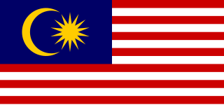
Malaysia is a country in Southeast Asia. The federal constitutional monarchy consists of 13 states and three federal territories, separated by the South China Sea into two similarly sized regions, Peninsular Malaysia and East Malaysia. Peninsular Malaysia shares a land and maritime border with Thailand in the north and maritime borders with Singapore in the south, Vietnam in the northeast, and Indonesia in the west. East Malaysia shares land and maritime borders with Brunei and Indonesia and a maritime border with the Philippines and Vietnam. Kuala Lumpur is the national capital and largest city while Putrajaya is the seat of federal government. With a population of over 30 million, Malaysia is the world's 44th most populous country. The southernmost point of continental Eurasia, Tanjung Piai, is in Malaysia. In the tropics, Malaysia is one of 17 megadiverse countries, with large numbers of endemic species.

Related Research Articles

Wonewoc is a town in Juneau County, Wisconsin, United States. The population was 783 at the 2000 census. The Village of Wonewoc is located within the town.

Oakdale is a town in Monroe County, Wisconsin, United States. The population was 679 at the 2000 census. The Village of Oakdale is located within the town.

Ludwigsparkstadion Sports ground in Saarbrücken, Saarland, Germany

Ludwigsparkstadion is a multi-purpose stadium in Saarbrücken, Germany. It was built in 1953 and holds 35,303 people. After renovation from 2016 to 2017 which costs about € 16 million, the capacity is reduced to around 16,000 seats.

Kampung Kling Mosque mosque in Malaysia

Kampong Kling Mosque is an old mosque in Malacca City, Malacca, Malaysia.

Oska Piła is a village in the administrative district of Gmina Międzybórz, within Oleśnica County, Lower Silesian Voivodeship, in south-western Poland..

Grabowno Małe Village in Lower Silesian, Poland

Grabowno Małe is a village in the administrative district of Gmina Twardogóra, within Oleśnica County, Lower Silesian Voivodeship, in south-western Poland. Prior to 1945 it was in Germany.

Fesdis Place in Batna, Algeria

Fesdis is a town in north-eastern Algeria.

Harthausen, Baden-Württemberg quarter of Filderstadt, Baden-Württemberg, Germany

Harthausen is a former municipality in the Esslingen district, in Baden-Württemberg, Germany.

Kamerlengo Castle

Kamerlengo is a castle and fortress in Trogir, Croatia. It was built by the Republic of Venice.

Gołąb-Kolonia is a village in the administrative district of Gmina Michów, within Lubartów County, Lublin Voivodeship, in eastern Poland.

Mierzyn-Kolonia is a village in the administrative district of Gmina Rozprza, within Piotrków County, Łódź Voivodeship, in central Poland.

Lututów Village in Łódź, Poland

Lututów is a village in Wieruszów County, Łódź Voivodeship, in central Poland. It is the seat of the gmina called Gmina Lututów. It lies approximately 22 kilometres (14 mi) east of Wieruszów and 85 km (53 mi) south-west of the regional capital Łódź.

Ruda, Gmina Serokomla Village in Lublin, Poland

Ruda is a village in the administrative district of Gmina Serokomla, within Łuków County, Lublin Voivodeship, in eastern Poland. It lies approximately 3 kilometres (2 mi) east of Serokomla, 25 km (16 mi) south of Łuków, and 52 km (32 mi) north of the regional capital Lublin.

Łany, Puławy County Village in Lublin, Poland

Łany is a village in the administrative district of Gmina Markuszów, within Puławy County, Lublin Voivodeship, in eastern Poland. It lies approximately 3 kilometres (2 mi) west of Markuszów, 20 km (12 mi) east of Puławy, and 28 km (17 mi) north-west of the regional capital Lublin.

Franciszków is a village in the administrative district of Gmina Wolanów, within Radom County, Masovian Voivodeship, in east-central Poland.

Gababedji is a village and rural commune in Niger.

Pavličina Village in Jablanica District, Serbia

Pavličina is a village in the municipality of Crna Trava, Serbia. According to the 2002 census, the village has a population of 40 people.

Kaali, Estonia Village in Saare County, Estonia

Kaali is a village in Saaremaa Parish, Saare County in western Estonia, 18 kilometres (11 mi) from Kuressaare, the island capital. Valjala, to the north-east, is the nearest town.

Budisavlje Village in Republika Srpska, Bosnia and Herzegovina

Budisavlje is a village in the municipality of Nevesinje, Republika Srpska, Bosnia and Herzegovina.

Makrešane Village in Rasina District, Serbia

Makrešane is a village in the municipality of Kruševac, Serbia. According to the 2002 census, the village had a population of 1,618.

References

  1. Moores, Eldridge M.; Fairbridge, Rhodes Whitmore (1997). Encyclopedia of European and Asian regional geology. Springer. p. 530. ISBN   0-412-74040-0.

1°22′19″N104°14′51″E / 1.37194°N 104.24750°E / 1.37194; 104.24750 Coordinates: 1°22′19″N104°14′51″E / 1.37194°N 104.24750°E / 1.37194; 104.24750

Geographic coordinate system Coordinate system

A geographic coordinate system is a coordinate system that enables every location on Earth to be specified by a set of numbers, letters or symbols. The coordinates are often chosen such that one of the numbers represents a vertical position and two or three of the numbers represent a horizontal position; alternatively, a geographic position may be expressed in a combined three-dimensional Cartesian vector. A common choice of coordinates is latitude, longitude and elevation. To specify a location on a plane requires a map projection.