Kangkar Pulai

Last updated

Kangkar Pulai
Towns and Suburbs
Other transcription(s)
   Jawi كڠكار ڤولاي
   Chinese 江加蒲來新村
Jiāngjiā Púlái Xīncūn
   Tamil கங்கார் பூலாய்
Kaṅkār pūlāy(Transliteration)
Johor location map.svg
Red pog.svg
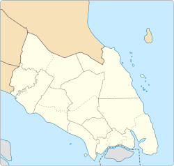
Kangkar Pulai
Kangkar Pulai shown within Johor Bahru.
West Malaysia location map.svg
Red pog.svg
Kangkar Pulai
Kangkar Pulai (Peninsular Malaysia)
Malaysia location map with districts.svg
Red pog.svg
Kangkar Pulai
Kangkar Pulai (Malaysia)
Coordinates: 1°33′28.260″N103°35′10.770″E / 1.55785000°N 103.58632500°E / 1.55785000; 103.58632500
Country Malaysia
State Johor
District Johor Bahru
City Iskandar Puteri
Mukim Pulai
Opening1917
Government
   Local Authority Majlis Bandaraya Iskandar Puteri / Majlis Perbandaran Kulai
   ADUN YB Sr Dzulkefly Ahmad
   Mayor Dato' Salehuddin bin Hassan
  PenghuluZainuddin
  Ketua KampungAdnan Ladimin
Time zone UTC+8 (MST)
Postcode
81110 Kangkar Pulai
Dialling code +607 (Johor)
Police Kangkar Pulai Police Station
Fire Iskandar Puteri Fire Station

Kangkar Pulai is a Town of mukim pulai, Kulai and Johor Bahru District, Johor, Malaysia. The township is bordered by Bandar Baru Kangkar Pulai to the north and west, and Taman Sri Pulai Perdana 2 to the north. The rest area on it perimeter are Palm Estates owned by Keck Seng Group. [1]
Contents

History

Establishment

The first settlement in Kangkar Pulai was the Kangkar Pulai Old Town, a chinese village that was built under the Kangchu system that was introduced during the reign of Sultan Ibrahim. [2]

Kangkar Pulai Municipal Council

Kangkar Pulai Municipal Council was established on 15 March 1953 with its first office at Jalan Kangkar Pulai. The office were moved to Chinese Business Assembly building two years later. After the independence of Malaya, the municipal council office was moved to the Kangkar Pulai Community Hall built by the government in 1959. On 1 March 1971, Kangkar Pulai Municipal Council and 7 other local authorities in Johor Bahru we amalgamated into Johor Bahru Tengah District Council, later known as Iskandar Puteri City Council in 2018. [3]

Settlements

Kangkar Pulai Old Town

Kangkar Pulai Old Town was a chinese village and the first settlement in Kangkar Pulai. The town was named after this village. Many villagers are descendants of early Hakka settlers during Kangchu system introduced in Johor in early 20th century. There are also Indian settlers from descendants of Tamil workers at the nearby Palm Estates. During the First Communist Insurgency, the village is divided into 5 zones under the British resettlement program. Kangkar Pulai police station and rural clinic are located at this village.

The main article for this topic is Kangkar Pulai Old Town

Kampung Melayu Kangkar Pulai

This Malay village is opened in early 1950s by Malay settlers and located at the hilly area at the west of the old town. The major mosque in Kangkar Pulai, Masjid Nur Syuhadah is located at this village.

Taman Desa Permai

Taman Desa Permai is the first planned development in Kangkar Pulai. The development is located across the river south from old town and Malay Village. There are around 300 terrace houses and flat houses in this development.

Taman Bestari

Taman Bestari is the second development located south across the road between Site B and flat houses of Taman Desa Permai.

Geography

Kangkar Pulai is situated at the valley of Pulai River. The earth is hilly with fertile peat soil thus making it suitable for plantation. Gambier and black pepper used to be main agricultural product until they were being replaced by Palm estates due to high demand of palm oil in 1970. [4]

See also

Related Research Articles

<span class="mw-page-title-main">Pasir Gudang</span> City in Johor, Malaysia

Pasir Gudang is a city in Johor Bahru District, Johor, Malaysia. The main industries are transportation and logistics, shipbuilding, petrochemicals and other heavy industries, and oil palm storage and distribution, which is located in Johor Port and Tanjung Langsat.

<span class="mw-page-title-main">Johor Bahru District</span> District of Malaysia in Johor

The Johor Bahru District is a district located in the southern part of Johor, Malaysia. The heavily suburban/suburbanizing district covers an area of 1,063.97 km2 (410.80 sq mi) and has a population of 1.71 million. The district capital is Johor Bahru City and the administrative capital is Iskandar Puteri City. The district borders Pontian District on the west, Kota Tinggi District on the east, Kulai District on the north and Straits of Johor to the south. The urban centres are divided into the cities of Johor Bahru, Iskandar Puteri and Pasir Gudang.

Johor Bahru, Malaysia, has the following notable landmarks.

<span class="mw-page-title-main">Skudai</span> Suburb in Johor Bahru, Malaysia

Skudai is a town in Johor, Malaysia. It is about 13 km northwest from Johor Bahru's central business district.

<span class="mw-page-title-main">Ulu Tiram</span> Suburb in Johor Bahru

Ulu Tiram is a suburb in Johor Bahru, Johor, Malaysia. The town lies along Tebrau Highway, a section of Malaysia Federal Route 3, at the junction which leads to Ulu Tiram. As a major trunk road on Peninsular Malaysia's east coast, Federal Route 3 connects Ulu Tiram with major east coast towns and cities such as Mersing, Pekan, Kuantan, Kuala Terengganu and Kota Bharu. Ulu Tiram is easily accessible through the Tebrau Highway, Jalan Kota Tinggi trunk road, and the Senai–Desaru Expressway.

<span class="mw-page-title-main">Iskandar Puteri</span> City in Johor, Malaysia

Iskandar Puteri is a city and the administrative capital of the state of Johor, Malaysia. It represents the seat of government of the state of Johor. Situated along the Straits of Johor at the southern end of the Malay Peninsula, it is also the southernmost city in Peninsular Malaysia.

<span class="mw-page-title-main">Mutiara Rini</span> Township in Johor, Malaysia

Mutiara Rini is a housing area and suburb in Skudai, Johor, Malaysia. It is developed by Mutiara Rini Sdn Bhd, a subsidiary of the military-linked Boustead Group.

<span class="mw-page-title-main">Johor Bahru City Council</span>

Johor Bahru City Council is the city council which administrates Johor Bahru city centre and other areas of the Iskandar Malaysia area in Johor, Malaysia. This agency is under Johor state government. MBJB are responsible for public health and sanitation, waste removal and management, town planning, environmental protection and building control, social and economic development and general maintenance functions of urban infrastructure.

<span class="mw-page-title-main">Iskandar Puteri City Council</span>

The Iskandar Puteri City Council is the city council which administrates Iskandar Puteri City in Johor, Malaysia. This agency is under Johor state government. MBIP are responsible for public health and sanitation, waste removal and management, town planning, environmental protection and building control, social and economic development and general maintenance functions of urban infrastructure. The MBIP new headquarters is located at Medini.

<span class="mw-page-title-main">Kulai District</span> District of Malaysia in Johor

The Kulai District is a district in the state of Johor, Malaysia. Its district capital is Kulai Town. It covers Kulai Town, Ayer Bemban, Bandar Putra Kulai, Bukit Batu, Indahpura, Bandar Baru Kangkar Pulai, Kelapa Sawit, Saleng, Sedenak, Seelong, Senai, and Sengkang. Kulai is also within Iskandar Malaysia economic zone.

<span class="mw-page-title-main">Tebrau</span> Town in Malaysia in Johor

Tebrau or Teberau is a mukim and a town in Johor Bahru District, Johor, Malaysia. It is the third largest mukim in the district.

<span class="mw-page-title-main">Pasir Gudang City Council</span>

The Pasir Gudang City Council is the city council which administrates Pasir Gudang in Johor Bahru District, Johor, Malaysia. This agency is under Johor state government. MBPG is responsible for public health and sanitation, waste removal and management, town planning, environmental protection and building control, social and economic development and general maintenance functions of urban infrastructure. The MBPG main headquarters is located at Pasir Gudang.

<span class="mw-page-title-main">Mukim Pulai, Johor</span> Place in Malaysia

Pulai or Mukim Pulai is the largest mukim in District of Johor Bahru, State of Johor Darul Ta'zim, Federation of Malaysia.

Taman Pulai Mutiara is a township in the Mukim Pulai, city of Iskandar Puteri, district of Johor Bahru, State of Johor Darul Ta'zim, Malaysia. The township is bordered by Pulai Indah and Laman Indah to the north, and Alam Jaya Business Park, Setia Business Park and Tropicana Upland to the south. The rest area on it perimeter is covered in green. This township is being developed since 2016, and ready for occupation from 2018 onward.


Pulai Indah is a township in the north of Mukim Pulai, city of Iskandar Puteri, district of Johor Bahru, State of Johor Darul Ta'zim, Malaysia. The township is bordered by Pulai Hijauan and Bandar Baru Kangkar Pulai to the north, and Pulai Mutiara to the south. The rest area on it perimeter is covered in green. This township is being developed by Huayang Berhad since 2008, and ready for occupation from 2010 onward.

Pulai Hijauan is a township in the Mukim Pulai, city of Iskandar Puteri, district of Johor Bahru, State of Johor Darul Ta'zim, Malaysia. The township is bordered by Bandar Baru Kangkar Pulai to the east, and Pulai Indah to the south. The rest area on it perimeter is covered in green. This township is being developed by Huayang Berhad since 2015, and ready for occupation from 2017 onward.

Bandar Baru kangkar Pulai is a township at the border of mukim Senai, district of Kulai, State of Johor Darul Ta'zim and mukim Pulai, city of Iskandar Puteri, district of Johor Bahru, State of Johor Darul Ta'zim, Malaysia. The township is bordered by Pulai Hijauan to the west, Kangkar Pulai and Taman Pulai Mas to the east, and Pulai Indah to the south. The rest area on it perimeter is covered in green. This township is being developed by Keck Seng since 2008, and ready for occupation from 2010 onward.

Pulai is a suburban area in the city of Iskandar Puteri, Mukim Pulai, district Johor Bahru, state of Johor, Malaysia

Bandar Nusa Bayu or Nusa Bayu, is a township in Iskandar Puteri, Johor Bahru District, Johor, Malaysia. The township is bordered by Setia Eco Gardens and Jelutong Hills forest to the north, Second Link Expressway to the west, Nusajaya Southern Industry Logistic Center (SILC) to the south, and GP Prima Transport Hub to the east. The township is part of the Iskandar Malaysia Flagship B and the Iskandar Puteri Master Plan. Formerly in the Nusajaya Master Plan, Nusa Bayu was known as Nusajaya Industrial Park, together with SILC. The development commenced in 2010 and began to be occupied since 2013 onward.

References

  1. Survey Department Kuala Lumpur (1959). "Kangkar Pulai Map". Malaya (Federation).
  2. Caroline Wong Mey Leng (1992). "Kangchu System in Johor". Malaysia Museum Association.
  3. Iskandar Puteri City Council (1 January 2019). "Kangkar Pulai Municipal Council".
  4. Mehran Sanam Bhatti (2013). "Geological and Geophysical Study of Kangkar Pulai Area, Johor, Malaysia". Department of Geology, Science Faculty, Universiti Malaya.