| The Dispensary | |
|---|---|
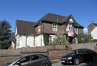
 Old Dispensary, St James Square | |
| General information | |
| Architectural style | Georgian |
| Town or city | Monmouth |
| Country | Wales |
| Coordinates | 51°48′47″N2°42′38″W / 51.81301°N 2.7106°W Coordinates: 51°48′47″N2°42′38″W / 51.81301°N 2.7106°W |
| Completed | <1868 |
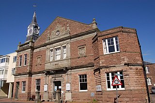
The Dispensary is a Georgian town house which is fairly typical of many town-centre houses in Monmouth, Wales, dating from the mid 18th century, but with early 19th-century additions. It stands in St James Square, opposite the Catalpa tree. The building was listed at Grade II on 27 June 1952. [1]

Monmouth is the historic county town of Monmouthshire, Wales and a community. It is situated where the River Monnow meets the River Wye, within 2 miles (3.2 km) of the border with England. The town is 30 miles (48 km) northeast of Cardiff, and 113 miles (182 km) west of London. It is within the Monmouthshire local authority, and the parliamentary constituency of Monmouth. Monmouth's population in the 2011 census was 10,508, rising from 8,877 in 2001.

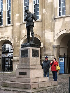
St James Square is a historic square in the town centre of Monmouth, Monmouthshire, Wales. It is located at the eastern end of Whitecross Street, within the medieval town walls. The area features the Monmouth War Memorial and the controversial, historic Indian Bean Tree. In addition, in 2010, the square was the site of discovery of the first Mesolithic artefacts in Monmouth. St James Square is lined with numerous listed buildings.

St James Square in Monmouth, Monmouthshire, Wales is the site of a historic Indian Bean Tree. The Catalpa bignonioides, a native of the southeastern United States, was planted in the square about 1900. It was joined by the Monmouth War Memorial in 1921. After more than one hundred years of presiding over the square, the tree became the focus of controversy when it was condemned by the Monmouthshire County Council in 2005. The decision was met with fierce community opposition. The parties involved resolved their differences in 2006, and the tree received treatment, albeit some of it unauthorized. By 2011, the Indian Bean Tree in St James Square was flourishing.
The architectural historian John Newman [2] calls this the "one substantial eighteenth century house" in St James Street, though it is surrounded by later attractive façades. A dispensary was established here in 1857. This became the Monmouth Hospital and Dispensary, with nine beds, in 1868, and closed in 1903. The dispensary is one of 24 buildings on the Monmouth Heritage Trail, marked by a ceramic blue plaque on the wall.

John Arthur Newman is an English architectural historian. He is the author of several of the Pevsner Architectural Guides and is the advisory editor to the series.
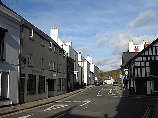
St James Street is a historic street in the town centre of Monmouth, Monmouthshire, Wales. It appears as a segment of Whitecross Street on the 1610 map of the town by cartographer John Speed and is within the medieval town walls. On more recent maps, it extends from St James Square southwest to Almshouse Street. In 2010, the street was the site of discovery of Mesolithic era artefacts. St James Street is lined with numerous listed buildings.

A dispensary is an office in a school, hospital, industrial plant, or other organization that dispenses medications, medical supplies, and in some cases even medical and dental treatment. In a traditional dispensary set-up, a pharmacist dispenses medication as per prescription or order form. The English term originated from the medieval Latin noun dispensaria and is cognate with the Latin verb dispensare, "to distribute".