 | |
| Details | |
|---|---|
| Established | 1921 |
| Location | |
| Country | Wales |
| Coordinates | 51°48′47″N2°42′40″W / 51.81308°N 2.71122°W |
| Type | military |
The Monmouth War Memorial commemorates the Monmouth fallen of the First and Second World Wars.
 | |
| Details | |
|---|---|
| Established | 1921 |
| Location | |
| Country | Wales |
| Coordinates | 51°48′47″N2°42′40″W / 51.81308°N 2.71122°W |
| Type | military |
The Monmouth War Memorial commemorates the Monmouth fallen of the First and Second World Wars.
The Monmouth War Memorial is located in Monmouth, Monmouthshire, Wales. [1] [2] It is positioned in the centre of St. James' Square, within the roundabout of Whitecross Street, Old Dixton Road, and St. James' Street. [3] The Catalpa tree behind the cenotaph was imported from North America and planted about 1900. At the time of the unveiling of the monument in 1921, the Catalpa was already a mature tree. [4] There are formal plantings on three sides of the memorial. The monument, plantings, and adjacent lawn are surrounded by railings. The Indian Bean Tree, however, was condemned by the Monmouthshire City Council. Opponents of the decision to fell the tree hired a professional arboriculturalist who concluded that the tree could be treated to extend its life. [4]
The Monmouth War Memorial was created by sculptor W. Clarke of Llandaff. [5] The war monument is composed of a three-step base and column, upon which there is the figure of a soldier. The column has multiple metal plaques, including two on the front. The upper, smaller plaque indicates that the monument commemorates the residents of Monmouth who died in both World War I and World War II. It reads: "To the memory of the Monmouth men who fell in the wars 1914–1918 1939–1945." The lower, larger plaque on the front of the monument lists the deceased Monmouth soldiers of the Second World War, 1939 to 1945. [6]
The war memorial is on the Statutory List of Buildings of Special Architectural or Historic Interest in the United Kingdom. It was listed as a Grade II structure on 8 October 2005. [2] Such structures are considered to be "nationally important and of special interest." Ninety-two percent of listed buildings are of this grade. [7] The monument's record is in the collection of the Royal Commission on the Ancient and Historical Monuments of Wales. [1] The Cadw Building ID Number for the Monmouth War Memorial is 85239. [2] Cadw is the historic environment service for the government of Wales. The Welsh term "cadw" means to keep or protect. [8]

The Kymin,, is a hill overlooking Monmouth, in Monmouthshire, Wales. It is located approximately one mile east of Monmouth, on the eastern side of the River Wye and adjacent to the border with the Forest of Dean and England. The summit of the hill, about 800 feet above sea level, is known for its neo-classical monuments, the Roundhouse and the Naval Temple, built between 1794 and 1800. The site is within a designated Area of Outstanding Natural Beauty (AONB) and is owned by the National Trust.

The Shire Hall in Agincourt Square, Monmouth, Wales, is a prominent Grade I listed building in the town centre. It was built in 1724, and was formerly the centre for the Assize Courts and Quarter Sessions for Monmouthshire. In 1839/40, the court was the location of the trial of the Chartist leader John Frost and others for high treason for their part in the Newport Rising. The building was also used as a market place. The Shire Hall is owned by Monmouthshire County Council and has audiovisual guides for visitors to Courtroom 1. It is currently used as a Tourist Information Centre and as the offices for Monmouth Town Council, and is open to the public in part.

The Nelson Garden, on 13 Chippenhamgate Street, at the rear of No.18 Monnow Street, Monmouth, Monmouthshire is a 19th-century garden that was the scene of a tea party held to honour Lord Nelson in 1802. The garden is one of 24 sites on the Monmouth Heritage Trail. It is bounded on the south by the line of the medieval town wall through which it is entered via a short underground passageway. The garden has limited public access and is now managed by a trust.

Glendower House, Glendower Street, Monmouth, Wales, is a Victorian former Congregational chapel constructed in a Classical style. The Royal Commission on the Ancient and Historical Monuments of Wales describes it as "a chapel of exceptional sophistication and elaboration of design and one of the earliest Italianate chapels in Wales". It is named after Prince Owain Glyndŵr.
There are a number of war memorials in Monmouth, Wales.

The War Memorial of the Royal Monmouthshire Royal Engineers commemorates the soldiers who died in World War I and World War II.

St James Square in Monmouth, Monmouthshire, Wales is the site of a historic Indian Bean Tree. The Catalpa bignonioides, a native of the southeastern United States, was planted in the square about 1900. It was joined by the Monmouth War Memorial in 1921. After more than one hundred years of presiding over the square, the tree became the focus of controversy when it was condemned by the Monmouthshire County Council in 2005. The decision was met with fierce community opposition. The parties involved resolved their differences in 2006, and the tree received treatment, albeit some of it unauthorized. By 2011, the Indian Bean Tree in St James Square was flourishing.

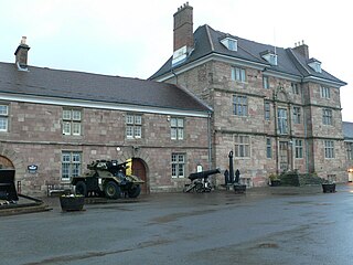
The Monmouth Regimental Museum is located on Castle Hill in Monmouth, Monmouthshire, Wales. The museum is in a wing of Great Castle House, a listed building on the Monmouth Heritage Trail. The focus of most of the museum's exhibits is the most senior regiment in the British Territorial Army, the Royal Monmouthshire Royal Engineers. Great Castle House is home to the Royal Monmouthshire Royal Engineers, and the museum maintains the records of the regiment.

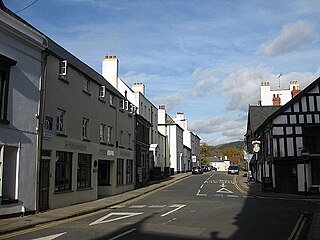
Whitecross Street is a historic street in the town centre of Monmouth, Monmouthshire, Wales. It was in existence by the 15th century, and appears as Whit crose on the 1610 map of the town by cartographer John Speed. It runs in an east-west direction, between Church Street and St James Square. It has been suggested that the street takes its name from a plague cross. Whitecross Street is lined with numerous listed buildings.

33 Whitecross Street is a grade II listed building in Monmouth, Monmouthshire, Wales. It is in the historic St James Square neighbourhood. The property was the site of archaeological excavation in 2009, which demonstrated evidence of Neolithic (prehistoric), Roman, and Medieval activity. The following year, archaeological excavation in the square discovered the first evidence of Mesolithic human settlement in Monmouth.

Monk Street is an historic street in the town of Monmouth, Monmouthshire, Wales. A portion of it was in existence by the 14th century, and appears on the 1610 map of the town by cartographer John Speed. It runs in a north-south direction, extending northward from its intersection with Whitecross Street. The name of the street relates to the nearby Priory, as well as the gate which was originally on this road and provided part of the town's defences, Monk's Gate. Monk Street is lined with numerous listed buildings.

The Masonic Hall is a grade II listed building on Monk Street in Monmouth, Monmouthshire, Wales. It was designed by architect George Vaughan Maddox. The building is believed to mark the site of Monk's Gate, part of the original defences of the town of Monmouth. Before its 1846 conversion to the Masonic Hall, the building served as the Monk Street Theatre. After more than 150 years of housing the Loyal Monmouth Lodge No. 457, the Masonic Hall sustained fire and smoke damage from suspected arson. The Lodge of Freemasons housed in the building is the oldest surviving Masonic Lodge in Monmouthshire.

Kingsley House and Hendre House are a pair of 19th-century, semi-detached houses on the North Parade section of Monk Street in Monmouth, Monmouthshire, Wales. The grade II listed houses were designed by noted Monmouth architect and builder George Vaughan Maddox, who also designed at least two of the twenty-four blue plaque buildings on the Monmouth Heritage Trail, including the Market Hall and the Monmouth Methodist Church. Hendre House should be distinguished from The Hendre, the estate of the Rolls family.

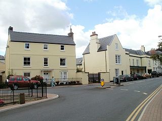
St James Square is a historic square in the town centre of Monmouth, Monmouthshire, Wales. It is located at the eastern end of Whitecross Street, within the medieval town walls. The area features the Monmouth War Memorial and the controversial, historic Indian Bean Tree. In addition, in 2010, the square was the site of discovery of the first Mesolithic artefacts in Monmouth. St James Square is lined with numerous listed buildings. It is also home to the Monmouth Catalpa Tree.

St James Street is a historic street in the town centre of Monmouth, Monmouthshire, Wales. It appears as a segment of Whitecross Street on the 1610 map of the town by cartographer John Speed and is within the medieval town walls. On more recent maps, it extends from St James Square southwest to Almshouse Street. In 2010, the street was the site of discovery of Mesolithic era artefacts. St James Street is lined with numerous listed buildings.

St James House is a grade II listed building in Monmouth, Monmouthshire, Wales. It is in the historic St James Square neighbourhood, within the Medieval town walls. While the house currently has an attractive, 18th-century facade, it originated as a burgage tenement. In addition, behind the house, evidence of a kiln has been unearthed, with both Medieval and Post-medieval pottery. In 2010, archaeological excavation in the square revealed the first evidence of Mesolithic human settlement in Monmouth. Recent residents of St James House have included boarding students from Monmouth School.

Glendower Street is a historic street in the town centre of Monmouth, Monmouthshire, Wales. It extends to the southeast from the intersection of Agincourt Street and St John's Street, within the medieval town walls. Glendower Street is lined with numerous listed buildings, including one of the 24 blue plaque buildings on the Monmouth Heritage Trail.

St John's is a grade II listed building in the town centre of Monmouth, Monmouthshire, Wales. It is located in the historic Glendower Street neighbourhood, within the medieval town walls. The eight bedroom home is most remarkable for the rear of the property which features a Coalbrookdale verandah and formal walled garden that have been separately grade II listed with the Cadw/ICOMOS Register of Parks and Gardens of Special Historic Interest in Wales. The villa's garden is also registered with the Welsh Historic Gardens Trust.

12–16 Church Street in Monmouth, Wales, is a row of three shop houses designed by the architect George Vaughan Maddox and constructed c. 1837. They form part of Maddox's redevelopment of the centre of Monmouth and stand on Church Street, to the rear of Maddox's Priory Street. The architectural historian John Newman has written that Maddox's work "gives Monmouth its particular architectural flavour" and Cadw describes the grouping of 12–16 Church Street as "the best preserved early 19th century shopfront in Monmouth."