
Arlington is a neighborhood and census-designated place (CDP) in the town of Poughkeepsie, Dutchess County, New York, United States. At the 2010 census, the CDP population was 4,061.

Crown Heights is a hamlet and census-designated place (CDP) in Dutchess County, New York, United States. The population was 2,840 at the 2010 census. It is part of the Poughkeepsie–Newburgh–Middletown, NY Metropolitan Statistical Area as well as the larger New York–Newark–Bridgeport, NY-NJ-CT-PA Combined Statistical Area.

Haviland is a community and census-designated place (CDP) in Dutchess County, New York, United States. The population was 4,174 at the 2020 census. It is part of the Poughkeepsie–Newburgh–Middletown, NY Metropolitan Statistical Area as well as the larger New York–Newark–Bridgeport, NY-NJ-CT-PA Combined Statistical Area.

Hillside Lake is a hamlet and census-designated place (CDP) in Dutchess County, New York, United States. The population was 1,084 at the 2010 census. It is part of the Poughkeepsie–Newburgh–Middletown, NY Metropolitan Statistical Area as well as the larger New York–Newark–Bridgeport, NY-NJ-CT-PA Combined Statistical Area.

LaGrange is a town in Dutchess County, New York, United States. The population was 15,975 at the 2020 census. The town was named after the estate of the Marquis de Lafayette.
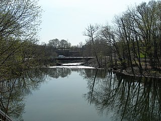
Red Oaks Mill is a hamlet and census-designated place (CDP) in Dutchess County, in the U.S. state of New York. It lies within the limits of the towns of Poughkeepsie and LaGrange. The population was 3,613 at the 2010 census.

Spackenkill is a hamlet and census-designated place (CDP) in Dutchess County, New York, United States. The population was 4,123 at the 2010 census. It is part of the Poughkeepsie–Newburgh–Middletown, NY Metropolitan Statistical Area as well as the larger New York–Newark–Bridgeport, NY-NJ-CT-PA Combined Statistical Area.

Amenia is a hamlet and census-designated place (CDP) in Dutchess County, New York, United States. The population was 725 at the 2020 census. It is part of the Poughkeepsie–Newburgh–Middletown, NY Metropolitan Statistical Area as well as the larger New York–Newark–Bridgeport, NY-NJ-CT-PA Combined Statistical Area.
Amenia is a town in Dutchess County, New York, United States. The population was 3,769 at the 2020 census, down from 4,436 at the 2010 census. The town is on the eastern border of the county.

Pleasant Valley is a census-designated place (CDP) in the southwestern part of the town of Pleasant Valley in Dutchess County, New York, United States. The population was 1,145 at the 2010 census. It is part of the Poughkeepsie–Newburgh–Middletown, NY Metropolitan Statistical Area as well as the larger New York–Newark–Bridgeport, NY-NJ-CT-PA Combined Statistical Area.

Poughkeepsie, officially the Town of Poughkeepsie, is a town in Dutchess County, New York, United States. As of the 2020 United States Census, the population was 45,471. The name is derived from the native term Uppuqui meaning "lodge-covered", plus ipis meaning "little water", plus ing meaning "place", all of which translates to "the reed-covered lodge by the little water place", or Uppuqui-ipis-ing. This later evolved into Apokeepsing, then into Poughkeepsing, and finally Poughkeepsie.

Wassaic is a hamlet and census-designated place in the town of Amenia, Dutchess County, New York, United States. As of the 2020 census, its population in 210. Located in southeastern New York in the valley of the Ten Mile River, Wassaic is bordered to the east and west by mountain ranges.

Wingdale is a hamlet and census-designated place (CDP) in the town of Dover in Dutchess County, New York, United States. It was first listed as a CDP prior to the 2020 census.
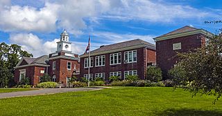
The Arlington Central School District is one of thirteen public school districts serving residents of Dutchess County, New York.
Piffard is a census-designated place (CDP) and hamlet in the town of York, Livingston County, New York, United States. As of the 2010 census, its population was 220. The ZIP Code is 14533.

Freedom Plains is a hamlet and census-designated place (CDP) in Dutchess County, New York, United States. As of the 2010 census the population was 421.

Hyde Park is a hamlet and census-designated place (CDP) in the town of Hyde Park, Dutchess County, New York, United States. Its population was 1,908 as of the 2010 census.

Merritt Park is a census-designated place (CDP) in the town of Fishkill in Dutchess County, New York, United States. As of the 2020 census it had a population of 1,647.
Upper Red Hook is a hamlet and census-designated place (CDP) in the town of Red Hook in Dutchess County, New York, United States. It was first listed as a CDP prior to the 2020 census.
MacDonnell Heights is a census-designated place (CDP) in the town of Poughkeepsie in Dutchess County, New York, United States. It was first listed as a CDP prior to the 2020 census.

