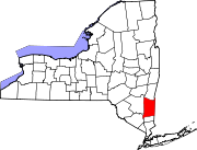
Verbank, New York

Last updated

Sprout Creek in the hamlet of Verbank Sprout Creek.JPG
Sprout Creek in the hamlet of Verbank

Verbank is a hamlet in the town of Union Vale in Dutchess County, New York, United States. Verbank is served by a post office with the ZIP code of 12585; [1] the ZCTA for ZIP Code 12585 had a population of 956 at the 2000 census.

Contents

Verbank is home to Camp Young Judaea Sprout Lake, which was established in 1976 as a camp for children grades 28, [2] focused on Zionist and Jewish education. [3] The camp was formerly a cardiac support summer camp. The Verbank Hunting And Fishing Club, on Verbank Club Road, was created in 1928. [4] The Verbank United Methodist Church is located at the junction of County Route 9 and New York State Route 82. [5] The Dutchess and Columbia Railroad was chartered in 1866 to build a line from Fishkill on the Hudson River, northeast and north to the New York and Harlem Railroad at Craryville. [6] On the railroad, a railroad station, the church, a post office, and two stores existed in the area that was known as Verbank Station. [7] In its early years, Verbank was home to two gristmills and a paper mill. [8]

Demographics

As of the census [9] of 2000, there were 956 people, 326 households, and 245 families residing in the ZCTA for ZIP Code 12585. The racial makeup of the ZCTA was 93.4% White, 2.9% Black or African American, 0.1% Native American, 2.0% Asian, 0.05% Pacific Islander, 5.29% from other races, and 0.9% from two or more races. Hispanic or Latino of any race were 3.3% of the population.

There were 326 households, out of which 40.5% had children under the age of 18 living with them, 67.8% were married couples living together, 4.6% had a female householder with no husband present, and 24.8% were non-families. 19.9% of all households were made up of one resident and 8.3% had someone living alone who was 65 years of age or older. The average household size was 2.89 people and the average family size was 3.37.

In the ZCTA the population was spread out, with 6.8% under the age of 5, 8.1% from 5 to 9, 10.0% from 10 to 14, 5.6% from 15 to 19, 3.3% from 20 to 24, 10.6% between 25 and 34, 22.2% between 35 and 44, 14.4% from 45 to 54, 4.5% from 55 to 59, 4.5% from 60 to 64, and 9.5% ages 65 or older. The median age was 37.5 years.

The median income for a household in the ZCTA was $50,673, and the median income for a family was $60,625. Males had a median income of $65,000 versus $24,148 for females. The per capita income for the ZCTA was $24,148. No families or individuals were below the poverty line.

Geography

Verbank is located at 41°43′41″N73°42′55″W / 41.72806°N 73.71528°W / 41.72806; -73.71528 , within the Dutchess County town of Union Vale, and is situated at about 591 ft (180 m) in elevation. [10] Verbank Village, a related community, is located at 41°43′36″N73°43′44″W / 41.72667°N 73.72889°W / 41.72667; -73.72889 (Verbank Village) , and sits at about 515 ft (157 m) above sea level. [11] New York State Route 82 travels through the town; [12] the road was first designated in 1930. [13] Sprout Creek, a tributary of the Fishkill Creek, also crosses the town in a roughly northsouth orientation. There are numerous smaller water bodies, including Willow Brook which feeds into Sprout Creek. Clove Mountain, at 1,398 ft (426 m) in elevation is located within the town. [14]

The highest known temperate in Verbank was 99 °F, which occurred in 1948. The lowest temperature was 29 °F, recorded in 1994. Average monthly precipitation ranges from 2.62 in (67 mm) in February, to 4.37 in (0.111 m) in July. The coldest month is typically January, with an average high of 34 °F and a low of 12 °F. By contrast the warmest month on average is July, with high temperatures typically reaching 81 °F, and lows falling to around 56 °F. [15]

See also

Related Research Articles

<span class="mw-page-title-main">Berrien Township, Michigan</span> Civil township in Michigan, United States

Berrien Township is a civil township of Berrien County in the U.S. state of Michigan. As of the 2020 census, the township population was 4,868.

<span class="mw-page-title-main">Newberg Township, Michigan</span> Civil township in Michigan, United States

Newberg Township is a civil township of Cass County in the U.S. state of Michigan. The population was 1,602 at the 2020 census.

<span class="mw-page-title-main">Volinia Township, Michigan</span> Civil township in Michigan, United States

Volinia Township is a civil township of Cass County in the U.S. state of Michigan. The population was 1,096 at the 2020 census. When the township was organized in 1833, it was at first named Volhynia, after the province in Poland. It is believed to have been given to honor General Tadeusz Kościuszko, the Polish patriot who helped the United States during the American Revolutionary War. The name was altered first to "Volenia" and then by 1901 or earlier to "Volinia".

<span class="mw-page-title-main">Sherman Township, Huron County, Michigan</span> Civil township in Michigan, United States

Sherman Township is a civil township of Huron County in the U.S. state of Michigan. The population was 1,083 at the 2010 census.

Sherman Township is a civil township of Iosco County in the U.S. state of Michigan. The population was 493 at the 2000 census and slightly decreased to 448 at the 2010 census.

<span class="mw-page-title-main">Metamora Township, Michigan</span> Civil township in Michigan, United States

Metamora Township is a civil township of Lapeer County in the U.S. state of Michigan. The population was 4,249 at the 2010 Census.

<span class="mw-page-title-main">Powell Township, Michigan</span> Civil township in Michigan, United States

Powell Township is a civil township of Marquette County in the U.S. state of Michigan. The population was 732 at the 2020 census, down from 816 in 2010.
<span class="mw-page-title-main">Lyon Township, Oakland County, Michigan</span> Charter township in Michigan, United States

Lyon Charter Township is a charter township of Oakland County in the U.S. state of Michigan. The population was 14,545 at the 2010 census.

<span class="mw-page-title-main">Hopewell Junction, New York</span> Census-designated place in New York, United States

Hopewell Junction is a hamlet and census-designated place (CDP) in Dutchess County, New York, United States. The population was 1330 at the 2020 census. It is part of the Poughkeepsie–Newburgh–Middletown, NY Metropolitan Statistical Area as well as the larger New York–Newark–Bridgeport, NY-NJ-CT-PA Combined Statistical Area.

<span class="mw-page-title-main">LaGrange, New York</span> Town in New York, United States

LaGrange is a town in Dutchess County, New York, United States. The population was 15,975 at the 2020 census. The town was named after the estate of the Marquis de Lafayette.

<span class="mw-page-title-main">Union Vale, New York</span> Town in New York, United States

Union Vale is a town in Dutchess County, New York, United States. The population was 4,558 at the 2020 census.
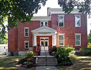
<span class="mw-page-title-main">Washington, New York</span> Town in Dutchess County, New York, US

Washington is a town in Dutchess County, New York, United States. The population was 4,522 at the 2020 census. The town is named after George Washington, who passed through the town during the Revolution.

<span class="mw-page-title-main">Taylor, Pennsylvania</span> Borough in Pennsylvania, United States

Taylor is a borough in Lackawanna County, Pennsylvania, United States, 3 miles (5 km) southwest of Scranton on the Lackawanna River. It was founded in 1790 by Cornelius Atherton. Silk manufacturing and coal mining were once practiced in the borough. Most of Taylor is built over abandoned mines. The Pennsylvania Turnpike Northeast Extension (I-476), accessible via the Keyser Avenue Interchange, passes through Taylor, going north to Clarks Summit and south to Philadelphia.

<span class="mw-page-title-main">Southmayd, Texas</span> City in Texas, United States

Southmayd is a city in Grayson County, Texas, United States. The population was 992 at the 2010 census. It is part of the Sherman–Denison Metropolitan Statistical Area.

<span class="mw-page-title-main">Acme, Washington</span> Village in Washington, United States

Acme is a rural village in Whatcom County, Washington, United States. There is a general store, post office, gas station, diner, elementary school and two churches located there. Acme is also included in, and the source-name for, a larger census-designated place (CDP). The Census Bureau no longer tracks the population for the village itself, but for the entire CDP the population was 246 at the 2010 census.

<span class="mw-page-title-main">Fishkill, New York</span> Village in New York, United States

Fishkill is a village within the town of Fishkill in Dutchess County, New York, United States. The village is in the eastern part of the town of Fishkill on U.S. Route 9. It is north of Interstate 84. NY 52 is the main street. It is part of the Poughkeepsie–Newburgh–Middletown, NY Metropolitan Statistical Area as well as the larger New York–Newark–Bridgeport, NY-NJ-CT-PA Combined Statistical Area. The first U. S. Post Office in New York state was established in Fishkill by Samuel Loudon, its first Postmaster.
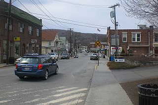
<span class="mw-page-title-main">Pawling (village), New York</span> Village in New York, United States

Pawling is a village in Dutchess County, New York, United States. The population was 1,995 at the 2020 census. It is part of the Poughkeepsie–Newburgh–Middletown, NY Metropolitan Statistical Area as well as the larger New York–Newark–Bridgeport, NY-NJ-CT-PA Combined Statistical Area. The John Kane House, a registered historic place, is situated in the village. The village was portrayed as the fictional town of Denning, New York, in the TV series Elementary.

Siloam is an unincorporated community in southeastern Surry County, North Carolina, United States. The Yadkin River makes up the community's southern border, and the Ararat River flows between it and the community of Shoals to the east. It is a Piedmont Triad community.

Modoc is an unincorporated community in Randolph County, Illinois, United States, located four miles southeast of Prairie du Rocher under the bluffs of the Mississippi River.

<span class="mw-page-title-main">Sprout Creek</span>

Sprout Creek is a 24.8-mile-long (39.9 km) creek located entirely within Dutchess County, New York, United States. It is the largest tributary of Fishkill Creek, entering that creek some 11 miles (18 km) upstream from the Hudson River. The creek is annually stocked with 6,000 brown trout, and maintains its own natural population of trout.

References

  1. "Search Results for ZIP code 12585". Zipinfo. Retrieved December 20, 2007.
  2. "Camp Information". Camp Young Judaea. Retrieved October 8, 2008.
  3. Staff Writer (March 10, 2003). "Kosher meals make fond memories at many sleep-away summer camps". South Florida Sun-Sentinel, Tribune News Service. Retrieved October 8, 2008.
  4. "Verbank Hunting And Fishing Inc". Manta. 2008. Retrieved October 7, 2008.
  5. "Events: Verbank United Methodist Church". Poughkeepsie Journal. 2008. Retrieved October 8, 2008.
  6. Lyndon A. Haight. "The Dutchess and Columbia Railroad". Little Nine Partners Historical Society. Retrieved October 8, 2008.
  7. James H. Smith. "HISTORY OF THE TOWN OF UNION VALE". USGenNet. Retrieved October 8, 2008.
  8. Frank Place, John Homer French (1860). Gazetteer of the State of New York. R.P. Smith. p.  277 . Retrieved October 8, 2008. verbank 1700.
  9. "Census 2000 Demographic Profile Highlights for 12585". U.S. Census Bureau. 2000. Archived from the original on February 10, 2020. Retrieved October 7, 2008.
  10. "Verbank, New York". Geographic Names Information System . United States Geological Survey. January 23, 1980. Retrieved October 8, 2008.
  11. "Verbank Village, New York". Geographic Names Information System . United States Geological Survey. January 23, 1980. Retrieved October 8, 2008.
  12. Google Maps (2008). "Overview of New York State Route 82 from starting terminus to Milbrook". [Map]. Retrieved February 24, 2008.{{cite web}}: |author= has generic name (help)
  13. Automobile Legal Association (ALA) Automobile Green Book, 1930/31 and 1931/32 editions, (Scarborough Motor Guide Co., Boston, 1930 and 1931). The 1930/31 edition shows New York state routes prior to the 1930 renumbering
  14. "Clove Mountain". Geographic Names Information System . United States Geological Survey. January 23, 1980. Retrieved October 8, 2008.
  15. "Monthly Averages for Verbank, New York". The Weather Channel. Retrieved October 8, 2008.

41°43′41″N73°42′55″W / 41.72806°N 73.71528°W / 41.72806; -73.71528