
Dutchess County is a county in the U.S. state of New York. As of the 2020 census, the population was 295,911. The county seat is the city of Poughkeepsie. The county was created in 1683, one of New York's first twelve counties, and later organized in 1713. It is located in the Mid-Hudson Region of the Hudson Valley, north of New York City.

Cohoes is an incorporated city located in the northeast corner of Albany County in the U.S. state of New York. It is called the "Spindle City" because of the importance of textile manufacturing to its growth in the 19th century. The city's factories processed cotton from the Deep South.

Watervliet is a city in northeastern Albany County, in the U.S. state of New York. The population was 10,375 as of the 2020 census. Watervliet is north of Albany, the capital of the state, and is bordered on the north, west, and south by the town of Colonie. The city is also known as "the Arsenal City".

Ancram is a town in Columbia County, New York, United States. The population was 1,440 at the 2020 census, down from 1,573 at the 2010 census. The town was named after Ancram, Scotland.
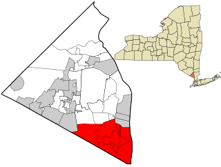
East Fishkill is a town on the southern border of Dutchess County, New York, United States. The population was 29,707 at the 2020 census. The town was once the eastern portion of the town of Fishkill.
Crawford is a town in the north of Orange County, New York, United States. The population was 9,130 at the 2020 census. The name comes from a settler who gave his name to a community in the hamlet now called Pine Bush.
Orangetown is a town in Rockland County, New York, United States, located in the southeastern part of the county. It is northwest of New York City, north of New Jersey, east of the town of Ramapo, south of the town of Clarkstown, and west of the Hudson River. The population was 48,655 at the 2020 census.
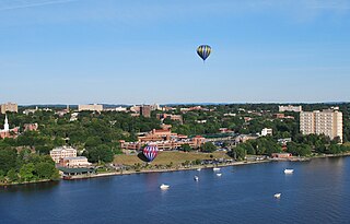
Poughkeepsie, officially the City of Poughkeepsie, which is separate from the Town of Poughkeepsie around it, is a city in the U.S. state of New York. It is the county seat of Dutchess County, with a 2020 census population of 31,577. Poughkeepsie is in the Hudson River Valley region, midway between the core of the New York metropolitan area and the state capital of Albany. It is a principal city of the Poughkeepsie–Newburgh–Middletown metropolitan area which belongs to the New York combined statistical area. It is served by the nearby Hudson Valley Regional Airport and Stewart International Airport in Orange County, New York.

Poughkeepsie, officially the Town of Poughkeepsie, is a town in Dutchess County, New York, United States. As of the 2020 United States Census, the population was 45,471. The name is derived from the native term Uppuqui meaning "lodge-covered", plus ipis meaning "little water", plus ing meaning "place", all of which translates to "the reed-covered lodge by the little water place", or Uppuqui-ipis-ing. This later evolved into Apokeepsing, then into Poughkeepsing, and finally Poughkeepsie.

Red Hook is a town in Dutchess County, New York, United States. The population was 9,953 at the time of the 2020 census, down from 11,319 in 2010. The name is supposedly derived from the red foliage on trees on a small strip of land on the Hudson River. The town contains two villages, Red Hook and Tivoli. The town is in the northwest part of Dutchess County.

Warwick is a town in the southwestern part of Orange County, New York, United States. Its population was 32,027 at the 2020 census. The town contains three villages and eight hamlets.
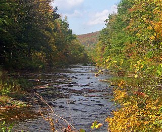
Rondout Creek is a 63.3-mile-long (101.9 km) tributary of the Hudson River in Ulster and Sullivan counties, New York, United States. It rises on Rocky Mountain in the eastern Catskills, flows south into Rondout Reservoir, part of New York City's water supply network, then into the valley between the Catskills and the Shawangunk Ridge, where it goes over High Falls and finally out to the Hudson at Kingston, receiving along the way the Wallkill River.

Anthony's Nose is a 900+ ft (270 m) peak in the Hudson Highlands along the east bank of the Hudson River in the hamlet of Cortlandt Manor, New York. It lies at the extreme northwest end of Westchester County, and serves as the east anchor of the Bear Mountain Bridge.

New York State Route 376 (NY 376) is a state highway located entirely within Dutchess County in the Hudson Valley region of New York in the United States. The route begins at an intersection with NY 52 in East Fishkill and passes north through Hopewell Junction and Red Oaks Mill on its way to the city of Poughkeepsie. It ends at a junction with U.S. Route 44 (US 44) and NY 55 east of the city limits in Arlington, a hamlet in the town of Poughkeepsie. NY 376 was originally designated as part of NY 39 in the mid-1920s. In the 1930 renumbering of state highways in New York, the East Fishkill–Poughkeepsie portion of NY 39 was renumbered to New York State Route 202. NY 202 was renumbered to NY 376 in 1935 to avoid numerical duplication with the new US 202.
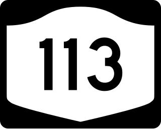
New York State Route 113 (NY 113) is an east–west state highway located southeast of the city of Poughkeepsie in Dutchess County, New York, in the United States. The western terminus of the route is at an intersection with U.S. Route 9 (US 9) in the town of Poughkeepsie. Its eastern terminus is at a junction with NY 376 in the Poughkeepsie hamlet of Red Oaks Mill. NY 113 is known as Spackenkill Road for the majority of its length.
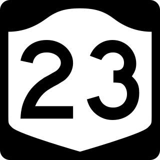
New York State Route 23 (NY 23) is an east–west state highway in the eastern portion of New York in the United States. It extends for 156.15 miles (251.30 km) from an intersection with NY 26 in the Central New York town of Cincinnatus in Cortland County to the Massachusetts state line in the Berkshire Mountains, where it continues east as that state's Route 23. Along the way, it passes through many communities, including the cities of Norwich and Oneonta. Outside of the communities, the route serves largely rural areas of the state and traverses the Catskill Mountains in the state's Central New York Region. NY 23 crosses the Hudson River at Catskill via the Rip Van Winkle Bridge.

Rhinecliff is a hamlet and census-designated place (CDP) located along the Hudson River in the town of Rhinebeck in northern Dutchess County, New York, United States. As of the 2010 census, the population of Rhinecliff was 425.

Eastview is a business district and former hamlet in Mount Pleasant, Westchester County, New York, United States, located approximately 25 miles north of Midtown Manhattan. It was primarily residential, and had a post office, railroad station, and school. In the late 1920s, John D. Rockefeller Jr. purchased most of the hamlet's property and razed the buildings. The Hammond House, a National Register of Historic Places-listed farmhouse dating to the 1720s, is located in the district, on New York State Route 100C. Currently, dozens of commercial buildings have been developed in the area. The community is now most prominently known as the global headquarters for Regeneron Pharmaceuticals, which moved into a newly constructed campus in 2014.
Grassy Point, was a hamlet on the west side of the Hudson River, in the Town of Stony Point in Rockland County, New York, United States. It was located north of West Haverstraw; east of Harriman State Park; south of Stony Point.

The Roeliff Jansen Kill is a major tributary to the Hudson River. Roeliff Jansen Kill was the traditional boundary between the Native American Mahican and Wappinger tribes.

