The Central Coast is a peri-urban region lying on the Pacific Ocean in northern-eastern New South Wales, Australia. The region is situated north of Sydney, which is filled with subtropical national parks, forests and also encompasses the major coastal waterways of Brisbane Water, Tuggerah Lakes and southern Lake Macquarie. The region's hinterland, which has fertile valleys, rural farmland and wineries, and also includes the Watagan Mountains. The Central Coast is known for its regional coastal towns like Terrigal, The Entrance, Ettalong Beach, Budgewoi and Bateau Bay with resorts and holiday parks, which feature many expansive beaches and lagoons with surfing and coastal tracks, as well as scenic views. Gosford is the main commercial hub and gateway.

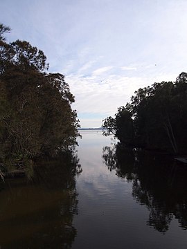
Tuggerah Lake, an intermittently open intermediate wave dominated barrier estuary that is part of the Tuggerah Lakes, is located within the Central Coast Council local government area in the Central Coast region of New South Wales, Australia. The lake is located near Wyong and is situated about 90 kilometres (56 mi) north of Sydney.

Wyong Shire was a local government area located in the Central Coast region of New South Wales, Australia. The incorporation of the Wyong area dates back to 7 March 1906 when the entire area of the Brisbane Water Police District outside of the Town of Gosford was proclaimed as the Erina Shire. From 1 January 1947, local government in the Central Coast region was reorganised, creating Gosford Shire and Wyong Shire, which comprised Erina Shire north and east of Kulnura, Central Mangrove and Lisarow.

The Division of Dobell is an Australian electoral division in the state of New South Wales.
Bateau Bay is a suburb of the Central Coast region of New South Wales, Australia. "Bateau" is French for "boat."

Wyong railway station is located on the Main Northern line in New South Wales, Australia. It serves the northern Central Coast town of Wyong.

Tuggerah railway station is located on the Main Northern line in New South Wales, Australia. It serves the northern Central Coast suburb of Tuggerah, opening in 1890. A pair of passing loops were added north of the station in 1948. These were removed in December 1995. The station was rebuilt in the 1990s.

Red Bus Services is an Australian bus company operating route bus services on the New South Wales Central Coast.
The Entrance is an electoral district of the Legislative Assembly located on the Central Coast of New South Wales, Australia.

Berkeley Vale is a suburb of the Central Coast region of New South Wales, Australia. Berkeley Vale is commuting distance from Sydney. It is part of the Central Coast Council local government area and part of the federal division of Dobell.

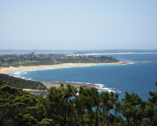
Budgewoi is a coastal town that is located on the Central Coast of New South Wales, Australia. Budgewoi is situated on two peninsulas that is split by the Budgewoi Lake. The town is located about 114 km northeast of Sydney. It is part of the Central Coast Council local government area.

Killarney Vale is a suburb of the Central Coast region of New South Wales, Australia, located approximately 5 kilometres south of The Entrance. It is part of the Central Coast Council local government area.
Kulnura is a rural suburb of the Central Coast region of New South Wales, Australia. It is located north of Mangrove Mountain along the George Downes Drive. Kulnura is located within the Central Coast Council local government area.
Yarramalong(cedar country) is a township and suburb of the Central Coast region of New South Wales, Australia, located 20 kilometres (12 mi) upstream from Wyong along the Wyong River. It is part of the Central Coast Council local government area.

Forresters Beach is a coastal suburb of the Central Coast region of New South Wales, Australia between Terrigal and Bateau Bay. It forms part of the Central Coast Council local government area. Forresters Beach's reef breaks are well known to surfers. Its name comes from Robert Forrester who purchased 50 acres (200,000 m2) of land in 1861.

Holgate is a semi-rural suburb on the Central Coast of the state of New South Wales, Australia. Holgate is located just north-east of Gosford. It is part of the Central Coast Council local government area.
Central Coast Highway is a 50-kilometre (31 mi) highway through the Central Coast region of New South Wales, Australia. It connects Pacific Motorway (M1) at Kariong with Pacific Highway (A43) at Doyalson. The highway was named after the region it goes through, to provide an easily identifiable route for visitors to the region, and is designated route A49.

The Central Coast Council is a local government area in the Central Coast region of New South Wales, Australia. It is adjacent to the Pacific Highway, Central Coast Highway, the Northern railway line and the Pacific Ocean. The council was formed on 12 May 2016 following the merger of the Gosford City and Wyong Shire Councils.
The Killarney Vale Australian Football Club, nicknamed the Bombers, is an Australian rules football club that competes in the AFL Hunter Central Coast competition. The club is based in the Central Coast suburb of Killarney Vale and plays its home games at Adelaide Street Oval, Tumbi Umbi.