Ramanathapuram, also known as Ramnad, is a town and a municipality in Ramanathapuram district in the Indian state of Tamil Nadu. It is the administrative headquarters of Ramanathapuram district and the second largest town in Ramanathapuram district.

Sivaganga is a city and headquarters of the Sivaganga district in the Indian state of Tamil Nadu. The city is located at a distance of 48 km (30 mi) from Madurai and 449 km from the state capital Chennai.
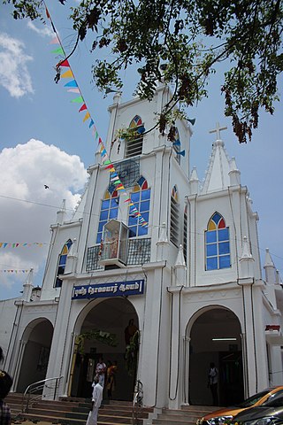
Kilakarai is a municipality in Ramanathapuram district in the Indian state of Tamil Nadu. As of 2011, the town had a population of 38,355. Kilakarai is one of the Taluka in Ramanathapuram District.
Paramakudi or Paramagudi is the largest town in the district of Ramanathapuram in Tamil Nadu, with a population of over 95,579. It has been the taluk headquarters since 1918, since the formation of Ramanathapuram District.

Tiruttani is a town in the Tiruvallur district, a suburb of Chennai within the Chennai Metropolitan Area, located in the state of Tamil Nadu, India. The town is renowned for the Tiruttani Murugan Temple, which is one of the Arupadaiveedu and is dedicated to Kartikeya (Murugan). Tiruttani was added to the Chennai Metropolitan Area in October 2022.
Nemili is a Taluk in Ranipet district of Tamil Nadu state, announced on 31 August 2015 by Tamil Nadu Chief minister Selvi J.Jayalalitha. This city, before becoming a separate taluk, it was a town panchyat under Arakkonam Taluk .This town is located in the Ranipet district about 72 kilometres from the state capital of Chennai. Nemili is supposedly one of the hottest towns in Tamil Nadu, where the temperature can exceed 43 °C (110 °F) for several days in peak of the summer. People of all religions are living in the city. The major businesses are farming, hand loom and power looms. Nemili itself is a panchayat town in Ranipet District in the Indian state of Tamil Nadu.
Ponnamaravathi is a town in Pudukkottai district in the Indian state of Tamil Nadu. The town holds the status of Taluk. It is located 37 km from the district headquarter Pudukkottai and 410 km from state capital Chennai.

Hosur is an industrial city located in Krishnagiri district in the Tamil Nadu state of India. Hosur is one of the 21 municipal corporations in Tamil Nadu. It is located on the bank of the river River Ponnaiyar, 40 kilometres (25 mi) southeast of Bengaluru and 306 kilometres (190 mi) west of Chennai, the state capital. Hosur is home to major manufacturing industries including Stellantis, Ashok Leyland, Titan, TVS Motors, Caterpillar, Ather Energy, Schaeffler, and many others.

Erwadi is a village in Ramanathapuram District, Tamil Nadu. It belongs to Kilakarai Taluk and town panchayat. The village is the location of the grave and shrine of Qutb-us-Sultan Syed Ibrahim Badshah Shaheed, a ruler of Medina. Erwadi also belongs to Kadaladi assembly constituency, which is a part of Ramanathapuram. After the delimitations in 2009, Erwadi was joined to the Ramanathapuram assembly constituency. Erwadi is the second largest contributor for the revenue of Ramanthapuram District.
Tirupathur taluk is a taluk in Tirupathur district of the Indian state of Tamil Nadu. The headquarters of the taluk is the town of Tirupathur. It is known as the "Sandalwood Town" due to the abundant availability of sandalwood trees in the surrounding hills. On 15 August 2019, Chief Minister of Tamil Nadu, Edapaadi K. Palanisami announced Tirupathur district, as a new district of Tamil Nadu.
Theriruveli is a village in the Ramanathapuram district of Tamil Nadu state in southern India. It is located near uthrakosamangai and belongs to the Mudukulathur Legislative Constituency. The economy is largely based on agriculture and sheep raising, and remittances from residents who have travelled abroad.
Muthuvijayapuram is a small village/hamlet located in Mudukulathur Block Ramanathapuram district of Tamil Nadu state in India. .It comes under Pirabakaloor Panchayat. It's located 25 km towards west from District headquarters Ramanathapuram.525 km from State capital chennai
Periyapattinam is a large village located in the eastern part of Ramanathapuram district, Tamil Nadu, India. The inhabitants of this village are primarily Tamil Muslim.
Athiyuthu is a village located 17 km(10 Miles) from the center of Ramanathapuram district, Tamil Nadu, India. It has some similar places nearby, such as Chittarkottai, Panaikulam, Pudhuvalasai Alagankulam and Aatrangarai.
Kansapuram is a village in the foothills of the Western Ghats in Virudhunagar District, Tamil Nadu, India. It is located 2 kilometres south of Koomapatti and 7 kilometres west of Watrap. Kansapuram has road connections to the district headquarters of Southern Tamil Nadu including Madurai, Virudhunagar, and Tirunelveli. Tourist attractions such as Courtallam, Madurai, Kodaikanal, and Tiruchendur are day trips from Kansapuram.

Alampattu is a village in the state of Tamil Nadu, Sivaganga District, India. It is 20 km from the town Karaikudi.
Sakkaramallur is an Indian village panchayat located in Arcot Taluk of Vellore District in the state of Tamil Nadu. Sakkaramallur is located on Right Bank of Palar River.
Kiladhari is a village in Tiruppuvanam taluk in Sivaganga district of Tamil Nadu state, India.
Karumbanoor is a village/hamlet in Alangulam Taluk in Tenkasi District of the Indian state of Tamil Nadu.
It comes under Andipatti Panchayath. It is located 23 km East of District headquarters Tenkasi. It is 12 km from Keelapavoor and 750 km from the state capital, Chennai. The Karumbanoor Pin code is 627851 and postal head office is Alangulam.
Karumbanoor is surrounded by Kadayam Taluk on the west, Keelapavoor Taluk on the North, Pappakudi Taluk on the South, Surandai Taluk on the North. Cities near to Karumbanoor are Alangulam, Surandai, Vikramasingapuram, Tenkasi, Shenkottai.

