Venustiano Carranza, Chiapas

Last updated
Venustiano Carranza
Venustiano Carranza en Chiapas.svg
Municipality of Venustiano Carranza in Chiapas
Mexico States blank map.svg
Red pog.svg
Venustiano Carranza
Location in Mexico
Coordinates: 16°19′46″N92°33′45″W / 16.32944°N 92.56250°W / 16.32944; -92.56250
CountryFlag of Mexico.svg  Mexico
State Chiapas
Area
  Total539.0 sq mi (1,396.1 km2)
Population
 (2010)
  Total61,341

Venustiano Carranza is a city and municipality in the Mexican state of Chiapas in southern Mexico.

As of 2010, the municipality had a total population of 61,341, [1] up from 52,833 as of 2005. [2] It covers an area of 1396.1 km².

As of 2010, the city of Venustiano Carranza had a population of 15,496. [1] Other than the city of Venustiano Carranza, the municipality had 436 localities, the largest of which (with 2010 populations in parentheses) were: San Francisco Pujiltic (7,137), Soyatitán (3,904), Ricardo Flores Magón (3,483), Aguacatenango (3,413), Presidente Echeverría (Laja Tendida) (3,084), classified as urban, and San Francisco (El Calvito) (2,409), Vicente Guerrero (1,997), Paraíso del Grijalva (1,930), Guadalupe Victoria (1,767), Mariano Matamoros (1,566), Miguel Hidalgo (1,178), and El Puerto (1,092), classified as rural. [1]

Related Research Articles

<span class="mw-page-title-main">Municipalities of Chiapas</span>

Chiapas is a state in Southwest Mexico. According to the 2020 Mexican Census, it has the eighth largest population of all states with 5,543,828 inhabitants and the 10th largest by land area spanning 73,560.47 square kilometres (28,401.86 sq mi). Chiapas is officially divided into 124 municipalities, although the establishment of municipal authorities in Belisario Domínguez was suspended in 2015 pending the resolution of a territorial dispute between Chiapas and the neighbouring state of Oaxaca. In 2021, the Mexican Supreme Court resolved this dispute in Oaxaca's favour, and annulled the 2011 decree that had created Belisario Domínguez.

<span class="mw-page-title-main">Mexicali Municipality</span> Municipality in Baja California, Mexico

Mexicali Municipality is a municipality in the Mexican state of Baja California. Its municipal seat is located in the city of Mexicali. As of 2020, the municipality had a total population of 1,049,792. The municipality has an area of 13,700 km2 (5,300 sq mi). This includes many smaller outlying communities as well as the city of Mexicali. Also, the islands of Baja California located in the Gulf of California are part of the municipality, among them the mudflat islands at the mouth of the Colorado River, Isla Ángel de la Guarda and the islands of the San Lorenzo Marine Archipelago National Park. Mexicali is the northernmost municipality of Latin America.

<span class="mw-page-title-main">Bella Vista Municipality</span> Municipality in Chiapas, Mexico

Bella Vista is a town and municipality in the Mexican state of Chiapas, in southern Mexico. It covers an area of 114.3 km2 and borders Guatemala.

<span class="mw-page-title-main">Cintalapa</span> Municipality in Chiapas, Mexico

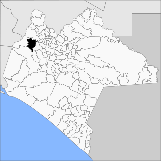
Cintalapa is a town and municipality in the Mexican state of Chiapas in southern Mexico. It covers an area of 2404.6 km².

<span class="mw-page-title-main">Chilón</span> Municipality in Chiapas, Mexico

Chilón is a town and municipality in the Mexican state of Chiapas in southern Mexico. It covers an area of 2490 km2.

<span class="mw-page-title-main">Huixtla</span> Municipality in Chiapas, Mexico

Huixtla is a town and municipality in the Mexican state of Chiapas in southern Mexico.

<span class="mw-page-title-main">La Independencia, Chiapas</span> Municipality in Chiapas, Mexico

La Independencia is a town and municipality in the Mexican state of Chiapas in southern Mexico.

<span class="mw-page-title-main">Francisco León, Chiapas</span> Municipality in Chiapas, Mexico

Francisco León is a municipality in the Mexican state of Chiapas. It covers an area of 114.3 km². In 1982 parts of the municipality were buried in the eruption of El Chichón Volcano.

<span class="mw-page-title-main">Escuintla, Chiapas</span> Municipality in Chiapas, Mexico

Escuintla is a town and municipality in the Mexican state of Chiapas, in southern Mexico. It covers an area of 206.2 km².

<span class="mw-page-title-main">Tecpatán</span> Municipality in Chiapas, Mexico

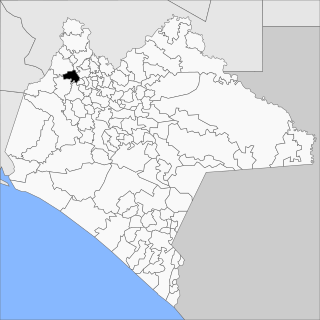
Tecpatán is a town and municipality in the Mexican state of Chiapas in southern Mexico.

<span class="mw-page-title-main">Ocotepec, Chiapas</span> Municipality in Chiapas, Mexico

Ocotepec is a town and municipality in the Mexican state of Chiapas in southern Mexico.

<span class="mw-page-title-main">Pantepec, Chiapas</span> Municipality in Chiapas, Mexico

Pantepec is a town and municipality in the Mexican state of Chiapas in southern Mexico. The Chiapas Zoque language is spoken in this municipality.

<span class="mw-page-title-main">Sabanilla</span> Municipality in Chiapas, Mexico

Sabanilla is a town and municipality in the Mexican state of Chiapas in southern Mexico.

<span class="mw-page-title-main">Pueblo Nuevo Solistahuacán</span> Municipality in Chiapas, Mexico

Pueblo Nuevo Solistahuacán is a town and municipality in the Mexican state of Chiapas in southern Mexico.

<span class="mw-page-title-main">San Fernando, Chiapas</span> Municipality in Chiapas, Mexico

San Fernando is a town and municipality in the Mexican state of Chiapas in southern Mexico.

<span class="mw-page-title-main">Soyaló</span> Municipality in Chiapas, Mexico

Soyaló is a town and municipality in the Mexican state of Chiapas in southern Mexico.

<span class="mw-page-title-main">Tapilula</span> Municipality in Chiapas, Mexico

Tapilula is a town and municipality in the Mexican state of Chiapas in southern Mexico.

<span class="mw-page-title-main">Villa Corzo</span> Municipality in Chiapas, Mexico

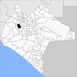
Villa Corzo is a city and municipality in the Mexican state of Chiapas in southern Mexico. The city of Villa Corzo (the municipal seat is located at
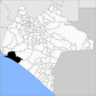
<span class="mw-page-title-main">Tonalá, Chiapas</span> Municipality in Chiapas, Mexico

Tonalá is a municipality in the Mexican state of Chiapas in southern Mexico.

Emiliano Zapata is a municipality in the Mexican state of Chiapas, located approximately 33 kilometres (21 mi) southeast of the state capital of Tuxtla Gutiérrez.

References

  1. 1 2 3 "Venustiano Carranza". Catálogo de Localidades. Secretaría de Desarrollo Social (SEDESOL). Retrieved 23 April 2014.
  2. "Venustiano Carranza". Enciclopedia de los Municipios de México. Instituto Nacional para el Federalismo y el Desarrollo Municipal Gobierno del Estado de Chiapas. Archived from the original on September 30, 2007. Retrieved July 27, 2008.