Vernon, New York

Last updated

Vernon
Oneida County New York incorporated and unincorporated areas Vernon (town) highlighted.svg
Location in Oneida County and the state of New York.
New York in United States (US48).svg
Location of New York in the United States
Coordinates: 43°4′47″N75°32′25″W / 43.07972°N 75.54028°W / 43.07972; -75.54028
CountryUnited States
State New York
County Oneida
Government
   Town Supervisor Myron J. Thurston (R)
  • Marcia A. Janowski (Ind.)
  • Eugene A. Bennati (R)
  • Michael G. McDonough (R)
  • J. Randall Watson (R)
Area
[1]
  Total37.84 sq mi (98.00 km2)
  Land37.83 sq mi (97.97 km2)
  Water0.01 sq mi (0.03 km2)
Population
 (2010)
  Total5,408
  Estimate 
(2016) [2]
5,371
  Density141.99/sq mi (54.82/km2)
Time zone EST
  Summer (DST) EDT
FIPS code 36-065-77123
Website Town website

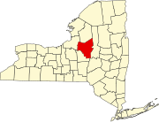
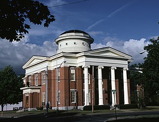
Vernon is a town in Oneida County, New York, United States. The population was 5,408 at the 2010 census.

Contents

The Town of Vernon is on the western border of the county. The town contains a village, also named Vernon.

History

The first European settler was Josiah Bushnell, from Berkshire County, Massachusetts, who came in 1794. [3]

The town was formed in 1802 from parts of the Towns of Augusta and Westmoreland.

Vernon was part of the original Oneida Reservation. In 1859, a remnant group of Oneida people lived in the southwestern part of the town. [3]

In 1920, the population of the Town of Vernon was 4,522.

Geography

According to the United States Census Bureau, the town has a total area of 38.1 square miles (98.7 km2), all land.

Skanandoa Creek ("hemlock", or "stream of hemlocks"), was named after the famous Skenandoa. It flows through the eastern section of town. [3]

The western town line is the border of Madison County and is formed by the Oneida Creek. [3]

Demographics

Historical population
CensusPop.Note
1810 1,519
1820 2,70778.2%
1830 3,04512.5%
1840 3,043−0.1%
1850 3,68921.2%
1860 2,968−19.5%
1870 2,840−4.3%
1880 3,0567.6%
1890 3,016−1.3%
1900 2,784−7.7%
1910 3,19714.8%
1920 4,52241.4%
1930 4,8547.3%
1940 5,1245.6%
1950 5,3975.3%
1960 7,14632.4%
1970 4,871−31.8%
1980 5,3549.9%
1990 5,338−0.3%
2000 5,329−0.2%
2010 5,4081.5%
2016 (est.)5,371 [2] −0.7%
U.S. Decennial Census [4]

As of the census [5] of 2000, there were 5,335 people, 2,112 households, and 1,484 families residing in the town. The population density was 139.9 inhabitants per square mile (54.0/km2). There were 2,266 housing units at an average density of 59.4 per square mile (22.9/km2). The racial makeup of the town was 97.94% White, 0.43% Black or African American, 0.41% Native American, 0.39% Asian, 0.07% from other races, and 0.75% from two or more races. Hispanic or Latino of any race were 0.69% of the population.

There were 2,112 households, out of which 32.9% had children under the age of 18 living with them, 54.6% were married couples living together, 10.5% had a female householder with no husband present, and 29.7% were non-families. 24.0% of all households were made up of individuals, and 8.3% had someone living alone who was 65 years of age or older. The average household size was 2.51 and the average family size was 2.98.

In the town, the population was spread out, with 26.1% under the age of 18, 7.1% from 18 to 24, 28.7% from 25 to 44, 24.6% from 45 to 64, and 13.6% who were 65 years of age or older. The median age was 38 years. For every 100 females, there were 97.5 males. For every 100 females age 18 and over, there were 94.4 males.

The median income for a household in the town was $38,339, and the median income for a family was $44,951. Males had a median income of $32,848 versus $24,076 for females. The per capita income for the town was $19,523. About 7.6% of families and 9.8% of the population were below the poverty line, including 15.6% of those under age 18 and 7.7% of those age 65 or over.

Communities and locations in the Town of Vernon

Education

Vernon-Verona-Sherrill Central School District operates area schools.

W.A. Wettel Elementary School is in Vernon. [6] and the E.A. Mcallister Elementary School is in Sherrill. The area secondary schools are Vernon-Verona-Sherrill Middle School and Vernon-Verona-Sherrill High School.

Related Research Articles

<span class="mw-page-title-main">Oneida County, New York</span> County in New York, United States

Oneida County is a county in the state of New York, United States. As of February 26, 2024, the population was 226,654. The county seat is Utica. The name is in honor of the Oneida, one of the Five Nations of the Iroquois League or Haudenosaunee, which had long occupied this territory at the time of European encounter and colonization. The federally recognized Oneida Indian Nation has had a reservation in the region since the late 18th century, after the American Revolutionary War.
<span class="mw-page-title-main">Byron, New York</span> Town in New York, United States

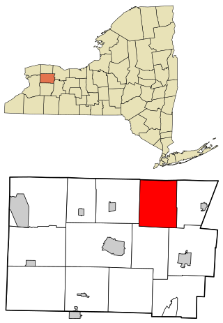
Byron is a town in Genesee County, New York, United States. The town is named after a famous poet, Lord Byron. It on the northern border of the county, and lies northeast of the city of Batavia. The population was 2,369 at the 2010 census. The local school district, Byron-Bergen Central School District, is shared with the town of Bergen.

Lenox is a town in Madison County, New York, United States. The population was 8,768 as of the 2020 census.

Wampsville is a village located inside the Town of Lenox in Madison County, New York, United States. The population was 543 as of the 2010 census. It is the county seat of Madison County.

<span class="mw-page-title-main">Oneida Castle, New York</span> Village in Oneida County, New York, US

Oneida Castle is a village in Oneida County, New York, United States. The population was 625 at the 2010 census.
<span class="mw-page-title-main">Sherrill, New York</span> City in New York, United States

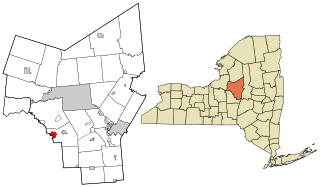
Sherrill is a city in Oneida County, New York, United States. With a population of 3,077, it is the state's least populous city. Sherrill is at the western end of the Town of Vernon on Route 5. Sherrill is referred to as The Silver City.

<span class="mw-page-title-main">Steuben, New York</span> Town in Oneida County, New York, US

Steuben is a town in Oneida County, New York, United States. The population was 1,110 at the 2010 census. The town is named after Baron von Steuben, a Prussian general who fought on the American side in the American Revolutionary War.

<span class="mw-page-title-main">Verona, New York</span> Town in New York, United States

Verona is a town in southwestern Oneida County, New York, United States. The population was 6,293 at the 2010 census. The town was named after Verona, Italy.

<span class="mw-page-title-main">Vienna, New York</span> Town in New York, United States

Vienna is a town in Oneida County, New York, United States. The population was 5,440 at the 2010 census. The town is named after the capital of Austria.

<span class="mw-page-title-main">Westmoreland, New York</span> Town in New York, United States

Westmoreland is a town in Oneida County, New York, United States. The population was 6,138 at the 2010 census.

<span class="mw-page-title-main">Whitesboro, New York</span> Village in New York, United States

Whitesboro is a village in Oneida County, New York, United States. The population was 3,772 at the 2010 census. The village is named after Hugh White, an early settler.

<span class="mw-page-title-main">Cleveland, New York</span> Village in New York, United States

Cleveland is a village in Oswego County, New York, United States. The population was 750 at the 2010 census. The village is located at the eastern boundary of the town of Constantia on NY Route 49.

<span class="mw-page-title-main">Hastings, New York</span> Town in New York, United States

Hastings is a town in Oswego County, New York, United States. Its population was 9,450 at the 2010 census. It is named after Hastings Curtiss, a prominent citizen and member of the State Assembly in 1824.

<span class="mw-page-title-main">Oak Grove, Kaufman County, Texas</span> Town in Texas, United States

Oak Grove is a town in Kaufman County, Texas, United States. The population was 603 at the 2010 census.

<span class="mw-page-title-main">Brewerton, New York</span> Census-designated place in New York, United States

Brewerton is a census-designated place (CDP) in the town of Cicero in Onondaga County and the town of Hastings in Oswego County in the U.S. state of New York. It lies at the west end of Oneida Lake at its outlet into the Oneida River. The population was 4,549 at the 2020 census. Maps of the 19th century indicate that this area was once known as Fort Brewerton, while Brewerton meant the Cicero portion.

<span class="mw-page-title-main">Camden, New York</span> Town in New York, United States

Camden is a town in Oneida County, New York, United States. The population was 4,934 at the 2010 census.

<span class="mw-page-title-main">Remsen (village), New York</span> Village in New York, United States

Remsen is a village in Oneida County, New York, United States. The population was 431 at the 2020 census.

<span class="mw-page-title-main">Vernon (village), New York</span> Village in New York, United States

Vernon is a village in Oneida County, New York, United States. The population was 1,172 at the 2010 census.

<span class="mw-page-title-main">Utica–Rome metropolitan area</span> Metropolitan Statistical Area in New York, United States

The Utica–Rome Metropolitan Statistical Area, as defined by the United States Census Bureau, is an area consisting of two counties in Central New York anchored by the cities of Utica and Rome. As of the 2020 census, the MSA had a population of 292,264.

Vernon-Verona-Sherrill Central School District is a school district in Verona, New York.

References

  1. "2016 U.S. Gazetteer Files". United States Census Bureau. Retrieved July 5, 2017.
  2. 1 2 "Population and Housing Unit Estimates" . Retrieved June 9, 2017.
  3. 1 2 3 4 Child, Hamilton (1869). Gazetteer and business directory of Oneida County. Syracuse, NY: Printed at the Journal office. p. 113.
  4. "Census of Population and Housing". Census.gov. Retrieved June 4, 2015.
  5. "U.S. Census website". United States Census Bureau . Retrieved January 31, 2008.
  6. Home. W.A. Wettel Elementary School. Retrieved on December 11, 2018.

43°4′47″N75°32′25″W / 43.07972°N 75.54028°W / 43.07972; -75.54028