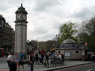
Clapham is a district in south London, England, lying mostly within the London Borough of Lambeth, but with some areas extending into the neighbouring London Borough of Wandsworth.

Wandsworth is a London borough in southwest London; it forms part of Inner London and has an estimated population of 329,677 inhabitants. Its main settlements are Battersea, Putney, Tooting and Wandsworth Town.

Lambeth is a London borough in South London, England, which forms part of Inner London. Its name was recorded in 1062 as Lambehitha and in 1255 as Lambeth. The geographical centre of London is at Frazier Street near Lambeth North tube station, though nearby Charing Cross on the other side of the Thames in the City of Westminster is traditionally considered the centre of London.

The Metropolitan Borough of Wandsworth was a Metropolitan borough under the London County Council, from 1900 to 1965.

Lambeth was a civil parish and metropolitan borough in south London, England. It was an ancient parish in the county of Surrey. The parish was included in the area of responsibility of the Metropolitan Board of Works in 1855 and became part of the County of London in 1889. The parish of Lambeth became a metropolitan borough in 1900, following the London Government Act 1899, with the parish vestry replaced by a borough council.

Hampstead was a civil parish and metropolitan borough in London, England. It was an ancient parish in the county of Middlesex, governed by an administrative vestry. The parish was included in the area of responsibility of the Metropolitan Board of Works in 1855 and became part of the County of London in 1889. The parish of Hampstead became a metropolitan borough in 1900, following the London Government Act 1899, with the parish vestry replaced by a borough council. In 1965 the borough was abolished and its former area became part of the London Borough of Camden in Greater London.

Hammersmith was a civil parish and metropolitan borough in London, England. It was formed as a civil parish in 1834 from the chapelry of Hammersmith that had existed in the ancient parish of Fulham, Middlesex since 1631. The parish was grouped with Fulham as the Fulham District from 1855 until 1886, when separate parish administration was restored. In 1889 it became part of the County of London and in 1900 it became a metropolitan borough. It included Hammersmith, Wormwood Scrubs, Old Oak Common and Shepherd's Bush. In 1965 it was abolished and became the northern part of the London Borough of Hammersmith, since 1979 renamed the London Borough of Hammersmith and Fulham.

Battersea was a civil parish and metropolitan borough in the County of London, England. In 1965, the borough was abolished and its area combined with parts of the Metropolitan Borough of Wandsworth to form the London Borough of Wandsworth. The borough was administered from Battersea Town Hall on Lavender Hill. That building is now Battersea Arts Centre.

Poplar was a local government district in the metropolitan area of London, England. It was formed as a district of the Metropolis in 1855 and became a metropolitan borough in the County of London in 1900. It comprised Poplar, Millwall, Bromley-by-Bow and Bow.

Penge was a civil parish and a local government district located to the southeast of London, England. It included the settlements of Penge, Anerley and part of Crystal Palace. It was part of the London postal district, Metropolitan Police District and, from 1933, the London Passenger Transport Area. In 1965 the urban district was abolished by the London Government Act 1963 and it became part of Greater London, being combined with other districts to form the London Borough of Bromley.

The London Government Act 1899 was an Act of the Parliament of the United Kingdom that reformed the administration of the capital. The Act divided the County of London into 28 metropolitan boroughs, replacing the 41 parish vestries and District Boards of Works administering the area. The legislation also transferred a few powers from the London County Council to the boroughs, and removed a number of boundary anomalies. The first elections to the new boroughs were held on 1 November 1900.
Bermondsey was a parish in the metropolitan area of London, England.

Brixton Hundred or the Hundred of Brixton was for many centuries a group of parishes (hundred) used for meetings and taxation of their respective great estates in the north east of the county of Surrey, England. Its area has been entirely absorbed by the growth of London; with its name currently referring to the Brixton district. Its area corresponds to London Boroughs: Southwark, Lambeth, Wandsworth and parts of Lewisham, Merton and Richmond upon Thames.

Lambeth London Borough Council is the local authority for the London Borough of Lambeth in Greater London, England. It is a London borough council, and one of the 32 in the United Kingdom capital of London. The council meets at Lambeth Town Hall in Brixton. Lambeth is divided into 25 wards: thirteen are represented by 3 councillors and twelve are represented by 2. The council was first elected in 1964.
Plumstead (1855–1894) and then Lee (1894–1900) was a local government district within the metropolitan area of London from 1855 to 1900. It was formed as the Plumstead district by the Metropolis Management Act 1855 and was governed by the Plumstead District Board of Works, which consisted of elected vestrymen.
Lewisham was a local government district within the metropolitan area of London, England from 1855 to 1900. It was formed by the Metropolis Management Act 1855 and was governed by the Lewisham District Board of Works, which consisted of elected vestrymen.

Greenwich was a local government district within the metropolitan area of London, England from 1855 to 1900. It was formed by the Metropolis Management Act 1855 and was governed by the Greenwich District Board of Works, which consisted of elected vestrymen.
Fulham was a local government district within the metropolitan area of London, England from 1855 to 1886. It was formed by the Metropolis Management Act 1855 and was governed by the Fulham District Board of Works, which consisted of elected vestrymen. It was in the part of the county of Middlesex that was within the area of the Metropolitan Board of Works. It occupied broadly the same area as ancient parish of Fulham and that of the current London Borough of Hammersmith and Fulham.
Hackney was a local government district within the metropolitan area of London, England from 1855 to 1894. It was formed by the Metropolis Management Act 1855 and was governed by the Hackney District Board of Works, which consisted of elected vestrymen. It was in the part of the county of Middlesex that was within the area of the Metropolitan Board of Works. In 1889 it became part of the County of London and the district board functioned as a local authority under the London County Council.
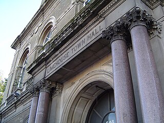
Limehouse was a local government district within the metropolitan area of London, England from 1855 to 1900.

