Metropolitan Borough of Bethnal Green

Last updated

Bethnal Green
Former Town Hall, Cambridge Heath Road.jpg
Metropolitan Borough of Bethnal Green.svg
Bethnal Green within the County of London
Area
  1911/1961759 acres (3.07 km2)
  1931760 acres (3.1 km2)
Population
  1911128,183
  1931108,194
  196147,078
Density
  1911169/acre
  1931142/acre
  196162/acre
History
  OriginHamlet in parish of Stepney
  Created1743
  Abolished1965
  Succeeded by London Borough of Tower Hamlets
Status Civil parish (1743–1965)
Poor law parish (1834–1930)
Metropolitan borough (1900–1965)
GovernmentVestry of the Parish of Bethnal Green (1743–1900)
Bethnal Green Borough Council (1900–1965)
   HQ Patriot Square
Seal bgreen.png
Borough seal
Metropolitan Borough of Bethnal Green Map of borough boundary

Bethnal Green was a civil parish and a metropolitan borough of the County of London between 1899 and 1965, when it was merged with the Metropolitan Borough of Stepney and the Metropolitan Borough of Poplar to form the London Borough of Tower Hamlets.

Contents

It was formed as a civil parish in 1743 from the Bethnal Green hamlet in Stepney ancient parish, [1] and the church of St Matthew, Bethnal Green, was dedicated in 1746. [2]

The vestry became an electing authority to the Metropolitan Board of Works in 1855 and in 1889 it became part of the County of London. In the 1900 reform of local government caused by the London Government Act 1899 the parish became a metropolitan borough which bordered Hackney, Poplar, Stepney and Shoreditch. In 1965 it was abolished and merged into the London Borough of Tower Hamlets.

Origins

1848 map of the parish of Bethnal Green Parish of Bethnal Green 1848.gif
1848 map of the parish of Bethnal Green

Until 1743 Bethnal Green formed a hamlet within the large parish of Stepney. [1] By the 17th century the settlement had achieved a measure of self-government, with its own overseer, constable and beadle. [3] It remained a rural area until the beginning of the 18th century, when the expansion of suburban London saw the development of the Brick Lane area in the south west of the hamlet. [4] The population rapidly increased and in 1743 an act of parliament, the Bethnal Green Parish Act 1742 (16 Geo. 2. c. 28), constituted Bethnal Green as a separate parish. [5] [6]

As well as forming a parish for ecclesiastical purposes, Bethnal Green was also created a civil parish with responsibility for relief of the poor and maintenance of highways. The government of the parish was shared by a vestry, governors of the poor and two separate bodies of trustees. A further board of paving and lighting commissioners were established in 1843. [3]

In 1855 the parish was included within the area of the Metropolitan Board of Works to which it nominated one member and the various local government bodies were replaced by a single incorporated vestry which consisted of 48 elected vestrymen. [3]

Under the Metropolis Management Act 1855 any parish that exceeded 2,000 ratepayers was to be divided into wards; as such the incorporated vestry of St Matthew Bethnal Green was divided into four wards (electing vestrymen): No. 1 or East (9), No. 2 or North (9), No. 3 or West (15) and No. 4 or South (15). [3] [7] [8]

In 1889 the Metropolitan Board was replaced by the London County Council, and Bethnal Green was formally removed from Middlesex to the new County of London.

Ecclesiastical parish

Bethnal Green was part of the ancient parish of St Dunstan's, Stepney, in the Diocese of London; in 1743 the area was split off to form a new parish dedicated to St Matthew. [9] From 1837, as the population of Bethnal Green increased, a number of new parishes were formed: [10]

In addition, as the population increased, western parts of Bethnal Green were transferred into neighbouring Shoreditch as the new parish of Holy Trinity, Shoreditch, in 1866.

Creation of the borough

Under the London Government Act 1899 the various vestries and district boards within the County of London were abolished and replaced by metropolitan borough councils. Accordingly, in 1900, a borough council consisting of a mayor, five aldermen and 30 councillors replaced the vestry. The boundaries of the borough and parish were realigned at the same time. [3]

Bethnal Green Town Hall in Patriot Square was opened in 1910, and extended in 1936–9. The architects were Percy Robinson and William Alban Jones. [3] [11] In 2010 the building was reopened as a hotel; much of the original art deco interior has been retained. [12]

Borough seal

The borough seal depicted a scene based on The Beggar's Daughter of Bednall Green, a poem in Percy’s Reliques of Ancient English Poetry , published in 1765, but probably dating from the era of Elizabeth I. [13] According to the legend related in the poem, a blind beggar living in Bethnal Green was in fact Henry de Montfort, eldest son of Simon de Montfort, having escaped from the field of the Battle of Evesham in 1265. His identity was revealed at the wedding feast of his daughter Bessie. [14] A depiction of the beggar had appeared on the head of the beadle's staff dating from 1690. [15] [16]

Politics

A map showing the wards of Bethnal Green Metropolitan Borough as they appeared in 1916. Bethnal Green Met. B Ward Map 1916.svg
A map showing the wards of Bethnal Green Metropolitan Borough as they appeared in 1916.

In the first election to the borough council, held on 1 November 1900 the Progressives gained a majority, with 22 of the 30 councillors. The Moderates (supported by the Conservative Party) formed the 8 member opposition group. The Progressives increased their majority to 24 at the 1903 elections, and in 1906 they won all the seats on the council. The Progressives held the council against the Municipal Reform Party until 1919 when the Labour Party gained a majority. Progressives and Liberals regained control at the 1928 election, holding power until 1934.

In 1934, Labour again took control, and from that date held all the seats on the council until the borough's abolition. [17]

For parliamentary elections, Bethnal Green was divided into two constituencies in 1885. Each consisted of two wards of the borough and earlier vestry:

In 1950, the borough's representation was decreased to a single constituency of Bethnal Green, which in 1955 was expanded to also include three wards from the neighbouring Metropolitan Borough of Hackney.

Population and area

The area of the borough was 760 acres (3.1 km2). It included the districts now known as Bethnal Green, Cambridge Heath, Bow, Whitechapel and Shoreditch, stretching to include part of the Boundary Estate in the west and parts of Mile End Park and Victoria Park in the east. In the south its boundary stopped just short of The Blind Beggar pub on Whitechapel Road. The populations recorded in National Censuses were:

Bethnal Green Vestry 1801-1899

Year [18] 1801181118211831184118511861187118811891
Population22,31033,61945,67662,01874,08890,193105,101120,104126,961129,132

Metropolitan Borough 1900-1961

Year [19] 1901191119211931194119511961
Population129,680128,183117,238108,194 [20] 58,35347,078

Second World War

During World War II, the Borough suffered from heavy aerial bombing. It is estimated that 80 tons of bombs fell on this area alone, affecting 21,700 houses, destroying 2,233 and making a further 893 uninhabitable. During the course of the aerial bombardment, 555 people were killed, and 400 were seriously injured. [21]

Related Research Articles

<span class="mw-page-title-main">Bethnal Green</span> Human settlement in England

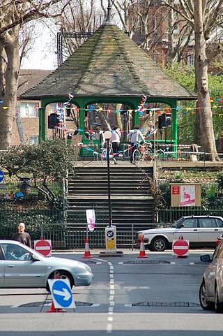
Bethnal Green is an area in London, England and is located in the London Borough of Tower Hamlets. It is in east London and part of the East End. The area emerged from the small settlement which developed around the Green, much of which survives today as Bethnal Green Gardens, beside Cambridge Heath Road. By the 16th century the term applied to a wider rural area, the Hamlet of Bethnal Green, which subsequently became a Parish, then a Metropolitan Borough before merging with neighbouring areas to become the north-western part of the new Tower Hamlets.

<span class="mw-page-title-main">Stepney</span> Human settlement in England

Stepney is an area in London, England and is located in the London Borough of Tower Hamlets. It is in East London and part of the East End. Stepney is no longer officially defined, and is usually used to refer to a relatively small area. However, for much of its history the place name applied to a much larger manor and parish. Stepney Green is a remnant of a larger area of Common Land formerly known as Mile End Green.

<span class="mw-page-title-main">County of London</span> County of England between 1889 and 1965

The County of London was a county of England from 1889 to 1965, corresponding to the area known today as Inner London. It was created as part of the general introduction of elected county government in England, by way of the Local Government Act 1888. The Act created an administrative County of London, which included within its territory the City of London. However, the City of London and the County of London formed separate ceremonial counties for "non-administrative" purposes. The local authority for the county was the London County Council (LCC), which initially performed only a limited range of functions, but gained further powers during its 76-year existence. The LCC provided very few services within the City of London, where the ancient Corporation monopolised local governance. In 1900, the lower-tier civil parishes and district boards were replaced with 28 new metropolitan boroughs. The territory of the county was 74,903 acres (303.12 km2) in 1961. During its existence, there was a long-term decline in population as more residents moved into the outer suburbs; there were periodic reviews of the local government structures in the greater London area and several failed attempts to expand the boundaries of the county. In 1965, the London Government Act 1963 replaced the county with the much larger Greater London administrative area.

<span class="mw-page-title-main">Metropolitan Borough of Islington</span> Former local authority of London, England

Islington was a civil parish and metropolitan borough in London, England. It was an ancient parish within the county of Middlesex, and formed part of The Metropolis from 1855. The parish was transferred to the County of London in 1889 and became a metropolitan borough in 1900. It was amalgamated with the Metropolitan Borough of Finsbury to form the London Borough of Islington in Greater London in 1965.

<span class="mw-page-title-main">Spitalfields</span> Area of London

Spitalfields is an area in London, England and is located in the London Borough of Tower Hamlets. It is in East London and situated in the East End. Spitalfields is formed around Commercial Street and Brick Lane. It has several markets, including Spitalfields Market, the historic Old Spitalfields Market, Brick Lane Market and Petticoat Lane Market. The area has a long attracted migrants from overseas, including many Jews, whose presence gained the area the 19th century nickname of Little Jerusalem.

<span class="mw-page-title-main">Metropolitan Borough of Chelsea</span> Former borough of London

The Metropolitan Borough of Chelsea was a metropolitan borough of the County of London between 1900 and 1965. It was created by the London Government Act 1899 from most of the ancient parish of Chelsea. Following the London Government Act 1963, it was amalgamated with the Royal Borough of Kensington in 1965 to form the Royal Borough of Kensington and Chelsea.

<span class="mw-page-title-main">Metropolitan Borough of Hackney</span>

The Metropolitan Borough of Hackney was a metropolitan borough of the County of London from 1900 to 1965. Its area became part of the London Borough of Hackney.

<span class="mw-page-title-main">Metropolitan Borough of Poplar</span> Former metropolitan borough of the County of London, in the United Kingdom

Poplar was a local government district in the metropolitan area of London, England. It was formed as a district of the Metropolis in 1855 and became a metropolitan borough in the County of London in 1900. It comprised Poplar, Millwall, Bromley-by-Bow and Bow as well as Old Ford, Fish Island and Cubitt Town.

<span class="mw-page-title-main">Metropolitan Borough of Stoke Newington</span> Former London borough, United Kingdom

The Metropolitan Borough of Stoke Newington was a metropolitan borough in the County of London between 1900 and 1965 when it became part of the London Borough of Hackney.

<span class="mw-page-title-main">Metropolitan Borough of Shoreditch</span>

The Metropolitan Borough of Shoreditch was a metropolitan borough of the County of London between 1899 and 1965, when it was merged with the Metropolitan Borough of Stoke Newington and the Metropolitan Borough of Hackney to form the London Borough of Hackney.

<span class="mw-page-title-main">Bow, London</span> Human settlement in England

Bow is an area of east London, England, within the London Borough of Tower Hamlets, 4.6 miles (7.4 km) east of Charing Cross.

Shoreditch (St Leonard) was an ancient parish in the county of Middlesex. It was both a civil parish, used for administrative purposes, and an ecclesiastical parish of the Church of England. The parish church is St Leonard's, Shoreditch, often simply called "Shoreditch Church".

<span class="mw-page-title-main">Hackney (parish)</span>

Hackney was a parish in the historic county of Middlesex. The parish church of St John-at-Hackney was built in 1789, replacing the nearby former 16th-century parish church dedicated to St Augustine. The original tower of that church was retained to hold the bells until the new church could be strengthened; the bells were finally removed to the new St John's in 1854. See details of other, more modern, churches within the original parish boundaries below.

<span class="mw-page-title-main">Boundary Estate</span> Housing estate in the London Borough of Tower Hamlets, England.

The Boundary Estate is a housing development in the London Borough of Tower Hamlets, in the East End of London.

<span class="mw-page-title-main">Westminster St James</span> United Kingdom legislation

Westminster St James was a civil parish in the metropolitan area of London, England. The creation of the parish followed the building of the Church of St James, Piccadilly, in 1684. After several failed attempts, the parish was formed in 1685 from part of the ancient parish of St Martin in the Fields in the Liberty of Westminster and county of Middlesex. It included part of the West End of London, taking in sections of Soho, Mayfair and St James's. Civil parish administration was in the hands of a select vestry until the parish adopted the Vestries Act 1831. The vestry was reformed again in 1855 by the Metropolis Management Act. In 1889 the parish became part of the County of London and the vestry was abolished in 1900, replaced by Westminster City Council. The parish continued to have nominal existence until 1922.

Hackney was a local government district within the metropolitan area of London, England from 1855 to 1894. It was formed by the Metropolis Management Act 1855 and was governed by the Hackney District Board of Works, which consisted of elected vestrymen. It was in the part of the county of Middlesex that was within the area of the Metropolitan Board of Works. In 1889 it became part of the County of London and the district board functioned as a local authority under the London County Council.

<span class="mw-page-title-main">Liberty of Norton Folgate</span>

Norton Folgate was a liberty in Middlesex, England; adjacent to the City of London in what would become the East End of London.

<span class="mw-page-title-main">Stepney (parish)</span>

Stepney was an ancient civil and ecclesiastical parish in the historic county of Middlesex to the east and north east of the City of London, England.

<span class="mw-page-title-main">St George in the East (parish)</span>

St George in the East, historically known as Wapping-Stepney, was an ancient parish, in the London Borough of Tower Hamlets, England. The place name is no longer widely used.

<span class="mw-page-title-main">Bethnal Green Town Hall</span> Municipal building in London, England

Bethnal Green Town Hall is a former municipal building on the corner of Cambridge Heath Road and Patriot Square in Bethnal Green, London. It is a Grade II listed building.

References

  1. 1 2 T F T Baker, ed. (1998). "Bethnal Green - Introduction". A History of the County of Middlesex: Volume 11: Stepney, Bethnal Green. British History Online. Retrieved 13 August 2010.
  2. "History of the Church". St Matthew's Church, Bethnal Green. Retrieved 11 January 2013.
  3. 1 2 3 4 5 6 "Bethnal Green - Local Government". A History of the County of Middlesex: Volume 11: Stepney, Bethnal Green. 1998. pp. 190–202. Retrieved 13 August 2010.
  4. Pevsner, Nikolaus (1952). London except the Cities of London and Westminster. The Buildings of England. Harmondsworth: Penguin Books. pp. 65–66.
  5. Youngs, Frederic A Jr. (1979). Guide to the Local Administrative Units of England, Vol.I: Southern England. London: Royal Historical Society. p. 316. ISBN   0-901050-67-9.
  6. An Act to make Hamlet of Bethnal Green a Separate Parish 16 Geo. 2. c. 28
  7. The London Gazette Issue: 21802. 20 October 1855. pp. 3881–3882. Retrieved 9 April 2015.
  8. "H.M.S.O. Boundary Commission Report 1885 Bethnal Green Map". Vision of Britain. Retrieved 9 April 2015.
  9. "'Bethnal Green: The Parish Church', A History of the County of Middlesex: Volume 11: Stepney, Bethnal Green". 1998. pp. 212–217. Retrieved 3 March 2014.
  10. "'Bethnal Green: List of Churches', A History of the County of Middlesex: Volume 11: Stepney, Bethnal Green". 1998. pp. 217–226. Retrieved 13 March 2014.
  11. T.F.T. Baker, ed. (1998). "Bethnal Green: Local Government". A History of the County of Middlesex: Volume 11: Stepney, Bethnal Green. Victoria County History. pp. 190–202. Retrieved 8 April 2013.
  12. "Town Hall Hotel & Apartments". Design Hotels. Retrieved 8 April 2013.
  13. Robinson, A. J.; Chesshyre, D. H. B. (1986). The Green: a history of the heart of Bethnal Green and the legend of the Blind Beggar (2nd ed.). London: London Borough of Tower Hamlets. p. 31. ISBN   0-902385-13-5.
  14. Blind Beggar of Bethnal Green (East London History) Archived 2019-08-28 at the Wayback Machine accessed 3 Dec 2007
  15. Beningfield, T J (1964). London 1900-1964. Armorial Bearings and Regalia of The London County Council, The Corporation of London and The Metropolitan Boroughs. London: E J Burrow. pp. 49–50.
  16. Crosley, Richard (1928). London's Coats of Arms and The Stories They Tell. London: Robert Scott. pp. 46–49.
  17. Election results as reported in The Times, 3 November 1900; 4 November 1903; 3 November 1906; 2 November 1909; 2 November 1912; 4 November 1919; 4 November 1925; 3 November 1928; 4 November 1931; 3 November 1934; 3 November 1937; 2 November 1945; 7 May 1949; 7 May 1953; 11 May 1956; 8 May 1959; 12 May 1962
  18. Statistical Abstract for London, 1901 (Vol. IV).
  19. Bethnal Green MetB: Census Tables at Vision of Britain accessed on 14 Dec 2006
  20. The census was suspended for World War II
  21. Bethnal Green: Building and Social Conditions from 1915 to 1945, A History of the County of Middlesex: Volume 11: Stepney, Bethnal Green (1998), pp. 132–135

Further reading

51°31′49″N0°03′18″W / 51.5302°N 0.0551°W / 51.5302; -0.0551