Metropolitan Borough of Islington

Last updated

Islington
St Mary
IslingtonTownHall.jpg
Metropolitan Borough of Islington.svg
Islington within the County of London
Population
  1961235,632
History
  OriginAncient parish
  Abolished1965
  Succeeded by London Borough of Islington
Status Civil parish (until 1965)
Metropolitan borough (1900–1965)
GovernmentVestry of the Parish of Islington (until 1900)
Islington Borough Council (1900–1965)
   HQ Town Hall, Upper Street (1923–1965)
   Motto Deus Per Omnia (God pervades all things)
Arms-islington.jpg
Coat of arms of the borough council
Metropolitan Borough of Islington Map of borough boundary
Coat of arms shown affixed to Orwell Court, municipal housing in Petherton Road Islington Arms.JPG
Coat of arms shown affixed to Orwell Court, municipal housing in Petherton Road

Islington was a civil parish and metropolitan borough in London, England. It was an ancient parish within the county of Middlesex, and formed part of The Metropolis from 1855. The parish was transferred to the County of London in 1889 and became a metropolitan borough in 1900. It was amalgamated with the Metropolitan Borough of Finsbury to form the London Borough of Islington in Greater London in 1965.

Contents

Geography

The borough comprised the districts of Pentonville (also partly in Clerkenwell/Finsbury), Islington (also partly in Clerkenwell/Finsbury), Barnsbury, Lower Holloway, Holloway, Tufnell Park (also partly in St Pancras), Archway, Highbury, and Canonbury.

The neighbouring boroughs were Finsbury, Hackney, Stoke Newington, Shoreditch, St Pancras.

Governance

The parish of St Mary Islington operated as an open vestry. [1] It was added to the bills of mortality area in 1636. The vestry was incorporated by the Metropolis Management Act 1855 as an administrative vestry in the metropolitan area managed by Metropolitan Board of Works. On 21 March 1889 the MBW was abolished and the parish was transferred from the County of Middlesex to the newly formed County of London. Because of the reforms directed by the London Government Act 1899, on 1 November 1900 the old parish was abolished and replaced by the Metropolitan Borough of Islington. The act allowed for the London County Council (1889-1965) and the metropolitan boroughs to transfer powers to and from each other, if both the county council and a majority of the boroughs agreed. Unlike municipal boroughs which received a grant of a charter of incorporation, the London metropolitan boroughs had no charters, being created by act of parliament.

The first election of councillors was set for 1 November 1900, with a third of the councillors going out of office each year. The borough was divided into wards, with three councillors for each ward. There were aldermen at a ratio of one to every six councillors. The chairman of the council received the title of mayor.

Services

The vestry started work on an electricity supply service at Eden Grove in 1894, which became operational in 1896. New streets were lit with electric light from 1906. In 1936 electricity showrooms were opened at the corner of Holloway Road and Camden Road. [2] The electric supply service became part of the London Electricity Board following the Electricity Act 1947.

Poor law

It was a local act parish so it did not come under the Poor Law Amendment Act 1834 and the vestry continued to be responsible for poor relief, instead of a separately elected board of guardians. This anomaly was rectified by the Metropolitan Poor Act 1867 (30 & 31 Vict. c. 6). The parish was large enough in terms of population to avoid being grouped into a poor law union and remained a single parish for this purpose.

Town Hall

Islington Town Hall on Upper Street was the headquarters of Metropolitan Borough of Islington and remains the headquarters of its successor body, Islington London Borough Council. [3]

Population and area

The metropolitan borough was conterminous with the Vestry authority, when it was formed in 1900. Statistics compiled by the London County Council, in 1901 show the population growth in London, over the preceding century.

The area of the borough in 1901 was 3,091 acres (12.5 km2). The populations recorded in National Censuses were:

Islington Vestry 1801–1899

Year [4] 1801181118211831184118511861187118811891
Population10,21215,06522,41737,31655,69095,329155,341213,778282,865319,143

Metropolitan Borough 1900–1961

Year [5] 1901191119211931194119511961
Population334,981327,403330,737321,795 [6] 235,632228,345

By comparison, after amalgamation with Finsbury, to form the modern London Borough of Islington, the combined area became 3,672 acres (14.9 km2); in 2005, this had a population of 182,600, [7] or a population density of 12,288/km2. In 1901 Islington the population density was 26,778/km2.

Archival records

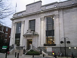
Islington Local History Centre holds records of the Metropolitan Borough of Islington, including council and committee minutes, rate books and publications. [8]

Politics

A map showing the wards of Islington Metropolitan Borough as they appeared in 1916. Islington Met. B Ward Map 1916.svg
A map showing the wards of Islington Metropolitan Borough as they appeared in 1916.

Under the Metropolis Management Act 1855 any parish that exceeded 2,000 ratepayers was to be divided into wards; as such the incorporated vestry of St Mary Islington was divided into six wards (electing vestrymen): No. 1 or Upper Holloway (9), No. 2 or Lower Holloway (12), No. 3 or Highbury (15), No. 4 or Thornhill (18), No. 5 or Barnsbury (18), No. 6 or St Mary's (15), No. 7 or Canonbury (15) and No. 8 or St Peter's (18). [9] [10]

In 1896 as its population had increased the incorporated vestry was re-divided into eleven wards (electing vestrymen): No. 1 or Tufnell (12), No. 2 or Upper Holloway (12), No. 3 or Tollington (9), No. 4 or Lower Holloway (15), No. 5 or West Highbury (15), No. 6 or East Highbury (12), No. 7 or Thornhill (9), No. 8 or Barnsbury (6), No. 9 or St Mary's (9), No. 10 or Canonbury (9) and No. 11 or St Peter's (12). [11]

The metropolitan borough was divided into eleven wards for elections: Barnsbury, Canonbury, Highbury, Lower Holloway, Mildmay, St Mary, St Peter, Thornhill, Tollington, Tufnell and Upper Holloway. [12] [13]

Borough council

Parliament constituency

For elections to Parliament, the borough was divided into four constituencies:

In 1950 the borough's representation was reduced to three seats:

See also

Related Research Articles

<span class="mw-page-title-main">London Borough of Islington</span> London borough in United Kingdom

The London Borough of Islington is a London borough which forms part of Inner London, England. Islington has an estimated population of 215,667. It was formed in 1965, under the London Government Act 1963, by the amalgamation of the metropolitan boroughs of Islington and Finsbury.

<span class="mw-page-title-main">Holloway, London</span> Human settlement in England

Holloway is an area of north London in the London Borough of Islington, England, 3.3 miles (5.3 km) north of Charing Cross, which follows the line of the Holloway Road (A1). At the centre of Holloway is the Nag's Head commercial area which sits between the more residential Upper Holloway and Lower Holloway neighbourhoods. Holloway has a multicultural population and includes the Emirates Stadium, home of Arsenal F.C.. Until 2016, it was the site of Holloway Prison, the largest women's prison in Europe. Before 1965, it was in the historic county of Middlesex.

<span class="mw-page-title-main">Newington, London</span> Human settlement in England

Newington is a district of South London, just south of the River Thames, and part of the London Borough of Southwark. It was an ancient parish and the site of the early administration of the county of Surrey. It was the location of the County of London Sessions House from 1917, in a building now occupied by the Inner London Crown Court.

<span class="mw-page-title-main">Islington</span> District of London, England

Islington is a district in the north of Greater London, England, and part of the London Borough of Islington. It is a mainly residential district of Inner London, extending from Islington's High Street to Highbury Fields, encompassing the area around the busy High Street, Upper Street, Essex Road, and Southgate Road to the east.

<span class="mw-page-title-main">County of London</span> County of England between 1889 and 1965

The County of London was a county of England from 1889 to 1965, corresponding to the area known today as Inner London. It was created as part of the general introduction of elected county government in England, by way of the Local Government Act 1888. The Act created an administrative County of London, which included within its territory the City of London. However, the City of London and the County of London formed separate ceremonial counties for "non-administrative" purposes. The local authority for the county was the London County Council (LCC), which initially performed only a limited range of functions, but gained further powers during its 76-year existence. The LCC provided very few services within the City of London, where the ancient Corporation monopolised local governance. In 1900, the lower-tier civil parishes and district boards were replaced with 28 new metropolitan boroughs. The territory of the county was 74,903 acres (303.12 km2) in 1961. During its existence, there was a long-term decline in population as more residents moved into the outer suburbs; there were periodic reviews of the local government structures in the greater London area and several failed attempts to expand the boundaries of the county. In 1965, the London Government Act 1963 replaced the county with the much larger Greater London administrative area.

<span class="mw-page-title-main">Metropolitan Borough of Finsbury</span>

The Metropolitan Borough of Finsbury was a metropolitan borough within the County of London from 1900 to 1965, when it was amalgamated with the Metropolitan Borough of Islington to form the London Borough of Islington.

<span class="mw-page-title-main">Metropolitan Borough of Hackney</span>

The Metropolitan Borough of Hackney was a metropolitan borough of the County of London from 1900 to 1965. Its area became part of the London Borough of Hackney.

<span class="mw-page-title-main">Metropolitan Borough of Bethnal Green</span> Civil parish and metropolitan borough in London, England

Bethnal Green was a civil parish and a metropolitan borough of the County of London between 1899 and 1965, when it was merged with the Metropolitan Borough of Stepney and the Metropolitan Borough of Poplar to form the London Borough of Tower Hamlets.

<span class="mw-page-title-main">Metropolitan Borough of Stoke Newington</span> Former London borough, United Kingdom

The Metropolitan Borough of Stoke Newington was a metropolitan borough in the County of London between 1900 and 1965 when it became part of the London Borough of Hackney.

<span class="mw-page-title-main">Metropolitan Borough of Shoreditch</span>

The Metropolitan Borough of Shoreditch was a metropolitan borough of the County of London between 1899 and 1965, when it was merged with the Metropolitan Borough of Stoke Newington and the Metropolitan Borough of Hackney to form the London Borough of Hackney.

<span class="mw-page-title-main">Archway, London</span> Human settlement in England

Archway is an area of north London, England, in the London Borough of Islington 3.8 miles (6 km) north of Charing Cross. It straddles the A1 and is named after a local landmark, the high, single-arched Archway Bridge which crossed the road in a cutting to the north. It has a modern commercial hub around Vantage Point and Archway tube station.

<span class="mw-page-title-main">Islington South and Finsbury (UK Parliament constituency)</span> Parliamentary constituency in the United Kingdom, 1974 onwards

Islington South and Finsbury is a constituency created in 1974 and represented in the House of Commons of the UK Parliament since 2005 by Emily Thornberry of the Labour Party. Thornberry served as Shadow Foreign Secretary from 2016 until 2020 and is currently Shadow Attorney General for England and Wales.

<span class="mw-page-title-main">Islington North (UK Parliament constituency)</span> Parliamentary constituency in the United Kingdom, 1885 onwards

Islington North is a constituency in Greater London represented in the House of Commons of the UK Parliament since 1983 by Jeremy Corbyn, who was Leader of the Labour Party and Leader of the Opposition from 2015 to 2020.

<span class="mw-page-title-main">Parks and open spaces in the London Borough of Islington</span>

The London Borough of Islington is short of large parks and open spaces, given its status in recent decades as a desirable place of residence. In fact, Islington has the lowest ratio of open space to built-up areas of any London borough. The largest continuous open space in the borough, at 11.75 hectares, is Highbury Fields.

<span class="mw-page-title-main">London Government Act 1899</span> United Kingdom legislation

The London Government Act 1899 was an act of the Parliament of the United Kingdom that reformed the administration of the capital. The act divided the County of London into 28 metropolitan boroughs, replacing the 41 parish vestries and district boards of works administering the area. The legislation also transferred a few powers from the London County Council to the boroughs, and removed a number of boundary anomalies. The first elections to the new boroughs were held on 1 November 1900.

Hornsey was an ancient parish in the county of Middlesex. It was both a civil parish, used for administrative purposes, and an ecclesiastical parish of the Church of England.

The Finsbury Division was one of four divisions of the Hundred of Ossulstone, in the historic county of Middlesex, England. The area of the Finsbury Division is now the core of modern north London. The other divisions were named Holborn, Kensington and Tower. Ossulstone hundred was divided in the seventeenth century, with each of the four divisions replacing the hundred for most administrative purposes.

<span class="mw-page-title-main">Westminster St James</span> United Kingdom legislation

Westminster St James was a civil parish in the metropolitan area of London, England. The creation of the parish followed the building of the Church of St James, Piccadilly, in 1684. After several failed attempts, the parish was formed in 1685 from part of the ancient parish of St Martin in the Fields in the Liberty of Westminster and county of Middlesex. It included part of the West End of London, taking in sections of Soho, Mayfair and St James's. Civil parish administration was in the hands of a select vestry until the parish adopted the Vestries Act 1831. The vestry was reformed again in 1855 by the Metropolis Management Act. In 1889 the parish became part of the County of London and the vestry was abolished in 1900, replaced by Westminster City Council. The parish continued to have nominal existence until 1922.

Hackney was a local government district within the metropolitan area of London, England from 1855 to 1894. It was formed by the Metropolis Management Act 1855 and was governed by the Hackney District Board of Works, which consisted of elected vestrymen. It was in the part of the county of Middlesex that was within the area of the Metropolitan Board of Works. In 1889 it became part of the County of London and the district board functioned as a local authority under the London County Council.

<span class="mw-page-title-main">2018 Islington London Borough Council election</span> 2018 local election in England

The 2018 Islington London Borough Council election took place on 3 May 2018 to elect members of Islington London Borough Council in England. This was on the same day as other local elections. The council had previously had elections in 2014. The Labour Party retained control of the council, winning 47 of the 48 seats. The sole non-Labour councillor elected was Caroline Russell of the Green Party.

References

  1. Baggs, A P; Bolton, Diane K; Croot, Patricia E C (1985). "'Islington: Local government', in A History of the County of Middlesex: Volume 8, Islington and Stoke Newington Parishes, ed. T F T Baker and C R Elrington". London: British History Online. pp. 76–82. Retrieved 8 April 2020.
  2. Baggs, A P; Bolton, Diane K; Croot, Patricia E C (1985). "'Islington: Public Services', in A History of the County of Middlesex: Volume 8, Islington and Stoke Newington Parishes, ed. T F T Baker and C R Elrington". London: British History Online. pp. 82–88. Retrieved 8 April 2020.
  3. "From Arsenal parades to nuclear bunkers, new tour shares history of Islington Town Hall". Islington Gazette. 23 November 2016. Retrieved 8 April 2020.
  4. Statistical Abstract for London, 1901 (Vol. IV)
  5. Islington MetB: Census Tables at Vision of Britain accessed on 14 Dec 2006
  6. The census was suspended for World War II
  7. 2005 estimate
  8. "Local History Collections". Islington Local History Centre. Archived from the original on 17 January 2011. Retrieved 3 March 2011.
  9. The London Gazette Issue: 21802. 20 October 1855. pp. 3876–3878. Retrieved 9 April 2015.
  10. "H.M.S.O. Boundary Commission Report 1885 Islington Map". Vision of Britain. Retrieved 9 April 2015.
  11. The London Gazette Issue: 26714. 21 February 1896. pp. 1042–1045. Retrieved 9 April 2015.
  12. Post Office London County Suburbs Directory, 1919. 1919. Retrieved 18 February 2015.
  13. Ordnance Survey 'County Series 3rd Edition' Map of London (1912-14) at 1:2500 scale. Accessed at https://www.old-maps.co.uk/

Further reading

51°32′30″N0°06′08″W / 51.5416°N 0.1022°W / 51.5416; -0.1022