Metropolitan Borough of Camberwell

Last updated

Camberwell
Southwark town hall 1.jpg
The former Camberwell Town Hall
Metropolitan Borough of Camberwell.svg
The Borough of Camberwell within the County of London
Area
  1911/19314,480 acres (18.1 km2) [1]
  19614,482 acres (18.14 km2) [1]
Population
  1911261,328 [1]
  1931251,294 [1]
  1961175,304 [1]
Density
  191158/acre
  193156/acre
  196139/acre
History
  OriginAncient parish
  Abolished1965
  Succeeded by London Borough of Southwark
Status Civil parish (until 1965)
Metropolitan borough (1900–1965)
GovernmentCamberwell Vestry (1674–1900, reformed 1855)
Camberwell Borough Council (1900–1965)
   HQ St Giles's Church (1674–1827)
Vestry Hall, Havil Street (1827–1873)
Vestry Hall, Peckham Road (1873–1934)
Town Hall, Peckham Road (1934–1965)
   Motto All's well
Camberwell arms.png
Coat of arms of the borough council
Metropolitan Borough of Camberwell 
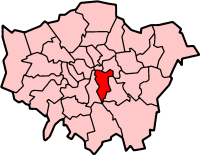
Map of borough boundary

Camberwell was a civil parish and metropolitan borough in south London, England. Camberwell was an ancient parish in the county of Surrey, governed by an administrative vestry from 1674. The parish was included in the area of responsibility of the Metropolitan Board of Works in 1855 and became part of the County of London in 1889. The parish of Camberwell became a metropolitan borough in 1900, following the London Government Act 1899, with the parish vestry replaced by a borough council. In 1965 the borough was abolished and its former area became part of the London Borough of Southwark in Greater London.

Contents

Geography

Metropolitan Borough of Camberwell
The ancient parish of Camberwell and the three divisions of Camberwell, Dulwich and Peckham

The original parish of Camberwell St Giles had three divisions. They were the Liberty of Peckham to the east, the Hamlet of Dulwich to the southwest and the central division of Camberwell proper. The liberty of Peckham stretched from north of Old Kent Road to Honor Oak, taking in Peckham and Nunhead. Camberwell stretched from what is now Burgess Park in the north to what is now the Horniman Museum in the south, taking in the central Camberwell area around Camberwell Green, the eastern part of Herne Hill and East Dulwich. It included a long protrusion in the west, surrounded by Lambeth, as far as what is now Myatt's Fields Park. The hamlet of Dulwich stretched from Champion Hill in the north to what is now Crystal Palace in the south, taking in Dulwich Village, West Dulwich and Sydenham Hill.

In 1900 the Camberwell/Lambeth boundary was tidied up with an exchange of population (approximately 6,000 each way) which had the effect of transferring Myatt's Fields Park to Lambeth.

Ecclesiastical parishes

The ancient parish, dedicated to St Giles, was in the Diocese of Winchester until 1877, then the Diocese of Rochester until 1905, and then finally in the Diocese of Southwark. From 1825, as the population of Camberwell increased, a number of new parishes were formed: [2]

In addition, as the population of neighbouring areas increased, parts of Camberwell parish were included in new parishes:

Coat of arms

The corporation was granted arms in 1901. The shield depicted the main areas of the borough. In the first and fourth quarter was a well, for Camberwell. The second quarter was for Dulwich: the chevron and cinquefoils from the arms of Edward Alleyn, founder of Alleyn's School. The third quarter represented Peckham: the lion was from the arms of Robert, Earl of Gloucester, one time lord of the manor.

The crest depicted a wounded hart, symbol of St Giles, patron saint of Camberwell.

In 1927 the borough was additionally granted an heraldic badge and standard. The badge depicted a Camberwell beauty butterfly.

Politics

A map showing the wards of the Camberwell Metropolitan Borough as they appeared in 1916. Camberwell Met. B Ward Map 1916.svg
A map showing the wards of the Camberwell Metropolitan Borough as they appeared in 1916.

Under the Metropolis Management Act 1855 any parish that exceeded 2,000 ratepayers was to be divided into wards; as such the incorporated vestry of St Giles Camberwell was divided into six wards (electing vestrymen): No. 1 or St George's West (12), No. 2 or St George's East (12), No. 3 or Camden (12), No. 4 or North Peckham (15), No. 5 or South Peckham (15) and No. 6 or Camberwell & Dulwich (18). [7] [8] [9]

In 1894 as its population had increased the incorporated vestry was re-divided into eight wards (electing vestrymen): St George's West (15), St George's East (12), Camden (12), North Peckham (21), South Peckham (21), North Dulwich (15), Central Dulwich (12) and South Dulwich (12). [10] [11]

The metropolitan borough was divided into twenty wards for elections: Addington, Alleyn, Clifton, Coburg, Goldsmith, Lyndhurst, Marlborough, North Peckham, Nunhead, Ruskin, Rye Lane, St George's, St Giles, St John's, St Mary's, The College, The Hamlet, The Rye, The West and Town Hall. [12] [13]

Borough council

From 1900 to 1934 the borough was controlled by the Municipal Reform Party (allied to the Conservatives). In 1934 the Labour Party gained control, which they retained until abolition in 1965.

Parliament constituency

For elections to Parliament, the borough was divided into three constituencies:

In 1918 the borough's representation was increased to four seats:

In 1950 the number of seats was halved to 2:

Population and area

The area of the borough was 4,480 acres (18.1 km2). The population, as recorded at the census, was:

Camberwell Vestry 18011899

Year [14] 1801181118211831184118511861187118811891
Population7,05911,30917,87628,23139,86854,66771,488111,306186,593235,344

Metropolitan Borough 19001961

Year [15] 1901191119211931194119511961
Population259,339261,328267,198251,294 [16] 179,777175,304

Related Research Articles

<span class="mw-page-title-main">Camberwell</span> Area of South London

Camberwell is an area of South London, England, in the London Borough of Southwark, 2+34 miles southeast of Charing Cross.

<span class="mw-page-title-main">London Borough of Southwark</span> London borough in United Kingdom

The London Borough of Southwark in South London forms part of Inner London and is connected by bridges across the River Thames to the City of London and London Borough of Tower Hamlets. It was created in 1965 when three smaller council areas amalgamated under the London Government Act 1963. All districts of the area are within the London postal district. It is governed by Southwark London Borough Council.

<span class="mw-page-title-main">Dulwich</span> Human settlement in England

Dulwich is an area in south London, England. The settlement is mostly in the London Borough of Southwark, with parts in the London Borough of Lambeth, and consists of Dulwich Village, East Dulwich, West Dulwich, and the Southwark half of Herne Hill. Dulwich lies in a valley between the neighbouring districts of Camberwell, Crystal Palace, Denmark Hill, Forest Hill, Peckham, Sydenham Hill, and Tulse Hill.

<span class="mw-page-title-main">Newington, London</span> Human settlement in England

Newington is a district of South London, just south of the River Thames, and part of the London Borough of Southwark. It was an ancient parish and the site of the early administration of the county of Surrey. It was the location of the County of London Sessions House from 1917, in a building now occupied by the Inner London Crown Court.

<span class="mw-page-title-main">Peckham</span> District in London, England

Peckham is a district in south-east London, within the London Borough of Southwark. It is 3.5 miles (5.6 km) south-east of Charing Cross. At the 2001 Census the Peckham ward had a population of 14,720.

<span class="mw-page-title-main">Metropolitan Borough of Lambeth</span> Metropolitan borough of England

Lambeth was a civil parish and metropolitan borough in south London, England. It was an ancient parish in the county of Surrey. The parish was included in the area of responsibility of the Metropolitan Board of Works in 1855 and became part of the County of London in 1889. The parish of Lambeth became a metropolitan borough in 1900, following the London Government Act 1899, with the parish vestry replaced by a borough council.

<span class="mw-page-title-main">Metropolitan Borough of Paddington</span> Former borough of London

Paddington was a civil parish and metropolitan borough in London, England. It was an ancient parish in the county of Middlesex, governed by an administrative vestry. The parish was included in the area of responsibility of the Metropolitan Board of Works in 1855 and became part of the County of London in 1889. The parish of Paddington became a metropolitan borough in 1900, following the London Government Act 1899, with the parish vestry replaced by a borough council. In 1965 the borough was abolished and its former area became part of the City of Westminster in Greater London.

<span class="mw-page-title-main">Metropolitan Borough of St Pancras</span> Metropolitan borough of England

St Pancras was a civil parish and metropolitan borough in London, England. It was an ancient parish in the county of Middlesex, governed by an administrative vestry. The parish was included in the area of responsibility of the Metropolitan Board of Works in 1855 and became part of the County of London in 1889. The parish of St Pancras became a metropolitan borough in 1900, following the London Government Act 1899, with the parish vestry replaced by a borough council. In 1965 the borough was abolished and its former area became part of the London Borough of Camden in Greater London.

<span class="mw-page-title-main">Metropolitan Borough of Hampstead</span> Former local authority in London

Hampstead was a civil parish and metropolitan borough in London, England. It was an ancient parish in the county of Middlesex, governed by an administrative vestry. The parish was included in the area of responsibility of the Metropolitan Board of Works in 1855 and became part of the County of London in 1889. The parish of Hampstead became a metropolitan borough in 1900, following the London Government Act 1899, with the parish vestry replaced by a borough council. In 1965 the borough was abolished and its former area became part of the London Borough of Camden in Greater London.

<span class="mw-page-title-main">Metropolitan Borough of Islington</span> Former local authority of London, England

Islington was a civil parish and metropolitan borough in London, England. It was an ancient parish within the county of Middlesex, and formed part of The Metropolis from 1855. The parish was transferred to the County of London in 1889 and became a metropolitan borough in 1900. It was amalgamated with the Metropolitan Borough of Finsbury to form the London Borough of Islington in Greater London in 1965.

<span class="mw-page-title-main">Metropolitan Borough of Poplar</span> Former metropolitan borough of the County of London, in the United Kingdom

Poplar was a local government district in the metropolitan area of London, England. It was formed as a district of the Metropolis in 1855 and became a metropolitan borough in the County of London in 1900. It comprised Poplar, Millwall, Bromley-by-Bow and Bow as well as Old Ford, Fish Island and Cubitt Town.

<span class="mw-page-title-main">Nunhead</span> Suburb of London Borough of Southwark, London

Nunhead is a suburb in the London Borough of Southwark in London, England. It is an inner-city suburb located 4 miles (6.4 km) southeast of Charing Cross. It is the location of the 52-acre (0.21 km2) Nunhead Cemetery. Nunhead has traditionally been a working-class area and, with the adjacent neighbourhoods, is currently going through a lengthy process of gentrification. Nunhead is the location of several underground reservoirs, built by the Southwark and Vauxhall Waterworks Company.

<span class="mw-page-title-main">Anglican Diocese of Southwark</span> Diocese of the Church of England

The Diocese of Southwark is one of the 42 dioceses of the Church of England, part of the worldwide Anglican Communion. The diocese forms part of the Province of Canterbury in England. It was created on 1 May 1905 from part of the ancient Diocese of Rochester that was served by a suffragan bishop of Southwark (1891–1905). Before 1877 most of the area was part of the Diocese of Winchester, some being part of the Diocese of London.

<span class="mw-page-title-main">Parliamentary constituencies in London</span>

The region of Greater London, including the City of London, is divided into 73 parliamentary constituencies which are sub-classified as borough constituencies, affecting the type of electoral officer and level of expenses permitted.

Dulwich was a borough constituency in the Dulwich area of South London, which returned one Member of Parliament (MP) to the House of Commons of the Parliament of the United Kingdom.

<span class="mw-page-title-main">Peckham Rye</span> Human settlement in England

Peckham Rye is an open space and road in the London Borough of Southwark, London, England. The roughly triangular open space lies to the south of Peckham and consists of two contiguous areas, Peckham Rye Common to the north and Peckham Rye Park to the south. The road forms the western and eastern perimeter of the open space.

Lambeth was a constituency 1832—1885 loosely equivalent in area to the later administrative units: the London Borough of Lambeth and the south-west and centre of the London Borough of Southwark. It returned two members of parliament (MPs) to the House of Commons of the UK Parliament by the bloc vote version of the first-past-the-post system.

Bermondsey was a parish in the metropolitan area of London, England.

<span class="mw-page-title-main">Greenwich District (Metropolis)</span>

Greenwich was a local government district within the metropolitan area of London, England from 1855 to 1900. It was formed by the Metropolis Management Act 1855 and was governed by the Greenwich District Board of Works, which consisted of elected vestrymen.

<span class="mw-page-title-main">Wandsworth District (Metropolis)</span>

Wandsworth was a local government district within the metropolitan area of London, England from 1855 to 1900. It was formed by the Metropolis Management Act 1855 and was governed by the Wandsworth District Board of Works, which consisted of elected vestrymen.

References

  1. 1 2 3 4 5 Vision of Britain - Camberwell population (area and density)
  2. A History of the County of Surrey: Volume 4.
  3. 1 2 Genuki.
  4. A History of the County of Surrey: Volume 4.
  5. A History of the County of Surrey: Volume 4.
  6. A History of the County of Surrey: Volume 4.
  7. The London Gazette Issue: 21802. 20 October 1855. pp. 3883–3884. Retrieved 8 April 2015.
  8. "H.M.S.O. Boundary Commission Report 1885 Camberwell Map". Vision of Britain. Retrieved 8 April 2015.
  9. "H.M.S.O. Boundary Commission Report 1885 Camberwell 2 Map". Vision of Britain. Retrieved 8 April 2015.
  10. The London Gazette Issue: 26542. 14 August 1894. pp. 4707–4709. Retrieved 8 April 2015.
  11. The London Gazette Issue: 26563. 23 October 1894. p. 5934. Retrieved 8 April 2015.
  12. Post Office London County Suburbs Directory, 1919. 1919. Retrieved 18 February 2015.
  13. "Ordnance Survey 'County Series 3rd Edition' Map of London (1912-14) at 1:2500 scale".
  14. Statistical Abstract for London, 1901 (Vol. IV); Census tables for Metropolitan Borough of Camberwell
  15. Census Tables for the Metropolitan Borough of Camberwell accessed 14 Jun 2007
  16. The census was suspended for World War II

Further reading

51°28′27″N0°04′58″W / 51.4741°N 0.0828°W / 51.4741; -0.0828