
Edgewood is located in eastern Cranston, Rhode Island. It is three miles away from Providence.

Federal Hill is a neighborhood in Providence, Rhode Island. It lies immediately west of the city's Downtown, across Interstate 95. Since the late 19th century, Federal Hill has been an enclave of Providence's Italian American community; today the neighborhood is known as Providence's Little Italy and is noted for its abundance of Italian restaurants, markets, and cultural establishments.

Blackstone is a predominantly residential neighborhood in Providence, Rhode Island. It is in the northeast corner of the city and is bounded to the south and west by Lloyd Avenue and Hope Street respectively. It is one of six neighborhoods comprising the East Side of Providence.
Norwood is a neighborhood in the city of Warwick, Rhode Island. Norwood is bounded by Route 37, the Pawtuxet River, Sherwood Avenue, the former Christopher Rhodes Elementary School, North Palm Boulevard, Palm Boulevard, and Post Road. Such borders mark the area traditionally served by the fire station previously located at the current site of the Norwood Boys & Girls Club.

Charles is a neighborhood in northern Providence, Rhode Island. Along with Wanskuck, it comprises what is sometimes referred to as the North End. To the west Charles is partitioned from Wanskuck by Route 146, while the Chad Brown public housing complex separates Charles from Smith Hill to the south, and the West River and Interstate 95 bounds the area to the east. The city limits abutting the city of North Providence bound Charles to the north.
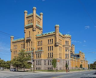
The West End is a neighborhood in the southwestern part of Providence, Rhode Island in the region often referred to as the South Side. Its boundaries are delineated by Westminster Street to the north, Huntington Avenue to the south, Elmwood Avenue to the east and the railroad tracks with Route 10 to the west. Cranston Street runs through the center of West End, past the Cranston Street Armory which has given the neighborhood the alternative name of the "Armory District."
The East Side is a collection of neighborhoods in the eastern part of the city of Providence, Rhode Island. It officially comprises the neighborhoods of Blackstone, Hope, Mount Hope, College Hill, Wayland, and Fox Point.
Forestdale is a village and historic district in North Smithfield, Providence County, Rhode Island, United States, one-half mile from Slatersville, Rhode Island. The historic district runs east and west along Main Street and north on Maple Avenue. School Street is the primary road through the village, and the one-room schoolhouse for which the street is named still stands. The Branch River runs through the valley adjacent to the School Street. The Village Haven Restaurant and local VFW chapter are also located in the village.

The South Side of Providence, Rhode Island, originally South Providence, is a term frequently used to describe the collective region comprising the official neighborhoods of Upper and Lower South Providence, Elmwood and the West End. The name was first used in the 1830s when the New York, Providence and Boston Railroad established its first station at a pier on the Providence River on a point of land about one half mile south of downtown Providence. The station was named South Providence.
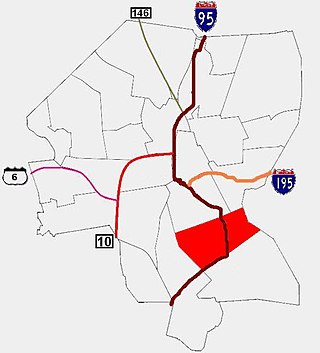
The Lower South Side is a neighborhood in the southern part of Providence, Rhode Island. It is bounded by Public Street to the north, by Interstate 95 to the south, by Broad Street to the west, and by the Providence River to the east.
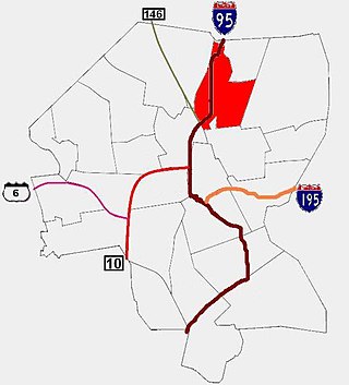
Mount Hope is a neighborhood in northern Providence, Rhode Island. It is one of six neighborhoods comprising the East Side of Providence. The area is bounded to the north by Rochambeau Avenue, to the east by Hope Street, to the south by Olney Street, while the western border is the former New York-New Haven Railroad and Interstate 95.
Lonsdale is a village and historic district in Lincoln and Cumberland, Providence County, Rhode Island, United States, near Rhode Island Route 146 and Route 95. The village was originally part of the town of Smithfield until Lincoln was created in the 1870s, and was originally centered on the Lincoln side of the Blackstone River. William Blaxton settled in the area in 1635. In the nineteenth and early twentieth centuries, Lonsdale was home to several manufacturers including the Lonsdale Company's Bleachery, and the Ann & Hope mill was also located in the village in Cumberland.

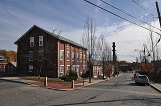
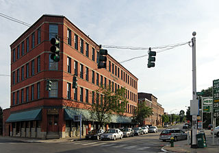
The Wanskuck Historic District is a historic district in the city of Providence, Rhode Island encompassing a mill village with more than two hundred years of history. As early as the mid-18th century, mills stood on the West River in northern Providence, a development which continued with the rise of industrialization in the 19th century. The mill village of Wanskuck is organized around three thoroughfares: Branch Street, Veazie Street, and Woodward Road, and is roughly bounded on the east by Louisquisset Pike and to the northwest by the city line with North Providence. The West River runs through the district, with its banks lined by two late-19th-century mill complexes. The village area includes a variety of examples of mill worker housing, from duplexes to rowhouses, as well as two church complexes and a community hall built in 1884 by the Wanskuck Company.

The Wayland Historic District is a predominantly residential historic district on the east side of Providence, Rhode Island. It is a large area, covering about 122 acres (49 ha), bounded roughly on the north by Everett and Laurel Avenues, on the east by Blackstone Boulevard and Butler Avenue, on the west by Arlington Avenue, and on the south by Angell and South Angell Streets. This area, which was in the 19th century part of the Moses Brown farm, was platted for development in 1891, with most of the construction taking place in the early decades of the 20th century. Most of the residential properties in the district are single-family houses, typically built in revival styles popular at the time. They are set on similarly sized lots with fairly uniform setbacks, and were typically built without garages. There are a number of two-family houses, and a small number of apartment buildings, most of which are found on the arterial roads of the area. There are several religious buildings, including several churches; the most architecturally distinctive religious building is the Jewish Temple Beth El, built 1951–54.
Davol Square is a historic area within the Jewelry District of Providence, Rhode Island. It is located at the intersection of Point Street and Eddy Street.
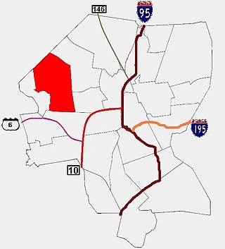
Mount Pleasant is a working-class residential neighborhood situated in the northwest of the city of Providence, Rhode Island. It is bordered by Olneyville to the south, Valley to the east, Manton to the west, and Elmhurst to the northeast, and the Town of North Providence to the north. The major street boundaries that define Mount Pleasant are Academy Avenue to the east, Smith Street to the northeast, Atwells Avenue to the south, and portions of Bullock, Chalkstone, Mera, and Rushmore Avenues to the west.
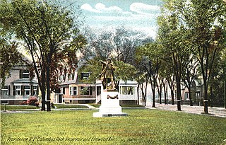
Columbus Square is a historic public square in the Historic Elmwood Neighborhood of Providence, Rhode Island. Located at the intersection of Elmwood Avenue and Reservoir Avenue, it serves as a gateway to Elmwood from the Reservoir and West End Neighborhoods.


