Fox Point, Providence, Rhode Island

Last updated
Fox Point
Wickenden Street Providence RI 2.jpg
Provneigh-foxpt.JPG
Location of Fox Point within Providence
CountryFlag of the United States.svg  United States
StateFlag of Rhode Island.svg  Rhode Island
City Providence

Fox Point is a neighborhood in the East Side of Providence, Rhode Island. It is bounded by the Providence and Seekonk rivers, Interstate 195 and the College Hill and Wayland neighborhoods. Fox Point is the southernmost neighborhood in the East Side area of Providence.

Contents

Fox Point retains much of its historical character, with housing stock dating from the 18th and 19th centuries in much of the neighborhood. Vernacular interpretations of the Federal, Greek revival, and Italianate architectural styles are well represented West of Governor Street, while somewhat more recent construction dominates on Ives and Gano Streets.

History

Fox Point was originally used for farmland, but its economy quickly changed to maritime affairs with the construction of Providence's first port at India Point in 1680, becoming a major trading point in the Atlantic Triangular Trade of slaves, sugar cane, and rum between New England, the West Indies, and West Africa.[ citation needed ]

The neighborhood derives its name from Tockwotten Hill, which was largely leveled (along with slum residences) as part of a public works project in the 19th century. The fill was used to reclaim part of the Seekonk River now consisting of Gano Street and land to the east of Gano Street. Once the area's street grid had been laid, Fox Point developed as a residential neighborhood.

However, Fox Point became an attractive location for industry with the completion of the Boston and Providence Rail Road and regular steamship connections to ports along the East Coast. The new industry, in turn, attracted many immigrants. Irish were the first wave, and the neighborhood became home to increasing numbers of Portuguese and Cape Verdeans by the second half of the 19th century.

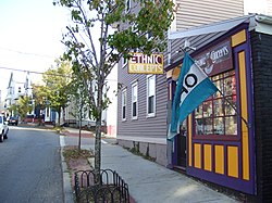
During much of the 20th Century, Fox Point was a neighborhood made up of immigrants from Cape Verde, Portugal, Ireland, Lebanon, and more. [1] Grocery stores, community centers, and restaurants dotted the neighborhood. By the 1980s, those residents and businesses were displaced by gentrification, resulting from urban renewal and the encroachment of students from nearby Brown University living off-campus. [1]

Demographics

Union Baptist Church, on East Street Union Baptist Church Providence RI.jpg
Union Baptist Church, on East Street

According to the Providence Plan, a local nonprofit aimed at improving city life, 78.6% of Fox Point residents are white, well-above the citywide average. In addition, 6.4% of residents are Asian, slightly higher than the citywide average. African-Americans and Hispanics each comprise less than 5% of the population. [2]

The median family income is $55,315, above the citywide average of $32,058. 8% of households live below the poverty line, while 2% of households receive some form of public assistance. [2] 14% of children under the age of six have been exposed to hazardous amounts of lead. [2] This is due to the prevalences of lead paint in older buildings.

Government

Fox Point is located within Ward One. [3] Ward One is currently represented in the Providence City Council by Democrat John Goncalves. [4]

Parks

Parks
View of Roger Williams Square, Providence RI.jpg
Slate Rock memorial in Roger Williams Square
Gano Park in winter, Providence Rhode Island.jpg
Gano Park

India Point Park

India Point Park is located along the northern shore of Narragansett Bay, at Green Jacket Shoal and the confluence of the Seekonk and the Providence River. The park is the only large expanse of Bay-side shoreline in Providence preserved for public use. Friends of India Point Park [5] is a local citizens organization interested in maintaining the park.

Roger Williams Square and Slate Rock Park

A prominent boulder on the west shore of the Seekonk River (near the current Gano Park) was once one of Providence's most important historic landmarks. Slate Rock was said to be the spot where a group of Narragansetts first welcomed the exiled Roger Williams in 1636 with the famous phrase "What cheer, netop?", and directed him to his eventual settlement location at the fork of the Woonasquatucket and Moshassuck Rivers. [6] [7] [8] The historic rock was accidentally blown up by city workers in 1877. They were attempting to expose a buried portion of the stone, but used too much dynamite and the stone was "blasted to pieces." [6] Pieces of the stone were later sold for souvenirs. A monument in Slate Rock Park at Roger Williams Square commemorates the site. [6] [7] [8]

Gano Street Park

Gano Street Park along the Seekonk River has numerous athletic fields and a dog park.

Schools

The Fox Point area includes two schools. One of these is the French-American School, a private school teaching in both French and English from kindergarten to eighth grade. [9] It is located at 75 John Street, near the intersection of John and Hope Street. The other school in Fox Point is the Vartan Gregorian Elementary School, located at 455 Wickenden Street near the Fox Point Boys and Girls Club. It is part of the Providence public school system and teaches students from kindergarten to fifth grade. [10]

Notable residents

Statue commemorating George M. Cohan George Cohan Statue in Providence, Rhode Island.jpg
Statue commemorating George M. Cohan

See also

Related Research Articles

<span class="mw-page-title-main">Roger Williams</span> English Protestant theologian, author, and founder of Rhode Island (1603–1683)

Roger Williams was an English-born New England Puritan minister, theologian, and author who founded Providence Plantations, which became the Colony of Rhode Island and Providence Plantations and later the State of Rhode Island. He was a staunch advocate for religious freedom, separation of church and state, and fair dealings with the Native Americans.

<span class="mw-page-title-main">Seekonk, Massachusetts</span> Town in Massachusetts, United States

Seekonk is a town in Bristol County, Massachusetts, United States, on the Massachusetts border with Rhode Island. It was incorporated in 1812 from the western half of Rehoboth. The population was 15,531 at the 2020 census. In 1862, under a U.S. Supreme Court decision resolving a longstanding border dispute between Massachusetts and Rhode Island, a portion of Tiverton Rhode Island was awarded to Massachusetts to become part of Fall River, while 2/3 of Seekonk was awarded to Rhode Island.

<span class="mw-page-title-main">Pawtucket, Rhode Island</span> City in Rhode Island

Pawtucket is a city in Providence County, Rhode Island. The population was 75,604 at the 2020 census, making the city the fourth-largest in the state. Pawtucket borders Providence and East Providence to the south, Central Falls and Lincoln to the north, and North Providence to the west. The city also borders the Massachusetts municipalities of Seekonk and Attleboro.

<span class="mw-page-title-main">Interstate 195 (Rhode Island–Massachusetts)</span> Highway in Rhode Island and Massachusetts

Interstate 195 (I-195) is an auxiliary Interstate Highway running a combined 44.55 miles (71.70 km) in the US states of Rhode Island and Massachusetts. It travels from a junction with I-95 in Providence, Rhode Island, east to a junction with I-495 and Massachusetts Route 25 in Wareham, Massachusetts. It runs east–west and passes through the cities of Fall River, Massachusetts, and New Bedford, Massachusetts. The portion of I-195 in East Providence is also known as the East Providence Expressway.

<span class="mw-page-title-main">Olneyville, Providence, Rhode Island</span> Neighborhood of Providence in Rhode Island, United States

Olneyville is a neighborhood in Providence, Rhode Island bordered by Atwells Avenue to the north, U.S. Route 6 to the south and Rhode Island Route 10 to the east. The Woonasquatucket River runs through the southern portion of the neighborhood. The area is roughly triangular.

<span class="mw-page-title-main">Henderson Bridge (Rhode Island)</span> Bridge in Between Providence and East Providence, Rhode Island

The Henderson Bridge is a bridge in Rhode Island which spans the Seekonk River, and connects the East Side neighborhood of Providence with the Watchemoket and Phillipsdale neighborhoods of East Providence. After a major reconstruction, the bridge reopened to automobile traffic in phases from November 16 to 20, 2023. A new cycle path opened on November 27. A few weeks later, it was used as a detour during the emergency closure of the westbound half of the parallel Washington Bridge.

<span class="mw-page-title-main">East Side Railroad Tunnel</span> Former railroad tunnel in Rhode Island

The East Side Railroad Tunnel is a former railroad tunnel that runs underneath the East Side of Providence, Rhode Island. The tunnel runs 5,080 feet (1,550 m), under College Hill, from Gano Street to just west of Benefit Street. It was opened on November 16, 1908, at a cost of $2 million. All rail service ceased through the tunnel in 1976 and has been abandoned since.

<span class="mw-page-title-main">Seekonk River</span> River in Rhode Island, United States

The Seekonk River is a tidal extension of the Providence River in the U.S. state of Rhode Island. It flows approximately 8 km (5 mi). The name may be derived from an Algonquian word for skunk or for black goose. The river is home to the Brown University men's rowing team, India Point Park, Blackstone Park Conservation District, Crook Point Bascule Bridge, Narragansett Boat Club, Swan Point Cemetery, and the Bucklin Point waste-water treatment facility. The River is listed by the Rhode Island Department of Environmental Management as an impaired waterway.

<span class="mw-page-title-main">Blackstone, Providence, Rhode Island</span>

Blackstone is a predominantly residential neighborhood in Providence, Rhode Island. It is in the northeast corner of the city and is bounded to the south and west by Lloyd Avenue and Hope Street respectively. It is one of six neighborhoods comprising the East Side of Providence.

<span class="mw-page-title-main">College Hill, Providence, Rhode Island</span> Neighborhood of Providence in Rhode Island, United States

College Hill is a historic neighborhood of Providence, Rhode Island, and one of six neighborhoods comprising the city's East Side. It is roughly bounded by South and North Main Street to the west, Power Street to the south, Governor Street and Arlington Avenue to the east and Olney Street to the north. The neighborhood's primary commercial area extends along Thayer Street, a strip frequented by students in the Providence area.

<span class="mw-page-title-main">India Point Park</span> Park in Providence, Rhode Island

India Point Park is a park in the Fox Point neighborhood of Providence, Rhode Island at the confluence of the Seekonk River and Providence River. The park takes its name from the maritime activity connecting Providence with the East and West Indies. The East Bay Bike Path begins at the eastern end of the park, and crosses over the Washington Bridge before heading to Watchemoket Square in East Providence and continuing on to the Bristol waterfront north of the Mount Hope Bridge. The park is also a part of the Washington–Rochambeau Revolutionary Route.

<span class="mw-page-title-main">Providence River</span> River in Rhode Island, United States

The Providence River is a tidal river in the U.S. state of Rhode Island. It flows approximately 8 miles (13 km). There are no dams along the river's length, although the Fox Point Hurricane Barrier is located south of downtown to protect the city of Providence from damaging tidal floods.

<span class="mw-page-title-main">East Side, Providence, Rhode Island</span> Collection of neighborhoods

The East Side is a collection of neighborhoods in the eastern part of the city of Providence, Rhode Island. It officially comprises the neighborhoods of Blackstone, Hope, Mount Hope, College Hill, Wayland, and Fox Point.

<span class="mw-page-title-main">Wickenden Street</span>

Wickenden Street in Fox Point, Providence, Rhode Island is a popular destination for students of the area's colleges and schools. The street is surrounded by schools and universities on the East Side of Providence's College Hill, including Brown University, RISD, Moses Brown School, & The Wheeler School.

<span class="mw-page-title-main">College Hill Historic District (Providence, Rhode Island)</span> Historic district in Rhode Island, United States

The College Hill Historic District is located in the College Hill neighborhood of Providence, Rhode Island. It was designated a National Historic Landmark District on December 30, 1970. The College Hill local historic district, established in 1960, partially overlaps the national landmark district. Properties within the local historic district are regulated by the city's historic district zoning ordinance, and cannot be altered without approval from the Providence Historic District Commission.

<span class="mw-page-title-main">Nathaniel Daggett House</span> Historic house in Rhode Island, United States

See also Daggett House, Slater Park, Pawtucket RI, built about the same time, by Nathaniel's father John.

<span class="mw-page-title-main">Providence, Rhode Island</span> Capital city of Rhode Island, United States

Providence is the capital and most populous city of the U.S. state of Rhode Island. The county seat of Providence County, it is one of the oldest cities in New England, founded in 1636 by Roger Williams, a Reformed Baptist theologian and religious exile from the Massachusetts Bay Colony. He named the area in honor of "God's merciful Providence" which he believed was responsible for revealing such a haven for him and his followers. The city developed as a busy port, as it is situated at the mouth of the Providence River at the head of Narragansett Bay.

<span class="mw-page-title-main">Edwin E. Cull</span> American architect

Edwin E. Cull was an American architect in practice in Providence, Rhode Island from 1921 until his death. In 1946 he was cofounder of what is now The Robinson Green Beretta Corporation, one of the largest architecture firms in Rhode Island.

Mashapaug Pond is the largest freshwater pond in the city of Providence, Rhode Island.

John Smith was a founding settler of Providence in what would become the Colony of Rhode Island and Providence Plantations. Smith joined Roger Williams at the Seekonk River in 1636 after both were expelled from Massachusetts Bay Colony. In the spring they crossed the river to found Providence where Smith later built and operated the town's gristmill.

References

  1. 1 2 Pickens, Katy (27 April 2022). "'The magnitude of the community that we had': Fox Point, gentrification, urban renewal". Providence, Rhode Island: The Brown Daily Herald. Archived from the original on 30 May 2023. Retrieved 26 June 2023.
  2. 1 2 3 "Fox Point". Archived from the original on 2008-11-20. Retrieved 2009-05-18.
  3. ward1.jpg Archived November 15, 2006, at archive.today
  4. "Councilman John Goncalves".
  5. "Friends of India Point Park". Archived from the original on 2007-05-02. Retrieved 2007-04-14.
  6. 1 2 3 "Roger Williams's Landing Place Monument". Quahog dot org. Archived from the original on 26 May 2021. Retrieved 23 December 2021.
  7. 1 2 Shamgochian, John (3 August 2020). "Slate Rock, The Landing Place of Roger Williams". Rhode Island Historical Society. Rhode Island Historical Society. Archived from the original on 23 December 2021. Retrieved 23 December 2021.
  8. 1 2 "Slate Rock Park". Sowams Heritage Area. 14 January 2019. Archived from the original on 8 May 2021. Retrieved 23 December 2021.
  9. About The French-American School of Rhode Island
  10. Vartan Gregorian School Profile - Providence, RI - CityRating.com

41°49′09″N71°23′53″W / 41.8191°N 71.3980°W / 41.8191; -71.3980