Watson Lake, Yukon

Last updated
Watson Lake
Town of Watson Lake
Watson Lake 4.jpg
Location map Yukon 2.png
Red pog.svg
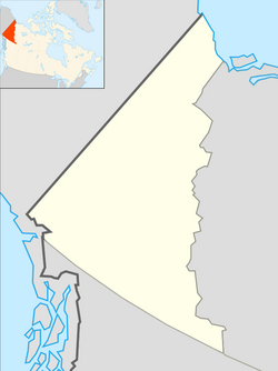
Watson Lake
Location of Watson Lake in Yukon
Canada location map 2.svg
Red pog.svg
Watson Lake
Watson Lake (Canada)
Coordinates: 60°03′45″N128°42′25″W / 60.06250°N 128.70694°W / 60.06250; -128.70694 [1]
CountryCanada
Territory Yukon
Government
  Town MayorChristopher Irvin
   MPs Brendan Hanley
   MLAs Patti McLeod
Area
[2]
  Land6.11 km2 (2.36 sq mi)
Population
 (2016) [2]
  Total790
  Density129.4/km2 (335/sq mi)
Time zone UTC−07:00 (MST)
Forward sortation area
Y0A 1C0 & Y0A 0A2
Area code 867
Website www.watsonlake.ca

Watson Lake is a town in Yukon, Canada, located at mile 635 on the Alaska Highway close to the British Columbia border. It has a population of 790 in 2016. The town is named for Frank Watson, an American-born trapper and prospector, who settled in the area at the end of the 19th century. [3]

Contents

Watson Lake is near the Liard River, at the junction of the Robert Campbell Highway and the Alaska Highway. The Stewart–Cassiar Highway's northern end is 22 km (14 mi) west of Watson Lake. The town is also served by the Watson Lake Airport; the airport was formerly served by Canadian Pacific Air Lines and other local and regional airlines, but now by Air North and corporate and charter services.

Watson Lake is the main centre of the small forestry industry in Yukon and has been a service centre for the mining industry, especially for the Cassiar, a now abandoned asbestos mine in northern British Columbia and the Cantung Mine, a tungsten mine on the Yukon-Northwest Territories border in the Mackenzie Mountains.

Tourist attractions in Watson Lake include the Northern Lights Centre [4] and the much-imitated original Sign Post Forest. The Sign Post Forest was started in 1942 by a homesick United States Army Corps of Engineers G.I. working on the Alaska Highway, who put up a sign with the name of his home town and the distance. Others followed suit and the tradition continues to this day. As of August 2010 there are more than 76,000 signs of various types depicting locations across the world. The Sign Post Forest is one of four roadside attractions featured on the first series of the Canadian Roadside Attractions Series issued by Canada Post on July 6, 2009. [5]

Watson Lake and the neighbouring Upper Liard settlement are the home of the Liard River First Nation, a member of the Kaska Dena Council. The Two Mile area immediately north of the core of town is a concentrated area of First Nations residents, while the town extends 8.0 km (5 mi) out to the turn-off of Airport Road. (Originally, Airport Road extended directly to the Alaska Highway, but most of it is now part of the Campbell highway.)

History

The Town of Watson Lake annexed Two Mile and Two and One-Half Mile Village on January 2, 2016. [6]

Geography

Climate

Like most of Yukon, Watson Lake has a subarctic climate (Dfc) with mild to warm summers and severely cold, snowy winters. Watson Lake experiences annual temperature average daily highs of 21.5 °C (70.7 °F) in July and average daily lows of −27.5 °C (−17.5 °F) in January. Record high temperature was 35.4 °C (95.7 °F) in July 2009 and the lowest was −58.9 °C (−74.0 °F) in January 1947. Watson Lake has more precipitation than other parts of Yukon with an average annual snowfall of 196.1 cm (77.2 in) and 262.0 mm (10.31 in) of rainfall, resulting in larger trees and a more viable forest industry. [7]

Climate data for Watson Lake (Watson Lake Airport)
Climate ID: 2101200; coordinates 60°06′59″N128°49′20″W / 60.11639°N 128.82222°W / 60.11639; -128.82222 (Watson Lake Airport) ; elevation: 687.4 m (2,255 ft); 1981–2010 normals
MonthJanFebMarAprMayJunJulAugSepOctNovDecYear
Record high humidex 5.611.111.520.034.233.341.436.826.817.611.77.941.4
Record high °C (°F)8.9
(48.0)
12.2
(54.0)
11.7
(53.1)
20.1
(68.2)
34.2
(93.6)
33.9
(93.0)
35.4
(95.7)
32.8
(91.0)
27.8
(82.0)
21.7
(71.1)
12.2
(54.0)
8.4
(47.1)
35.4
(95.7)
Mean maximum °C (°F)−1.8
(28.8)
2.9
(37.2)
7.3
(45.1)
15.6
(60.1)
22.4
(72.3)
27.3
(81.1)
28.6
(83.5)
27.3
(81.1)
20.2
(68.4)
13.2
(55.8)
3.3
(37.9)
−0.5
(31.1)
30.0
(86.0)
Mean daily maximum °C (°F)−17.5
(0.5)
−10.4
(13.3)
−1.8
(28.8)
7.0
(44.6)
14.0
(57.2)
19.6
(67.3)
21.5
(70.7)
19.1
(66.4)
12.8
(55.0)
3.7
(38.7)
−10.0
(14.0)
−16.0
(3.2)
3.5
(38.3)
Daily mean °C (°F)−22.5
(−8.5)
−17.0
(1.4)
−9.6
(14.7)
0.1
(32.2)
7.6
(45.7)
13.2
(55.8)
15.3
(59.5)
13.0
(55.4)
7.5
(45.5)
−0.5
(31.1)
−14.7
(5.5)
−20.8
(−5.4)
−2.4
(27.7)
Mean daily minimum °C (°F)−27.5
(−17.5)
−23.5
(−10.3)
−17.3
(0.9)
−6.8
(19.8)
1.3
(34.3)
6.8
(44.2)
9.0
(48.2)
6.9
(44.4)
2.2
(36.0)
−4.7
(23.5)
−19.3
(−2.7)
−25.6
(−14.1)
−8.2
(17.2)
Mean minimum °C (°F)−44.0
(−47.2)
−39.0
(−38.2)
−34.3
(−29.7)
−20.3
(−4.5)
−5.3
(22.5)
0.6
(33.1)
3.9
(39.0)
0.5
(32.9)
−5.1
(22.8)
−18.0
(−0.4)
−33.1
(−27.6)
−40.3
(−40.5)
−47.8
(−54.0)
Record low °C (°F)−58.9
(−74.0)
−56.2
(−69.2)
−46.7
(−52.1)
−32.8
(−27.0)
−16.0
(3.2)
−3.3
(26.1)
0.6
(33.1)
−6.7
(19.9)
−13.9
(7.0)
−36.6
(−33.9)
−47.5
(−53.5)
−53.3
(−63.9)
−58.9
(−74.0)
Record low wind chill −66−63−51−36−16−50−5−19−43−55−64−66
Average precipitation mm (inches)30.9
(1.22)
20.4
(0.80)
15.3
(0.60)
14.1
(0.56)
37.4
(1.47)
54.9
(2.16)
59.5
(2.34)
47.6
(1.87)
42.6
(1.68)
37.7
(1.48)
27.9
(1.10)
27.9
(1.10)
416.4
(16.39)
Average rainfall mm (inches)0.1
(0.00)
0.0
(0.0)
0.1
(0.00)
4.6
(0.18)
33.6
(1.32)
54.9
(2.16)
59.5
(2.34)
47.4
(1.87)
41.1
(1.62)
19.5
(0.77)
0.6
(0.02)
0.5
(0.02)
262.0
(10.31)
Average snowfall cm (inches)40.6
(16.0)
28.5
(11.2)
19.6
(7.7)
11.4
(4.5)
3.7
(1.5)
0.0
(0.0)
0.0
(0.0)
0.3
(0.1)
1.7
(0.7)
20.8
(8.2)
34.2
(13.5)
35.3
(13.9)
196.1
(77.2)
Average precipitation days (≥ 0.2 mm)13.210.39.36.311.512.714.813.713.814.414.612.6147.2
Average rainy days (≥ 0.2 mm)0.20.10.22.311.012.714.813.713.47.50.50.476.6
Average snowy days (≥ 0.2 cm)13.910.89.84.81.50.00.00.21.08.315.213.278.7
Average relative humidity (%)75.573.759.946.341.443.547.749.656.469.179.876.960.0
Source 1: Environment and Climate Change Canada [7]
Source 2: Météo Climat (mean maximum) [8] (mean minimum) [9]

Demographics

Federal census population history of Watson Lake
YearPop.±%
1941 58    
1951 238+310.3%
1971553+132.4%
1976808+46.1%
1981 748−7.4%
1986 826+10.4%
1991 912+10.4%
1996 993+8.9%
2001 912−8.2%
2006 846−7.2%
2011 802−5.2%
2016 790−1.5%
2016  (rev.)1,083+37.1%
2021 1,133+4.6%
Source: Statistics Canada
[10] [11] [12] [13] [14] [15] [16] [17] [18] [19] [2] [20]

In the 2021 Census of Population conducted by Statistics Canada, Watson Lake had a population of 1,133 living in 499 of its 564 total private dwellings, a change of

See also

Related Research Articles

<span class="mw-page-title-main">Beaver Creek, Yukon</span> Place in Yukon, Canada

Beaver Creek is a community in Yukon, Canada. Located at kilometre 1870.6 of the Alaska Highway, 1 NM southeast of Beaver Creek Airport and close to the Alcan - Beaver Creek Border Crossing, it is Canada's westernmost community. The community's main employers are a Canada Border Services Agency port, the White River First Nation and a number of tourist lodges.

<span class="mw-page-title-main">Dawson City</span> City in Yukon, Canada

Dawson City, officially the City of Dawson, is a city in the Canadian territory of Yukon. It is inseparably linked to the Klondike Gold Rush (1896–1899). Its population was 1,577 as of the 2021 census, making it the second-largest city in Yukon.

<span class="mw-page-title-main">Carcross</span> Place in Yukon, Canada

Carcross, originally known as Caribou Crossing, is an unincorporated community in Yukon, Canada, on Bennett Lake and Nares Lake. It is home to the Carcross/Tagish First Nation.

<span class="mw-page-title-main">Haines Junction, Yukon</span> Village in Yukon, Canada

Haines Junction is a village in Yukon, Canada. It is at Kilometre 1,632 of the Alaska Highway at its junction with the Haines Highway, hence the name of the community. According to the 2021 Census, the population was 688. However, the Yukon Bureau of Statistics lists the population count for 2022 as 1,018.

<span class="mw-page-title-main">Old Crow, Yukon</span> Place in Yukon, Canada

Old Crow is a community in the Canadian territory of Yukon.

<span class="mw-page-title-main">Burwash Landing</span> Place in Yukon, Canada

Burwash Landing is a small community, at historical mile 1093 on the Alaska Highway, in Yukon, Canada along the southern shore of Kluane Lake.

<span class="mw-page-title-main">Carmacks, Yukon</span> Village in Yukon, Canada

Carmacks is a village in Yukon, Canada, on the Yukon River along the Klondike Highway, and at the west end of the Robert Campbell Highway from Watson Lake. The population is 588, an increase from the Census of 2016. It is the home of the Little Salmon/Carmacks First Nation, a Northern Tutchone-speaking people.

<span class="mw-page-title-main">Mayo, Yukon</span> Village in Yukon, Canada

Mayo is a village in Yukon, Canada, along the Silver Trail and the Stewart River. It had a population of 200 in 2016. The Yukon Bureau of Statistics estimated a population of 496 in 2019. It is also the home of the First Nation of Na-Cho Nyak Dun, whose primary speak the northern variety of the Tutchone language. Na-Cho Nyäk Dun translates into "big river people."

<span class="mw-page-title-main">Teslin, Yukon</span> Village in Yukon, Canada

The community of Teslin includes the Village of Teslin in Yukon, Canada. Teslin is situated at historical Mile 804 on the Alaska Highway along Teslin Lake. The Hudson's Bay Company established a small trading post at Teslin in 1903.

<span class="mw-page-title-main">Destruction Bay</span> Place in Yukon, Canada

Destruction Bay is a small community on the Alaska Highway in Canada's Yukon on Kluane Lake.

<span class="mw-page-title-main">Ibex Valley, Yukon</span>

Ibex Valley is a hamlet in Canada's Yukon. The hamlet is considered a local advisory area with an advisory council providing local government. Its population in 2021 according to the 2021 Canadian Census was 523.

Marsh Lake is an unincorporated community on the Alaska Highway on the shores of Marsh Lake southeast of Whitehorse in Canada's Yukon. The area was organized in 2001, as a local area council to help the residents with some form of municipal government.

Upper Liard is a chiefly First Nation settlement immediately west of Watson Lake in Canada's Yukon. It is situated at historical mile 642 of the Alaska Highway. Most of the residents are citizens of the Liard River First Nation, who also prominently populate the Two Mile area just north of Watson Lake.

<span class="mw-page-title-main">Johnsons Crossing</span> Settlement in Yukon, Canada

Johnsons Crossing or Johnson's Crossing is a settlement in Yukon, Canada. It is located at historical mile 836 of the Alaska Highway, at the junction of the Canol Road where the highway crosses the Teslin River.

<span class="mw-page-title-main">Swift River, Yukon</span> Human settlement in Yukon, Canada

Swift River is a settlement in the Canadian territory of Yukon, primarily a service stop on the Alaska Highway at historical mile 733. The radius of the area is estimated to be about 22.71 square kilometres ). The only permanent population owns and operates, or is employed at, the area's commercial highway establishment. Other residents are transient, working at the Yukon government's highway maintenance camp.

Two Mile Village is an Indian settlement in southeast Yukon, Canada. It is located on the Robert Campbell Highway, approximately 12 km (7.5 mi) northwest of Watson Lake. The settlement is recognized as a census subdivision by Statistics Canada.

Two and One-Half Mile Village is an Indian settlement in southeast Yukon, Canada. It is located on the Robert Campbell Highway, approximately 16 km (9.9 mi) northwest of Watson Lake. The settlement is recognized as a census subdivision by Statistics Canada.

<span class="mw-page-title-main">Unorganized Yukon</span> Unorganized area in Yukon, Canada

Unorganized Yukon, or Yukon, Unorganized, is the unorganized area covering the majority of Yukon, Canada. It represents 98% of Yukon's 474,712.64 km2 (183,287.57 sq mi) land mass, and is recognized as a census subdivision by Statistics Canada.

Two Mile and Two and One-Half Mile Village is a designated place within the Town of Watson Lake in southeast Yukon, Canada that includes the Indian settlements of Two Mile Village and Two and One-Half Mile Village.

References

  1. "Watson Lake". Geographical Names Data Base . Natural Resources Canada.
  2. 1 2 3 "Population and dwelling counts, for Canada, provinces and territories, and census subdivisions (municipalities), 2016 and 2011 censuses – 100% data (Yukon)". Statistics Canada. February 8, 2017. Retrieved January 30, 2022.
  3. "Watson Lake History - Yukon Territory Information".
  4. www.northernlightscentre
  5. Canada Post Details, Canada Post, July to September 2009, Volume XVIII, No. 3, p. 10
  6. "Interim List of Changes to Municipal Boundaries, Status and Names: From January 2nd, 2016 to January 1st, 2021" (PDF). Statistics Canada. November 17, 2021. p. 74. Retrieved May 8, 2022.
  7. 1 2 "Canadian Climate Normals 1981-2010 Station Data". Environment Canada. Retrieved 9 July 2013.
  8. "Météo climat stats for Whitehorse". Météo Climat. Retrieved 23 February 2022.
  9. "Météo climat stats for Whitehorse". Météo Climat. Retrieved 23 February 2022.
  10. Ninth Census of Canada, 1951 (PDF). Vol. SP-7 (Population: Unincorporated villages and hamlets). Dominion Bureau of Statistics. March 31, 1954. Retrieved February 2, 2022.
  11. "Table 2: Population of Census Subdivisions, 1921–1971". 1971 Census of Canada (PDF). Population. Vol. Census Subdivisions (Historical). Ottawa: Statistics Canada. July 1973. Retrieved January 30, 2022.
  12. "1976 Census of Canada: Population - Geographic Distributions" (PDF). Statistics Canada. June 1977. Retrieved January 30, 2022.
  13. "1981 Census of Canada: Census subdivisions in decreasing population order" (PDF). Statistics Canada. May 1992. Retrieved January 30, 2021.
  14. "1986 Census: Population - Census Divisions and Census Subdivisions" (PDF). Statistics Canada. September 1987. Retrieved January 30, 2022.
  15. "91 Census: Census Divisions and Census Subdivisions - Population and Dwelling Counts" (PDF). Statistics Canada. April 1992. Retrieved January 30, 2022.
  16. "96 Census: A National Overview - Population and Dwelling Counts" (PDF). Statistics Canada. April 1997. Retrieved January 30, 2022.
  17. "Population and Dwelling Counts, for Canada, Provinces and Territories, and Census Subdivisions (Municipalities), 2001 and 1996 Censuses - 100% Data (Yukon Territory)". Statistics Canada. August 15, 2012. Retrieved January 30, 2022.
  18. "Population and dwelling counts, for Canada, provinces and territories, and census subdivisions (municipalities), 2006 and 2001 censuses - 100% data (Yukon Territory)". Statistics Canada. August 20, 2021. Retrieved January 30, 2022.
  19. "Population and dwelling counts, for Canada, provinces and territories, and census subdivisions (municipalities), 2011 and 2006 censuses (Yukon)". Statistics Canada. July 25, 2021. Retrieved January 30, 2022.
  20. 1 2 "Population and dwelling counts: Canada, provinces and territories, and census subdivisions (municipalities), Yukon". Statistics Canada. February 9, 2022. Retrieved February 18, 2022.