
Franklin County is a county on the northern border of the U.S. state of New York. To the north across the Canada–United States border are the Canadian provinces of Quebec and Ontario, from east to west. As of the 2020 census, the county population was 47,555. Its county seat is Malone. The county is named in honor of United States Founding Father Benjamin Franklin.

Keene is a town in central Essex County, New York, United States. It includes the hamlets of Keene, Keene Valley, and St. Huberts, with a total population of 1,144 as of the 2020 census

St. Armand is a town in Essex County, New York, United States. The population was 1,548 at the 2010 census. The town was named by an early settler for Saint-Armand, Quebec, in Canada.

Wilmington is a town in Essex County, New York, United States. The population was 1,253 at the 2010 census. The town is named after the nearby town of Wilmington, Vermont.

Bombay is a town in Franklin County, New York, United States. The population was 1,357 at the 2010 census. The town was named after a major port city in India, now known as Mumbai, by an early landowner whose wife was from Byculla.
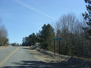
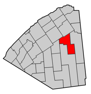
Brandon is a town in Franklin County, New York, United States. It is centrally located in the county, southwest of Malone. The town population was 577 at the 2010 census. It was named after Brandon, Vermont, by early settlers.

Brighton is a town in Franklin County, New York, United States. The population was 1,435 at the 2010 census. It was named after Brighton, England, by early surveyors in the region.
Dickinson is a town in Franklin County, New York, United States. The population was 823 at the 2010 census. The town was named after Philemon Dickinson, a brigadier general of the New Jersey militia during the American Revolutionary War.
Duane is a town in Franklin County, New York, United States. The population was 174 at the 2010 census. The town is named after James Duane, a developer and grandson of New York City mayor James Duane.

Franklin is a town located in Franklin County, New York, United States. As of the 2010 census, the town had a population of 1,140.

Harrietstown is a town in Franklin County, New York, United States. The total population was 5,254 at the 2020 census, In 2010 3,879 of the town's residents lived in the village of Saranac Lake on the eastern side of the town.
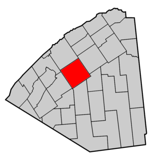
Moira is a town in Franklin County, New York, United States. The population was 2,934 at the 2010 census. Moira is located on the western border of Franklin County and is west of Malone. The town was named for the Earl of Moira. The correct pronunciation of Moira is moʊ-aɪ-rʌ.

Santa Clara is a town in Franklin County, New York, United States. The population was 345 at the 2010 census. The name was derived from the wife of an early town businessman, John Hurd.

Brasher is a town in St. Lawrence County, New York, United States. The population was 2,512 at the 2010 census. The town is named after Philip Brasher, an original landowner.

Clifton is a town in St. Lawrence County, New York, United States. The population was 675 at the 2020 census. The town takes its name from a mining company.

Hopkinton is a town in St. Lawrence County, New York, United States. The population was 1,105 at the 2020 census and has a Population density of 5.9 square miles. The town is named for Roswell Hopkins, a pioneer settler and a government official.
Lawrence is a town in St. Lawrence County, New York, United States. The population was 1,715 at the 2020 census. The town is named after William Lawrence, an early land owner.
Parishville is a town in the east-central part of St. Lawrence County, east of Potsdam, in the state of New York, United States. The population was 2,153 at the 2010 census.

Putnam is a town in northern Washington County, New York, United States. It is part of the Glens Falls Metropolitan Statistical Area. The town population was 645 at the 2000 census. The town is named after Israel Putnam, a hero of the American Revolution.
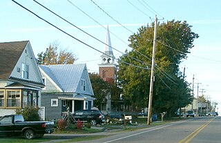
Canton is an incorporated town in St. Lawrence County, New York. The population was 11,638 at the time of the 2020 census. The town contains two villages: one also named Canton, the other named Rensselaer Falls. The town is named after the great port of Canton in China. Canton is the home of St. Lawrence University and the State University of New York at Canton. The Canton Central School District is based in the village of Canton.


