Wentworth, New South Wales

Last updated

Wentworth
New South Wales
WentworthDarlingSt.JPG
Darling Street, Wentworth
Australia New South Wales location map blank.svg
Red pog.svg
Wentworth
Coordinates 34°05′0″S141°54′0″E / 34.08333°S 141.90000°E / -34.08333; 141.90000
Population1,221 (2016 census) [1]
Postcode(s) 2648
Elevation37.0 m (121 ft)
Location1,034 km (642 mi) from Sydney
  • 570 km (354 mi) from Melbourne
  • 266 km (165 mi) from Broken Hill
  • 34 km (21 mi) from Mildura
  • LGA(s) Wentworth Shire
    State electorate(s) Murray
    Federal division(s) Farrer
    Mean max tempMean min tempAnnual rainfall
    24.3 °C
    76 °F
    10.9 °C
    52 °F
    283.9 mm
    11.2 in

    Wentworth is a small border town in the far south west of the state of New South Wales, Australia. It lies at the confluence of Australia's two most important rivers, the Darling and the Murray, the latter forming the border with the state of Victoria to the south. The border with the state of South Australia lies approximately 100 kilometres (62 mi) to the west. The town of Wentworth is in the local government area of the same name.

    Contents

    History

    Named after the famous explorer and politician William Charles Wentworth in 1859, [2] the town is 34 kilometres (21 mi) to the west (via the Calder Highway) of the Victorian regional city of Mildura. The famous mining city of Broken Hill is 266 kilometres (165 mi) to the north along the Silver City Highway.

    Moorna Post Office opened on 22 February 1855 and was renamed Wentworth in 1860. [3]

    In 1876, Wentworth township was described in the following terms:

    Wentworth is situated on the Darling, about half a mile from the junction, and is plainly visible from the Murray. The township is built on rising ground, and, save in very exceptional seasons, is quite out of reach of flood waters. The population is between 400 and 500. The place appears prosperous and progressive. The trade up the Darling River, and the supply of stores to the stations in the vicinity, form the life-blood of its prosperity. Wentworth possesses a custom-house – a hideous little building resembling a watch-house, and as great an eyesore as the cause of its establishment is an inconvenience and annoyance to trade. The other public buildings are a post and telegraph office, for Wentworth is on the main telegraph line to Adelaide, and a court-house and offices, which are also used for land offices. There is a resident police magistrate, Mr. Richardson ... The two churches in Wentworth are buildings creditable to the town. The Roman Catholic Church is a brick structure, the Protestant Church an edifice of brick and stone... There are three or four stores of considerable size, and several hotels. The Australian Joint Stock Bank has a branch here. The river, which, opposite the town is about the width of the Murray at Echuca, is crossed by a punt. [4]

    Heritage listings

    Wentworth has a number of heritage-listed sites, including:

    Railways

    During the late 1800s Wentworth was an important river port; however, like many such towns, its significance faded with the development of the railways. In 1902, the people of Wentworth were lobbying for a railway from Mildura to be built, including a bridge over the Murray River.

    The town is nowadays served by NSW TrainLink coach services, connecting it to Broken Hill, from which trains operate to Sydney, and Mildura. [9]

    Floods

    The town has been flooded many times by the two rivers. The most significant was in 1956, when both rivers flooded simultaneously. Local farmers, supplemented by the army and navy, worked for months to build levee banks to hold the water out of the town. [10]

    Visitor attractions

    Wentworth is now an important tourist outback destination and provides a welcome break for those travelling to or from Broken Hill. In addition to its authentic outback charm, the town offers some interesting attractions:

    The Great Wentworth Tractor Rally is a commemoration of the grey Fergie tractors that were used to maintain the levee banks and save the town from the 1956 Murray River flood. [10]

    Wentworth was a popular destination for 'pokie tour' bus rides from Adelaide, the capital city of South Australia, prior to the legalisation of poker (gambling) machines in that state. [11]

    Sport

    The town has an Australian rules football team competing in the Sunraysia Football League. [12]

    And the Wentworth District Rowing Club has regular regattas and attendance at national and international events. http://www.sunraysiadaily.com.au/story/4598820/gold-edge-to-regatta/

    Notable people

    Climate

    Wentworth has a Semi-arid climate (BSh) with hot summers and mild winters. Historical maxima and minima are 48.1 °C and −2.8 °C, respectively.

    Climate data for Wentworth, NSW (temps 1907-1967; precip 1868-present)
    MonthJanFebMarAprMayJunJulAugSepOctNovDecYear
    Record high °C (°F)48.1
    (118.6)
    45.6
    (114.1)
    43.3
    (109.9)
    36.7
    (98.1)
    31.7
    (89.1)
    25.6
    (78.1)
    26.4
    (79.5)
    31.1
    (88.0)
    36.7
    (98.1)
    40.0
    (104.0)
    42.8
    (109.0)
    46.1
    (115.0)
    48.1
    (118.6)
    Mean daily maximum °C (°F)32.9
    (91.2)
    32.3
    (90.1)
    29.2
    (84.6)
    24.0
    (75.2)
    19.5
    (67.1)
    16.1
    (61.0)
    15.6
    (60.1)
    17.6
    (63.7)
    21.1
    (70.0)
    24.5
    (76.1)
    28.3
    (82.9)
    31.1
    (88.0)
    24.3
    (75.7)
    Mean daily minimum °C (°F)17.1
    (62.8)
    16.8
    (62.2)
    14.5
    (58.1)
    10.6
    (51.1)
    7.9
    (46.2)
    5.8
    (42.4)
    4.8
    (40.6)
    6.0
    (42.8)
    8.1
    (46.6)
    10.8
    (51.4)
    13.4
    (56.1)
    15.7
    (60.3)
    11.0
    (51.8)
    Record low °C (°F)9.4
    (48.9)
    8.3
    (46.9)
    6.1
    (43.0)
    3.3
    (37.9)
    0.0
    (32.0)
    −1.7
    (28.9)
    −2.8
    (27.0)
    −0.6
    (30.9)
    1.7
    (35.1)
    2.8
    (37.0)
    5.0
    (41.0)
    8.3
    (46.9)
    −2.8
    (27.0)
    Average precipitation mm (inches)21.2
    (0.83)
    21.4
    (0.84)
    19.5
    (0.77)
    18.6
    (0.73)
    27.5
    (1.08)
    26.1
    (1.03)
    23.7
    (0.93)
    25.7
    (1.01)
    26.6
    (1.05)
    27.2
    (1.07)
    24.9
    (0.98)
    22.0
    (0.87)
    284.9
    (11.22)
    Average precipitation days2.92.62.93.75.87.17.57.46.15.44.43.359.1
    Source: [13]

    Related Research Articles

    <span class="mw-page-title-main">Broken Hill</span> Town in New South Wales, Australia

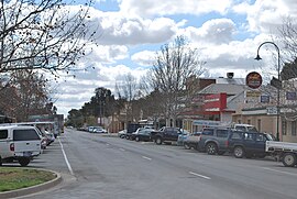
    Broken Hill is a city in the far west region of outback New South Wales, Australia. An inland mining city, is near the border with South Australia on the crossing of the Barrier Highway (A32) and the Silver City Highway (B79), in the Barrier Range. It is 315m above sea level, with a hot desert climate, and an average rainfall of 235mm. The closest major city is Mildura, 300 km to the south and the nearest State Capital City is Adelaide, the capital of South Australia, which is more than 500 km to the southwest and linked via route A32.

    <span class="mw-page-title-main">Randwick, New South Wales</span> Suburb of Sydney, New South Wales, Australia

    Randwick is a suburb in the Eastern Suburbs of Sydney, in the state of New South Wales, Australia. Randwick is located 6 kilometres south-east of the Sydney central business district and is the administrative centre for the local government area of the City of Randwick. The postcode is 2031.

    <span class="mw-page-title-main">Windsor, New South Wales</span> Town in New South Wales, Australia

    Windsor is a historic town in north-west of Sydney, New South Wales, Australia. It is the council seat of the Hawkesbury local government area. The town sits on the Hawkesbury River, enveloped by farmland and Australian bush. Many of the oldest surviving European buildings in Australia are located at Windsor. It is 56 km (35 mi) north-west of the Sydney CBD, on the fringes of urban sprawl. Windsor is the fourth oldest town in Australia European settlement to have European settlement. Windsor have all amenities including Shopping Malls, Supermarkets, Hospital, Schools, Service Australia, Police Station, Railway Station, Bus Depot, Hotel, Restaurants and Cafe.

    <span class="mw-page-title-main">Menindee, New South Wales</span> Town in New South Wales, Australia

    Menindee is a small town in the far west of New South Wales, Australia, in Central Darling Shire, on the banks of the Darling River, with a sign-posted population of 980 and a 2016 census population of 551. Menindee was the first town to be established on the Darling River. There are two distinct theories for the derivation of the township’s name: (a) from the Barkindji word "minandichi" for the shallow ephemeral lake north-west of the present-day township; (b) from the Barkindji word 'milhthaka', meaning "yolk of an egg".

    <span class="mw-page-title-main">Sunraysia</span> Region of Australia

    Sunraysia is a region located in northwestern Victoria and southwestern New South Wales in Australia. The region is renowned for its sunshine, intensive horticulture including grapes and oranges. Its main centre is Mildura, Victoria.

    <span class="mw-page-title-main">City of Blue Mountains</span> Local government area in New South Wales, Australia

    The City of Blue Mountains is a local government area of New South Wales, Australia, governed by the Blue Mountains City Council. The city is located in the Blue Mountains, on the Great Dividing Range at the far western fringe of the Greater Sydney area.

    <span class="mw-page-title-main">Berrima, New South Wales</span> Town in New South Wales, Australia

    Berrima is a historic village in the Southern Highlands of New South Wales, Australia, in Wingecarribee Shire. The village, once a major town, is located on the Old Hume Highway between Sydney and Canberra. It was previously known officially as the Town of Berrima. It is close to the three major towns of the Southern Highlands: Mittagong, Bowral and Moss Vale.

    <span class="mw-page-title-main">City of Randwick</span> Local government area in New South Wales, Australia

    The City of Randwick is a local government area in the Eastern Suburbs of Sydney, New South Wales, Australia located south-east of the CBD. Established in 1859, Randwick is the second-oldest local government area in New South Wales, after the City of Sydney. It comprises an area of 36 square kilometres (14 sq mi) and as at the 2016 census had a population of 140,660.

    <span class="mw-page-title-main">Municipality of Woollahra</span> Local government area in New South Wales, Australia

    Woollahra Municipal Council is a local government area in the eastern suburbs of Sydney, in the state of New South Wales, Australia. Woollahra is bounded by Sydney Harbour in the north, Waverley Council in the east, Randwick City in the south and the City of Sydney in the west.

    <span class="mw-page-title-main">Wentworth Gaol</span>

    The Wentworth Gaol is a heritage-listed former gaol and school building and now museum and old wares shop located at 112 Beverley Street, Wentworth, in the Wentworth Shire, New South Wales, Australia. It was designed by James Barnet and built from 1879 to 1881 by Whitcombe Brothers, Hay. It is also known as the Old Wentworth Gaol. The property is owned by Department of Primary Industries - Western Lands Commissioner, an agency of the Government of New South Wales. The property was added to the New South Wales State Heritage Register on 21 October 2016.

    <span class="mw-page-title-main">Wentworth Shire</span> Local government area in New South Wales, Australia

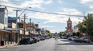
    Wentworth Shire is a local government area in the far south-west Riverina region of New South Wales, Australia. This Shire is located adjacent to the Murray and Darling Rivers. The Shire's major roads are the Sturt and the Silver City Highways. The Shire includes the towns of Wentworth, Buronga, Gol Gol, Dareton and Pooncarie. The shire's namesake is explorer and politician William Wentworth.

    East Maitland is a suburb in Maitland, New South Wales, Australia. It is on the New England Highway and it has two railway stations, Victoria Street and East Maitland. Both stations are served by NSW TrainLink. Hunter Valley Buses provides bus service.

    The 1956 Murray River flood involved the rising of waters in the Murray River and flooding of many towns in New South Wales, Victoria and South Australia. The flood was and still is considered the biggest flood in the recorded history of the Murray and described as "the greatest catastrophe in South Australia's history", although few lives were lost.

    <span class="mw-page-title-main">Mortimer Lewis</span> English-born architect, surveyor and public servant (1796–1879)

    Mortimer William Lewis was an English-born architect, surveyor and public servant who migrated to Australia and became Colonial Architect in the colony of New South Wales from 1835 to 1849. Lewis was responsible for designing and overseeing many government buildings in Sydney and rural New South Wales, many of which are heritage listed.

    <span class="mw-page-title-main">Murray River Council</span> Local government area in New South Wales, Australia

    The Murray River Council is a local government area in the Riverina region of New South Wales, Australia. This area was formed in 2016 from the merger of Murray Shire with Wakool Shire.

    <span class="mw-page-title-main">Dubbo Regional Council</span> Local government area in New South Wales, Australia

    The Dubbo Regional Council is a local government area located in the Central West and Orana regions of New South Wales, Australia. The council was formed on 12 May 2016 through a merger of the City of Dubbo and Wellington Council as part of a widespread council amalgamation program. It was initially named Western Plains Regional Council for almost four months, and its name was changed to Dubbo Regional Council on 7 September 2016.

    <span class="mw-page-title-main">St John's Anglican Church, Wentworth</span> Church in New South Wales, Australia

    St John's Anglican Church, officially the Church of St John the Evangelist, is a heritage-listed Anglican church located at Darling Street, Wentworth, Wentworth Shire, New South Wales, Australia. It was designed by Reverend A. D. Soares and built in 1871. It is also known as St. John's Anglican Church and Rectory. The property is owned by the Anglican Parish of Wentworth. The church was added to the New South Wales State Heritage Register on 2 April 1999.

    The Avoca Homestead Complex is a heritage-listed former station homestead and station facilities and now catered accommodation and visitor attraction at 1122a Low Darling Road, Wentworth, in the Wentworth Shire, New South Wales, Australia. It was built between 1871 and 1879. It is also known as the Avoca Station Homestead and outbuildings. It was added to the New South Wales State Heritage Register on 8 April 2016.

    PS Rodney is a heritage-listed paddle steamer shipwreck on the Darling River at Polia Station, Pooncarie in the Wentworth Shire, New South Wales, Australia. It was designed by Captains Dorward and Davies and built by Thomas McDonald. The property is owned by Department of Trade & Investment, Regional Infrastructure & Services, an agency of the Government of New South Wales. It was added to the New South Wales State Heritage Register on 23 November 2007.

    <span class="mw-page-title-main">Tooleybuc Bridge</span> Bridge crossing Murray River in Victoria, Australia

    The Tooleybuc Bridge is a dual heritage-listed road bridge that carries Tooleybuc Road across the Murray River, located in Tooleybuc, New South Wales, Australia. It was built in 1925. The bridge is owned by the Transport for NSW, and is also called the Tooleybuc Bridge over Murray River. The bridge was added to the New South Wales State Heritage Register on 20 June 2000 and the Victorian Heritage Register on 10 July 2008.

    References

    1. "2011 Census Quickstats". Australian Bureau of Statistics . Retrieved 22 June 2012.
    2. "Our History". Wentworth Shire Council. Retrieved 8 December 2023.
    3. Premier Postal History, Post Office List , retrieved 11 April 2008
    4. 'The Riverine Trade (No. V): Down the Murray', The Argus (newspaper), 12 February 1876, p. 9.
    5. "Old Wentworth Gaol". New South Wales State Heritage Register . Department of Planning & Environment. H01982. Retrieved 18 May 2018. CC BY icon.svg Text is licensed by State of New South Wales (Department of Planning and Environment) under CC-BY 4.0 licence .
    6. "St. Ignatius School". New South Wales State Heritage Register . Department of Planning & Environment. H01507. Retrieved 18 May 2018. CC BY icon.svg Text is licensed by State of New South Wales (Department of Planning and Environment) under CC-BY 4.0 licence .
    7. "St. John's Anglican Church and Rectory". New South Wales State Heritage Register . Department of Planning & Environment. H00661. Retrieved 18 May 2018. CC BY icon.svg Text is licensed by State of New South Wales (Department of Planning and Environment) under CC-BY 4.0 licence .
    8. "Avoca Homestead Complex". New South Wales State Heritage Register . Department of Planning & Environment. H01971. Retrieved 18 May 2018. CC BY icon.svg Text is licensed by State of New South Wales (Department of Planning and Environment) under CC-BY 4.0 licence .
    9. "Western timetable". NSW TrainLink. 7 September 2019.
    10. 1 2 The 1956 flood of Wentworth, Mildura Tourism Inc, Accessed September 16, 2007
    11. Bob Byrne; David Blowers (12 November 2017). "How hundreds of people caught the pokies express into NSW to play poker machines". The Advertiser. Retrieved 10 July 2018.
    12. Full Points Footy, Sunraysia Football League , retrieved 15 April 2009
    13. "Climate statistics for". Bureau of Meteorology. Retrieved 20 January 2014.