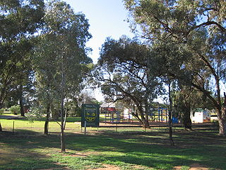
Wisemans Ferry is a town in the state of New South Wales, Australia, located 75 kilometres north north-west of the Sydney central business district in the local government areas of Hornsby Shire, The Hills Shire, City of Hawkesbury and Central Coast Council. The town is a tourist spot with picnic and barbecue facilities. As well as a rich convict and colonial heritage in the area, the Dharug National Park and Yengo National Park are close by.

Underbool is a town in the Mallee region of north-west Victoria, Australia. The town is in the Rural City of Mildura local government area and on the Mallee Highway—between Ouyen and the South Australian border – 476 kilometres (296 mi) north west of the state capital, Melbourne. The town services the grain farmers and graziers in the area. For tourists it provides access to the Pink Lakes in Murray-Sunset National Park.

Werrimull is a small Australian town and locality in the state of Victoria and a part of the Sunraysia region. The place by road, is situated about 10 kilometres west of Karawinna and 10 kilometres east of Bambill. It is 79 kilometres (49 mi) west southwest of Mildura, 13 kilometres south of the Sturt Highway opposite Lake Cullulleraine. At the 2016 census, Werrimull and the surrounding area had a population of 112, declining from 320 in 2011.
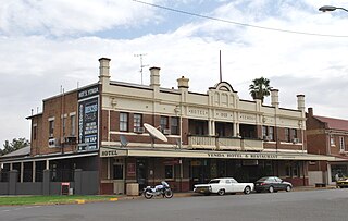
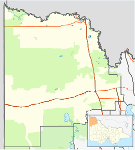
Yenda is a town in the Riverina district of New South Wales, Australia. The town is located about 16 kilometres (9.9 mi) east of Griffith, 65 kilometres (40 mi) north-west of Narrandera, and 550 kilometres (340 mi) west of Sydney in the Murrumbidgee Irrigation Area of southern New South Wales. Although most of the original 15-acre farms have been consolidated into large vineyards and most farmhouses have disappeared, farm roads are named after the original settlers. In 1940 Yenda had two clothing stores, two bakers, two butchers, two grocery stores, two barbers, one newsagency, one pharmacy, one cinema, one Greek restaurant and one bank but residents now do their shopping in nearby Griffith. At the 2011 census, Yenda had a population of 1,503.
Brawlin is a small community in the north east part of the Riverina and situated about 12 kilometres south of Cootamundra and 29 kilometres north of Coolac.
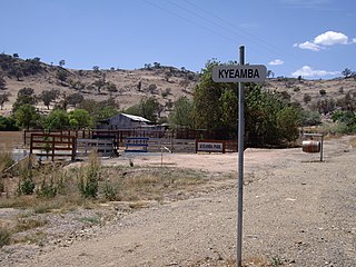
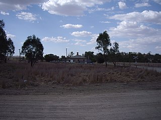
Kyeamba is a farming community in the central east part of the Riverina and situated about 16 kilometres (9.9 mi) north west of Humula and 23 kilometres (14 mi) south west of Tarcutta. At the 2016 census, Kyeamba had a population of 54.

Welaregang is a rural community in the far south east part of the Riverina and situated about 11 kilometres south west from Tooma and 15 kilometres south east from Ournie. At the 2006 census, Welaregang had a population of 162.

Muttama is a rural community in the central east part of the Riverina. It is situated by road, about 24 kilometres south of Cootamundra and 17 kilometres north of Coolac.

Merriwagga is a town in the northern part of the Riverina region of the Australian state of New South Wales. It is situated by road, about 20 kilometres (12 mi) north west of Goolgowi and 42 kilometres (26 mi) south of Hillston on the Kidman Way in NSW. At the 2011 census, it has a population of 169. The main industry is agriculture.
Tantonan is a rural locality in the central south part of the Riverina, New South Wales, Australia. It is situated by road, about 8 kilometres north west from Caldwell and 13 kilometres south east from Bunnaloo.

Beverford is a locality situated in the Sunraysia region. The place by road, is situated about 5 kilometres north west from Tyntynder South and 8 kilometres south east from Vinifera. At the 2011 census, Beverford and the surrounding area had a population of 372.

Panitya is a locality situated in the Sunraysia region. The place by road, is situated about 23 kilometres east from Pinnaroo and 10 kilometres west from Carina on the Mallee Highway.
Sunset Country is a desert situated in remote north-west Victoria in the Sunraysia region. By road, the area is about 4 kilometres north from Manya and 30 kilometres south from Berrook.

Cowangie is a locality situated on the section of the Mallee Highway between Ouyen and the South Australian border in the Sunraysia region of Victoria, Australia. The place by road, is situated about 12 kilometres southeast from Tutye and 12 kilometres northwest from Danyo.

Walpeup is a town in the Mallee region of north west Victoria. The town is in the Rural City of Mildura local government area and on the Mallee Highway and Pinnaroo railway line between Ouyen and the South Australian border, 458 kilometres (285 mi) north west of the state capital, Melbourne and 130 kilometres (81 mi) south west of the regional centre of Mildura. At the 2016 census, Walpeup had a population of 158.

Wollun is a small rural community about 26 kilometres north-west of Walcha and is included in the Uralla Shire local government area of the Northern Tablelands region of New South Wales, Australia.

Clackline is a locality in the Wheatbelt region of Western Australia, about 80 kilometres (50 mi) east-north-east of Perth.

The City of Munno Para, formerly the District Council of Munno Para, was a local government area of South Australia from 1933 to 1997, seated at the township of Smithfield.
Tourist Drives in Western Australia are routes through areas of scenic or historic significance, designated by route markers with white numbers on a brown shield. Tourist Drives were introduced into Western Australia while Eric Charlton was the state government Minister for Transport in the 1990s. The 28 numbered routes collectively traverse more than 2,000 kilometres (1,200 mi) across the state. In addition to the Tourist Drives, there are unnumbered routes such as the Golden Pipeline Heritage Trail, and local governments may designate and maintain local scenic drives, generally unnamed and unnumbered.
Gretna is a rural locality in the local government areas (LGA) of Central Highlands and Derwent Valley in the Central and South-east LGA regions of Tasmania. The locality is about 20 kilometres (12 mi) south-east of the town of Hamilton. The 2016 census has a population of 211 for the state suburb of Gretna. It was formerly known as Stony Hut Plains, though the Gretna post office was known as Macquarie Plains for many years. It has a postcode of 7140.