Western Interior Seaway

Last updated
Map of North America with the Western Interior Seaway during the Campanian Map of North America with the Western Interior Seaway during the Campanian (Upper Cretaceous).png
Map of North America with the Western Interior Seaway during the Campanian

The Western Interior Seaway (also called the Cretaceous Seaway, the Niobraran Sea, the North American Inland Sea, and the Western Interior Sea) was a large inland sea that split the continent of North America into two landmasses. The ancient sea, which existed from the early Late Cretaceous (100 Ma) to the earliest Paleocene (66 Ma), connected the Gulf of Mexico to the Arctic Ocean. The two land masses it created were Laramidia to the west and Appalachia to the east. At its largest extent, it was 2,500 feet (760 m) deep, 600 miles (970 km) wide and over 2,000 miles (3,200 km) long.

Contents

Origin and geology

A broken concretion with fossils inside; late Cretaceous Pierre Shale near Ekalaka, Montana. BrokenConcretion22.jpg
A broken concretion with fossils inside; late Cretaceous Pierre Shale near Ekalaka, Montana.
Monument Rocks (Kansas), located 25 miles south of Oakley. Monument rocks view.jpg
Monument Rocks (Kansas), located 25 miles south of Oakley.

By the late Cretaceous, Eurasia and the Americas had separated along the south Atlantic, and subduction on the west coast of the Americas had commenced, resulting in the Laramide orogeny, the early phase of growth of the modern Rocky Mountains. The Western Interior Seaway may be seen as a downwarping of the continental crust ahead of the growing Laramide/Rockies mountain chain. [1]

The earliest phase of the seaway began in the mid-Cretaceous when an arm of the Arctic Ocean transgressed south over western North America; this formed the Mowry Sea, so named for the Mowry Shale, an organic-rich rock formation. [1] In the south, the Gulf of Mexico was originally an extension of the Tethys Ocean. In time, the southern embayment merged with the Mowry Sea in the late Cretaceous, forming a completed seaway, creating isolated environments for land animals and plants. [1]

Relative sea levels fell multiple times, as a margin of land temporarily rose above the water along the ancestral Transcontinental Arch, [2] each time rejoining the separated, divergent land populations, allowing a temporary mixing of newer species before again separating the populations.

At its largest, the Western Interior Seaway stretched from the Rockies east to the Appalachian Mountains, some 1,000 km (620 mi) wide. At its deepest, it may have been only 800 or 900 metres (2,600 or 3,000 ft) deep, shallow in terms of seas. Two great continental watersheds drained into it from east and west, diluting its waters and bringing resources in eroded silt that formed shifting delta systems along its low-lying coasts. There was little sedimentation on the eastern shores of the seaway; the western boundary, however, consisted of a thick clastic wedge eroded eastward from the Sevier orogenic belt. [1] [3] The western shore was thus highly variable, depending on variations in sea level and sediment supply. [1]

Widespread carbonate deposition suggests that the seaway was warm and tropical, with abundant calcareous planktonic algae. [4] Remnants of these deposits are found in northwest Kansas. A prominent example is Monument Rocks, an exposed chalk formation towering 70 feet (21 m) over the surrounding range land. [5] The Western Interior Seaway is believed to have behaved similarly to a giant estuary in terms of water mass transport. Riverine inputs exited the seaway as coastal jets, while correspondingly drawing in water from the Tethys in the south and Boreal waters from the north. [6] During the late Cretaceous, the Western Interior Seaway went through multiple periods of anoxia, when the bottom water was devoid of oxygen and the water column was stratified. [7]

At the end of the Cretaceous, continued Laramide uplift hoisted the sandbanks (sandstone) and muddy brackish lagoons (shale), thick sequences of silt and sandstone still seen today as the Laramie Formation, while low-lying basins between them gradually subsided. The Western Interior Seaway divided across the Dakotas and retreated south towards the Gulf of Mexico. This shrunken and final regressive phase is sometimes called the Pierre Seaway. [1]

During the early Paleocene, parts of the Western Interior Seaway still occupied areas of the Mississippi Embayment, submerging the site of present-day Memphis. Later transgression, however, was associated with the Cenozoic Tejas sequence, rather than with the previous event responsible for the seaway. [8] [9] [10]

Fauna

The Western Interior Seaway was a shallow sea, filled with abundant marine life. Interior seaway denizens included predatory marine reptiles such as plesiosaurs, and mosasaurs. Other marine life included sharks such as Squalicorax, Cretoxyrhina, and the giant shellfish-eating Ptychodus mortoni (believed to be 10 metres (33 ft) long); [11] and advanced bony fish including Pachyrhizodus , [12] Enchodus , and the massive 5-metre (16 ft) long Xiphactinus , larger than any modern bony fish. [13] Other sea life included invertebrates such as mollusks, ammonites, squid-like belemnites, and plankton including coccolithophores that secreted the chalky platelets that give the Cretaceous its name, foraminiferans and radiolarians. [14] [15]

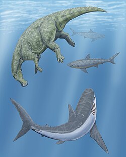
The seaway was home to early birds, including the flightless Hesperornis that had stout legs for swimming through water and tiny wings used for marine steering rather than flight; and the tern-like Ichthyornis , an early avian with a toothy beak. Ichthyornis shared the sky with large pterosaurs such as Nyctosaurus and Pteranodon . Pteranodon fossils are very common; it was probably a major participant in the surface ecosystem, though it was found in only the southern reaches of the seaway. [16]

Inoceramids (oyster-like bivalve molluscs) were well-adapted to life in the oxygen-poor bottom mud of the seaway. [17] These left abundant fossils in the Kiowa, Greenhorn, Niobrara, Mancos, and Pierre formations. There is great variety in the shells and the many distinct species have been dated and can be used to identify specific beds in those rock formations of the seaway. Many species can easily fit in the palm of the hand, while some like Inoceramus (Haploscapha) grandis [18] could be well over a meter in diameter. Entire schools of fish sometimes sought shelter within the shell of the giant Platyceramus . [19] The shells of the genus are known for being composed of prismatic calcitic crystals that grew perpendicular to the surface, and fossils often retain a pearly luster. [20]

See also

Related Research Articles

<span class="mw-page-title-main">Plesiosauroidea</span> Extinct clade of reptiles

Plesiosauroidea is an extinct clade of carnivorous marine reptiles. They have the snake-like longest neck to body ratio of any reptile. Plesiosauroids are known from the Jurassic and Cretaceous periods. After their discovery, some plesiosauroids were said to have resembled "a snake threaded through the shell of a turtle", although they had no shell.

<i>Squalicorax</i> Extinct genus of sharks

Squalicorax, commonly known as the crow shark, is a genus of extinct lamniform shark known to have lived during the Cretaceous period. The genus had a global distribution in the Late Cretaceous epoch. Multiple species within this genus are considered to be wastebasket taxon due to morphological similarities in the teeth.

<i>Cretoxyrhina</i> Extinct genus of shark

Cretoxyrhina is an extinct genus of large mackerel shark that lived about 107 to 73 million years ago during the late Albian to late Campanian of the Late Cretaceous. The type species, C. mantelli, is more commonly referred to as the Ginsu shark, first popularized in reference to the Ginsu knife, as its theoretical feeding mechanism is often compared with the "slicing and dicing" when one uses the knife. Cretoxyrhina is traditionally classified as the likely sole member of the family Cretoxyrhinidae but other taxonomic placements have been proposed, such as within the Alopiidae and Lamnidae.

<i>Ichthyornis</i> Extinct genus of bird-like dinosaurs

Ichthyornis is an extinct genus of toothy seabird-like ornithuran from the late Cretaceous period of North America. Its fossil remains are known from the chalks of Alberta, Alabama, Kansas, New Mexico, Saskatchewan, and Texas, in strata that were laid down in the Western Interior Seaway during the Turonian through Campanian ages, about 95–83.5 million years ago. Ichthyornis is a common component of the Niobrara Formation fauna, and numerous specimens have been found.

<i>Xiphactinus</i> Extinct genus of fishes

Xiphactinus, colloquially referred to as the X-fish, is an extinct genus of large predatory marine bony fish that lived during the late Albian to the late Maastrichtian. The genus grew up to 5–6 metres (16–20 ft) in length, and superficially resembled a gargantuan, fanged tarpon.

<i>Nyctosaurus</i> Genus of nyctosaurid pterosaur from the Late Cretaceous

Nyctosaurus is a genus of nyctosaurid pterosaur from the Late Cretaceous period of what is now the Niobrara Formation of the mid-western United States, which, during the time Nyctosaurus was alive, was covered in an extensive shallow sea. Some remains belonging to a possible Nyctosaurus species called N.lamegoi have been found in Brazil, making Nyctosaurus more diverse. The genus Nyctosaurus has had numerous species referred to it, though how many of these may actually be valid requires further study. At least one species possessed an extraordinarily large antler-like cranial crest.

<span class="mw-page-title-main">Dakota Formation</span> Rock units in midwestern North America

The Dakota is a sedimentary geologic unit name of formation and group rank in Midwestern North America. The Dakota units are generally composed of sandstones, mudstones, clays, and shales deposited in the Mid-Cretaceous opening of the Western Interior Seaway. The usage of the name Dakota for this particular Albian-Cenomanian strata is exceptionally widespread; from British Columbia and Alberta to Montana and Wisconsin to Colorado and Kansas to Utah and Arizona. It is famous for producing massive colorful rock formations in the Rocky Mountains and the Great Plains of the United States, and for preserving both dinosaur footprints and early deciduous tree leaves.

<i>Sea Monsters: A Prehistoric Adventure</i> 2007 American film

Sea Monsters: A Prehistoric Adventure is a 2007 American IMAX 3D documentary film by National Geographic, about prehistoric marine reptiles. It alternates modern-day sequences about the work of scientists studying the animals with computer-animated scenes depicting the prehistoric past.

<span class="mw-page-title-main">Niobrara Formation</span> Geological formation in the United States

The Niobrara Formation, also called the Niobrara Chalk, is a geologic formation in North America that was deposited between 87 and 82 million years ago during the Coniacian, Santonian, and Campanian stages of the Late Cretaceous. It is composed of two structural units, the Smoky Hill Chalk Member overlying the Fort Hays Limestone Member. The chalk formed from the accumulation of coccoliths from microorganisms living in what was once the Western Interior Seaway, an inland sea that divided the continent of North America during much of the Cretaceous. It underlies much of the Great Plains of the US and Canada. Evidence of vertebrate life is common throughout the formation and includes specimens of plesiosaurs, mosasaurs, pterosaurs, and several primitive aquatic birds. The type locality for the Niobrara Chalk is the Niobrara River in Knox County in northeastern Nebraska. The formation gives its name to the Niobrara cycle of the Western Interior Seaway.

Colorado is a geologic name applied to certain rocks of Cretaceous age in the North America, particularly in the western Great Plains. This name was originally applied to classify a group of specific marine formations of shale and chalk known for their importance in Eastern Colorado. The surface outcrop of this group produces distinctive landforms bordering the Great Plains and it is a significant feature of the subsurface of the Denver Basin and the Western Canadian Sedimentary Basin. These formations record important sequences of the Western Interior Seaway. As the geology of this seaway was studied, this name came to be used in states beyond Colorado but later was replaced in several of these states with more localized names.

<span class="mw-page-title-main">Paleobiota of the Niobrara Formation</span>

During the time of the deposition of the Niobrara Chalk, much life inhabited the seas of the Western Interior Seaway. By this time in the Late Cretaceous many new lifeforms appeared such as mosasaurs, which were to be some of the last of the aquatic lifeforms to evolve before the end of the Mesozoic. Life of the Niobrara Chalk is comparable to that of the Dakota Formation, although the Dakota Formation, which was deposited during the Cenomanian, predates the chalk by about 10 million years.

<span class="mw-page-title-main">Austin Chalk</span> Geologic formation in Texas, United States

The Austin Chalk is an upper Cretaceous geologic formation in the Gulf Coast region of the United States. It is named after type section outcrops near Austin, Texas. The formation is made up of chalk and marl.

<span class="mw-page-title-main">Tropic Shale</span>

The Tropic Shale is a Mesozoic geologic formation. Dinosaur remains are among the fossils that have been recovered from the formation, including Nothronychus graffami. The Tropic Shale is a stratigraphic unit of the Kaiparowits Plateau of south central Utah. The Tropic Shale was first named in 1931 after the town of Tropic where the Type section is located. The Tropic Shale outcrops in Kane and Garfield counties, with large sections of exposure found in the Grand Staircase–Escalante National Monument.

<span class="mw-page-title-main">Mowry Shale</span> Geologic formation in Wyoming, USA

The Mowry Shale is an Early Cretaceous geologic formation. The formation was named for Mowrie Creek, northwest of Buffalo in Johnson County, Wyoming.

The Kiowa Formation or Kiowa Shale is a Cretaceous geologic formation in Kansas, diminishing to member status in Colorado and Oklahoma. In Colorado, the Kiowa Shale was classified as a member of the now abandoned Purgatoire Formation. In the vicinity of Longford, Kansas, the local Longford member comprises thinly bedded siltstone, clay, polished gravel, lignite, and sandstone suggests a river and estuary environment.

<span class="mw-page-title-main">Carlile Shale</span> Geologic formation in the western US

The Carlile Shale is a Turonian age Upper/Late Cretaceous series shale geologic formation in the central-western United States, including in the Great Plains region of Colorado, Kansas, Nebraska, New Mexico, North Dakota, South Dakota, and Wyoming.

<i>Cardabiodon</i> Extinct genus of sharks

Cardabiodon is an extinct genus of large mackerel shark that lived about 95 to 91 million years ago (Ma) during the Cenomanian to Turonian of the Late Cretaceous. It is a member of the Cardabiodontidae, a family unique among mackerel sharks due to differing dental structures, and contains the two species C. ricki and C. venator. Cardabiodon fossils have been found in Australia, North America, England, and Kazakhstan. It was likely an antitropical shark that inhabited temperate neritic and offshore oceans between 40° and 60° paleolatitude, similar to the modern porbeagle shark.

<span class="mw-page-title-main">Graneros Shale</span> Geological formation

The Graneros Shale is a geologic formation in the United States identified in the Great Plains as well as New Mexico that dates to the Cenomanian Age of the Cretaceous Period. It is defined as the finely sandy argillaceous or clayey near-shore/marginal-marine shale that lies above the older, non-marine Dakota sand and mud, but below the younger, chalky open-marine shale of the Greenhorn. This definition was made in Colorado by G. K. Gilbert and has been adopted in other states that use Gilbert's division of the Benton's shales into Carlile, Greenhorn, and Graneros. These states include Kansas, Texas, Oklahoma, Nebraska, and New Mexico as well as corners of Minnesota and Iowa. North Dakota, South Dakota, Wyoming, and Montana have somewhat different usages — in particular, north and west of the Black Hills, the same rock and fossil layer is named Belle Fourche Shale.

The Thermopolis Shale is a geologic formation which formed in west-central North America in the Albian age of the Late Cretaceous period. Surface outcroppings occur in central Canada, and the U.S. states of Montana and Wyoming. The rock formation was laid down over about 7 million years by sediment flowing into the Western Interior Seaway. The formation's boundaries and members are not well-defined by geologists, which has led to different definitions of the formation. Some geologists conclude the formation should not have a designation independent of the formations above and below it. A range of invertebrate and small and large vertebrate fossils and coprolites are found in the formation.

The Favel Formation is a stratigraphic unit of Late Cretaceous age. It is present in southern Manitoba and southeastern Saskatchewan, and consists primarily of calcareous shale. It was named for the Favel River near Minitonas, Manitoba, by R.T.D. Wickenden in 1945.

References

  1. 1 2 3 4 5 6 Stanley, Steven M. (1999). Earth System History. New York: W.H. Freeman and Company. pp. 487–489. ISBN   0-7167-2882-6.
  2. R.J. Weimer (1984). J.S. Schlee (ed.). "Relation of unconformities, tectonics, and sea-level changes, Cretaceous of Western Interior, U.S.A.; in" (PDF). AAPG Memoir (Memoir 36, Interregional unconformities and hydrocarbon accumulation). American Association of Petroleum Geologists: 7-35. Retrieved March 6, 2021. [The url is to a Rice University-hosted pdf of a book chapter adapted from the original Weimer 1984 paper.]
  3. Monroe, James S.; Wicander, Reed (2009). The Changing Earth: Exploring Geology and Evolution (5th ed.). Belmont, CA: Brooks/Cole, Cengage Learning. p.  605. ISBN   978-0495554806.
  4. "Oceans of Kansas Paleontology". Mike Everhart. Retrieved 2007-02-06.
  5. Stokes, Keith. "Monument Rocks, the Chalk Pyramids - Kansas". www.kansastravel.org. Retrieved 7 April 2018.
  6. Slingerland, Rudy; Kump, Lee R.; Arthur, Michael A.; Fawcett, Peter J.; Sageman, Bradley B.; Barron, Eric J. (1 August 1996). "Estuarine circulation in the Turonian Western Interior seaway of North America". Geological Society of America Bulletin . 108 (8): 941–952. doi:10.1130/0016-7606(1996)108<0941:ECITTW>2.3.CO;2 . Retrieved 5 April 2023.
  7. Lowery, Christopher M.; Leckie, R. Mark; Bryant, Raquel; Elderbak, Khalifa; Parker, Amanda; Polyak, Desiree E.; Schmidt, Maxine; Snoeyenbos-West, Oona; Sterzinare, Ericfa (1 February 2018). "The Late Cretaceous Western Interior Seaway as a model for oxygenation change in epicontinental restricted basins" (PDF). Earth-Science Reviews . 177: 545–564. Bibcode:2018ESRv..177..545L. doi:10.1016/j.earscirev.2017.12.001.
  8. Stanley, Steven M. (1998). Earth system history. New York: W.H. Freeman. p. 516. ISBN   0716728826.
  9. Monroe, James S. (1997). The changing earth: exploring geology and evolution (2nd ed.). Belmont, Calif.: Wadsworth Pub. p. 643. ISBN   0314095772.
  10. Frazier, William J.; Schwimmer, David R. (1987). "The Tejas Sequence: Tertiary—Recent". Regional Stratigraphy of North America. pp. 523–652. doi:10.1007/978-1-4613-1795-1_9. ISBN   978-1-4612-9005-6.
  11. Walker, Matt (24 February 2010). "Giant predatory shark fossil unearthed in Kansas". BBC Earth News. Retrieved 16 April 2013.
  12. Mike Everhart (February 2, 2010). "Pachyrhizodus. A Large Predatory Fish from the Late Cretaceous Western Interior Sea". Oceans of Kansas Paleontology. Retrieved May 5, 2011.
  13. Cumbaa, Stephen L.; Tokaryk, Tim T. (1999). "Recent Discoveries of Cretaceous Marine Vertebrates on the Eastern Margins of the Western Interior Seaway" (PDF). Saskatchewan Geological Survey Summary of Investigations. 1: 57–63. Retrieved 27 August 2021.
  14. Boyles, M.J.; Scott, A.J. (1982). "Comparison of Wave-Dominated Deltaic Deposits and Associated Sand-Rich Strand Plains, Mesaverde Group, Northwest Colorado". AAPG Bulletin. 66 (5): 551–552.
  15. Kauffman, E.G. (1984). "Paleobiogeography and evolutionary response dynamic in the Cretaceous Western Interior Seaway of North America". Jurassic-Cretaceous biochronology and paleogeography of North America (PDF). Vol. 27. Geological Association of Canada. pp. 273–306. Retrieved 27 August 2021.
  16. Benton, S.C. (1994). "The Pterosaurs of the Niobrara Chalk." The Earth Scientist, 11(1): 22-25.
  17. Da Gama, Rui O.B.P.; Lutz, Brendan; Desjardins, Patricio; Thompson, Michelle; Prince, Iain; Espejo, Irene (November 2014). "Integrated paleoenvironmental analysis of the Niobrara Formation: Cretaceous Western Interior Seaway, northern Colorado". Palaeogeography, Palaeoclimatology, Palaeoecology. 413: 66–80. Bibcode:2014PPP...413...66D. doi:10.1016/j.palaeo.2014.05.005.
  18. Moss, Rycroft G. (May 2004) [1 December 1932]. "Bulletin 19: The Geology of Ness and Hodgeman Counties, Kansas". Bulletin of the University of Kansas—Lawrence. 33 (18): Stratigraphy: Rocks Exposed. Retrieved 2020-11-17.
  19. Prothero, Donald R. (2013). Bringing fossils to life : an introduction to paleobiology (Third ed.). New York: Columbia University Press. p. 172. ISBN   9780231158930.
  20. Ludvigsen, Rolf; Beard, Graham (1997). West Coast Fossils: A Guide to the Ancient Life of Vancouver Island . Harbour Pub. pp.  102–103. ISBN   9781550171792.

Further reading