
The Boston Post Road was a system of mail-delivery routes between New York City and Boston, Massachusetts, that evolved into one of the first major highways in the United States.
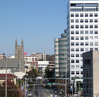
Fairfield County is a county in the southwestern corner of the U.S. state of Connecticut, as well as its fastest-growing from 2010 to 2018 and largest in terms of population. As of the 2010 census, the county's population was 916,829, estimated to have increased by 3.6% to 949,921 in 2017, and decreased to 943,332 in 2019. The most populous county in the state, the county population represents a little over 25% of Connecticut's overall population and is one of its fastest-growing counties. The closest to the center of the New York metropolitan area, the county contains four of the state's largest cities–Bridgeport (1st), Stamford (3rd), Norwalk (6th), and Danbury (7th)–whose combined population of 433,368 is nearly half the county's total population.

Huntington is a city in Cabell and Wayne Counties in the U.S. state of West Virginia. It is the county seat of Cabell County, and largest city in the Huntington-Ashland, WV-KY-OH Metropolitan Statistical Area, sometimes referred to as the Tri-State Area. A historic and bustling city of commerce and heavy industry, Huntington has benefited from its location on the Ohio River at the mouth of the Guyandotte River. It is home to the Port of Huntington Tri-State, the second-busiest inland port in the United States.
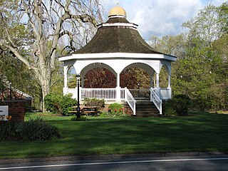
Monroe is a town located in eastern Fairfield County, Connecticut, United States. The population was 19,479 at the 2010 census.

Drexel Hill is a neighborhood and census-designated place (CDP) located in Upper Darby, Pennsylvania. The population was 28,043 at the 2010 census, down from 29,364 at the 2000 census.

Ansonia is a city in New Haven County, Connecticut, United States, on the Naugatuck River, immediately north of Derby, and about 12 miles (19 km) northwest of New Haven. The population was 19,249 at the 2010 census. The ZIP code for Ansonia is 06401. The city is served by the Metro-North Railroad. Ansonia Station is a stop on the railroad passenger commuter service's Waterbury line, connecting to New York's Grand Central Terminal. Ansonia also is served by the Connecticut Transit bus carrier. Connecticut Route 8 serves Ansonia.

Shelton is a city in Fairfield County, Connecticut, United States. The population was 39,559 at the 2010 census.

Route 34 is a primary state highway in the U.S. state of Connecticut. Route 34 is 24.37 miles (39.22 km) long, and extends from Washington Avenue near I-84/US 6 in Newtown to the junction of I-95 and I-91 in New Haven. The highways connects the New Haven and Danbury areas via the Lower Naugatuck River Valley. The portion of the route between New Haven and Derby was an early toll road known as the Derby Turnpike.
New York State Route 104 (NY 104) is a 182.41-mile-long (293.56 km) east–west state highway in Upstate New York in the United States. It spans six counties and enters the vicinity of four cities—Niagara Falls, Lockport, Rochester, and Oswego—as it follows a routing largely parallel to the southern shoreline of Lake Ontario, along a ridge of the old shoreline of Glacial Lake Iroquois. The western terminus of NY 104 is an intersection with NY 384 in Niagara Falls, Niagara County, while its eastern terminus is a junction with NY 13 in the town of Williamstown, Oswego County. The portion of NY 104 between Rochester and the village of Webster east of the city is a limited-access highway known as the Keeler Street Expressway west of NY 590 and the Irondequoit–Wayne County Expressway east of NY 590; from Williamson to Oswego, NY 104 is a super two highway.
Highway 1 is the Saskatchewan section of the Trans-Canada Highway mainland route. The total distance of the Trans-Canada Highway in Saskatchewan is 654 kilometres (406 mi). The highway traverses Saskatchewan from the western border with Alberta, from Highway 1, to the Manitoba border where it continues as PTH 1. The Trans–Canada Highway Act was passed on December 10, 1949. The Saskatchewan segment was completed August 21, 1957, and completely twinned on November 6, 2008. The speed limit along the majority of the route is 110 kilometres per hour (70–mph) with urban area thoroughfares slowing to a speed of 90–100 kilometres per hour (55–65 mph). Portions of the highway—the section through Swift Current, an 8-kilometre (5 mi) section east of Moose Jaw, and a 44-kilometre (27 mi) section between the West Regina Bypass and Balgonie—are controlled-access. Highway 1 serves as a major east–west transport route for commercial traffic. It is the main link between southern Saskatchewan's largest cities, and also serves as the province's main link to the neighbouring provinces of Alberta and Manitoba.
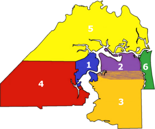
There are more than 500 neighborhoods within the area of Jacksonville, Florida, the largest city in the contiguous United States by area. These include Downtown Jacksonville and surrounding neighborhoods. Additionally, greater Jacksonville is traditionally divided into several major sections with amorphous boundaries: Northside, Westside, Southside, and Arlington, as well as the Jacksonville Beaches.
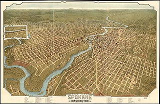
Neighborhoods in Spokane, Washington are officially grouped by the Spokane City Council into three main city council districts: 1, 2, and 3. Each city council district contains multiple, official neighborhoods that are recognized with a neighborhood council. Informally, neighborhoods are colloquially grouped by local geographical, geological, cultural, or historical features The list of neighborhoods below is organized based on the official designations by the City of Spokane. Unofficial neighborhoods and districts are listed within the official neighborhood in which they are located.

In the American folklore of Ohio, and Connecticut, Melon Heads are beings generally described as small humanoids with bulbous heads who occasionally emerge from hiding places to attack people. Different variations of the legend attribute different origins to the entities.
New York State Route 110 (NY 110) is a major north–south state highway along the western border of Suffolk County, New York. It runs between the village of Amityville in the town of Babylon and Halesite in the town of Huntington. NY 110 comes close to the Nassau County line several times in the town of Babylon, which is only surpassed by NY 108 in distance to the county line for a state highway.
County Route 502 (CR 502) is a county highway in the U.S. state of New Jersey. The highway extends 23.79 miles (38.29 km) from Paterson-Hamburg Turnpike (CR 504) in Wayne to Palisades Boulevard in Alpine.
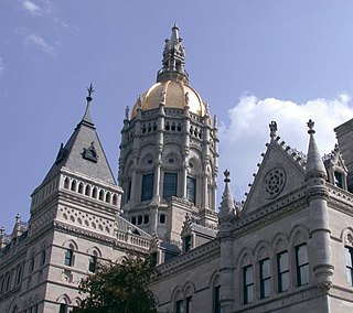
The neighborhoods of Hartford, Connecticut in the United States are varied and historic.

Route 108 in the U.S. state of Connecticut, locally called Nichols Avenue and Huntington Turnpike, is a two-lane state highway that runs northerly from US 1, Boston Post Road in Stratford, through Trumbull, to Route 110 in downtown Shelton. Originally called the Farm Highway, it was laid out to the south side of Mischa Hill in Trumbull on December 7, 1696 and is considered to be the third oldest documented highway in Connecticut after the Mohegan Road in Norwich (1670) and the Boston Post Road or US 1 (1673).

Route 113 is a Connecticut state highway running from the Bridgeport-Stratford town line around the Lordship section of Stratford to the eastern part of the town.

Bridgeport is a historic seaport city in the U.S. state of Connecticut, and its largest city. With a census-estimated population of 144,399 in 2019, it is also the fifth-most populous in New England. Located in Fairfield County at the mouth of the Pequonnock River on Long Island Sound, it is 60 miles (97 km) from Manhattan and 40 miles (64 km) from The Bronx. It is bordered by the towns of Trumbull to the north, Fairfield to the west, and Stratford to the east. Bridgeport and other settlements in Fairfield County make up the Bridgeport-Stamford-Norwalk-Danbury metropolitan statistical area, the second largest metropolitan area in Connecticut. The Bridgeport-Stamford-Norwalk-Danbury metropolis forms part of the New York megacity.

The Paugussett Trail is a 9.2-mile (14.8 km) Blue-Blazed hiking trail "system" in the lower Housatonic River valley in Fairfield County and, today, is entirely in Shelton and Monroe, Connecticut. Much of the trail is in Indian Well State Park and the Town of Monroe's Webb Mountain Park. The mainline trail is primarily southeast to northwest with three short side or spur trails.


