Handy Cross is a hamlet in the parish of Little Marlow, Buckinghamshire, England. It is located on Marlow Hill, on the old road between Marlow and High Wycombe. At the 2011 Census the population of the hamlet was included in the civil parish of Great Marlow. Today the hamlet consists of a farm, several households and a Harvester pub & restaurant.
Nash Lee is a hamlet in the parish of Ellesborough, in Buckinghamshire, England. It is located to the north of the village, about two miles west of Wendover.
Westlington is a hamlet near the village of Dinton in the civil parish of Dinton-with-Ford and Upton, Buckinghamshire, England.
Upton is a hamlet in the civil parish of Dinton-with-Ford and Upton, in Buckinghamshire, England. It is located to the north of the main village of Dinton, on the junction between the new road from Aylesbury to Thame, and the old road before it was rerouted.

Wormstone is a hamlet in the parish of Waddesdon, in Buckinghamshire, England. It is located just south-south east of the main village.

Waldridge is an ancient village in the civil parish of Dinton-with-Ford and Upton in Buckinghamshire, England. Although little of the village survives today, the Waldridge Manor in the nearby village of Meadle shows the approximate location of the original settlement of Waldridge Village.
Greencroft is a village in County Durham, England. The population of the civil parish taken at the 2011 census was 171. It is situated between Lanchester and Annfield Plain.

Holwell is a small village and a civil parish two miles north of Hitchin in Hertfordshire, England, near the Bedfordshire border. At the 2011 Census the population of the village was 362. The church is unusual and, although largely rebuilt, retains some Perpendicular features and an interesting brass to Richard Wodehouse. The school, almshouses, and rectory are all in a similar Tudor style erected in the 1830s, but are no longer in use and have been converted into housing. Fragments of early wall paintings and wooden mullioned windows have been discovered in the mediaeval timber-framed Church Farmhouse.

Engine Common is a village in the civil parish of Iron Acton in South Gloucestershire, England. It lies about 1 mile north west of Yate.
Little Meadle is a hamlet in Buckinghamshire, England. It is part of the civil parish of Longwick-cum-Ilmer and is located between the hamlets of Owlswick and Meadle. It is approximately 5 miles (8.0 km) from Aylesbury and 20 miles (32 km) from Oxford. In addition to the Farm House it consists of a collection of houses built over the past 60 years, and it gained an official name with the Royal Mail in 2004, as well as being mapped with the Ordnance Survey 2006. The term Little Meadle is a relatively new one it has no historical meaning in itself, except that it is close to the village of Meadle and is a small hamlet that was previously known only by the name of the road in which it is situated Stockwell Lane.

The A105 road is an A road in London, England. It runs from Canonbury, in between Highbury and Dalston, to Enfield Town. The road is 8 miles (13 km) long. Part of the road forms Green Lanes, one of the longest streets in London, while the A105 also serves as the primary access route to the Shopping City shopping centre.
Woodside Green is an area and street located in Woodside, London, centred on a village green. The station is located near to Woodside tram stop in the London Borough of Croydon. The green is over 4.75 acres (1.92 ha).
Gosford and Water Eaton is a civil parish in the Cherwell district of the county of Oxfordshire, England. It is north of the city of Oxford and is crossed nearby by two major roads for, or by-passing, the city. The parish contains the village of Gosford and the hamlet of Water Eaton and as at the 2011 census had 1373 people resident across its 8.75km².

Woosehill is a suburb of Wokingham in the English county of Berkshire.

The A107 is an A road in London, England. It runs from Whitechapel to Hackney.
Lye Green is a hamlet in the civil parish of Chesham in Buckinghamshire, England. It is located north east of Chesham. Lycrome Road runs through the centre of the hamlet, from the A416 in the east to the B4505 in the west.

Whelpley Hill is a hamlet in the parish of Ashley Green in Buckinghamshire, England. It is located to the east of Chesham, near the border with Hertfordshire and is the site of an Iron Age hillfort.

Hunsdon is a village and civil parish in Hertfordshire, England. It is around 5.5 miles (9 km) east of Ware and 5 miles (8 km) north-west of Harlow. The population of the village taken at the 2011 Census was 1,080.
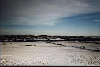
Crai is a village in the Brecon Beacons National Park in the county of Powys, Wales and the historic county of Breconshire. The population of Cray at the 2011 census was 241. It gives its name to the community of Cray, within which are the hamlet of Felin-Crai and a large number of dispersed farms around the valley of the Afon Crai. The river is dammed 2 km / 1.5 mi southwest of the village to form Cray Reservoir. Crai means fresh, raw water. The famous Llywel Stone was found close to the Crai/Trecastle boundary. A history of the village is contained in Lewis, D. Craionog: Hanes plwyf Defynog : yn cynnwys y rhanbarthau cynlynol; Crai, Glyntawy, Senni, Glyntarell, a Maescar. Merthyr Tydfil : H. W. Southey a'i Feibion, Cyf, Argrffwyr, 1911.
The Broxbourne Mill Stream which diverges from the River Lee Navigation just south of Dobbs Weir, is one of the few remaining 'old river' loops of the River Lea, with a relatively natural channel form and a diverse range of habitats. Broxbourne developed as a small settlement for milling at a river crossing point at Broxbourne Mill. Spital Brook empties into the Mill Stream by Nazeing New Road.


