Tylers Green

Last updated

Tylers Green
St Margaret, Tylers Green, Bucks - geograph.org.uk - 333195.jpg
St Margaret's parish church
Buckinghamshire UK location map.svg
Red pog.svg
Tylers Green
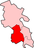
Location within Buckinghamshire
OS grid reference SU905940
Civil parish
Unitary authority
Ceremonial county
Region
Country England
Sovereign state United Kingdom
Post town High Wycombe
Postcode district HP10
Dialling code 01494
Police Thames Valley
Fire Buckinghamshire
Ambulance South Central
UK Parliament
Website Chepping Wycombe Parish Council
List of places
UK
England
Buckinghamshire
51°38′13″N0°41′35″W / 51.637°N 0.693°W / 51.637; -0.693
Widmer Pond Tylers Green Pond.JPG
Widmer Pond

Tylers Green is a village in the civil parish of Chepping Wycombe, Buckinghamshire, England.

Contents

The village is adjoined on one side by Hazlemere and on the other by Penn. "Penn and Tylers Green" are often referred to as one. Tylers Green centres on a village green where an annual fête is held. In one corner of the green is a duck pond.

History

Artefacts have been found suggesting habitation in Penn and Tylers Green since the Stone Age. [1] In the 12th century, the village was known as Garretts Green. [2] By the 14th century, the name was changed to Tiler End Green as it became known for well-organized commercial tile workshops. [3]

In 2006, Thames Valley Police cordoned off the woodland between Tylers Green, Totteridge, Micklefield and High Wycombe (Kingswood) for a fingertip search for evidence linked to the 2006 transatlantic aircraft plot. The woodland remained cordoned off for four months before being reopened in November 2006. [4]

Geography

The village is in the Chiltern Hills and from here there are many walks through beech woodland which once supplied the furniture industry in High Wycombe.

Amenities

The Church of England parish church of St Margaret was built in 1854 of flint and stone and is Grade II listed. [5] [6] The wooden bell-turret was added in 1891. [6] The ashes of Arthur Whitten Brown, the navigator of the 1919 Transatlantic flight of Alcock and Brown, the first non-stop crossing of the Atlantic, are buried in St Margaret's churchyard.

The village has two schools, Tylers Green First School for children aged 4 – 7 and Tylers Green Middle School for children aged 7 – 11. [7] [8]

It has its own football club, Penn & Tylers Green F. C, which was established in 1905.

Related Research Articles

<span class="mw-page-title-main">High Wycombe</span> Town in Buckinghamshire, England

High Wycombe, often referred to as Wycombe, is a market town in Buckinghamshire, England. Lying in the valley of the River Wye surrounded by the Chiltern Hills, it is 29 miles (47 km) west-northwest of Charing Cross in London, 13 miles (21 km) south-southeast of Aylesbury, 23 miles (37 km) southeast of Oxford, 15 miles (24 km) northeast of Reading and 8 miles (13 km) north of Maidenhead.

<span class="mw-page-title-main">Chiltern Hills</span> Range of hills in Southeast England

The Chiltern Hills are a chalk escarpment in the UK northwest of London, covering 660 square miles (1,700 km2) across Oxfordshire, Buckinghamshire, Hertfordshire, and Bedfordshire, stretching 45 miles (72 km) from Goring-on-Thames in the southwest to Hitchin in the northeast. The hills are 12 miles (19 km) at their widest.

<span class="mw-page-title-main">Beaconsfield</span> Human settlement in England

Beaconsfield is a market town and civil parish in Buckinghamshire, England, 23+12 miles northwest of central London and 16 miles southeast of Aylesbury. Three other towns are within five miles : Gerrards Cross, Amersham and High Wycombe.

<span class="mw-page-title-main">Flackwell Heath</span> Human settlement in England

Flackwell Heath is a village in the civil parish of Chepping Wycombe on the outskirts of High Wycombe, Buckinghamshire, England. With an elevation of about 150 metres (490 ft), in the Chiltern Hills. It has a population of around 6000.

<span class="mw-page-title-main">Bledlow</span> Human settlement in England

Bledlow is a village and former civil parish, now in the parish of Bledlow-cum-Saunderton, in Buckinghamshire, England. It is about 1+12 miles (2.4 km) WSW of Princes Risborough, and is on the county boundary with Oxfordshire. In 1931 the parish had a population of 925. On 1 April 1934 the parish was abolished to form "Bledlow cum Saunderton".

<span class="mw-page-title-main">Holmer Green</span> Human settlement in England

Holmer Green is a village in the civil parish of Little Missenden, in Buckinghamshire, England. It is next to Hazlemere, about 3 miles (5 km) south of Great Missenden.

<span class="mw-page-title-main">Little Missenden</span> Human settlement in England

Little Missenden is a village and civil parish on the River Misbourne in Buckinghamshire, England. It is in the Chiltern Hills, about 3 miles (5 km) southeast of Great Missenden and 3 miles (5 km) west of Amersham. The village lies on the River Misbourne in the Misbourne valley.

<span class="mw-page-title-main">Radnage</span> Village in Buckinghamshire, England

Radnage is a village and civil parish in the Buckinghamshire district of Buckinghamshire, England. It is in the Chiltern Hills about two miles north east of Stokenchurch and six miles WNW of High Wycombe.

<span class="mw-page-title-main">Stokenchurch</span> Human settlement in England

Stokenchurch is a village and civil parish in south-west Buckinghamshire, England. It is located in the Chiltern Hills, about 3 miles (5 km) south of Chinnor in Oxfordshire and 6 miles (10 km) west of High Wycombe. Stokenchurch is a commuter village, served by junction 5 of the M40 motorway to London, Oxford and Birmingham. The Stokenchurch BT Tower, to the west of the village, is a highly visible landmark on the edge of the Chilterns and pinpoints the village's location for miles ahead.

<span class="mw-page-title-main">Penn, Buckinghamshire</span> Village in Buckinghamshire, England

Penn is a village and civil parish in Buckinghamshire, England, about 3 miles (4.8 km) north-west of Beaconsfield and 4 miles (6.4 km) east of High Wycombe. The parish's 3,991 acres (1,615 ha) cover Penn village and the hamlets of Penn Street, Knotty Green, Forty Green and Winchmore Hill. The population was estimated at 4,168 in 2019.

<span class="mw-page-title-main">Chepping Wycombe</span> Human settlement in England

Chepping Wycombe is a civil parish in the ceremonial county of Buckinghamshire, England. The parish includes the three large villages of Tylers Green, Loudwater, and Flackwell Heath. The central part of the parish comprises extensive business and industrial development lying adjacent and underneath an elevated section of the M40 in the valley of the River Wye.

<span class="mw-page-title-main">Wycombe (UK Parliament constituency)</span> Parliamentary constituency in Buckinghamshire

Wycombe is a constituency in Buckinghamshire represented in the House of Commons of the UK Parliament since 2010 by Steve Baker, a Conservative.

<span class="mw-page-title-main">Beaconsfield (UK Parliament constituency)</span> Parliamentary constituency in the United Kingdom since 1974

Beaconsfield is a constituency in Buckinghamshire represented in the House of Commons of the UK Parliament since 2019 by Joy Morrissey of the Conservative Party. She succeeded Independent and former Conservative Dominic Grieve, whom she defeated following his suspension from the party. The constituency was established for the February 1974 general election.

<span class="mw-page-title-main">Chesham and Amersham (UK Parliament constituency)</span> Parliamentary constituency in the United Kingdom, 1974 onwards

Chesham and Amersham is a parliamentary constituency in Buckinghamshire, South East England, represented in the House of Commons by Sarah Green, a Liberal Democrat elected at a 2021 by-election.

<span class="mw-page-title-main">Ley Hill</span> Human settlement in England

Ley Hill is a Chiltern village on the Buckinghamshire/Hertfordshire border in south-east England, near the town of Chesham. It is part of the civil parish of Latimer and Ley Hill, and comes under Chiltern District Council in the County of Buckinghamshire. Ley Hill lies in the Chiltern Hills and is contiguous with Botley.

<span class="mw-page-title-main">Beacon Hill, Buckinghamshire</span> Hill near Penn and on the outskirts of High Wycombe Buckinghamshire

The hamlet of Beacon Hill, is situated off the B474 near Penn and on the outskirts of High Wycombe Buckinghamshire. Nearby is the Golf Course at Wycombe Heights.

Micklefield is a ward of High Wycombe, Buckinghamshire, located on the eastern side of the town. Surrounded on one side by the Chiltern Hills and King's Wood, it neighbours the villages of Penn and Tylers Green, as well as being adjacent to Wycombe Marsh. Some points in the Micklefield area rise to an altitude of some 450 feet, and there are some great views over the Wycombe valley.

<span class="mw-page-title-main">Lewknor</span> Human settlement in England

Lewknor is a village and civil parish about 5 miles (8 km) south of Thame in Oxfordshire.The civil parish includes the villages of Postcombe and South Weston. The 2011 Census recorded the parish's population as 663.

References

  1. "The Chilterns AONB - Map categories". www.chilternsaonb.org. Retrieved 4 February 2021.
  2. Forbes, Hilary (10 February 2017). "A Potted History of Penn & Tylers Green". Penn and Tylers Green Residents Society. Retrieved 4 February 2021.
  3. Forbes, Hilary (10 February 2017). "A Potted History of Penn & Tylers Green". Penn and Tylers Green Residents Society. Retrieved 4 February 2021.
  4. Penn and Tylers Green News Website Archived 2011-07-21 at the Wayback Machine
  5. "CHURCH OF ST MARGARET, Chepping Wycombe - 1125628 | Historic England".
  6. 1 2 Pevsner 1960, p. 271.
  7. "Admissions | Tylers Green First School". www.tylersgreenfirst.co.uk. Retrieved 4 February 2021.
  8. "Admissions | Tylers Green Middle School". www.tylersgreenmiddle.bucks.sch.uk. Retrieved 4 February 2021.

Sources and further reading